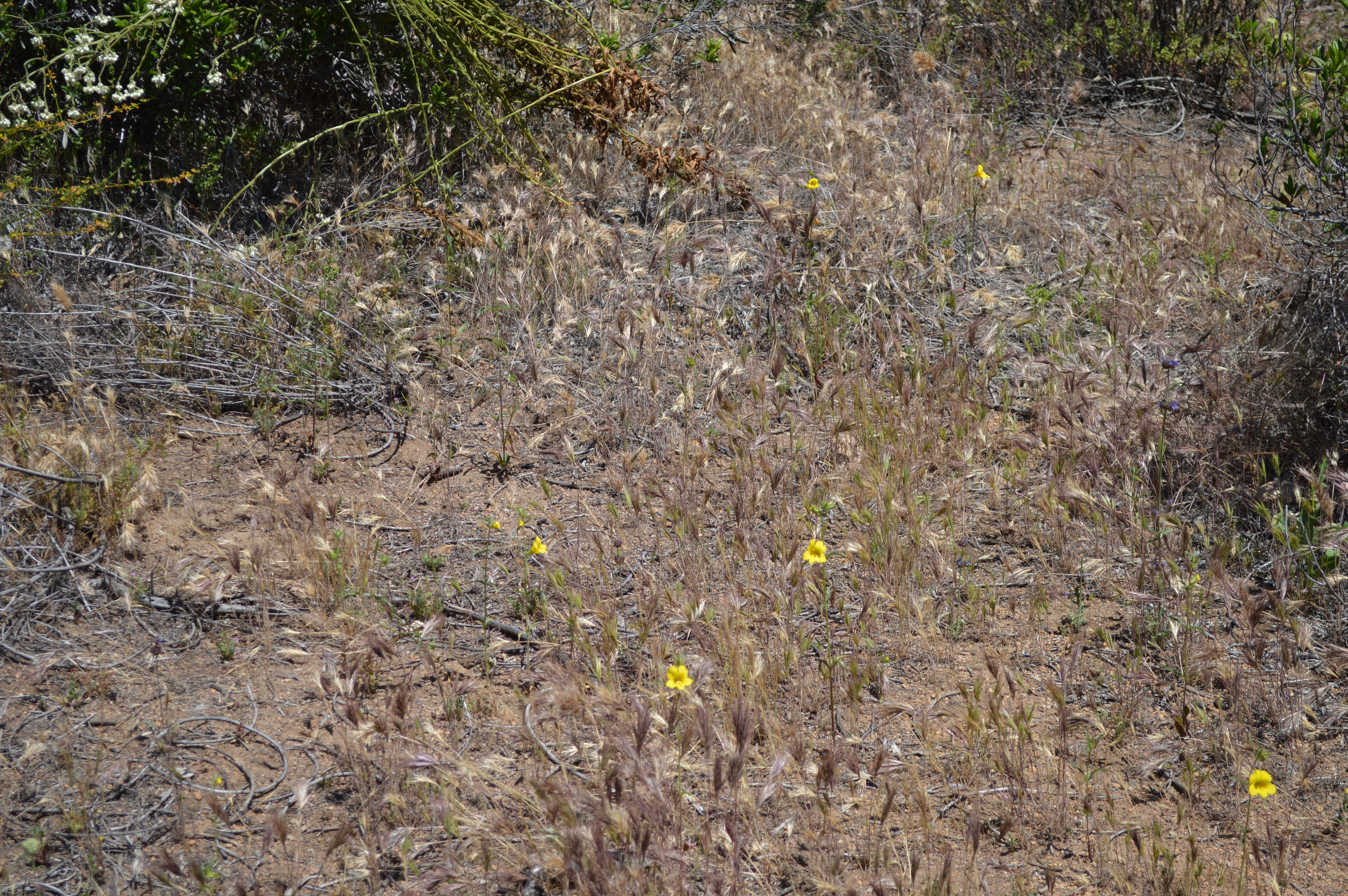
Foxtails
Photo Credit: Emily Perkins, SDMMP
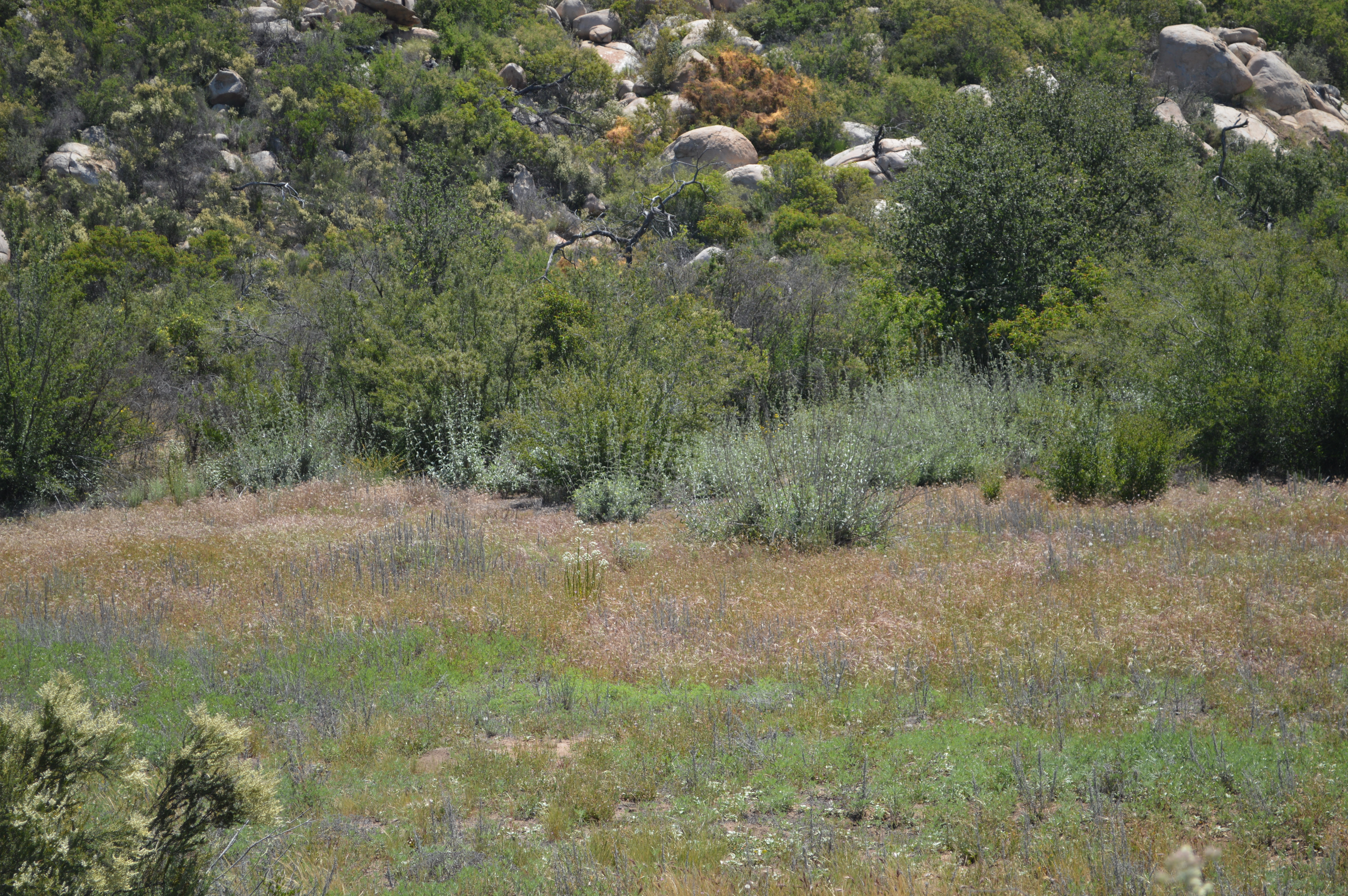
Invasive plants push out natives
Photo Credit: Emily Perkins, SDMMP
Goal: The overarching goals for addressing invasive plant species in the MSPA are to: (1) Protect Conserved Lands from new or expanding invasive plant species; (2) Detect new invasive species and new invasions early on and control them before the plants have a chance to establish; (3) Address invasive species using the response appropriate for the level of invasiveness (level 1 through 5) as defined in the Invasive Plant Strategic Plan (IPSP)
Management units: 1, 2, 3, 4, 5, 6, 7, 8, 9, 10, 11
From 2017-2021, continue implementing the IPSP by removing Levels 1, 2, and 3 invasive plant species before their distribution becomes too abundant to control.
| Criteria | Deadline year |
|---|---|
| Reduction in =50% of the IPSP Levels 1 and 2 Species by 2021 | 2021 |
| Threat Name | Threat Code |
|---|---|
| Invasive plants | INVPLA |
Management units: 1, 2, 3, 4, 5, 6, 7, 8, 9, 10, 11
Starting in 2017, using a quick assessment, monitor the effectiveness of implementation of the IPSP.
| Action | Statement | Action status | Projects |
|---|---|---|---|
| IMP-1 | Submit project metadata, data, and report to MSP web portal | In progress |
| Criteria | Deadline year |
|---|---|
| Effectiveness of IPSP Implementation Determined | 2021 |
| Threat Name | Threat Code |
|---|---|
| Invasive plants | INVPLA |
Management units: 1, 2, 3, 4, 5, 6, 7, 8, 9, 10, 11
Starting in 2017, pursue outside funding for Level 3 invasive plants species (e.g. arundo) to control them at a watershed level.
| Action | Statement | Action status | Projects |
|---|---|---|---|
| RSUP-1 | Coordinate with local agencies to pursue state and federal funding/grant options for the control of Level 3 species. | available for implementation |
| Criteria | Deadline year |
|---|---|
| At Least 1 Proposal Submitted for Outside Funding for Level 3 Species by 2019 | 2021 |
| Threat Name | Threat Code |
|---|---|
| Invasive plants | INVPLA |
Management units: 1, 2, 3, 4, 5, 6, 7, 8, 9, 10, 11
In 2018-2019, prepare a biosecurity plan for the MSPA that includes BMPs to prevent the spread of invasive plants and the introduction of new exotics.
| Action | Statement | Action status | Projects |
|---|---|---|---|
| PRP-1 | Review ?Preventing the Spread of Invasive Plants: Best Management Practices for Land Managers? by Cal-IPC and use to model a general MSPA Biosecurity Plan. | Available for implementation | |
| PRP-2 | Include in the MSPA Biosecurity Plan a breakdown of BMPs for the different habitat types, e.g. riparian, grassland, sage scrub. | Unknown | |
| PRP-3 | Provide tailored BMPs for the most resilient and aggressive invasive plants. | Unknown |
| Criteria | Deadline year |
|---|---|
| A Biosecurity Plan Developed for the MSPA by 2020 | 2021 |
| Threat Name | Threat Code |
|---|---|
| Invasive plants | INVPLA |
Management units: 1, 2, 3, 4, 5, 6, 7, 8, 9, 10, 11
Beginning in 2017, develop and adopt an Early Detection and Rapid Response (EDRR) strategy and database for the MSPA that includes the ability for land managers and Citizen Scientists to report invasive plant sightings using handheld devices to feed into a system of review and management action.
| Action | Statement | Action status | Projects |
|---|---|---|---|
| RSUP-1 | Create and maintain a watchlist for known or expected invasive in the MSPA | Available for implementation | |
| RSUP-2 | Develop an EDRR database for reporting and monitoring invasive species action in the MSPA | Unknown | |
| RSUP-3 | Generate EDRR reporting, treatment, and control protocol for land managers | Unknown |
| Criteria | Deadline year |
|---|---|
| An EDRR Program Developed by 2021 | 2021 |
| Threat Name | Threat Code |
|---|---|
| Invasive plants | INVPLA |
Management units: 1, 2, 3, 4, 5, 6, 7, 8, 9, 10, 11
Starting in 2021, monitor the effectiveness of implementation of the EDRR system for the region.
| Action | Statement | Action status | Projects |
|---|---|---|---|
| IMP-1 | Submit project metadata, data, and report to MSP web portal | waiting for precedent action |
| Criteria | Deadline year |
|---|---|
| Effectiveness of IPSP Implementation Determined | 2021 |
| Threat Name | Threat Code |
|---|---|
| Invasive plants | INVPLA |
Management units: 1, 2, 3, 4, 5, 6, 7, 8, 9, 10, 11
From 2017-2021, remove Level 4 and 5 invasive species that are threatening MSP species as specified in the Invasive Plant Strategic Plan.
| Action | Statement | Action status | Projects |
|---|---|---|---|
| IMP-1 | Remove Level 4 and 5 species that are threatening significant occurrences of MSP species on Conserved Lands | Available for implementation | Brachypodium Control, North County Dunes Restoration |
| Criteria | Deadline year |
|---|---|
| Project reports submitted within 1 Year of Removal Efforts | 2021 |
| Threat Name | Threat Code |
|---|---|
| Invasive plants | INVPLA |
Management units: 3, 4, 5, 6
Starting in 2017, reduce the potential impact of fire for at risk large populations of San Diego thornmint (see occurrence table) by reducing fuel loads of invasive annuals
| Action | Statement | Action status | Projects |
|---|---|---|---|
| IMP-1 | Manage thatch and invasive annuals every 3-5 years to reduce fire threat for populations of San Diego thornmint most at risk of fire (populations with ignition probability or fire frequency > 3 or that have burned since 2003) | available for implementation | Test project on production server, created by DAM 4/3/19 |
| IMP-2 | Submit project metadata, monitoring datasets and report with management actions to the MSP Web Portal. | waiting for precedent action | Test project on production server, created by DAM 4/3/19 |
| Criteria | Deadline year |
|---|---|
| Fuel Loads and Invasive Grasses Reduced for at Risk Populations | 2021 |
| Threat Name | Threat Code |
|---|---|
| Altered fire regime | ALTFIR |
| Human uses of the Preserves | HUMUSE |
| Invasive plants | INVPLA |
| Loss of connectivity | LOSCON |
| Urban development | URBDEV |
Management units: 3, 4, 5, 6
Beginning in 2017, annually inspect conserved populations of San Diego thornmint (see occurrence table) using the regional rare plant IMG monitoring protocol to record abundance and collect covariate habitat and threats data to determine management needs.
| Action | Statement | Action status | Projects |
|---|---|---|---|
| IMP-1 | Based upon occurrence status and threats, determine management needs including whether routine management or more intensive management is warranted. | some occurrences are in progress | |
| IMP-2 | Submit project metadata, occurrence status, habitat and threats data, and management recommendations to the MSP Web Portal. | some occurrences are in progress |
| Criteria | Deadline year |
|---|---|
| Surveys Completed Annually with Management Recommendations | 2021 |
| Threat Name | Threat Code |
|---|---|
| Altered fire regime | ALTFIR |
| Human uses of the Preserves | HUMUSE |
| Invasive plants | INVPLA |
| Urban development | URBDEV |
Management units: 3, 4, 5, 6
Beginning in 2017, conduct routine management actions identified through the IMG monitoring at San Diego thornmint occurrences on Conserved Lands (see occurrence table). Depending on the type and level of threat, management should only be conducted as needed, not necessarily every year, and using BMPs with precautions to do no harm.
| Action | Statement | Action status | Projects |
|---|---|---|---|
| IMP-1 | Perform routine management activities as needed, such as protecting occurrences from disturbance through enforcement and controlling invasive non-native plant species to =20% absolute cover. | available for implementation | San Diego Thornmint Restoration |
| IMP-2 | Submit project metadata and management data to MSP web portal. | available for implementation | San Diego Thornmint Restoration |
| Criteria | Deadline year |
|---|---|
| Routine Management Completed as Needed Based Upon Monitoring Recommendations | 2021 |
| Threat Name | Threat Code |
|---|---|
| Altered fire regime | ALTFIR |
| Human uses of the Preserves | HUMUSE |
| Invasive plants | INVPLA |
| Urban development | URBDEV |
Management units: 3, 4, 5, 6
In 2017, continue refining BMPs developed for San Diego thornmint (CBI 2014) by incorporating results of management experiments to control invasive species that threaten populations (e.g., Brachypodium removal studies at Mission Trails and South Crest) and based on research studies (e.g., seed bulking guidelines, seed transfer zones).
| Action | Statement | Action status | Projects |
|---|---|---|---|
| DEV-1 | Refine BMPs prepared by CBI in the San Diego Thornmint Adaptive Management Framework (2014) by incorporating results of management experiments to control invasive species that threaten populations (e.g., Brachypodium removal and South County Grasslands projects) and based on research studies (e.g., seed bulking guidelines, seed transfer) | In progress | |
| DEV-2 | Submit project metadata, management datasets and BMP report to MSP web portal. | In progress |
| Criteria | Deadline year |
|---|---|
| BMPs for San Diego Thornmint Prepared by 2018 | 2021 |
| Threat Name | Threat Code |
|---|---|
| Altered fire regime | ALTFIR |
| Human uses of the Preserves | HUMUSE |
| Invasive plants | INVPLA |
| Loss of connectivity | LOSCON |
| Urban development | URBDEV |
Management units: 3, 4, 5, 6
In 2018, begin preparing a section for San Diego thornmint the MSP Rare Plant Management Plan that prioritizes management actions to maintain or expand occurrences on Conserved Lands based upon an assessment of data on occurrence status, habitat and threats. Prioritize management recommendations to maintain large occurrences and enhance at least 3 small occurrences (see occurrence table). Minimum criteria for enhancement are to reduce invasive annual nonnative plants and thatch to less than 20% absolute cover within the occurrence
| Action | Statement | Action status | Projects |
|---|---|---|---|
| PRP-1 | Consult the San Diego County Rare Plant Working Group made up of plant ecologists, geneticists, rare plant experts, land managers, restoration practitioners, seed banking and bulking practitioners, wildlife agencies, and other stakeholders to provide input and recommendations for the San Diego thornmint section in the MSP Rare Plant Management Plan. | waiting for precedent action | |
| PRP-2 | Develop a conceptual model that identifies management actions to effectively reduce threats to San Diego thornmint occurrences. | waiting for precedent action | |
| PRP-3 | Prioritize occurrences for management based upon an assessment of occurrence size, the potential for management to significantly reduce identified threats, and the availability of adjacent suitable habitat for occurrence expansion. | waiting for precedent action | |
| PRP-4 | Develop an implementation plan for San Diego thornmint that prioritizes management actions for the next 5 years and details tasks, lead entities, responsibilities, and timelines, budgets. | waiting for precedent action | |
| PRP-5 | Submit project metadata and MSP Rare Plant Management Plan to the MSP Web Portal. | waiting for precedent action |
| Criteria | Deadline year |
|---|---|
| By 2019 Completed Section for San Diego Thornmint in the MSP Rare Plant Management Plan. | 2021 |
| Threat Name | Threat Code |
|---|---|
| Altered fire regime | ALTFIR |
| Climate change | CLICHN |
| Human uses of the Preserves | HUMUSE |
| Invasive plants | INVPLA |
| Loss of connectivity | LOSCON |
| Urban development | URBDEV |
Management units: 3, 4, 5, 6
In 2019, begin implementing highest priority management actions identified for San Diego thornmint in the MSP Rare Plant Management Plan.
| Action | Statement | Action status | Projects |
|---|---|---|---|
| IMP-1 | Submit project metadata, management datasets, and report to the MSP Web Portal. | waiting for precedent action |
| Criteria | Deadline year |
|---|---|
| By 2023, =2 High Priority Management Actions Implemented for San Diego Thornmint from the MSP Rare Plant Management Plan | 2021 |
| Threat Name | Threat Code |
|---|---|
| Altered fire regime | ALTFIR |
| Climate change | CLICHN |
| Human uses of the Preserves | HUMUSE |
| Invasive plants | INVPLA |
| Loss of connectivity | LOSCON |
| Urban development | URBDEV |
Management units: 3, 4, 5, 6
In 2019, begin monitoring the effectiveness of implementation of the highest priority management actions identified in the San Diego thornmint section of the MSP Rare Plant Management Plan.
| Action | Statement | Action status | Projects |
|---|---|---|---|
| IMP-1 | Submit metadata, management effectiveness datasets, analyses, and report to the MSP Web Portal. | waiting for precedent action |
| Criteria | Deadline year |
|---|---|
| Effectiveness of High Priority Management Actions Determined | 2021 |
| Threat Name | Threat Code |
|---|---|
| Altered fire regime | ALTFIR |
| Climate change | CLICHN |
| Human uses of the Preserves | HUMUSE |
| Invasive plants | INVPLA |
| Loss of connectivity | LOSCON |
| Urban development | URBDEV |
Management units: 3, 4, 5, 6
In 2018, begin preparing a section for San Diego thornmint in the MSP Seed Collection, Banking and Bulking Plan to preserve genetic diversity and rescue occurrences in case of catastrophic disturbance. The plan should incorporate best science and management practices (Wall 2009, KEW 2016) and recommendations from the 2016-2017 genetic study to provide guidelines for collecting and storing seeds over the long term at a permanent, established conservation seed bank (e.g., Institute for Conservation Research Native Plant Seed Bank, Rancho Santa Ana Botanic Garden Seed Conservation Program) and for providing sources of seeds for management purposes. The plan should include recommendations for: collecting and storing seeds for conservation banking; management oriented research; rescuing occurrences after catastrophic disturbances; and seed bulking and out-planting to augment extant occurrences or to establish new occurrences with consideration of genetic implications for population sustainability.
| Action | Statement | Action status | Projects |
|---|---|---|---|
| PRP-1 | Consult the San Diego County Rare Plant Working Group made up of plant ecologists, geneticists, rare plant experts, land managers, restoration practitioners, seed banking and bulking practitioners, wildlife agencies, and other stakeholders to provide input and recommendations for the San Diego thornmint section of the MSP Seed Collection, Banking and Bulking Plan. | waiting for precedent action | California Plant Rescue (CaPR) - San Diego Zoo Wildlife Alliance's Native Plant Seed Bank |
| PRP-2 | Prepare a seed collection plan to collect seeds over multiple years, collect seeds several times within a season, accumulate seeds across populations, and to sample among habitats and ecological niches. Include guidelines for collecting and storing seeds along maternal lines from small occurrences (<1,000 plants) and to provide propagules to be used in management experiments, enhancement of existing occurrences, and establishment of new occurrences. | waiting for precedent action | California Plant Rescue (CaPR) - San Diego Zoo Wildlife Alliance's Native Plant Seed Bank |
| PRP-3 | The seed collection plan should include guidelines for collecting seeds from occurrences of sufficient size to accommodate harvest and based on genetic studies as available. Include provisions for collecting seed from unconserved populations planned for development. | waiting for precedent action | California Plant Rescue (CaPR) - San Diego Zoo Wildlife Alliance's Native Plant Seed Bank |
| PRP-4 | Include protocols and guidelines for collecting voucher specimens and submitting to the San Diego Natural History Museum (McEachern et al. 2007). | waiting for precedent action | California Plant Rescue (CaPR) - San Diego Zoo Wildlife Alliance's Native Plant Seed Bank |
| PRP-5 | Include guidelines for testing seeds for viability and to obtain information on dormancy and germination rates. | waiting for precedent action | California Plant Rescue (CaPR) - San Diego Zoo Wildlife Alliance's Native Plant Seed Bank |
| PRP-6 | Submit project metadata and MSP Seed Collection, Banking and Bulking Plan to MSP Web Portal. | waiting for precedent action | California Plant Rescue (CaPR) - San Diego Zoo Wildlife Alliance's Native Plant Seed Bank |
| Criteria | Deadline year |
|---|---|
| By 2019, Completed Section for San Diego thornmint in the MSP Seed Collection Banking and Bulking Plan | 2021 |
| Threat Name | Threat Code |
|---|---|
| Altered fire regime | ALTFIR |
| Climate change | CLICHN |
| Human uses of the Preserves | HUMUSE |
| Invasive plants | INVPLA |
| Loss of connectivity | LOSCON |
| Urban development | URBDEV |
Management units: 3, 4, 5, 6
In 2019, begin implementing the MSP Seed Collection, Banking and Bulking Plan for San Diego thornmint to collect and store seeds at a permanent seed bank and to provide propagules as needed for management oriented research, existing population enhancement and establishment of new occurrences.
| Action | Statement | Action status | Projects |
|---|---|---|---|
| IMP-1 | Bulk seed at a qualified facility for enhancement, expansion, establishment or transplantation projects using seed from genetically appropriate donor accessions in the propagation seed bank collection. | waiting for precedent action | California Plant Rescue (CaPR) - San Diego Zoo Wildlife Alliance's Native Plant Seed Bank |
| IMP-2 | Maintain records for collected seed to document donor and receptor sites, collection dates and amounts. Submit seed collection, storage and bulking data to the MSP Web Portal. | waiting for precedent action | California Plant Rescue (CaPR) - San Diego Zoo Wildlife Alliance's Native Plant Seed Bank |
| Criteria | Deadline year |
|---|---|
| By 2023, =2 Highest Priority Actions Implemented for San Diego thornmint from the MSP Seed Banking and Bulking Plan | 2021 |
| Threat Name | Threat Code |
|---|---|
| Altered fire regime | ALTFIR |
| Climate change | CLICHN |
| Human uses of the Preserves | HUMUSE |
| Invasive plants | INVPLA |
| Loss of connectivity | LOSCON |
| Urban development | URBDEV |
Management units: 3, 4, 5, 6
In 2017, continue field research into soils and habitat relationships and development of habitat suitability and climate change models for San Diego thornmint and other edaphic endemic plants to better understand habitat requirements and to identify and prioritize geographic areas important for connectivity, restoration, and range shifts due to climate change and other threats.
| Action | Statement | Action status | Projects |
|---|---|---|---|
| RES-1 | Test soils at potential expansion sites and compare to occupied reference sites to determine site suitability based on soils. | In progress | Enhancing the Resilience of Edaphic Endemic Plants |
| RES-2 | Prepare habitat suitability models under current environmental conditions and for different scenarios of climate change to delineate potential future habitat. | In progress | Enhancing the Resilience of Edaphic Endemic Plants |
| RES-3 | Collect covariate data on vegetation composition and cover (alliance and association-level mapping), soils, invasive plants and other threats for selected populations. | In progress | Enhancing the Resilience of Edaphic Endemic Plants |
| RES-4 | Prioritize locations for conservation, management, and future surveys based on predicted distributions and environmental correlates. | In progress | Enhancing the Resilience of Edaphic Endemic Plants |
| RES-5 | Submit project metadata, monitoring data and report to MSP web portal. | In progress | Enhancing the Resilience of Edaphic Endemic Plants |
| Criteria | Deadline year |
|---|---|
| Refined Models and Prioritized Future Survey Locations for San Diego Thornmint by 2018 | 2021 |
| Threat Name | Threat Code |
|---|---|
| Altered fire regime | ALTFIR |
| Climate change | CLICHN |
| Human uses of the Preserves | HUMUSE |
| Invasive plants | INVPLA |
| Loss of connectivity | LOSCON |
| Urban development | URBDEV |
Management units: 1, 7
From 2017-2012, inspect extant Nuttall's acmispon occurrences annually on Conserved Lands (see occurrence table) using the regional rare plant IMG monitoring protocol to record abundance and collect habitat and threats covariate data to determine management needs.
| Action | Statement | Action status | Projects |
|---|---|---|---|
| IMP-1 | Based upon occurrence status and threats, determine management needs including whether routine management or more intensive management is warranted. | some occurrences are in progress | |
| IMP-2 | Submit project metadata, monitoring datasets and management recommendations to the MSP Web Portal. | some occurrences are in progress |
| Criteria | Deadline year |
|---|---|
| Surveys Completed Annually with Management Recommendations | 2021 |
| Threat Name | Threat Code |
|---|---|
| Human uses of the Preserves | HUMUSE |
| Invasive plants | INVPLA |
| Urban development | URBDEV |
Management units: 1, 7
Beginning in 2017, conduct routine management actions identified through the IMG monitoring at Nuttall's acmispon occurrences on Conserved Lands (see occurrence table). Depending on the type and level of threat, management should be conducted as needed, not necessarily every year, and using BMPs with precautions to do no harm.
| Action | Statement | Action status | Projects |
|---|---|---|---|
| IMP-1 | Perform routine management activities such as protecting occurrences from disturbance through fencing and enforcement and controlling invasive non-native plant species =20% absolute cover. | some occurrences are in progress | |
| IMP-2 | Submit project metadata and management data to the MSP Web Portal. | some occurrences are in progress | Adaptive Management of Coastal Sand Dunes in Mission Bay to Benefit Native Plants and the CA Least Tern |
| Criteria | Deadline year |
|---|---|
| Routine Management Completed as Needed Based Upon Monitoring Recommendations | 2021 |
| Threat Name | Threat Code |
|---|---|
| Human uses of the Preserves | HUMUSE |
| Invasive plants | INVPLA |
| Urban development | URBDEV |
Management units: 1
From 2017 through 2019, enhance and expand the 4 Nuttall's acmispon occurrences at Mariner's Point, South Shores, South Carlsbad State Beach and Cardiff State Beaches (see occurrence table) and establish a new occurrence at Stony Point in Mission Bay. Invasive plant control should be conducted using BMPs so that invasive plants are reduced to less than 20% absolute cover within the occurrence
| Action | Statement | Action status | Projects |
|---|---|---|---|
| IMP-1 | Conduct invasive plant control within each occurrence | in progress | |
| IMP-2 | Seed collection, bulking and redistribution should follow recommendations for Nuttall's acmispon in the MSP Seed Collection, Banking and Bulking Plan to minimize potential risks to populations from seed collection and distribution activities. | in progress | |
| IMP-3 | Submit project metadata and management data to the MSP Web Portal. | in progress |
| Criteria | Deadline year |
|---|---|
| By 2019, 5 Nuttall's Acmispon Occurrences Enhanced/Established and Reports Submitted | 2021 |
| Threat Name | Threat Code |
|---|---|
| Invasive plants | INVPLA |
Management units: 1, 7
In 2017, begin preparing a section for Nuttall's acmispon in the MSP Seed Collection, Banking and Bulking Plan to preserve genetic diversity and rescue occurrences in case of catastrophic disturbance. The plan should incorporate best science and management practices (e.g., Wall 2009, KEW 2016) and provide guidelines for collecting and storing seeds over the long term at a permanent, established conservation seed bank (e.g., Institute for Conservation Research Native Plant Seed Bank, Rancho Santa Ana Botanic Garden Seed Conservation Program) and for providing a source of seeds for management purposes. The plan should include recommendations for: collecting and storing seeds for conservation banking; management oriented research; rescuing occurrences after catastrophic disturbances; and seed bulking and out-planting to augment extant occurrences or to establish new occurrences with consideration of genetic implications for population sustainability.
| Action | Statement | Action status | Projects |
|---|---|---|---|
| PRP-1 | Consult the San Diego County Rare Plant Working Group made up of plant ecologists, geneticists, rare plant experts, land managers, restoration practitioners, seed banking and bulking practitioners, wildlife agencies, and other stakeholders to provide input and recommendations for Nuttall's acmispon in the MSP Seed Collection, Banking and Bulking Plan. | Available for implementation | |
| PRP-2 | Prepare a seed collection plan to collect seeds over multiple years, collect seeds several times within a season, accumulate seeds across populations, and to sample among habitats and ecological niches. Include guidelines for collecting and storing seeds along maternal lines from small occurrences (<1,000 plants) and to provide propagules to be used in management experiments, enhancement of existing occurrences, and establishment of new occurrences. | Available for implementation | |
| PRP-3 | The seed collection plan should include guidelines for collecting seeds from occurrences of sufficient size to accommodate harvest and based on genetic studies as available. Include provisions for collecting seed from unconserved populations planned for development. | Available for implementation | |
| PRP-4 | Include protocols and guidelines for collecting voucher specimens and submitting to the San Diego Natural History Museum (McEachern et al. 2007). | Available for implementation | |
| PRP-5 | Include guidelines for testing seeds for viability and to obtain information on dormancy and germination rates. | Available for implementation | |
| PRP-6 | Submit project metadata and MSP Seed Collection, Banking and Bulking Plan to the MSP Web Portal. | Available for implementation |
| Criteria | Deadline year |
|---|---|
| By 2018, Completed Nuttall's Acmispon Section in the MSP Seed Collection, Banking and Bulking Plan | 2021 |
| Threat Name | Threat Code |
|---|---|
| Climate change | CLICHN |
| Human uses of the Preserves | HUMUSE |
| Invasive plants | INVPLA |
| Loss of connectivity | LOSCON |
| Urban development | URBDEV |
Management units: 1, 7
In 2018, begin implementing the Nuttall's acmispon section in the MSP Seed Collection, Banking and Bulking Plan to collect and store seeds at a permanent seed bank and to provide propagules as needed for management oriented research, existing population enhancement and establishment of new occurrences.
| Action | Statement | Action status | Projects |
|---|---|---|---|
| IMP-1 | Bulk seed at a qualified facility for enhancement, expansion, establishment or transplantation projects using seed from genetically appropriate donor accessions in the propagation seed bank collection. | Available for implementation | |
| IMP-2 | Maintain records for collected seed to document donor and receptor sites, collection dates and amounts. Submit seed collection, storage and bulking data to the MSP Web Portal. | Available for implementation |
| Criteria | Deadline year |
|---|---|
| By 2021, =1 Highest Priority Action Implemented for Nuttall's Acmispon from the MSP Seed Collection, Banking and Bulking Plan | 2021 |
| Threat Name | Threat Code |
|---|---|
| Climate change | CLICHN |
| Human uses of the Preserves | HUMUSE |
| Invasive plants | INVPLA |
| Loss of connectivity | LOSCON |
| Urban development | URBDEV |
Management units: 1, 7
In 2017, begin preparing a section for Nuttall's acmispon in the MSP Rare Plant Management Plan that prioritizes management actions to maintain the 5 large occurrences and to enhance at least 3 small occurrences on Conserved Lands (see occurrence table) based upon an assessment of data on occurrence status, habitat and threats. Minimum criteria for enhancement are to reduce invasive annual nonnative plants and thatch to less than or equal to 20% absolute cover within the occurrence.
| Action | Statement | Action status | Projects |
|---|---|---|---|
| PRP-1 | Consult the San Diego County Rare Plant Working Group made up of plant ecologists, geneticists, rare plant experts, land managers, restoration practitioners, seed banking and bulking practitioners, wildlife agencies, and other stakeholders to provide input and recommendations for Nuttall's acmispon in the MSP Rare Plant Management Plan. | available for implementation | |
| PRP-2 | Develop a conceptual model that identifies management actions to effectively reduce threats to Nuttall's acmispon occurrences. | available for implementation | |
| PRP-3 | Prioritize occurrences for management based upon an assessment of occurrence size, the potential for management to significantly reduce identified threats, and the availability of adjacent suitable habitat for occurrence expansion. | available for implementation | |
| PRP-4 | Develop an implementation plan for Nuttall's acmispon that prioritizes management actions for the nex 5 years and details tasks, lead entities, responsibilities, and timelines, budgets. | available for implementation | |
| PRP-5 | Submit project metadata, project datasets, and the MSP Rare Plant Management Plan to the MSP Web Portal. | available for implementation |
| Criteria | Deadline year |
|---|---|
| By 2018, Completed Nuttall's Acmispon Section in the MSP Rare Plant Management Plan | 2021 |
| Threat Name | Threat Code |
|---|---|
| Climate change | CLICHN |
| Human uses of the Preserves | HUMUSE |
| Invasive plants | INVPLA |
| Loss of connectivity | LOSCON |
| Urban development | URBDEV |
Management units: 1, 7
In 2018, begin implementing highest priority management actions identified for Nuttall's acmispon in the MSP Rare Plant Management Plan.
| Action | Statement | Action status | Projects |
|---|---|---|---|
| IMP-1 | Submit metadata, management datasets, and report to the MSP Web Portal. | waiting for precedent action |
| Criteria | Deadline year |
|---|---|
| By 2021, =1 High Priority Management Action Implemented for Nuttall's Acmispon from the MSP Rare Plant Management Plan | 2021 |
| Threat Name | Threat Code |
|---|---|
| Climate change | CLICHN |
| Human uses of the Preserves | HUMUSE |
| Invasive plants | INVPLA |
| Loss of connectivity | LOSCON |
| Urban development | URBDEV |
Management units: 1, 7
In 2018, monitor effectiveness of implementing highest priority management actions identified for Nuttall's acmispon in the MSP Rare Plant Management Plan.
| Action | Statement | Action status | Projects |
|---|---|---|---|
| IMP-1 | Submit metadata, management datasets, analyses, and report to the MSP Web Portal. | waiting for precedent action |
| Criteria | Deadline year |
|---|---|
| Effectiveness of High Priority Management Actions Determined | 2021 |
| Threat Name | Threat Code |
|---|---|
| Climate change | CLICHN |
| Human uses of the Preserves | HUMUSE |
| Invasive plants | INVPLA |
| Loss of connectivity | LOSCON |
| Urban development | URBDEV |
Management units: 1, 6, 7
In 2021, inspect extant Shaw's agave occurrences on Conserved Lands (see occurrence table) using the regional rare plant IMG monitoring protocol to record abundance and collect habitat and threats covariate data to determine management needs.
| Action | Statement | Action status | Projects |
|---|---|---|---|
| IMP-1 | Based upon occurrence status and threats, determine management needs including whether routine management or more intensive management is warranted. | on hold | |
| IMP-2 | Submit project metadata, monitoring datasets and management recommendations to the MSP Web Portal. | on hold |
| Criteria | Deadline year |
|---|---|
| Surveys Completed in 2021 with Management Recommendations | 2021 |
| Threat Name | Threat Code |
|---|---|
| Human uses of the Preserves | HUMUSE |
| Invasive plants | INVPLA |
Management units: 1, 6, 7
Beginning in 2017, conduct routine management actions as identified through the IMG monitoring conducted in 2016 and 2021 at Shaw's agave occurrences on Conserved Lands (see occurrence table). Depending on the type and level of threat, management should be conducted as needed, not necessarily every year, and using BMPs with precautions to do no harm.
| Action | Statement | Action status | Projects |
|---|---|---|---|
| IMP-1 | Perform as needed routine management activities, such as protecting occurrences from disturbance through fencing and enforcement and controlling invasive non-native plant species =20% absolute cover. | available for implementation | |
| IMP-2 | Submit project metadata and management data to the MSP Web Portal. | available for implementation |
| Criteria | Deadline year |
|---|---|
| Routine Management Completed as Needed Based Upon Monitoring Recommendations | 2021 |
| Threat Name | Threat Code |
|---|---|
| Human uses of the Preserves | HUMUSE |
| Invasive plants | INVPLA |
Management units: 3, 4, 6, 8
Beginning in 2017, annually inspect San Diego ambrosia occurrences on Conserved Lands in (see occurrence table) using the regional rare plant IMG monitoring protocol to record abundance and collect habitat and threats covariate data to determine management needs.
| Action | Statement | Action status | Projects |
|---|---|---|---|
| IMP-1 | Based upon occurrence status and threats, determine management needs including whether routine management or more intensive management is warranted. | some occurrences are in progress | |
| IMP-2 | Submit project metadata, monitoring datasets and management recommendations to the MSP Web Portal. | some occurrences are in progress |
| Criteria | Deadline year |
|---|---|
| Surveys Completed Annually with Management Recommendations | 2021 |
| Threat Name | Threat Code |
|---|---|
| Human uses of the Preserves | HUMUSE |
| Invasive plants | INVPLA |
| Loss of connectivity | LOSCON |
| Urban development | URBDEV |
Management units: 3, 4, 6, 8
Beginning in 2017, conduct routine management actions identified through the IMG monitoring at San Diego ambrosia occurrences on Conserved Lands in (see occurrence table). Depending on the type and level of threat, management should only be conducted as needed, not necessarily every year, and using BMPs with precautions to do no harm.
| Action | Statement | Action status | Projects |
|---|---|---|---|
| IMP-1 | Perform routine management activities such as protecting occurrences from disturbance through fencing, signage, and enforcement. | available for implementation | |
| IMP-1 | Perform routine management activities such as protecting occurrences from disturbance through fencing, signage, and enforcement. | available for implementation | |
| IMP-2 | Submit project metadata and management data to the MSP Web Portal. |
| Criteria | Deadline year |
|---|---|
| Routine Management Completed as Needed Based Upon Monitoring Recommendations | 2021 |
| Threat Name | Threat Code |
|---|---|
| Human uses of the Preserves | HUMUSE |
| Invasive plants | INVPLA |
| Loss of connectivity | LOSCON |
| Urban development | URBDEV |
Management units: 3, 4, 6, 8
In 2020, begin preparing a section for San Diego ambrosia in the MSP Rare Plant Management Plan that prioritizes management actions to maintain large occurrences and expand at least 3 small occurrences on Conserved Lands (see occurrence table) based upon an assessment of data on occurrence status, habitat, threats, genetic data, and results of existing restoration efforts. Minimum criteria for enhancement are to reduce invasive annual nonnative plants and thatch to less than 20% absolute cover within the occurrence.
| Action | Statement | Action status | Projects |
|---|---|---|---|
| PRP-1 | Consult the San Diego County Rare Plant Working Group made up of plant ecologists, geneticists, rare plant experts, land managers, restoration practitioners, seed banking and bulking practitioners, wildlife agencies, and other stakeholders to provide input and recommendations for San Diego ambrosia in the MSP Rare Plant Management Plan. | on hold | |
| PRP-2 | Develop a conceptual model that identifies management actions to effectively reduce threats to San Diego ambrosia occurrences. | on hold | |
| PRP-3 | Prioritize occurrences for management based upon an assessment of occurrence size, the potential for management to significantly reduce identified threats, and the availability of adjacent suitable habitat for occurrence expansion. | on hold | |
| PRP-4 | Develop an implementation plan for San Diego ambrosia that prioritizes management actions for the next 5 years and details tasks, lead entities, responsibilities, and timelines, budgets. | on hold | |
| PRP-5 | Submit project metadata, management datasets and the MSP Rare Plant Management Plan to MSP web portal | on hold |
| Criteria | Deadline year |
|---|---|
| By 2021, Completed San Diego Ambrosia Section in the MSP Rare Plant Management Plan | 2021 |
| Threat Name | Threat Code |
|---|---|
| Human uses of the Preserves | HUMUSE |
| Invasive plants | INVPLA |
| Loss of connectivity | LOSCON |
| Urban development | URBDEV |
Management units: 3, 4, 6, 8
In 2021, begin implementing highest priority management actions identified for San Diego ambrosia in the MSP Rare Plant Management Plan.
| Action | Statement | Action status | Projects |
|---|---|---|---|
| IMP-1 | Using BMPs, conduct invasive plant control annually until success criteria are met and then as needed thereafter. | waiting for precedent action | |
| IMP-2 | Submit project metadata, management data and monitoring data to MSP web portal. | waiting for precedent action |
| Criteria | Deadline year |
|---|---|
| By 2025, >1 High priority Management Actions for San Diego Ambrosia initiated from the MSP Rare Plant Management Plan | 2021 |
| Threat Name | Threat Code |
|---|---|
| Human uses of the Preserves | HUMUSE |
| Invasive plants | INVPLA |
| Loss of connectivity | LOSCON |
| Urban development | URBDEV |
Management units: 3, 4, 6, 8
In 2021, monitor the effectiveness of highest priority management actions for San Diego Ambrosia in the MSP Rare Plant Management Plan.
| Action | Statement | Action status | Projects |
|---|---|---|---|
| IMP-1 | Submit metadata, management effectiveness datasets, analyses, and report to the MSP Web Portal. | waiting for precedent action |
| Criteria | Deadline year |
|---|---|
| Effectiveness of High Priority Management Actions Determined | 2021 |
| Threat Name | Threat Code |
|---|---|
| Human uses of the Preserves | HUMUSE |
| Invasive plants | INVPLA |
| Loss of connectivity | LOSCON |
| Urban development | URBDEV |
Management units: 3, 4, 6, 8
In 2020, begin preparing a section for San Diego Ambrosia in the MSP Seed Collection, Banking and Bulking Plan to preserve genetic diversity and rescue occurrences in case of catastrophic disturbance. The plan should incorporate best science and management practices (e.g., Wall 2009, KEW 2016) and provide guidelines for collecting and storing seeds over the long term at a permanent, established conservation seed bank (e.g., Institute for Conservation Research Native Plant Seed Bank, Rancho Santa Ana Botanic Garden Seed Conservation Program) and for providing a source of seeds for management purposes. The plan should include recommendations for: collecting and storing seeds for conservation banking; management oriented research; rescuing occurrences after catastrophic disturbances; and seed bulking and out-planting to augment extant occurrences or to establish new occurrences with consideration of genetic implications for population sustainability.
| Action | Statement | Action status | Projects |
|---|---|---|---|
| PRP-1 | Consult the San Diego County Rare Plant Working Group made up of plant ecologists, geneticists, rare plant experts, land managers, restoration practitioners, seed banking and bulking practitioners, wildlife agencies, and other stakeholders to provide input and recommendations for San Diego Ambrosia in the MSP Seed Collection, Banking and Bulking Plan. | On hold | |
| PRP-2 | Prepare a seed collection plan to collect seeds over multiple years, collect seeds several times within a season, accumulate seeds across populations, and to sample among habitats and ecological niches. Include guidelines for collecting and storing seeds along maternal lines from small occurrences (<1,000 plants) and to provide propagules to be used in management experiments, enhancement of existing occurrences, and establishment of new occurrences. | On hold | |
| PRP-3 | The seed collection plan should include guidelines for collecting seeds from occurrences of sufficient size to accommodate harvest and based on genetic studies as available. Include provisions for collecting seed from unconserved populations planned for development. | On hold | |
| PRP-4 | Include protocols and guidelines for collecting voucher specimens and submitting to the San Diego Natural History Museum (McEachern et al. 2007). | On hold | |
| PRP-5 | Include guidelines for testing seeds for viability and to obtain information on dormancy and germination rates. | On hold | |
| PRP-6 | Submit project metadata and MSP Seed Collection, Banking and Bulking Plan to the MSP Web Portal. | On hold |
| Criteria | Deadline year |
|---|---|
| By 2021, Completed San Diego Ambrosia section in the MSP Seed Collection Banking and Bulking Plan | 2021 |
| Threat Name | Threat Code |
|---|---|
| Human uses of the Preserves | HUMUSE |
| Invasive plants | INVPLA |
| Loss of connectivity | LOSCON |
| Urban development | URBDEV |
Management units: 3, 4, 6, 8
In 2021, begin implementing the San Diego Ambrosia section in the MSP Seed Collection, Banking and Bulking Plan to collect and store seed at a permanent seed bank and to provide propagules as needed for management oriented research, existing population enhancement and establishment of new occurrences.
| Action | Statement | Action status | Projects |
|---|---|---|---|
| IMP-1 | Bulk seed at a qualified facility for enhancement, expansion, establishment or transplantation projects using seed from genetically appropriate donor accessions in the propagation seed bank collection. | waiting for precedent action | |
| IMP-2 | Maintain records for collected seed to document donor and receptor sites, collection dates and amounts. Submit seed collection, storage and bulking data to the MSP Web Portal. | waiting for precedent action |
| Criteria | Deadline year |
|---|---|
| By 2025, >1 San Diego Ambrosia Seed Collection, Banking and Bulking initiated | 2021 |
| Threat Name | Threat Code |
|---|---|
| Human uses of the Preserves | HUMUSE |
| Invasive plants | INVPLA |
| Loss of connectivity | LOSCON |
| Urban development | URBDEV |
Management units: 3, 4, 5, 6, 8, 9, 10, 11
Annually inspect known areas occupied by arroyo toad to identify and reduce threats that can be managed at the local scale including road crossings, illegal encroachment, off-road vehicle use, non-native plants, trash dumping, grazing by livestock, and incompatible human recreation. Where possible, restrict access to arroyo toad upland and breeding habitats to help prevent disturbance to all arroyo toad life history stages (eggs, larvae, metamorphs and adults). Activities should be restricted in upland habitat year-round and in breeding habitat during the core of the breeding season (March to July).
| Action | Statement | Action status | Projects |
|---|---|---|---|
| IMP-1 | Using a regional "IMG" monitoring protocol, annually inspect significant Arroyo toad occurrences to assess status and quantify potential threats to determine management needs. AID_20161229_1831_100 | Available for implementation | |
| IMP-2 | Roads should be examined for high risk areas for arroyo toad crossing and use. Only slow moving vehicles (<5mph) with an occupant experienced in arroyo toad identification should be allowed on high risk roads after sunset (Zimmitti and Mahrdt 1999). | Available for implementation | |
| IMP-3 | An education program should be implemented that promotes the value of the arroyo toad and informs the public of restrictions and the importance of not disturbing the wildlife. | Available for implementation | |
| IMP-4 | Based upon occurrence status and threats, determine management needs including whether routine management or more intensive management is warranted. | Available for implementation | |
| IMP-5 | Submit monitoring and management recommendations to the MSP web portal | Available for implementation |
| Criteria | Deadline year |
|---|---|
| Annual IMG monitoring of Arroyo toad completed | 2021 |
| Threat Name | Threat Code |
|---|---|
| Altered fire regime | ALTFIR |
| Altered hydrology | ALTHYD |
| Climate change | CLICHN |
| Herbivory/predation | |
| Human uses of the Preserves | HUMUSE |
| Invasive animals | INVANI |
| Invasive plants | INVPLA |
| Urban development | URBDEV |
Management units: 3, 4, 5, 6, 8, 9, 10, 11
Beginning in 2018, conduct routine management actions for arroyo toad identified through the IMG regional protocol monitoring, including protecting populations from detrimental human use (e.g. ORV, trampling, altered hydrology), removing invasive plants, and removing aquatic predators and exotic species (which compete and/or prey on arroyo toads, primarily young) within the known arroyo toad habitat.
| Action | Statement | Action status | Projects |
|---|---|---|---|
| IMP-1 | Perform routine management activities such as protecting occurrences from human disturbance, controlling invasive plants, and removing invasive aquatic animals. | available for implementation | |
| IMP-2 | Submit project metadata and management data to MSP web portal. | available for implementation |
| Criteria | Deadline year |
|---|---|
| Routine Management Completed as Needed Based Upon Monitoring Recommendations | 2021 |
| Threat Name | Threat Code |
|---|---|
| Altered fire regime | ALTFIR |
| Altered hydrology | ALTHYD |
| Climate change | CLICHN |
| Herbivory/predation | |
| Human uses of the Preserves | HUMUSE |
| Invasive animals | INVANI |
| Invasive plants | INVPLA |
| Urban development | URBDEV |
Management units: 3, 4, 5, 6, 8, 9, 10, 11
In 2020 and 2021 (assuming adequate rainfall levels), conduct comprehensive arroyo toad surveys using USGS survey protocols throughout the MSPA on Conserved Lands in known occupied and potential habitat to determine current distribution and status of arroyo toad, collect data on threats and habitat covariates, and identify management needs.
| Action | Statement | Action status | Projects |
|---|---|---|---|
| SURV-1 | Survey known occupied and potantial habitat on Conserved Lands across the MSPA to determine the distribution and abundance of arroyo toad on Conserved Lands. | Available for implementation | |
| SURV-2 | Collect data on threats and identify management needs to support self-sustaining occurrences. | Available for implementation | |
| SURV-3 | Continue to collect genetic samples from all arroyo toads captured. | Available for implementation | |
| SURV-4 | Submit survey data and management recommendations to MSP web portal | Available for implementation |
| Criteria | Deadline year |
|---|---|
| Comprehensive surveys completed for Arroyo toad by 2021 | 2021 |
| Threat Name | Threat Code |
|---|---|
| Altered fire regime | ALTFIR |
| Altered hydrology | ALTHYD |
| Climate change | CLICHN |
| Herbivory/predation | |
| Human uses of the Preserves | HUMUSE |
| Invasive animals | INVANI |
| Invasive plants | INVPLA |
| Loss of connectivity | LOSCON |
| Urban development | URBDEV |
Management units: 3, 4, 5, 6, 8, 9, 10, 11
In 2017, continue to convene with the working group of land managers, scientists, wildlife agencies, and local biologists knowledgeable in arroyo toad to review existing conditions of known occurrences on Conserved Lands, to prepare a plan for management of arroyo toad which considers each site, and to develop a regional monitoring strategy.
| Action | Statement | Action status | Projects |
|---|---|---|---|
| PRP-1 | Convene working group meetings to review existing conditions of known occurrences. | in progress | |
| PRP-2 | Use habitat models developed by USGS and results from survey and genetic analyses to identify suitable areas for long-term management. | in progress | |
| PRP-3 | Conduct site visits as necessary to identify appropriate management actions. | in progress | |
| PRP-4 | Develop an arroyo toad management plan. The plan should prioritize management actions for the next five years and detail tasks, lead entities, responsibilities, timelines, and budgets. | in progress | |
| PRP-5 | Submit management plan to MSP web portal | in progress |
| Criteria | Deadline year |
|---|---|
| Arroyo toad management plan completed by 2018 | 2021 |
| Threat Name | Threat Code |
|---|---|
| Altered fire regime | ALTFIR |
| Altered hydrology | ALTHYD |
| Climate change | CLICHN |
| Herbivory/predation | |
| Human uses of the Preserves | HUMUSE |
| Invasive animals | INVANI |
| Invasive plants | INVPLA |
| Loss of connectivity | LOSCON |
| Urban development | URBDEV |
Management units: 3, 4, 5, 6, 8, 9, 10, 11
Beginning in 2018, implement high priority actions identified in the Arroyo Toad Management Plan.
| Action | Statement | Action status | Projects |
|---|---|---|---|
| IMP-1 | Submit project metadata, management actions and report to MSP web portal | waiting for precedent action |
| Criteria | Deadline year |
|---|---|
| High priority management actions implemented for Arroyo toad | 2021 |
| Threat Name | Threat Code |
|---|---|
| Altered fire regime | ALTFIR |
| Altered hydrology | ALTHYD |
| Climate change | CLICHN |
| Herbivory/predation | |
| Human uses of the Preserves | HUMUSE |
| Invasive animals | INVANI |
| Invasive plants | INVPLA |
| Loss of connectivity | LOSCON |
| Urban development | URBDEV |
Management units: 3, 4, 5, 6, 8, 9, 10, 11
Beginning in 2018, monitor the effectiveness of management actions implemented for the arroyo toad.
| Action | Statement | Action status | Projects |
|---|---|---|---|
| IMP-1 | Submit project metadata, monitoring data and reports to MSP web portal | waiting for precedent action |
| Criteria | Deadline year |
|---|---|
| Effectiveness of implementing high priority arroyo toad management actions determined | 2021 |
| Threat Name | Threat Code |
|---|---|
| Altered fire regime | ALTFIR |
| Altered hydrology | ALTHYD |
| Climate change | CLICHN |
| Herbivory/predation | |
| Human uses of the Preserves | HUMUSE |
| Invasive animals | INVANI |
| Invasive plants | INVPLA |
| Loss of connectivity | LOSCON |
| Urban development | URBDEV |
Management units: 1, 7
Beginning in 2017, inspect extant aphanisma occurrence(s) on Conserved Lands (see occurrence table) using the regional rare plant IMG monitoring protocol to record abundance and collect habitat and threats covariate data to determine management needs. After 2017, repeat monitoring every 2 years, unless an occurrence is small (<100 individuals) or faces a high degree of threat, in which case monitor annually.
| Action | Statement | Action status | Projects |
|---|---|---|---|
| IMP-1 | Based upon occurrence status and threats, determine management needs including whether routine management or more intensive management is warranted. | in progress | |
| IMP-2 | Submit project metadata, monitoring datasets and management recommendations to the MSP Web Portal. | in progress |
| Criteria | Deadline year |
|---|---|
| Surveys Completed Every 2 Years with Management Recommendations | 2021 |
| Threat Name | Threat Code |
|---|---|
| Climate change | CLICHN |
| Human uses of the Preserves | HUMUSE |
| Invasive plants | INVPLA |
Management units: 1, 7
Beginning in 2017, conduct routine management actions as identified through the IMG monitoring at aphamisma occurrence(s) on Conserved Lands (see occurrence table). Depending on the type and level of threat, management should be conducted as needed, not necessarily every year, and using BMPs with precautions to do no harm.
| Action | Statement | Action status | Projects |
|---|---|---|---|
| IMP-1 | Perform as needed routine management activities, such as protecting occurrences from disturbance through fencing and enforcement and controlling invasive non-native plant species less than or equal to 20% absolute cover. | available for implementation | |
| IMP-2 | Submit project metadata and management data to the MSP Web Portal. | available for implementation |
| Criteria | Deadline year |
|---|---|
| Routine Management Completed as Needed Based Upon Monitoring Recommendations | 2021 |
| Threat Name | Threat Code |
|---|---|
| Climate change | CLICHN |
| Human uses of the Preserves | HUMUSE |
| Invasive plants | INVPLA |
Management units: 1, 7
In 2019, survey historic aphanisma locations to determine occurrence status; survey and delineate potentially suitable habitat for new occurrences; survey existing occurrences to identify the potential for enhancement and expansion; and at all sites collect data on occurrence status, habitat and threats and determine management needs.
| Action | Statement | Action status | Projects |
|---|---|---|---|
| SURV-1 | At each extant occurrence, map the extent of the occurrence, collect data on abundance, map adjacent suitable habitat for potential occurrence expansion, collect covariate data on threats including estimates of cover of invasive non-native plants and trampling. | On hold | |
| SURV-2 | Submit project metadata, habitat mapping, occurrence status, habitat and threats assessments, management recommendations, and report to the MSP Web Portal. | On hold |
| Criteria | Deadline year |
|---|---|
| Surveys and Report Completed by 2020 | 2021 |
| Threat Name | Threat Code |
|---|---|
| Human uses of the Preserves | HUMUSE |
| Invasive plants | INVPLA |
| Loss of connectivity | LOSCON |
| Urban development | URBDEV |
Management units: 1, 7
In 2021, begin preparing a section for aphanisma in the MSP Seed Collection, Banking and Bulking Plan to preserve genetic diversity and rescue occurrences in case of catastrophic disturbance. The plan should incorporate best science and management practices (Wall 2009; KEW 2016) and provide guidelines for collecting and storing seeds over the long term at a permanent, established conservation seed bank (e.g., Institute for Conservation Research Native Plant Seed Bank, Rancho Santa Ana Botanic Garden Seed Conservation Program) and for providing a source of seeds for management purposes. The plan should include recommendations for: collecting and storing seeds for conservation banking; management oriented research; rescuing occurrences after catastrophic disturbances; and seed bulking and out-planting to augment extant occurrences or to establish new occurrences with consideration of genetic implications for population sustainability.
| Action | Statement | Action status | Projects |
|---|---|---|---|
| PRP-1 | Consult the San Diego County Rare Plant Working Group made up of plant ecologists, geneticists, rare plant experts, land managers, restoration practitioners, seed banking and bulking practitioners, wildlife agencies, and other stakeholders to provide input and recommendations for the aphanisma section of the MSP Seed Collection, Banking and Bulking Plan. | some occurrences are in progress | |
| PRP-2 | Write a seed collection plan section that includes collecting seeds over multiple years and several times within a season, accumulating seeds across populations, and sampling among habitats and ecological niches. Include guidelines for collecting and storing seeds along maternal lines from occurrences with <1,000 plants and to provide propagules to be used in management experiments, enhancement of existing occurrences, and establishment of new occurrences. | some occurrences are in progress | |
| PRP-3 | The seed collection plan section should include guidelines for collecting seeds from occurrences of sufficient size to accommodate harvest and based on genetic studies as available. Include provisions for collecting seed from unconserved populations planned for development. | some occurrences are in progress | |
| PRP-4 | Include protocols and guidelines for collecting voucher specimens and submitting to the San Diego Natural History Museum (McEachern et al. 2007). | some occurrences are in progress | |
| PRP-5 | Include guidelines for testing seeds for viability and to obtain information on dormancy and germination rates. | some occurrences are in progress | |
| PRP-6 | Submit project metadata and MSP Seed Collection, Banking and Bulking Plan to the MSP Web Portal. | some occurrences are in progress |
| Criteria | Deadline year |
|---|---|
| By 2022, Completed Aphanisma Section in the MSP Seed Collection, Banking and Bulking Plan | 2021 |
| Threat Name | Threat Code |
|---|---|
| Climate change | CLICHN |
| Human uses of the Preserves | HUMUSE |
| Invasive plants | INVPLA |
| Loss of connectivity | LOSCON |
| Urban development | URBDEV |
Management units: 1, 7
In 2021, begin preparing a section for aphanisma in the MSP Rare Plant Management Plan that prioritizes management actions to maintain and expand conserved occurrences based upon an assessment of data on occurrence status, habitat and threats. Prioritize management recommendations for re-establishment of historic occurrences and/or establishment of new occurrences in suitable habitat as needed to achieve at least 3 occurrences with self-sustaining populations on Conserved Lands (see occurrence table). Minimum criteria for enhancement are to reduce invasive annual nonnative plants and thatch to less than 20% absolute cover within the occurrence
| Action | Statement | Action status | Projects |
|---|---|---|---|
| PRP-1 | Consult the San Diego County Rare Plant Working Group made up of plant ecologists, geneticists, rare plant experts, land managers, restoration practitioners, seed banking and bulking practitioners, wildlife agencies, and other stakeholders to provide input and recommendations for the aphanisma section of the MSP Rare Plant Management Plan. | some occurrences are in progress | |
| PRP-2 | Develop a conceptual model that identifies management actions to effectively reduce threats to aphanisma populations. | some occurrences are in progress | |
| PRP-3 | Prioritize occurrences for management based upon "IMG" monitoring data and baseline survey assessments of occurrence size, the potential for management to significantly reduce identified threats, and the availability of adjacent suitable habitat for occurrence expansion. | available for implementation | |
| PRP-3 | Prioritize occurrences for management based upon "IMG" monitoring data and baseline survey assessments of occurrence size, the potential for management to significantly reduce identified threats, and the availability of adjacent suitable habitat for occurrence expansion. | some occurrences are in progress | |
| PRP-4 | Develop an implementation plan for aphanisma that prioritizes management actions for the next 5 year and details tasks, lead entities, responsibilities, and timelines, budgets. | some occurrences are in progress | |
| PRP-5 | Submit project metadata, project datasets, and MSP Rare Plant Management Plan to the MSP Web Portal. | some occurrences are in progress |
| Criteria | Deadline year |
|---|---|
| By 2022, Completed Aphanisma Section in MSP Rare Plant Management Plan | 2021 |
| Threat Name | Threat Code |
|---|---|
| Climate change | CLICHN |
| Human uses of the Preserves | HUMUSE |
| Invasive plants | INVPLA |
| Loss of connectivity | LOSCON |
| Urban development | URBDEV |
Management units: 3, 4, 5, 6, 8, 9, 10, 11
In 2021, use the results and recommendations from the Golden Eagle Nesting, Foraging, and Habitat Use Study and the Golden Eagle Genetics Study to develop a comprehensive Golden Eagle Management Plan for managing golden eagle territories with nesting, roosting, and foraging habitat on Conserved Lands within the MSPA (see occurrence table). The plan should include recommendations for managing important foraging habitat to minimize human disturbance to foraging eagles and to improve habitat quality to enhance prey availability, especially during drought periods. The plan should also include specifications to control human disturbance that could discourage nesting, cause nest abandonment, or adversely affect the survival of nestlings, and for managing unstable nest ledges or tree nest sites that are critical to maintaining a breeding pair in territories with limited nesting sites.
| Action | Statement | Action status | Projects |
|---|---|---|---|
| PRP-1 | Prepare a five year plan for maintaining and enhancing golden eagle foraging habitat in grasslands and suitable areas in open coastal sage scrub and chaparral, and for reducing human impacts to foraging eagles. Use the Golden Eagle Nesting, Foraging, and Habitat Use Study and modeling results to identify important foraging areas for golden eagles on Conserved Lands in the MSPA. Specify management to reduce human disturbance in important foraging habitat and to manage invasive annual grasses to promote abundant prey, such as California ground squirrels and black-tailed jackrabbit. Include a mechanism for updating the management plan with monitoring results and specific management recommendations from the Comprehensive Golden Eagle Monitoring Plan. | waiting for precedent action | |
| PRP-2 | Prioritize for management, those nest ledges and trees that are in territories where alternative nest sites are limited. Prepare a nest restoration plan for each prioritized unstable nest ledge or vulnerable nest tree in consultation with a qualified golden eagle biologist. | waiting for precedent action | |
| PRP-3 | Establish procedures for managing human activities within the nest site protective zone, including rerouting trails, closing trails during the breeding season, educational outreach, and enforcement. | waiting for precedent action | |
| PRP-4 | Submit project metadata and Comprehensive Golden Eagle Management Plan to the MSP Web Portal. | waiting for precedent action |
| Criteria | Deadline year |
|---|---|
| Comprehensive Golden Eagle Management Plan Completed by 2022 | 2021 |
| Threat Name | Threat Code |
|---|---|
| Altered fire regime | ALTFIR |
| Human uses of the Preserves | HUMUSE |
| Invasive animals | INVANI |
| Invasive plants | INVPLA |
| Pesticides | |
| Urban development | URBDEV |
Management units: 3, 4, 5, 6, 8, 9, 10, 11
In 2021, use the results and recommendations from the Golden Eagle Nesting, Foraging, and Habitat Use Study and the Golden Eagle Genetics Study to develop a comprehensive Golden Eagle Monitoring Plan for monitoring golden eagle status and assessing nesting, roosting, and foraging habitat on Conserved Lands within the MSPA (see occurrence table). The plan should include standardized monitoring protocols to track the status of eagles at nesting territories, to monitor use of important foraging areas, and to collect habitat and threats covariate data to inform needed management actions.
| Action | Statement | Action status | Projects |
|---|---|---|---|
| PRP-1 | Complete a plan to monitor the status and habitat use of eagles over the long term within the MSPA that is based upon the occupancy monitoring study in the Golden Eagle Nesting, Foraging and Habitat Use Study. The plan should include detailed monitoring objectives, statistically valid sampling design, sampling locations, monitoring timeline, and standardized monitoring protocols to record eagles and important habitat and threat attributes. | waiting for precedent action | |
| PRP-2 | Develop a plan to rapidly assess the condition of important golden eagle foraging habitat on Conserved Lands across the MSPA using a standardized protocol, statistically valid sampling design, and designated sampling locations. The protocol should describe monitoring methods to collect specific habitat and threat covariates associated with habitat quality, as identified by the Golden Eagle Nesting, Foraging, and Habitat Use Study. The results of this monitoring will be used to periodically prioritize sites and develop specific recommendations for managing foraging habitat to minimize human disturbance and enhance habitat quality to support abundant eagle prey. | waiting for precedent action | |
| PRP-3 | A golden eagle expert should prepare a protocol, standardized data sheets, and provide periodic training to land managers in how to safely conduct annual nest inspections and determine management needs with minimal disturbance to eagles. The protocol should assess nest sites during the non-breeding season to identify nest ledges that are unstable and nest trees that are vulnerable to loss from threats such as wildfire, pests, and fungal pathogens. | waiting for precedent action | |
| PRP-4 | Submit project metadata, sampling design, sampling locations, protocols and Comprehensive Golden Eagle Monitoring Plan to the MSP Web Portal. | waiting for precedent action |
| Criteria | Deadline year |
|---|---|
| Comprehensive Golden Eagle Monitoring Plan Completed by 2022 | 2021 |
| Threat Name | Threat Code |
|---|---|
| Altered fire regime | ALTFIR |
| Human uses of the Preserves | HUMUSE |
| Invasive animals | INVANI |
| Invasive plants | INVPLA |
| Urban development | URBDEV |
Management units: 3, 4, 5, 6, 9
Continue the research study of breeding burrowing owls, foraging, threats, artifiical and natural burrows, movements, and habitat assessments to inform management at existing occupied and future potential nodes. Include translocated owls in the study to determine effectiveness of translocation and to gather information to inform continued management at new nodes.
| Action | Statement | Action status | Projects |
|---|---|---|---|
| RES-1 | Submit project metadata, survey data, and report with management recommendations to the MSP web portal. | In progress |
| Criteria | Deadline year |
|---|---|
| Burrowing Owl Surveys and Reports Completed by 2021. | 2021 |
| Threat Name | Threat Code |
|---|---|
| Climate change | CLICHN |
| Herbivory/predation | |
| Human uses of the Preserves | HUMUSE |
| Invasive plants | INVPLA |
| Parasitism/disease | |
| Urban development | URBDEV |
Management units: 3, 4, 5, 6, 9
Annually inspect artificial and natural burrows and occupied habitat to determine management needs using a regional IMG protocol. The monitoring should include considerations for retrofitting existing artificial burrows with the most current design to maximize fledgling success, removal/closing of burrows at poorly performing sites, and addition of burrows to maximize success.
| Action | Statement | Action status | Projects |
|---|---|---|---|
| IMP-1 | Conduct regional IMG monitoring protocol survey locations and habitat, assess status, and quantify potential threats. | available for implementation | |
| IMP-2 | Based upon occurrence status and threats, determine management needs including whether routine management or more intensive management is warranted. | available for implementation | |
| IMP-3 | Submit monitoring and management data to the regional MSP web portal. | available for implementation |
| Criteria | Deadline year |
|---|---|
| Surveys Completed Annually with management recommendations | 2021 |
| Threat Name | Threat Code |
|---|---|
| Climate change | CLICHN |
| Herbivory/predation | |
| Human uses of the Preserves | HUMUSE |
| Invasive plants | INVPLA |
| Parasitism/disease | |
| Pesticides | |
| Urban development | URBDEV |
Management units: 3, 4, 5, 6, 9
Conduct management actions identified through the IMG regional protocol monitoring, including protecting populations from disturbance, removing invasive plants, cleaning, repairing, and fortifying burrows within the known occupied and suitable habitat, retrofitting existing artificial burrows with the most current design to maximize fledgling success, removal/closing of burrows at poorly performing sites, and addition of burrows to maximize success.
| Action | Statement | Action status | Projects |
|---|---|---|---|
| IMP-1 | Perform management activities such as protecting populations from disturbance, removing invasive plants, cleaning, repairing, and fortifying burrows, retrofitting existing artificial burrows with the most current design to maximize fledgling success, removal/closing of burrows at poorly performing sites, and addition of burrows to maximize success.. | some occurrences are in progress | |
| IMP-2 | Submit project metadata and management data to MSP web portal. | some occurrences are in progress |
| Criteria | Deadline year |
|---|---|
| Management Completed as Needed Based Upon Monitoring Recommendations | 2021 |
| Threat Name | Threat Code |
|---|---|
| Climate change | CLICHN |
| Herbivory/predation | |
| Human uses of the Preserves | HUMUSE |
| Invasive plants | INVPLA |
| Parasitism/disease | |
| Urban development | URBDEV |
Management units: 3, 4, 5, 6, 9
In 2017, finalize the Burrowing Owl Conservation and Management Plan that includes results from the research study and habitat assessments and recommendations for the establishment of at least two nodes and enhancement of existing occurrences to ensure persistence on Conserved Lands and establishment of a captive breeding population as a source for burrowing owls.
| Action | Statement | Action status | Projects |
|---|---|---|---|
| PRP-1 | Consult with the Burrowing Owl Working Group consisting of species experts, scientists, wildlife agencies, land managers and other stakeholders to gather input into prioritized management actions. | completed | |
| PRP-2 | Submit project metadata and Burrowing Owl Conservation and Management Plant to the MSP Web Portal. |
| Criteria | Deadline year |
|---|---|
| Burrowing Owl Management Plan Completed in 2017 | 2021 |
| Threat Name | Threat Code |
|---|---|
| Climate change | CLICHN |
| Herbivory/predation | |
| Human uses of the Preserves | HUMUSE |
| Invasive plants | INVPLA |
| Pesticides | |
| Urban development | URBDEV |
Management units: 3, 4, 5, 6, 9
Beginning in 2017, implement highest priority management actions from the Burrowing Owl Conservation and Management Plan.
| Action | Statement | Action status | Projects |
|---|---|---|---|
| IMP-1 | Submit project metadata, management datasets, and report to the MSP Web Portal. | available for implementation |
| Criteria | Deadline year |
|---|---|
| By 2021, =1 High Priority Management Action Implemented from the Burrowing Owl Conservation and Management Plan | 2021 |
| Threat Name | Threat Code |
|---|---|
| Climate change | CLICHN |
| Herbivory/predation | |
| Human uses of the Preserves | HUMUSE |
| Invasive plants | INVPLA |
| Pesticides | |
| Urban development | URBDEV |
Management units: 3, 4, 5, 6, 9
Beginning in 2017, monitor the effectiveness of management actions implemented for western burrowing owl on Conserved Lands.
| Action | Statement | Action status | Projects |
|---|---|---|---|
| IMP-1 | Submit monitoring data and reports to MSP web portal | waiting for precedent action |
| Criteria | Deadline year |
|---|---|
| Monitoring Completed and Data and Report Submitted within one year of management actions | 2021 |
| Threat Name | Threat Code |
|---|---|
| Climate change | CLICHN |
| Herbivory/predation | |
| Human uses of the Preserves | HUMUSE |
| Invasive plants | INVPLA |
| Pesticides | |
| Urban development | URBDEV |
Management units: 3, 5
In 2018, inspect occurrences of alkali playa MSP VF plant species (i.e., Coulter's saltbush, Parish's brittlescale, southern tarplant) on Conserved Lands using the regional IMG monitoring protocol to record abundance and collect habitat and threat covariate data to determine management needs.
| Action | Statement | Action status | Projects |
|---|---|---|---|
| IMP-1 | Based upon occurrence status and threats, determine management needs including whether routine management or more intensive management is warranted. | on hold | |
| IMP-2 | Submit project metadata, monitoring datasets and management recommendations to the MSP Web Portal. | on hold |
| Criteria | Deadline year |
|---|---|
| Surveys Completed 2018 with Management Recommendations | 2021 |
| Threat Name | Threat Code |
|---|---|
| Altered hydrology | ALTHYD |
| Human uses of the Preserves | HUMUSE |
| Invasive plants | INVPLA |
| Urban development | URBDEV |
Management units: 5
In 2018, inspect occurrences of alkali playa MSP VF plant species (i.e., Coulter's saltbush, Parish's brittlescale, southern tarplant) on Conserved Lands using the regional IMG monitoring protocol to record abundance and collect habitat and threat covariate data to determine management needs.
| Action | Statement | Action status | Projects |
|---|---|---|---|
| IMP-1 | Based upon occurrence status and threats, determine management needs including whether routine management or more intensive management is warranted. | on hold | |
| IMP-2 | Submit project metadata, monitoring datasets and management recommendations to the MSP Web Portal. | on hold |
| Criteria | Deadline year |
|---|---|
| Surveys Completed 2018 with Management Recommendations | 2021 |
| Threat Name | Threat Code |
|---|---|
| Altered hydrology | ALTHYD |
| Human uses of the Preserves | HUMUSE |
| Invasive plants | INVPLA |
| Urban development | URBDEV |
Management units: 3, 4, 6
Beginning in 2017, inspect Encinitas baccharis occurrences on Conserved Lands (see occurrence table) using the regional IMG monitoring protocol to record abundance and collect habitat and threat covariate data to determine management needs. After 2017, repeat monitoring every 2 years.
| Action | Statement | Action status | Projects |
|---|---|---|---|
| IMP-1 | Based upon occurrence status and threats, determine management needs including whether routine management or more intensive management is warranted. | in progress | |
| IMP-2 | Submit project metadata, monitoring datasets and management recommendations to the MSP Web Portal. | in progress |
| Criteria | Deadline year |
|---|---|
| Surveys Completed Every 2 Years with Management Recommendations | 2021 |
| Threat Name | Threat Code |
|---|---|
| Altered fire regime | ALTFIR |
| Human uses of the Preserves | HUMUSE |
| Invasive plants | INVPLA |
| Urban development | URBDEV |
Management units: 3, 4, 6
Beginning in 2017, conduct routine management actions identified through the IMG monitoring at Encinitas baccharis occurrences on Conserved Lands (see occurrence table). Depending on the type and level of threat, management should be conducted as needed, not necessarily every year, and using BMPs with precautions to do no harm.
| Action | Statement | Action status | Projects |
|---|---|---|---|
| IMP-1 | Perform routine management activities, such as protecting occurrences from disturbance through enforcement and controlling invasive non-native plant species =20% absolute cover. | available for implementation | |
| IMP-2 | Submit project metadata and management data to the MSP Web Portal. | available for implementation |
| Criteria | Deadline year |
|---|---|
| Routine Management Completed as Needed Based Upon Monitoring Recommendations | 2021 |
| Threat Name | Threat Code |
|---|---|
| Altered fire regime | ALTFIR |
| Human uses of the Preserves | HUMUSE |
| Invasive plants | INVPLA |
| Urban development | URBDEV |
Management units: 3, 4, 6
In 2018, begin preparing a section for Encinitas baccharis in the MSP Seed Collection, Banking and Bulking Plan to preserve genetic diversity and rescue occurrences in case of catastrophic disturbance. The plan should incorporate best science and management practices (Wall 2009; KEW 2016) and provide guidelines for collecting and storing seeds over the long term at a permanent, established conservation seed bank (e.g., Institute for Conservation Research Native Plant Seed Bank, Rancho Santa Ana Botanic Garden Seed Conservation Program) and for providing a source of seeds for management purposes. The plan should include recommendations for: collecting and storing seeds for conservation banking; management oriented research; rescuing occurrences after catastrophic disturbances; and seed bulking and out-planting to augment extant occurrences or to establish new occurrences with consideration of genetic implications for population sustainability.
| Action | Statement | Action status | Projects |
|---|---|---|---|
| PRP-1 | Consult the San Diego County Rare Plant Working Group made up of plant ecologists, geneticists, rare plant experts, land managers, restoration practitioners, seed banking and bulking practitioners, wildlife agencies, and other stakeholders to provide input and recommendations for the Encinitas baccharis section in the MSP Species Seed Collection, Banking and Bulking Plan. | some occurrences are in progress | Wed Demo |
| PRP-2 | Design the seed collection plan to incorporate genetic study results and with recommendations to collect seeds over multiple years and several times within a season, accumulate seeds across populations, and to sample among habitats and ecological niches. Include guidelines for collecting and storing seeds along maternal lines and to provide propagules to be used in management experiments, enhancement of existing occurrences, and establishment of new occurrences. | some occurrences are in progress | |
| PRP-3 | The seed collection plan should include guidelines for collecting seeds from occurrences of sufficient size to accommodate harvest. Include provisions for collecting seed from unconserved populations planned for development. | some occurrences are in progress | |
| PRP-4 | Include protocols and guidelines for collecting voucher specimens and submitting to the San Diego Natural History Museum (McEachern et al. 2007). | some occurrences are in progress | |
| PRP-5 | Include guidelines for testing seeds for viability and to obtain information on dormancy and germination rates. | some occurrences are in progress | |
| PRP-6 | Submit project metadata and MSP Seed Collection, Banking and Bulking Plan to MSP Web Portal. | some occurrences are in progress |
| Criteria | Deadline year |
|---|---|
| By 2019, Completed Encinitas Baccharis Section in the MSP Seed Collection, Banking and Bulking Plan | 2021 |
| Threat Name | Threat Code |
|---|---|
| Altered fire regime | ALTFIR |
| Climate change | CLICHN |
| Invasive plants | INVPLA |
| Loss of connectivity | LOSCON |
| Urban development | URBDEV |
Management units: 1, 7
In 2019, begin implementing the MSP Seed Collection, Banking and Bulking Plan for Encinitas baccharis to collect and store seeds at a permanent seed bank and to provide propagules as needed for management oriented research, existing population enhancement and establishment of new occurrences.
| Action | Statement | Action status | Projects |
|---|---|---|---|
| IMP-1 | Bulk seed at a qualified facility for enhancement, expansion, establishment or transplantation projects using seed from genetically appropriate donor accessions in the propagation seed bank collection. | waiting for precedent action | |
| IMP-2 | Maintain records for collected seed to document donor and receptor sites, collection dates and amounts. Submit seed collection, storage and bulking data to the MSP Web Portal. | waiting for precedent action |
| Criteria | Deadline year |
|---|---|
| By 2021, =1 Highest Priority Action Implemented for Encinitas Baccharis from the MSP Seed Collection, Banking, and Bulking Plan | 2021 |
| Threat Name | Threat Code |
|---|---|
| Altered fire regime | ALTFIR |
| Climate change | CLICHN |
| Invasive plants | INVPLA |
| Loss of connectivity | LOSCON |
| Urban development | URBDEV |
Management units: 4, 5, 8
Begin preparing a section for Encinitas baccharis in the MSP Rare Plant Management Plan that prioritizes management actions to maintain or expand occurrences on Conserved Lands based upon an assessment of data on occurrence status, habitat and threats. Prioritize management recommendations to maintain large occurrences and enhance at least 3 small occurrences (see occurrence table). Minimum criteria for enhancement are to reduce invasive annual nonnative plants and thatch to less than 20% absolute cover within the occurrence.
| Action | Statement | Action status | Projects |
|---|---|---|---|
| PRP-1 | Consult the San Diego County Rare Plant Working Group made up of plant ecologists, geneticists, rare plant experts, land managers, restoration practitioners, seed banking and bulking practitioners, wildlife agencies, and other stakeholders to provide input and recommendations for the Encinitas baccharis section of the MSP Rare Plant Management Plan. | some occurrences are in progress | |
| PRP-2 | Develop a conceptual model that identifies management actions to effectively reduce threats to Encinitas baccharis occurrences. | some occurrences are in progress | |
| PRP-3 | Prioritize occurrences for management based upon an assessment of occurrence size, the potential for management to significantly reduce identified threats, and the availability of adjacent suitable habitat for occurrence expansion. | some occurrences are in progress | |
| PRP-4 | Develop an implementation plan for Encinitas Baccharis that prioritizes management actions for the next 5 years and details tasks, lead entities, responsibilities, and timelines, budgets. | some occurrences are in progress | |
| PRP-5 | Submit project metadata and MSP Rare Plant Management Plan to the MSP Web Portal. | some occurrences are in progress |
| Criteria | Deadline year |
|---|---|
| By 2019, Completed Encinitas Baccharis Section of the MSP Rare Plant Management Plan | 2021 |
| Threat Name | Threat Code |
|---|---|
| Altered fire regime | ALTFIR |
| Climate change | CLICHN |
| Invasive plants | INVPLA |
| Loss of connectivity | LOSCON |
| Urban development | URBDEV |
Management units: 1, 7
Beginning in 2019, implement highest priority management actions identified in the Encinitas baccharis section of the MSP Rare Plant Management Plan.
| Action | Statement | Action status | Projects |
|---|---|---|---|
| IMP-1 | Submit project metadata, management datasets, and report to the MSP Web Portal. | waiting for precedent action |
| Criteria | Deadline year |
|---|---|
| By 2021, =1 High Priority Management Action Implemented for Encinitas Baccharis from the MSP Rare Plant Management Plan | 2021 |
| Threat Name | Threat Code |
|---|---|
| Altered fire regime | ALTFIR |
| Climate change | CLICHN |
| Invasive plants | INVPLA |
| Loss of connectivity | LOSCON |
| Urban development | URBDEV |
Management units: 1, 7
Beginning in 2019, monitor effectiveness of implementation of highest priority management actions identified in the Encinitas baccharis section of the MSP Rare Plant Management Plan.
| Action | Statement | Action status | Projects |
|---|---|---|---|
| IMP-1 | Submit metadata, management effectiveness datasets, analyses, and report to the MSP Web Portal. | waiting for precedent action |
| Criteria | Deadline year |
|---|---|
| Effectiveness of High Priority Management Actions Determined | 2021 |
| Threat Name | Threat Code |
|---|---|
| Altered fire regime | ALTFIR |
| Climate change | CLICHN |
| Invasive plants | INVPLA |
| Loss of connectivity | LOSCON |
| Urban development | URBDEV |
Management units: 4, 5, 8
Determine the population dynamics of Encinitas baccharis in response to natural and altered fire frequencies that may affect successional processes and population dynamics. The study should begin when the next fire burns an Encinitas baccharis occurrence and include subsequently burned occurrences to research post-fire recovery mechanisms (e.g., resprouter vs. obligate seeder) and circumstances in which post-fire management is necessary to facilitate robust post-fire recovery. Use results to identify postfire management actions for Encinitas baccharis to assist in recovery of burned populations.
| Action | Statement | Action status | Projects |
|---|---|---|---|
| RES-1 | Submit project metadata, datasets, analyses, and report to the MSP Web Portal. | On hold |
| Criteria | Deadline year |
|---|---|
| Encinitas Baccharis Fire Study Completed and Report Submitted by 5 Years Post Fire | 2021 |
| Threat Name | Threat Code |
|---|---|
| Altered fire regime | ALTFIR |
| Invasive plants | INVPLA |
Management units: 3, 4, 6
Beginning in 2018, inspect extant San Diego goldenstar occurrences on Conserved Lands (see occurrence table) using the regional rare plant IMG monitoring protocol to record abundance and collect habitat and threats covariate data to determine management needs. After 2018, repeat monitoring every 2 years, unless an occurrence is small (<100 individuals) or faces a high degree of threat, in which case monitor annually.
| Action | Statement | Action status | Projects |
|---|---|---|---|
| IMP-1 | Based upon occurrence status and threats, determine management needs including whether routine management or more intensive management is warranted. | on hold | |
| IMP-2 | Submit project metadata, monitoring datasets and management recommendations to the MSP Web Portal. | on hold |
| Criteria | Deadline year |
|---|---|
| Surveys Completed Every 2 Years with Management Recommendations | 2021 |
| Threat Name | Threat Code |
|---|---|
| Altered fire regime | ALTFIR |
| Human uses of the Preserves | HUMUSE |
| Invasive plants | INVPLA |
| Urban development | URBDEV |
Management units: 3, 4, 6
Beginning in 2017, conduct routine management actions as identified through the IMG monitoring conducted in 2016, 2018, and 2020 at San Diego goldenstar occurrence(s) on Conserved Lands (see occurrence table). Depending on the type and level of threat, management should be conducted as needed, not necessarily every year, and using BMPs with precautions to do no harm.
| Action | Statement | Action status | Projects |
|---|---|---|---|
| IMP-1 | Perform as needed routine management activities, such as protecting occurrences from disturbance through fencing and enforcement and controlling invasive non-native plant species =20% absolute cover. | available for implementation | |
| IMP-2 | Submit project metadata and management data to the MSP Web Portal. | available for implementation |
| Criteria | Deadline year |
|---|---|
| Routine Management Completed as Needed Based Upon Monitoring Recommendations | 2021 |
| Threat Name | Threat Code |
|---|---|
| Altered fire regime | ALTFIR |
| Human uses of the Preserves | HUMUSE |
| Invasive plants | INVPLA |
| Urban development | URBDEV |
Management units: 2, 3, 4, 5, 6
Beginning in 2018, conduct annual qualitative surveys during the wet season to determine the presence of San Diego fairy shrimp in vernal pools on Conserved Lands. Every 3 years conduct dry season quantitative cyst soil sampling at a rotating panel of vernal pools to determine the density of San Diego fairy shrimp cysts, as identified by genetic analysis. Use methods and protocols specified in the City of San Diego Vernal Pool Management and Monitoring Plan (VPMMP; 2015) . Determine whether the pools fall into Level 1 (stable), Level 2 (enhancement) or Level 3 (restoration) management categories based on the presence of shrimp among pools in each complex and track increases or declines in cyst densities over 3 monitoring years to determine if movement is triggered between management categories as identified in the VPMMP. If there is sufficient decline in San Diego fairy shrimp cyst density to trigger an increase in management levels as identified in the VPMMP, then more intensive monitoring is required to determine topographic or hydrologic disturbances as described in the VPMMP.
| Action | Statement | Action status | Projects |
|---|---|---|---|
| IMP-1 | Submit project metadata, datasets, and monitoring reports with management and Monitoring recommendations to the MSP Web Portal. | Available for implementation |
| Criteria | Deadline year |
|---|---|
| Annual Qualitative Surveys Conducted for San Diego Fairy Shrimp and Quantitative Cyst Sampling Every 3 Years with Reports Completed | 2021 |
| Threat Name | Threat Code |
|---|---|
| Altered hydrology | ALTHYD |
| Human uses of the Preserves | HUMUSE |
| Invasive plants | INVPLA |
Management units: 6, 7, 8
Beginning in 2017, inspect conserved populations of thread-leaved brodiaea in (see occurrence table) using the regional rare plant IMG monitoring protocol to record abundance and collect covariate habitat and threats data to determine management needs. After 2017, repeat monitoring every 2 years.
| Action | Statement | Action status | Projects |
|---|---|---|---|
| IMP-1 | Based upon occurrence status and threats, determine management needs including whether routine management or more intensive management is warranted. | some occurrences are in progress | |
| IMP-2 | Submit project metadata, monitoring datasets and management recommendations to the MSP Web Portal. | some occurrences are in progress |
| Criteria | Deadline year |
|---|---|
| Surveys Completed Every 2 Years with Management Recommendations | 2021 |
| Threat Name | Threat Code |
|---|---|
| Human uses of the Preserves | HUMUSE |
| Invasive plants | INVPLA |
| Urban development | URBDEV |
Management units: 6, 7, 8
Beginning in 2017, conduct routine management actions identified through the IMG monitoring at thread-leaved brodiaea occurrences on Conserved Lands (see occurrence table). Depending on the type and level of threat, management should only be conducted as needed, not necessarily every year, and using BMPs with precautions to do no harm.
| Criteria | Deadline year |
|---|---|
| Routine Management Completed as Needed Based Upon Monitoring Recommendations | 2021 |
| Threat Name | Threat Code |
|---|---|
| Human uses of the Preserves | HUMUSE |
| Invasive plants | INVPLA |
| Urban development | URBDEV |
Management units: 6, 7, 8
In 2017, continue field research into soils and habitat relationships and development of habitat suitability and climate change models for thread-leaved brodiaea and other edaphic endemic plants to better understand habitat requirements and to identify and prioritize geographic areas important for connectivity, restoration, and range shifts due to climate change and other threats.
| Action | Statement | Action status | Projects |
|---|---|---|---|
| RES-1 | Test soils at potential expansion sites and compare to occupied reference sites to determine site suitability based on soils. | In progress | Enhancing the Resilience of Edaphic Endemic Plants |
| RES-2 | Prepare habitat suitability models under current environmental conditions and for different scenarios of climate change to delineate potential future habitat. | In progress | Enhancing the Resilience of Edaphic Endemic Plants |
| RES-3 | Collect covariate data on vegetation composition and cover (alliance and association-level mapping), soils, invasive plants and other threats for selected populations. | In progress | Enhancing the Resilience of Edaphic Endemic Plants |
| RES-4 | Prioritize locations for conservation, management, and future surveys based on predicted distributions and environmental correlates. | In progress | Enhancing the Resilience of Edaphic Endemic Plants |
| RES-5 | Submit project metadata, monitoring data and report to MSP web portal. | In progress | Enhancing the Resilience of Edaphic Endemic Plants |
| Criteria | Deadline year |
|---|---|
| Refined Models and Prioritized Future Survey Locations for thread-leaved brodiaea by 2018 | 2021 |
| Threat Name | Threat Code |
|---|---|
| Climate change | CLICHN |
| Invasive plants | INVPLA |
| Loss of connectivity | LOSCON |
| Urban development | URBDEV |
Management units: 6, 7, 8
In 2019, survey historic thread-leaved brodiaea locations to determine occurrence status; survey and delineate potentially suitable habitat for new occurrences; survey existing occurrences to identify the potential for enhancement and expansion; and at all sites collect data on occurrence status, habitat and threats and determine management needs.
| Action | Statement | Action status | Projects |
|---|---|---|---|
| SURV-1 | At each extant occurrence, map the extent of the occurrence, collect data on abundance, map adjacent suitable habitat for potential occurrence expansion, collect covariate data on threats including estimates of cover of invasive non-native plants and trampling. | On hold | |
| SURV-2 | Submit project metadata, occurrence status, habitat mapping and assessment, and report to the MSP Web Portal. | On hold |
| Criteria | Deadline year |
|---|---|
| Surveys and Report Completed by 2020 | 2021 |
| Threat Name | Threat Code |
|---|---|
| Climate change | CLICHN |
| Human uses of the Preserves | HUMUSE |
| Invasive plants | INVPLA |
| Loss of connectivity | LOSCON |
| Urban development | URBDEV |
Management units: 6, 7, 8
In 2020, begin preparing a section for thread-leaved brodiaea in the MSP Rare Plant Management Plan that prioritizes management actions to maintain and expand conserved occurrences (see occurrence table) based upon an assessment of data on occurrence status, habitat and threats. Prioritize management recommendations for re-establishment of historic occurrences or establishment of new occurrences in suitable habitat, as needed, to achieve at least 4 occurrences with self-sustaining populations on Conserved Lands. Minimum criteria for enhancement are to reduce invasive annual nonnative plants and thatch to less than 20% absolute cover within the occurrence.
| Action | Statement | Action status | Projects |
|---|---|---|---|
| PRP-1 | Prioritize extant occurrences for management based upon "IMG" monitoring data and baseline survey assessments of occurrence size, the potential for management to significantly reduce identified threats, and the availability of adjacent suitable habitat for occurrence expansion. | some occurrences are in progress | |
| PRP-2 | Develop a conceptual model that identifies management actions to effectively reduce threats to thread-leaved brodiaea occurrences. | some occurrences are in progress | |
| PRP-3 | Identify and prioritize sites for re-establishment of historic occurrences or that appear suitable for establishment of new occurrences. Specify the highest priority sites for establishing occurrences on Conserved Lands. | some occurrences are in progress | |
| PRP-4 | Develop an implementation plan for thread-leaved brodiaea that prioritizes management actions for the next 5 years and details tasks, lead entities, responsibilities, and timelines, budgets. | some occurrences are in progress | |
| PRP-5 | Submit project metadata and MSP Rare Plant Management Plan to MSP Web Portal. | some occurrences are in progress |
| Criteria | Deadline year |
|---|---|
| By 2021, Completed Section for Thread-leaved brodiaea in the MSP Rare Plant Management Plan | 2021 |
| Threat Name | Threat Code |
|---|---|
| Climate change | CLICHN |
| Human uses of the Preserves | HUMUSE |
| Invasive plants | INVPLA |
| Loss of connectivity | LOSCON |
| Urban development | URBDEV |
Management units: 6, 7, 8
Beginning in 2021, begin implementing highest priority management actions identified in the thread-leaved brodiaea section of the MSP Rare Plant Management Plan.
| Action | Statement | Action status | Projects |
|---|---|---|---|
| IMP-1 | Submit project metadata, management datasets, and report to the MSP Web Portal. | waiting for precedent action |
| Criteria | Deadline year |
|---|---|
| By 2025, =1 High priority Management Action Implemented for Thread-leaved Brodiaea from the MSP Rare Plant Management Plan | 2021 |
| Threat Name | Threat Code |
|---|---|
| Climate change | CLICHN |
| Human uses of the Preserves | HUMUSE |
| Invasive plants | INVPLA |
| Loss of connectivity | LOSCON |
| Urban development | URBDEV |
Management units: 6, 7, 8
Monitor effectiveness of implementation of highest priority management actions identified in the thread-leaved brodiaea section in the MSP Rare Plant Management Plan.
| Action | Statement | Action status | Projects |
|---|---|---|---|
| IMP-1 | Submit metadata, management effectiveness datasets, analyses, and report to the MSP Web Portal. | waiting for precedent action |
| Criteria | Deadline year |
|---|---|
| Effectiveness of High Priority Management Actions Determined | 2021 |
| Threat Name | Threat Code |
|---|---|
| Climate change | CLICHN |
| Human uses of the Preserves | HUMUSE |
| Invasive plants | INVPLA |
| Loss of connectivity | LOSCON |
| Urban development | URBDEV |
Management units: 6, 7, 8
In 2020, begin preparing a section for Thread-leaved brodiaea in the MSP Seed Collection, Banking and Bulking Plan to preserve genetic diversity and rescue occurrences in case of catastrophic disturbance. The plan should incorporate best science and management practices (Wall 2009, KEW 2016) and recommendations from the genetic study to provide guidelines for collecting and storing seeds over the long term at a permanent, established conservation seed bank (e.g., Institute for Conservation Research Native Plant Seed Bank, Rancho Santa Ana Botanic Garden Seed Conservation Program) and for providing seed sources for management purposes. The plan should include recommendations for: collecting and storing seeds for conservation banking; management oriented research; rescuing occurrences after catastrophic disturbances; and seed bulking and out-planting to augment extant occurrences or to establish new occurrences with consideration of genetic implications for population sustainability.
| Action | Statement | Action status | Projects |
|---|---|---|---|
| PRP-1 | Consult the San Diego County Rare Plant Working Group made up of plant ecologists, geneticists, rare plant experts, land managers, restoration practitioners, seed banking and bulking practitioners, wildlife agencies, and other stakeholders to provide input and recommendations for the Thread-leaved brodiaea MSP Seed Collection, Banking and Bulking Plan. | some occurrences are in progress | |
| PRP-2 | Design a seed collection plan to collect seeds over multiple years, collect seeds several times within a season, accumulate seeds across populations, and to sample among habitats and ecological niches. Include guidelines for collecting and storing seeds along maternal lines from small occurrences (<1,000 plants) and to provide propagules to be used in management experiments, enhancement of existing occurrences, and establishment of new occurrences. | some occurrences are in progress | |
| PRP-3 | The seed collection plan should include guidelines for collecting seeds from occurrences of sufficient size to accommodate harvest and based on genetic studies as available. Include provisions for collecting seed from unconserved populations planned for development. | some occurrences are in progress | |
| PRP-4 | Include protocols and guidelines for collecting voucher specimens and submitting to the San Diego Natural History Museum (McEachern et al. 2007). | some occurrences are in progress | |
| PRP-5 | Include guidelines for testing seeds for viability and to obtain information on dormancy and germination rates. | waiting for precedent action |
| Criteria | Deadline year |
|---|---|
| By 2021, completed section for Thread-leaved brodiaea in the MSP Seed Collection, Banking and Bulking Plan | 2021 |
| Threat Name | Threat Code |
|---|---|
| Climate change | CLICHN |
| Human uses of the Preserves | HUMUSE |
| Invasive plants | INVPLA |
| Loss of connectivity | LOSCON |
| Urban development | URBDEV |
Management units: 6, 7, 8
In 2021, begin implementing the MSP Seed Collection, Banking and Bulking Plan for Thread-leaved brodiaea to collect and store seeds at a permanent seed bank and to provide propagules as needed for management oriented research, existing population enhancement and establishment of new occurrences
| Action | Statement | Action status | Projects |
|---|---|---|---|
| IMP-1 | Seed should be stored for conservation banking and as source of propagules for enhancement and restoration projects at a permanent, established seed bank. | waiting for precedent action | |
| IMP-2 | Submit project metadata and Thread-leaved brodiaea MSP Seed Collection, Banking and Bulking Plan to the MSP Web Portal. | waiting for precedent action |
| Criteria | Deadline year |
|---|---|
| By 2025, =1 Highest Priority Action Implemented for Thread-leaved brodiaea from the MSP Seed Banking and Bulking Plan | 2021 |
| Threat Name | Threat Code |
|---|---|
| Human uses of the Preserves | HUMUSE |
| Invasive plants | INVPLA |
| Loss of connectivity | LOSCON |
| Urban development | URBDEV |
Management units: 2, 3, 4, 6, 8
From 2017-2021, inspect Orcutt's brodiaea occurrences annually on Conserved Lands (see occurrence table) using the regional rare plant IMG monitoring protocol to record abundance and collect habitat and threats covariate data to determine management needs.
| Action | Statement | Action status | Projects |
|---|---|---|---|
| IMP-1 | Based upon occurrence status and threats, determine management needs including whether routine management or more intensive management is warranted. | some occurrences are in progress | |
| IMP-2 | Submit project metadata, monitoring datasets and management recommendations to the MSP Web Portal. | some occurrences are in progress |
| Criteria | Deadline year |
|---|---|
| Surveys Completed Annually with Management Recommendations | 2021 |
| Threat Name | Threat Code |
|---|---|
| Human uses of the Preserves | HUMUSE |
| Invasive plants | INVPLA |
| Urban development | URBDEV |
Management units: 2, 3, 4, 6, 8
Beginning in 2017, conduct routine management actions identified through the IMG monitoring at Orcutt's brodiaea occurrences on Conserved Lands (see occurrence table). Depending on the type and level of threat, management should be conducted as needed, not necessarily every year, and using BMPs with precautions to do no harm.
| Action | Statement | Action status | Projects |
|---|---|---|---|
| IMP-1 | Perform routine management activities such as protecting occurrences from disturbance through fencing and enforcement and controlling invasive non-native plant species =20% absolute cover. | available for implementation | Otay Mesa Rare Plants |
| IMP-2 | Submit project metadata and management data to the MSP Web Portal. | available for implementation | Otay Mesa Rare Plants |
| Criteria | Deadline year |
|---|---|
| Routine Management Completed as Needed Based Upon Monitoring Recommendations | 2021 |
| Threat Name | Threat Code |
|---|---|
| Human uses of the Preserves | HUMUSE |
| Invasive plants | INVPLA |
| Urban development | URBDEV |
Management units: 2, 3, 4, 6, 7, 8
In 2019, survey historic Orcutt's brodiaea locations to determine occurrence status; survey and delineate potentially suitable habitat for new occurrences; survey existing occurrences to identify the potential for enhancement and expansion; and at all sites collect data on occurrence status, habitat and threats and determine management needs.
| Action | Statement | Action status | Projects |
|---|---|---|---|
| SURV-1 | At each extant occurrence, map the extent of the occurrence, collect data on abundance, map adjacent suitable habitat for potential occurrence expansion, collect covariate data on threats including estimates of cover of invasive non-native plants and trampling. | On hold | |
| SURV-2 | Submit project metadata, habitat mapping, occurrence status, habitat and threats assessments, management recommendations, and report to the MSP Web Portal. | On hold |
| Criteria | Deadline year |
|---|---|
| Surveys and Report Completed by 2020 | 2021 |
| Threat Name | Threat Code |
|---|---|
| Human uses of the Preserves | HUMUSE |
| Invasive plants | INVPLA |
| Urban development | URBDEV |
Management units: 3
Beginning in 2017, establish 2 new Orcutt's brodiaea occurrences at Proctor Valley and Cal Terraces/Dennery Canyon. Invasive plant control should be conducted using BMPs so that invasive plants are reduced to less than 20% absolute cover within the occurrence
| Action | Statement | Action status | Projects |
|---|---|---|---|
| IMP-1 | Conduct invasive plant control and distribute seed to establish new Orcutt's brodiaea occurrences. | in progress | |
| IMP-2 | Implement seed augmentation using seed collected and bulked by San Diego Zoo's Institute for Conservation Research. | in progress | |
| IMP-3 | Submit project metadata, management datasets and report to the MSP Web Portal. | in progress |
| Criteria | Deadline year |
|---|---|
| By 2020, 2 New Occurrences of Orcutt's Brodiaea Established and Report Submitted | 2021 |
| Threat Name | Threat Code |
|---|---|
| Climate change | CLICHN |
| Human uses of the Preserves | HUMUSE |
| Invasive plants | INVPLA |
| Loss of connectivity | LOSCON |
| Urban development | URBDEV |
Management units: 2, 3, 4, 6, 8
In 2020, begin preparing an Orcutt's brodiaea section in the MSP Seed Collection, Banking and Bulking Plan to preserve genetic diversity and rescue occurrences in case of catastrophic disturbance. The plan should incorporate best science and management practices (Wall 2009, KEW 2016) and recommendations from 2017-2019 seed collection and bulking efforts conducted by San Diego Zoo's Institute for Conservation Research to collect and store seeds over the long term at a permanent, established conservation seed bank (e.g., Institute for Conservation Research Native Plant Seed Bank, Rancho Santa Ana Botanic Garden Seed Conservation Program) and for providing a source of seeds for management purposes. The plan should include recommendations for: collecting and storing seeds for conservation banking; management oriented research; rescuing occurrences after catastrophic disturbances; and seed bulking and out-planting to augment extant occurrences or to establish new occurrences with consideration of genetic implications for population sustainability.
| Action | Statement | Action status | Projects |
|---|---|---|---|
| PRP-1 | Consult the San Diego County Rare Plant Working Group made up of plant ecologists, geneticists, rare plant experts, land managers, restoration practitioners, seed banking and bulking practitioners, wildlife agencies, and other stakeholders to provide input and recommendations for the Orcutt's brodiaea section in the MSP Seed Collection, Banking and Bulking Plan. | some occurrences are in progress | |
| PRP-2 | Design the seed collection plan to include recommendations to collect seeds over multiple years and several times within a season, accumulate seeds across populations, and to sample among habitats and ecological niches. Include guidelines for collecting and storing seeds along maternal lines and to provide propagules to be used in management experiments, enhancement of existing occurrences, and establishment of new occurrences. | some occurrences are in progress | |
| PRP-3 | The seed collection plan should have guidelines for collecting seeds from occurrences of sufficient size to accommodate harvest. Include provisions for collecting seed from unconserved populations planned for development. | some occurrences are in progress | |
| PRP-4 | Include protocols and guidelines for collecting voucher specimens and submitting to the San Diego Natural History Museum (McEachern et al. 2007). | some occurrences are in progress | |
| PRP-5 | Include guidelines for testing seeds for viability and to obtain information on dormancy and germination rates. | some occurrences are in progress | |
| PRP-6 | Submit project metadata and the MSP Seed Collection, Banking and Bulking Plan to MSP Web Portal. | some occurrences are in progress |
| Criteria | Deadline year |
|---|---|
| By 2021, Completed Orcutt's Brodiaea Section in the MSP Seed Collection, Banking and Bulking Plan | 2021 |
| Threat Name | Threat Code |
|---|---|
| Climate change | CLICHN |
| Human uses of the Preserves | HUMUSE |
| Invasive plants | INVPLA |
| Loss of connectivity | LOSCON |
| Urban development | URBDEV |
Management units: 2, 3, 4, 6, 8
From 2017-2019, collect Orcutt's brodiaea seed for conservation banking and bulk seed for establishment of new occurrences at Cal Terraces/Dennery Canyon and Proctor Valley. In 2021, begin implementing high priority actions for Orcutt's bird's-beak in the MSP Seed Collection, Banking and Bulking Plan to collect and store seeds at a permanent seed bank and to provide propagules as needed for management oriented research, existing population enhancement and establishment of new occurrences.
| Action | Statement | Action status | Projects |
|---|---|---|---|
| IMP-1 | Bulk seed at a qualified facility for enhancement, expansion, establishment or transplantation projects using seed from genetically appropriate donor accessions in the propagation seed bank collection. | some occurrences are in progress | |
| IMP-2 | Maintain records for collected seed to document donor and receptor sites, collection dates and amounts. Submit seed collection, storage and bulking data to the MSP Web Portal. | some occurrences are in progress |
| Criteria | Deadline year |
|---|---|
| By 2025, =1 Highest Priority Action Implemented for Orcutt's brodiaea from the MSP Seed Banking and Bulking Plan | 2021 |
| Threat Name | Threat Code |
|---|---|
| Climate change | CLICHN |
| Human uses of the Preserves | HUMUSE |
| Invasive plants | INVPLA |
| Loss of connectivity | LOSCON |
| Urban development | URBDEV |
Management units: 2, 3, 4, 6, 8
In 2020, begin preparing an Orcutt's brodiaea section in the MSP Rare Plant Management Plan to maintain large occurrences and expand at least 3 small occurrences on Conserved Lands (see occurrence table) based upon an assessment of data on occurrence status, habitat and threats. Minimum criteria for enhancement are to reduce invasive annual nonnative plants and thatch to less than 20% absolute cover within the occurrence.
| Action | Statement | Action status | Projects |
|---|---|---|---|
| PRP-1 | Consult the San Diego County Rare Plant Working Group made up of plant ecologists, geneticists, rare plant experts, land managers, restoration practitioners, seed banking and bulking practitioners, wildlife agencies, and other stakeholders to provide input and recommendations for the Orcutt's brodiaea section in the MSP Rare Plant Management Plan. | some occurrences are in progress | |
| PRP-2 | Develop a conceptual model that identifies management actions to effectively reduce threats to Orcutt's brodiaea occurrences. | some occurrences are in progress | |
| PRP-3 | Prioritize occurrences for management based upon an assessment of occurrence status, the potential for management to significantly reduce identified threats, and the availability of adjacent suitable habitat for occurrence expansion. | some occurrences are in progress | |
| PRP-4 | Develop an implementation plan for Orcutt's brodiaea that prioritizes management actions for the next 5 years and details tasks, lead entities, responsibilities, and timelines, budgets. | some occurrences are in progress | |
| PRP-5 | Submit project metadata and MSP Rare Plant Management Plan to the MSP Web Portal. | some occurrences are in progress |
| Criteria | Deadline year |
|---|---|
| By 2021, Completed Orcutt's Brodiaea Section in MSP Rare Plant Management Plan | 2021 |
| Threat Name | Threat Code |
|---|---|
| Climate change | CLICHN |
| Human uses of the Preserves | HUMUSE |
| Invasive plants | INVPLA |
| Loss of connectivity | LOSCON |
| Urban development | URBDEV |
Management units: 2, 3, 4, 6, 8
In 2021, begin implementing highest priority management actions identified for Orcutt's brodiaea in the MSP Rare Plant Management Plan.
| Action | Statement | Action status | Projects |
|---|---|---|---|
| IMP-1 | Submit metadata, management datasets, and report to the MSP Web Portal. | waiting for precedent action |
| Criteria | Deadline year |
|---|---|
| By 2025, =1 High Priority Management Action Implemented for Orcutt's Brodiaea from the MSP Rare Plant Management Plan | 2021 |
| Threat Name | Threat Code |
|---|---|
| Climate change | CLICHN |
| Human uses of the Preserves | HUMUSE |
| Invasive plants | INVPLA |
| Loss of connectivity | LOSCON |
| Urban development | URBDEV |
Management units: 2, 3, 4, 6, 8
In 2021, monitor effectiveness of implementation of highest priority management actions identified in the Orcutt's brodiaea section in the MSP Rare Plant Management Plan.
| Action | Statement | Action status | Projects |
|---|---|---|---|
| IMP-1 | Submit metadata, management effectiveness datasets, analyses, and report to the MSP Web Portal. | waiting for precedent action |
| Criteria | Deadline year |
|---|---|
| Effectiveness of High Priority Management Actions Determined | 2021 |
| Threat Name | Threat Code |
|---|---|
| Climate change | CLICHN |
| Human uses of the Preserves | HUMUSE |
| Invasive plants | INVPLA |
| Loss of connectivity | LOSCON |
| Urban development | URBDEV |
Management units: 8
In 2018, inspect extant Santa Rosa brodiaea occurrences on Conserved Lands (see occurrence table) using the regional rare plant IMG monitoring protocol to record abundance and collect habitat and threats covariate data to determine management needs.
| Action | Statement | Action status | Projects |
|---|---|---|---|
| IMP-1 | Based upon occurrence status and threats, determine management needs including whether routine management or more intensive management is warranted. | on hold | |
| IMP-2 | Submit project metadata, monitoring datasets and management recommendations to the MSP Web Portal. | on hold |
| Criteria | Deadline year |
|---|---|
| Surveys Completed in 2018 with Management Recommendations | 2021 |
| Threat Name | Threat Code |
|---|---|
| Human uses of the Preserves | HUMUSE |
| Invasive plants | INVPLA |
Management units: 8
Beginning in 2019, conduct routine management actions as identified through the IMG monitoring in 2018 at Santa Rosa brodiaea occurrences on Conserved Lands (see occurrence table). Depending on the type and level of threat, management should be conducted as needed, not necessarily every year, and using BMPs with precautions to do no harm.
| Action | Statement | Action status | Projects |
|---|---|---|---|
| IMP-1 | Perform as needed routine management activities, such as protecting occurrences from disturbance through fencing and enforcement and controlling invasive non-native plant species =20% absolute cover. | on hold | |
| IMP-2 | Submit project metadata and management data to the MSP Web Portal. | on hold |
| Criteria | Deadline year |
|---|---|
| Routine Management Completed as Needed Based Upon Monitoring Recommendations | 2021 |
| Threat Name | Threat Code |
|---|---|
| Human uses of the Preserves | HUMUSE |
| Invasive plants | INVPLA |
Management units: 2, 3, 4
From 2017 through 2021, continue implementing high priority management actions to: expand coastal cactus wren populations; rehabilitate habitat destroyed in the 2003 Cedar and 2007 Harris wildfires; improve connectivity within and between the Otay and San Diego/El Cajon genetic clusters (see occurrence table); and manage high risk of anthropogenic predation of adults and nestlings. These priority management actions are identified in the South San Diego County Coastal Cactus Wren Habitat Conservation and Management Plan prepared in 2015.
| Action | Statement | Action status | Projects |
|---|---|---|---|
| IMP-1 | Following best practices in the South San Diego County Coastal Cactus Wren Habitat Conservation and Management Plan, design cactus scrub enhancement and restoration projects to provide high quality nesting and foraging habitat with large patches of cacti >1 m tall in a mosaic of open scrub that provides sufficient food resources for reproduction and survival, especially during drought. As they become available, incoporate the results from the Cactus Wren Demography, Foraging and Arthropod Study to create restoration palettes that favor plant species associated with important arthropod food resources. Design planting layouts to maximize water availability by allocating a portion of the plantings to more mesic sites, such as ravines, at the bottom of slopes, and on northerly and easterly aspects. Control invasive nonnative plants to =20% absolute cover to reduce competition with native plants for water and light. | some occurrences are in progress | Otay River Valley Cactus Wren Habitat Restoration and Enhancement , Salt Creek Coastal Cactus Wren Habitat Restoration Project |
| IMP-2 | Implement management actions, as needed, to reduce anthropogenic predation on wrens and their nests in fragmented habitats bordered by development where wrens are vulnerable to predation by cats, Cooper's hawks, corvids and other human-subsidized predators. Actions could include removing selected trees within or bordering cactus scrub that provide hunting, roosting, and nesting perches for hawks and corvids and avoiding cactus scrub restoration in areas where the terrain and location make wrens especially vulnerable to predation. Other measures could involve humanely removing feral cats from Conserved Lands and providing educational material and signage encouraging neighboring homeowners to keep their cats indoors so that wrens are protected and cats are safe from predation by wild animals, such as coyotes. | some occurrences are in progress | Otay River Valley Cactus Wren Habitat Restoration and Enhancement , Salt Creek Coastal Cactus Wren Habitat Restoration Project |
| Criteria | Deadline year |
|---|---|
| By 2021, =3 High Priority Management Actions Implemented from the 2015 South San Diego County Coastal Cactus Wren Habitat Conservation and Management Plan | 2021 |
| Threat Name | Threat Code |
|---|---|
| Altered fire regime | ALTFIR |
| Climate change | CLICHN |
| Herbivory/predation | |
| Invasive plants | INVPLA |
| Loss of connectivity | LOSCON |
| Urban development | URBDEV |
Management units: 2, 3, 4
From 2017-2021, collect data on the effectiveness of implementing high priority management actions from the 2015 South San Diego County Coastal Cactus Wren Habitat Conservation and Management Plan. In 2021, compile data from all restoration projects and determine the effectiveness of cumulative management actions for the combined Otay and San Diego/El Cajon genetic clusters (see occurrence table) in south San Diego County. These results will be used in 2022 to update management recommendations and success criteria for the South San Diego County Coastal Cactus Wren Habitat Conservation and Management Plan.
| Action | Statement | Action status | Projects |
|---|---|---|---|
| IMP-1 | Collect vegetation data to document success of cactus scrub restoration projects. This can include monitoring the height, diameter and survival of planted cactus and the composition and percent cover of native and nonnative shrubs, forbs and grasses. Document wren use of restored cactus scrub. | some occurrences are in progress | |
| IMP-2 | Submit restoration and enhancement project metadata, management datasets, and reports to the MSP Web Portal. | in progress | |
| IMP-3 | Conduct a meta-analysis of habitat restoration data and cactus wren population survey data to determine whether short-term success criteria have been achieved for habitat restoration actions and for wren populations in south San Diego County. Based upon these results, prepare recommendations for the 2022-2031 management strategy for coastal cactus wren. These broad recommendations can be used in 2022 to update the South San Diego County Coastal Cactus Wren Habitat Conservation and Management Plan with the next set of success criteria and specific, prioritized management actions. | waiting for precedent action | |
| IMP-4 | Submit cactus wren habitat restoration and population meta-analysis datasets, results, and management strategy recommendations for south San Diego County to the MSP Web Portal. | waiting for precedent action |
| Criteria | Deadline year |
|---|---|
| Success Criteria 2013-2021: Restore =70 Acres of High Quality Cactus Scrub and Increase the Combined Otay and San Diego/El Cajon Genetic Clusters to =75 Territories on C | 2021 |
| Threat Name | Threat Code |
|---|---|
| Altered fire regime | ALTFIR |
| Climate change | CLICHN |
| Herbivory/predation | |
| Invasive plants | INVPLA |
| Loss of connectivity | LOSCON |
| Urban development | URBDEV |
Management units: 2, 3, 4, 6
From 2017 to 2021, use a standardized protocol to survey for cactus wrens to determine territory, pairing and banding status and collect habitat covariate data in cactus scrub habitats on Conserved Lands in the Otay and San Diego/El Cajon genetic clusters (see occurrence table). In 2018 and 2021, expand surveys to include the San Pasqual Valley/Lake Hodges genetic cluster.
| Action | Statement | Action status | Projects |
|---|---|---|---|
| SURV-1 | Conduct 2 rounds of protocol surveys each year for coastal cactus wrens in mapped cactus at long term monitoring sites and expand monitoring sites, as needed, to include restoration sites and newly conserved cactus scrub. Use standardized protocols to document the number of wrens observed, age, sex, pairing and nesting status, and color band combinations, and to assess habitat for shrub overgrowth and crowding, invasive plants, unhealthy or dead cactus, and dominant shrub and cactus species. Update cactus mapping at restored and newly conserved sites. | in progress | |
| SURV-2 | In conjunction with the Coastal Cactus Wren Demography, Vegetation and Arthropod Study, focus on collecting banding status data to better understand cactus wren population dynamics, adult and juvenile survival, and dispersal capabilities in south San Diego County. | unknown | |
| SURV-3 | Submit project metadata, cactus wren survey and habitat assessment datasets, analyses and survey reports to the MSP Web Portal. | in progress |
| Criteria | Deadline year |
|---|---|
| Cactus Wren Surveys and Habitat Assessments Completed 2017-2021 | 2021 |
| Threat Name | Threat Code |
|---|---|
| Altered fire regime | ALTFIR |
| Climate change | CLICHN |
| Herbivory/predation | |
| Invasive plants | INVPLA |
| Loss of connectivity | LOSCON |
| Urban development | URBDEV |
Management units: 2, 3, 4
From 2017 to 2019, continue the Coastal Cactus Wren Demography, Vegetation and Arthropod Study begun in 2015 to investigate relationships between habitat quality and wren reproduction, dispersal and survival in the Otay and San Diego/El Cajon genetic clusters (see occurrence table). Habitat quality is measured at the territory scale and characterized by vegetation attributes, arthropod community composition, nestling diet, and potential availability of arthropod prey based on plant associations. Use the results to develop specific restoration recommendations to enhance habitat suitability and food resources important to cactus wren reproduction and survival.
| Action | Statement | Action status | Projects |
|---|---|---|---|
| RES-1 | Capture, uniquely color band, and monitor cactus wrens regularly during the breeding season to collect data on territory and breeding status, nesting phenology, nest fate, number of eggs/nestlings/fledglings per nest, and annual productivity, dispersal and survival. Measure habitat quality at each territory by characterizing the vegetation and by sampling arthropod communities associated with bare ground and 8 plant species common to cactus scrub. Determine nestling diets by collecting fecal samples during banding and using DNA barcoding methods to identify the arthropod taxa fed to nestlings. | in progress | |
| RES-2 | Identify arthropods important in the diet of nestling cactus wrens based on a DNA barcoding identification of arthropods in fecal samples obtained from the south San Diego County study, from the results of a similar study in Orange County, and from a literature search of adult and nestling cactus wren diets across their range. Evaluate the occurrence of arthropod taxa important to wren diets in association with 8 specific plant species and bare ground to determine those habitat attributes in cactus scrub that provide significant food resources for cactus wrens. Analyze wren reproductive parameters in relation to expected arthropod food availability based on the habitat attributes of each territory. Use the results to develop specific management recommendations for plant restoration palettes and for restoring the composition and cover of plants and bare ground that enhance food availablity for wrens. Determine how plants might be situated in the landscape to enhance arthropod food availability during droughts, such as planting a portion of plants in more mesic sites in ravines, at the bottom of slopes and on northerly and easterly aspects. | in progress | |
| RES-3 | Project metadata, datasets, analyses, and report with specific management recommendations will be submitted to the MSP Web Portal. | in progress |
| Criteria | Deadline year |
|---|---|
| Coastal Cactus Wren Demography, Vegetation and Arthropod Study and Report with Management Recommendations Completed by 2020 | 2021 |
| Threat Name | Threat Code |
|---|---|
| Altered fire regime | ALTFIR |
| Climate change | CLICHN |
| Herbivory/predation | |
| Invasive plants | INVPLA |
| Urban development | URBDEV |
Management units: 2, 3, 4, 6
From 2017-2021, continue operation of the North San Diego County Cactus Nursery and support a South San Diego County Cactus Nursery to supply cactus to land managers to enhance, restore and create coastal cactus wren habitat. Grow cactus pads, segments and entire plants sufficient for restoration projects to expand and enhance cactus scrub habitat and as a source of plants for immediate habitat rehabilitation following severe wildfire.
| Action | Statement | Action status | Projects |
|---|---|---|---|
| IMP-1 | Implement BMPs when harvesting and growing cactus at a nursery in preparation for transplant into natural lands for cactus restoration projects and to provide an emergency source of cactus following wildfire. | some occurrences are in progress | North County Cactus Nursery and Coastal Cactus Wren Habitat Restoration (2015-2018) |
| IMP-2 | Grow and supply cactus pads, segments, and entire plants from locally harvested native cactus with a composition of species reflecting what naturally occurs in each geographic area. The North County Cactus Nursery should cactus to projects in MUs 6 and 8 and those areas in MU 4 dominated by prickly pear cactus. The South County Cactus Nursery should supply cactus to MUs 2 and 3 and to those areas in MU 4 dominated by coast cholla. The amount of cactus produced will be determined periodically based upon: management recommendations from the 2015 South San Diego County Coastal Cactus Wren Habitat Conservation and Management Plan; from ICR's Restoration Analyses for the San Pasqual Valley and Lake Hodges; an evaluation of planned and ongoing cactus restoration projects; and an assessment of cactus needed to be kept in reserve for future post-fire rehabilitation efforts. | some occurrences are in progress | North County Cactus Nursery and Coastal Cactus Wren Habitat Restoration (2015-2018) |
| IMP-3 | Submit project metadata, nursery plans, and reports with information on harvesting, growing and distributing cactus for restoration projects to the MSP Web Portal. | some occurrences are in progress | North County Cactus Nursery and Coastal Cactus Wren Habitat Restoration (2015-2018) |
| Criteria | Deadline year |
|---|---|
| Cactus Nurseries Established in North and South San Diego County to Provide Sufficient Cactus for Restoration and PostFire Rehabilitation | 2021 |
| Threat Name | Threat Code |
|---|---|
| Altered fire regime | ALTFIR |
| Climate change | CLICHN |
| Invasive plants | INVPLA |
| Loss of connectivity | LOSCON |
| Urban development | URBDEV |
Management units: 5, 6
In 2017-2021, continue supporting restoration of cactus scrub based upon ICR's Restoration Analyses for the San Pasqual Valley/Lake Hodges coastal cactus wren genetic cluster (see occurrence table) to: rehabilitate cactus scrub destroyed or degraded by the 2007 Witch Fire; to expand occurrences, particularly adjacent to Lake Hodges; to improve connectivity within the genetic cluster; and as needed, to manage high risk of anthropogenic predation of adults and nestlings.
| Action | Statement | Action status | Projects |
|---|---|---|---|
| IMP-1 | Following best practices, design cactus scrub enhancement and restoration projects to provide high quality nesting and foraging habitat with large patches of cacti >1 m tall in a mosaic of open scrub that provides sufficient food resources for reproduction and survival, especially during drought years when arthropod food resources are limiting. As they become available, incoporate the results from the Cactus Wren Demography, Foraging and Arthropod Study to create restoration palettes that favor plant species associated wtih important wren food resources. Design planting layouts to maximize water availability by allocating a portion of the plantings to more mesic sites, such as ravines, at the bottom of slopes, and on northerly and easterly aspects. Control invasive nonnative plants to =20% absolute cover to reduce competition with native plants for water and light. | in progress | Hodges Reservoir-Bernardo Bay Cactus Wren Habitat Restoration Grant Project |
| IMP-2 | Implement management actions, as needed, to reduce anthropogenic predation on wrens and their nests in fragmented habitats bordered by development where wrens are vulnerable to predation by cats, Cooper's hawks, corvids and other human-subsidized predators. Actions could include removing selected trees within or bordering cactus scrub that provide hunting, roosting, and nesting perches for hawks and corvids and avoiding cactus scrub restoration in areas where the terrain and location make wrens especially vulnerable to predation. Other measures could involve humanely removing feral cats from Conserved Lands and providing educational material and signage encouraging neighboring homeowners to keep their cats indoors so that wrens are protected and cats are safe from predation by wild animals, such as coyotes. | in progress | Hodges Reservoir-Bernardo Bay Cactus Wren Habitat Restoration Grant Project |
| Criteria | Deadline year |
|---|---|
| By 2021, =2 High Priority Management Actions Implemented from ICR's Restoration Analyses for the San Pasqual Valley and Lake Hodges | 2021 |
| Threat Name | Threat Code |
|---|---|
| Altered fire regime | ALTFIR |
| Climate change | CLICHN |
| Invasive plants | INVPLA |
| Loss of connectivity | LOSCON |
| Urban development | URBDEV |
Management units: 5, 6
From 2017-2021, collect data on the effectiveness of implementing high priority management actions to restore cactus scrub to expand coastal cactus wren populations and enhance connectivity within the San Pasqual Valley/Lake Hodges genetic cluster (see occurrence table). In 2021, compile data from all restoration projects and determine the effectiveness of cumulative management actions for north San Diego County. Use these results to develop a management strategy that will provide the basis for preparing a North County Coastal Cactus Wren Habitat Conservation and Management Plan in 2022.
| Action | Statement | Action status | Projects |
|---|---|---|---|
| IMP-1 | Collect vegetation data to document success of cactus scrub restoration projects. This can include monitoring the height, diameter and survival of planted cactus and the composition and percent cover of native and nonnative shrubs, forbs and grasses. Document wren use of restored cactus scrub. | some occurrences are in progress | |
| IMP-2 | Submit restoration and enhancement project metadata, management datasets, and reports to the MSP Web Portal. | some occurrences are in progress | |
| IMP-3 | Conduct a meta-analysis of habitat restoration data and cactus wren population survey data to determine whether short-term success criteria have been achieved for habitat restoration actions and for wren populations in north San Diego County. Based upon these results, prepare recommendations for a 2022-2031 management strategy for coastal cactus wren. These broad recommendations can be used in 2022 to prepare a North San Diego County Coastal Cactus Wren Habitat Conservation and Management Plan with specific, prioritized management actions. | waiting for precedent action | |
| IMP-4 | Submit cactus wren habitat restoration and population meta-analysis datasets, results, and management strategy recommendations for north San Diego County to the MSP Web Portal. | waiting for precedent action |
| Criteria | Deadline year |
|---|---|
| Success Criteria 2013-2021: Restore =75 Acres of High Quality Cactus Scrub and Increase the San Pasqual Valley/Lake Hodges Genetic Cluster to =90 Territories on Conserve | 2021 |
| Threat Name | Threat Code |
|---|---|
| Altered fire regime | ALTFIR |
| Climate change | CLICHN |
| Herbivory/predation | |
| Invasive plants | INVPLA |
| Loss of connectivity | LOSCON |
| Urban development | URBDEV |
Management units: 2, 3, 4, 5, 6
Implement prefire management to reduce potential severity and impacts from future fire at prioritized cactus wren occurrences and habitats most at risk from wildfire.
| Action | Statement | Action status | Projects |
|---|---|---|---|
| IMP-1 | Implement management actions to reduce severity of potential fires through opening up dense cactus scrub habitats by trimming and thinning shrubs to maintain open scrub, maintaining bare ground buffers around large intact cactus patches, and by reducing nonnative grasses and herbs that can carry wildfire into cactus patches. Design management actions to avoid significant impacts to CSS vegetation or to other MSP species. | Available for implementation | |
| IMP-2 | As opportunities arise, implement management actions to reduce potential fire impacts in conjunction with other ongoing enhancement and restoration projects for cactus wrens. | Available for implementation | |
| IMP-3 | Submit project metadata and management actions to the MSP Web Portal. | Available for implementation |
| Criteria | Deadline year |
|---|---|
| By 2021, Implement =1 Management Action to Reduce Impacts from Future Fire at Prioritized Wren Occurrences | 2021 |
| Threat Name | Threat Code |
|---|---|
| Altered fire regime | ALTFIR |
| Invasive plants | INVPLA |
Management units: 2, 3, 4, 5, 6
For at least the first 3 years following a wildfire, use a standardized survey protocol to determine the status of coastal cactus wren occurrences affected by the wildfire. Use a standardized postfire protocol to collect vegetation and other covariates important in characterizing postfire cactus scrub habitat recovery. Collect habitat recovery data at unoccupied cactus scrub sites that are important for enhancing connectivity or for future population expansion. Identify and prioritize management actions to recover wren populations and important cactus scrub habitat patches.
| Action | Statement | Action status | Projects |
|---|---|---|---|
| IMP-1 | Prepare postfire habitat monitoring protocols and sampling design to determine the status of coastal cactus wrens and characterize cactus scrub recovery following wildfire. Use the monitoring results to identify management actions to ensure postfire recovery of high quality cactus scrub at occupied cactus wren sites and at unoccupied cactus scrub sites important for wren population expansion and connectivity within and between genetic clusters. | On hold | |
| IMP-2 | Submit project metadata, cactus wren postfire survey and habitat monitoring data, annual reports with management recommendations, and a final report documenting project methods and results to the MSP Web Portal. | On hold |
| Criteria | Deadline year |
|---|---|
| At Least 3 Years of Postfire Monitoring of Cactus Wrens and Habitats with Annual Management Recommendations | 2021 |
| Threat Name | Threat Code |
|---|---|
| Altered fire regime | ALTFIR |
| Invasive plants | INVPLA |
| Loss of connectivity | LOSCON |
Management units: 2, 3, 4, 5, 6
For at least the first 3 years following a wildfire, implement management actions identified by postfire monitoring as necessary to protect and rehabilitate high quality cactus scrub to allow for recovery of coastal cactus wren occurrences affected by the wildfire.
| Action | Statement | Action status | Projects |
|---|---|---|---|
| IMP-1 | Implement management actions to restore cactus scrub habitat destroyed by wildfire. These management actions may include planting large >1m cactus to create nesting and roosting habitat for immediate postfire use by cactus wrens, planting pads and segments to improve habitat over the longer term, and to seed or plant native shrubs and forbs as needed to enhance habitat suitability and increase available arthropod food resources (use recommendations from the Coastal Cactus Wren Demography, Vegetation and Arthropod Study). Control invasive nonnative plants to =20% absolute cover to reduce postfire invasion of nonnative plants and to allow postfire recovery of native plants by reducing competition for water and light. Control erosion and human use impacts while habitat is recoverying. | On hold | |
| IMP-2 | Submit project metadata and management actions to the MSP Web Portal. | On hold |
| Criteria | Deadline year |
|---|---|
| At Least 3 Years of Postfire Management in Priority Cactus Wren Habitats | 2021 |
| Threat Name | Threat Code |
|---|---|
| Altered fire regime | ALTFIR |
| Altered hydrology | ALTHYD |
| Invasive plants | INVPLA |
Management units: 5, 6
In 2018, inspect occurrences of alkali playa MSP VF plant species (i.e., Coulter's saltbush, Parish's brittlescale, southern tarplant) on Conserved Lands using the regional IMG monitoring protocol to record abundance and collect habitat and threat covariate data to determine management needs.
| Action | Statement | Action status | Projects |
|---|---|---|---|
| IMP-1 | Based upon occurrence status and threats, determine management needs including whether routine management or more intensive management is warranted. | on hold | |
| IMP-2 | Submit project metadata, monitoring datasets and management recommendations to the MSP Web Portal. | on hold |
| Criteria | Deadline year |
|---|---|
| Surveys Completed 2018 with Management Recommendations | 2021 |
| Threat Name | Threat Code |
|---|---|
| Altered hydrology | ALTHYD |
| Human uses of the Preserves | HUMUSE |
| Invasive plants | INVPLA |
| Urban development | URBDEV |
Management units: 1
Beginning in 2017, annually inspect salt marsh bird's-beak occurrences on Conserved Lands (see occurrence table) using the regional rare plant IMG monitoring protocol to record abundance and collect habitat and threats covariate data to determine management needs.
| Action | Statement | Action status | Projects |
|---|---|---|---|
| IMP-1 | Based upon occurrence status and threats, determine management needs including whether routine management or more intensive management is warranted. | some occurrences are in progress | |
| IMP-2 | Submit project metadata, monitoring datasets and management recommendations to the MSP Web Portal. | some occurrences are in progress |
| Criteria | Deadline year |
|---|---|
| Surveys Completed Annually with Management Recommendations | 2021 |
| Threat Name | Threat Code |
|---|---|
| Climate change | CLICHN |
| Human uses of the Preserves | HUMUSE |
| Invasive plants | INVPLA |
| Urban development | URBDEV |
Management units: 1
Beginning in 2017, conduct routine management actions as identified through the IMG monitoring at salt marsh bird's-beak occurrences on Conserved Lands (see occurrence table). Depending on the type and level of threat, management should be conducted as needed, not necessarily every year, and using BMPs with precautions to do no harm.
| Action | Statement | Action status | Projects |
|---|---|---|---|
| IMP-1 | Perform as needed routine management activities, such as protecting occurrences from disturbance through fencing and enforcement and controlling invasive non-native plant species =20% absolute cover. | available for implementation | |
| IMP-2 | Submit project metadata and management data to the MSP Web Portal. | available for implementation |
| Criteria | Deadline year |
|---|---|
| Routine Management Completed as Needed Based Upon Monitoring Recommendations | 2021 |
| Threat Name | Threat Code |
|---|---|
| Climate change | CLICHN |
| Human uses of the Preserves | HUMUSE |
| Invasive plants | INVPLA |
| Urban development | URBDEV |
Management units: 1
Prepare a salt marsh bird's-beak section in the MSP Seed Collection, Banking and Bulking Plan that incorporates best science and management practices (Wall 2009, KEW 2016) to preserve genetic diversity and rescue occurrences in case of catastrophic disturbance. The plan should include recommendations from the 2016-2017 genetics study and from 2017-2019 seed collection and banking efforts conducted by San Diego Zoo's Institute for Conservation Research to guide collection and storing of seeds over the long term at a permanent, established conservation seed bank (e.g., Institute for Conservation Research Native Plant Seed Bank, Rancho Santa Ana Botanic Garden Seed Conservation Program) and for providing seeds for management purposes. The plan should include recommendations for: collecting and storing seeds for conservation banking; management oriented research; rescuing occurrences after catastrophic disturbances; and seed bulking and out-planting to augment extant occurrences or to establish new occurrences with consideration of genetic implications for population sustainability.
| Action | Statement | Action status | Projects |
|---|---|---|---|
| PRP-1 | Consult the San Diego County Rare Plant Working Group made up of plant ecologists, geneticists, rare plant experts, land managers, restoration practitioners, seed banking and bulking practitioners, wildlife agencies, and other stakeholders to provide input and recommendations for the salt marsh bird's-beak section in the MSP Seed Collection, Banking and Bulking Plan. | some occurrences are in progress | California Plant Rescue (CaPR) - San Diego Zoo Wildlife Alliance's Native Plant Seed Bank |
| PRP-2 | Prepare the seed collection plan to incorporate genetic study results and with recommendations to collect seeds over multiple years and several times within a season, accumulate seeds across populations, and to sample among habitats and ecological niches. Include guidelines for collecting and storing seeds along maternal lines and to provide propagules to be used in management experiments, enhancement of existing occurrences, and establishment of new occurrences. | some occurrences are in progress | California Plant Rescue (CaPR) - San Diego Zoo Wildlife Alliance's Native Plant Seed Bank |
| PRP-3 | The seed collection plan should have guidelines for collecting seeds from occurrences of sufficient size to accommodate harvest. Include provisions for collecting seed from unconserved populations planned for development. | some occurrences are in progress | California Plant Rescue (CaPR) - San Diego Zoo Wildlife Alliance's Native Plant Seed Bank |
| PRP-4 | Include protocols and guidelines for collecting voucher specimens and submitting to the San Diego Natural History Museum (McEachern et al. 2007). | some occurrences are in progress | California Plant Rescue (CaPR) - San Diego Zoo Wildlife Alliance's Native Plant Seed Bank |
| PRP-5 | Include guidelines for testing seeds for viability and to obtain information on dormancy and germination rates. | some occurrences are in progress | California Plant Rescue (CaPR) - San Diego Zoo Wildlife Alliance's Native Plant Seed Bank |
| PRP-6 | Submit project metadata and the MSP Seed Collection, Banking and Bulking Plan to MSP Web Portal. | some occurrences are in progress | California Plant Rescue (CaPR) - San Diego Zoo Wildlife Alliance's Native Plant Seed Bank |
| Criteria | Deadline year |
|---|---|
| By 2019, Completed Salt Marsh Bird's-beak Section in the MSP Seed Collection, Banking and Bulking Plan | 2021 |
| Threat Name | Threat Code |
|---|---|
| Climate change | CLICHN |
| Human uses of the Preserves | HUMUSE |
| Invasive plants | INVPLA |
| Loss of connectivity | LOSCON |
| Urban development | URBDEV |
Management units: 1
From 2017-2019, collect salt marsh bird's-beak seed for conservation banking. In 2019, begin implementing high priority actions for salt marsh bird's-beak from the MSP Seed Collection, Banking and Bulking Plan to collect and store seeds at a permanent seed bank and to provide propagules as needed for management oriented research, existing population enhancement and establishment of new occurrences.
| Action | Statement | Action status | Projects |
|---|---|---|---|
| IMP-1 | Bulk seed at a qualified facility for enhancement, expansion, establishment or transplantation projects using seed from genetically appropriate donor accessions in the propagation seed bank collection. | some occurrences are in progress | California Plant Rescue (CaPR) - San Diego Zoo Wildlife Alliance's Native Plant Seed Bank |
| IMP-2 | Maintain records for collected seed to document donor and receptor sites, collection dates and amounts. Submit seed collection, storage and bulking data to the MSP Web Portal. | some occurrences are in progress | California Plant Rescue (CaPR) - San Diego Zoo Wildlife Alliance's Native Plant Seed Bank |
| Criteria | Deadline year |
|---|---|
| By 2022, =2 Highest Priority Actions Implemented for Salt Marsh Bird's-beak from the MSP Seed Collection, Banking and Bulking Plan | 2021 |
| Threat Name | Threat Code |
|---|---|
| Climate change | CLICHN |
| Human uses of the Preserves | HUMUSE |
| Invasive plants | INVPLA |
| Loss of connectivity | LOSCON |
| Urban development | URBDEV |
Management units: 1
In 2018, begin preparing a salt marsh bird's-beak section in the MSP Rare Plant Management Plan that prioritizes management actions to maintain and enhance large occurrences, enhance and expand at least 3 small occurrences, and establish at least 1 new occurrence on Conserved Lands (see occurrence table). Management actions should be based upon an assessment of data on occurrence status, habitat and threats and include recommendations for creating salt marsh habitat and establishing new occurrences in response to a projected rise in sea level and for re-establishing historic occurrences as necessary for gene flow and long term persistence. Include recommendations from the 2017 genetics study, MSP Seed Collection, Banking and Bulking Plan, relevant best management practices (BMPs), and for monitoring the effectiveness of management actions.
| Action | Statement | Action status | Projects |
|---|---|---|---|
| PRP-1 | Consult the San Diego County Rare Plant Working Group made up of plant ecologists, geneticists, rare plant experts, land managers, restoration practitioners, seed banking and bulking practitioners, wildlife agencies, and other stakeholders to provide input and recommendations for the salt marsh bird's-beak section in the MSP Rare Plant Management Plan. | some occurrences are in progress | |
| PRP-2 | Develop a conceptual model that identifies management actions to effectively reduce threats to salt marsh bird's-beak occurrences. | some occurrences are in progress | |
| PRP-3 | Prioritize occurrences for management based upon an assessment of occurrence status, the potential for management to significantly reduce identified threats, and the availability of adjacent suitable habitat for occurrence expansion. | some occurrences are in progress | |
| PRP-4 | Develop an implementation plan for salt marsh bird's-beak that prioritizes management actions for the next 5 years and details tasks, lead entities, responsibilities, and timelines, budgets. | some occurrences are in progress | |
| PRP-5 | Submit project metadata and MSP Rare Plant Management Plan to the MSP Web Portal. | some occurrences are in progress |
| Criteria | Deadline year |
|---|---|
| By 2019, Completed Salt Marsh Bird's-beak Section in MSP Rare Plant Management Plan | 2021 |
| Threat Name | Threat Code |
|---|---|
| Climate change | CLICHN |
| Human uses of the Preserves | HUMUSE |
| Invasive plants | INVPLA |
| Loss of connectivity | LOSCON |
| Urban development | URBDEV |
Management units: 1
In 2019, begin implementing highest priority management actions identified for salt marsh bird's-beak in the MSP Rare Plant Management Plan.
| Action | Statement | Action status | Projects |
|---|---|---|---|
| IMP-1 | Submit metadata, management datasets, and report to the MSP Web Portal. | waiting for precedent action |
| Criteria | Deadline year |
|---|---|
| By 2022, =2 High Priority Management Actions Implemented for Salt Marsh Bird's-beak from the MSP Rare Plant Management Plan | 2021 |
| Threat Name | Threat Code |
|---|---|
| Climate change | CLICHN |
| Human uses of the Preserves | HUMUSE |
| Invasive plants | INVPLA |
| Loss of connectivity | LOSCON |
| Urban development | URBDEV |
Management units: 1
In 2019, begin monitoring effectiveness of implementation of highest priority management actions identified in the salt marsh bird's-beak section in the MSPRare Plant Management Plan.
| Action | Statement | Action status | Projects |
|---|---|---|---|
| IMP-1 | Submit metadata, management effectiveness datasets, analyses, and report to the MSP Web Portal. | waiting for precedent action |
| Criteria | Deadline year |
|---|---|
| Effectiveness of High Priority Management Actions Determined | 2021 |
| Threat Name | Threat Code |
|---|---|
| Climate change | CLICHN |
| Human uses of the Preserves | HUMUSE |
| Invasive plants | INVPLA |
| Loss of connectivity | LOSCON |
| Urban development | URBDEV |
Management units: 6, 7
Beginning in 2017, conduct annual surveys of all Orcutt's spineflower.
| Action | Statement | Action status | Projects |
|---|---|---|---|
| IMP-1 | Based upon occurrence status and threats, determine management needs including whether routine management or more intensive management is warranted. | in progress | |
| IMP-2 | Submit project metadata, monitoring datasets and management recommendations to the MSP Web Portal. | some occurrences are in progress |
| Criteria | Deadline year |
|---|---|
| Surveys Completed Annually with Management Recommendations | 2021 |
| Threat Name | Threat Code |
|---|---|
| Human uses of the Preserves | HUMUSE |
| Invasive plants | INVPLA |
| Loss of connectivity | LOSCON |
| Urban development | URBDEV |
Management units: 6, 7
Beginning in 2017, conduct routine management actions as identified through the IMG monitoring at Orcutt's spineflower occurrences on Conserved Lands (see occurrence table). Depending on the type and level of threat, management should only be conducted as needed, not necessarily every year, and using BMPs with precautions to do no harm.
| Action | Statement | Action status | Projects |
|---|---|---|---|
| IMP-1 | Perform routine management activities such as protecting occurrences from disturbance through fencing and enforcement and controlling invasive non-native plant species =20% absolute cover. | in progress | Otay Mesa Rare Plants |
| IMP-2 | Submit project metadata and management data to the MSP Web Portal. | in progress | Otay Mesa Rare Plants |
| Criteria | Deadline year |
|---|---|
| Routine Management Completed as Needed Based Upon Monitoring Recommendations | 2021 |
| Threat Name | Threat Code |
|---|---|
| Human uses of the Preserves | HUMUSE |
| Invasive plants | INVPLA |
| Loss of connectivity | LOSCON |
| Urban development | URBDEV |
Management units: 6, 7
In 2017, continue efforts begun in 2015 to survey historic Orcutt's spineflower locations to: determine current occurrence status; survey and delineate potentially suitable habitat for new occurrences; survey existing occurrences to identify the potential for enhancement and expansion; and at all sites collect data on occurrence status, habitat and threats and determine management needs.
| Action | Statement | Action status | Projects |
|---|---|---|---|
| SURV-1 | At each extant occurrence, map the extent of the occurrence, collect data on abundance, map adjacent suitable habitat for potential occurrence expansion, collect covariate data on threats including estimates of cover of invasive non-native plants and trampling. | In progress | |
| SURV-2 | Submit project metadata, habitat mapping, occurrence status, habitat and threats assessments, management recommendations, and report to the MSP Web Portal. | In progress |
| Criteria | Deadline year |
|---|---|
| Baseline Surveys and Report Completed by 2018 | 2021 |
| Threat Name | Threat Code |
|---|---|
| Human uses of the Preserves | HUMUSE |
| Invasive plants | INVPLA |
| Loss of connectivity | LOSCON |
| Urban development | URBDEV |
Management units: 6, 7
In 2017, continue BMPs initiated in 2015 to establish 4 new occurrences of Orcutt's spineflower.
| Action | Statement | Action status | Projects |
|---|---|---|---|
| IMP-1 | Establish 4 new occurrences of Orcutt | in progress | |
| IMP-2 | Use BMPs for site preparation (Bauder 2010a,b). Sites with ice plant or Acacia shrubs should be cleared of these invasive plants and duff and then watched for at least 2 years with suitable growing conditions to determine if there are viable spineflower | in progress | |
| IMP-3 | Maintain newly established occurrences so that there is <20% invasive non-native absolute cover, minimal encroachment of native plants (based upon standards used at the Point Loma Naval Base), and no ground disturbance from erosion or trampling. | in progress | |
| IMP-4 | Use the seed collection and bulking plan to determine seed sources and timing and amount of seeding. | in progress | |
| IMP-5 | Submit project metadata, monitoring and management data to MSP web portal. | in progress |
| Criteria | Deadline year |
|---|---|
| 4 New Occurrences of Orcutt's Spineflower Established by 2018 | 2021 |
| Threat Name | Threat Code |
|---|---|
| Human uses of the Preserves | HUMUSE |
| Invasive plants | INVPLA |
| Loss of connectivity | LOSCON |
| Urban development | URBDEV |
Management units: 6, 7
In 2019, begin preparing a section for Orcutt's spineflower in the MSP Seed Collection, Banking and Bulking Plan to preserve genetic diversity and rescue occurrences in case of catastrophic disturbance. The plan should incorporate best science and management practices (Wall 2009, KEW 2016) and recommendations from the 2014 genetic study to provide guidance for collecting and storing seeds over the long term at a permanent, established conservation seed bank (e.g., Institute for Conservation Research Native Plant Seed Bank, Rancho Santa Ana Botanic Garden Seed Conservation Program) and for providing a source of seeds for management purposes. The plan should include recommendations for: collecting and storing seeds for conservation banking; management oriented research; rescuing occurrences after catastrophic disturbances; and seed bulking and out-planting to augment extant occurrences or to establish new occurrences with consideration of genetic implications for population sustainability.
| Action | Statement | Action status | Projects |
|---|---|---|---|
| PRP-1 | Consult the San Diego County Rare Plant Working Group made up of plant ecologists, geneticists, rare plant experts, land managers, restoration practitioners, seed banking and bulking practitioners, wildlife agencies, and other stakeholders to provide input and recommendations for the Orcutt's spineflower section in the MSP Seed Collection, Banking and Bulking Plan. | On hold | |
| PRP-2 | Prepare a seed collection plan to collect seeds over multiple years, collect seeds several times within a season, accumulate seeds across populations, and to sample among habitats and ecological niches. Include guidelines for collecting and storing seeds along maternal lines from small occurrences (<1,000 plants) and to provide propagules to be used in management experiments, enhancement of existing occurrences, and establishment of new occurrences. | On hold | |
| PRP-3 | The seed collection plan should include guidelines for collecting seeds from occurrences of sufficient size to accommodate harvest and based on genetic studies as available. Include provisions for collecting seed from unconserved populations planned for development. | On hold | |
| PRP-4 | Include protocols and guidelines for collecting voucher specimens and submitting to the San Diego Natural History Museum (McEachern et al. 2007). | On hold | |
| PRP-5 | Include guidelines for testing seeds for viability and to obtain information on dormancy and germination rates. | On hold | |
| PRP-6 | Submit project metadata and MSP Seed Collection, Banking and Bulking Plan to the MSP Web Portal. | On hold |
| Criteria | Deadline year |
|---|---|
| By 2020, Completed Section for Orcutt's Spineflower in MSP Seed Collection Banking and Bulking Plan | 2021 |
| Threat Name | Threat Code |
|---|---|
| Human uses of the Preserves | HUMUSE |
| Invasive plants | INVPLA |
| Loss of connectivity | LOSCON |
| Urban development | URBDEV |
Management units: 6, 7
In 2020, begin implementing high priority actions for Orcutt's spineflower in the MSP Seed Collection, Banking and Bulking Plan to collect and store seeds at a permanent seed bank and to provide propagules as needed for management oriented research, existing population enhancement and establishment of new occurrences.
| Action | Statement | Action status | Projects |
|---|---|---|---|
| IMP-1 | Bulk seed at a qualified facility for enhancement, expansion, establishment or transplantation projects using seed from genetically appropriate donor accessions in the propagation seed bank collection. | waiting for precedent action | |
| IMP-2 | Maintain records for collected seed to document donor and receptor sites, collection dates and amounts. Submit seed collection, storage and bulking data to the MSP Web Portal. | waiting for precedent action |
| Criteria | Deadline year |
|---|---|
| By 2022, =1 Highest Priority Actions Implemented for Orcutt's Spineflower from the MSP Seed Collection, Banking and Bulking Plan | 2021 |
| Threat Name | Threat Code |
|---|---|
| Human uses of the Preserves | HUMUSE |
| Invasive plants | INVPLA |
| Loss of connectivity | LOSCON |
| Urban development | URBDEV |
Management units: 6, 7
In 2019, begin preparing a section for Orcutt's spineflower in the MSP Rare Plant Management Plan to maintain large occurrences (>1,000 plants) and expand at least 3 small occurrences on Conserved Lands (see occurrence table) based upon an assessment of data on occurrence status, habitat and threats. Minimum criteria for enhancement are to reduce invasive annual nonnative plants and thatch to less than 20% absolute cover within the occurrence
| Action | Statement | Action status | Projects |
|---|---|---|---|
| PRP-1 | Consult the San Diego County Rare Plant Working Group made up of plant ecologists, geneticists, rare plant experts, land managers, restoration practitioners, seed banking and bulking practitioners, wildlife agencies, and other stakeholders to provide input and recommendations for Orcutt's spineflower in the MSP Rare Plant Management Plan. | on hold | |
| PRP-2 | Develop a conceptual model that identifies management actions to effectively reduce threats to Orcutt's spineflower occurrences. | on hold | |
| PRP-3 | Prioritize occurrences for management based upon an assessment of occurrence status, the potential for management to significantly reduce identified threats, and the availability of adjacent suitable habitat for occurrence expansion. | on hold | |
| PRP-4 | Develop an implementation plan for Orcutt's spineflower that prioritizes management actions for the next 5 years and details tasks, lead entities, responsibilities, and timelines, budgets. | on hold | |
| PRP-5 | Submit project metadata and MSP Rare Plant Management Plan to the MSP Web Portal. | on hold |
| Criteria | Deadline year |
|---|---|
| By 2020, Completed Section for Orcutt's Spineflower in MSP Rare Plant Management Plan | 2021 |
| Threat Name | Threat Code |
|---|---|
| Human uses of the Preserves | HUMUSE |
| Invasive plants | INVPLA |
| Loss of connectivity | LOSCON |
| Urban development | URBDEV |
Management units: 6, 7
Beginning in 2020, begin implementation of the highest priority management actions for Orcutt's spineflower identified in the MSP Rare Plant Management Plan.
| Action | Statement | Action status | Projects |
|---|---|---|---|
| IMP-1 | Submit metadata, management datasets, and report to the MSP Web Portal. | waiting for precedent action |
| Criteria | Deadline year |
|---|---|
| By 2022, =1 High Priority Management Action Initiated for Orcutt's spineflower from the MSP Rare Plant Management Plan | 2021 |
| Threat Name | Threat Code |
|---|---|
| Human uses of the Preserves | HUMUSE |
| Invasive plants | INVPLA |
| Loss of connectivity | LOSCON |
| Urban development | URBDEV |
Management units: 6, 7
Monitor the effectiveness of highest priority management actions implemented for Orcutt's spineflower.
| Action | Statement | Action status | Projects |
|---|---|---|---|
| IMP-1 | Submit metadata, management effectiveness datasets, analyses, and report to the MSP Web Portal. | waiting for precedent action |
| Criteria | Deadline year |
|---|---|
| Effectiveness of High Priority Management Actions Determined | 2021 |
| Threat Name | Threat Code |
|---|---|
| Human uses of the Preserves | HUMUSE |
| Invasive plants | INVPLA |
| Loss of connectivity | LOSCON |
| Urban development | URBDEV |
Management units: 1, 3, 4, 5, 6, 7, 8
In 2019, conduct a survey for northern harrier and other associated raptors to document the harrier's current distribution and abundance and to assess habitat and threats at survey sites. Prepare site-specific management recommendations based on survey results and habitat assessments.
| Action | Statement | Action status | Projects |
|---|---|---|---|
| SURV-1 | Submit monitoring data and management recommendations to MSP web portal | Available for implementation |
| Criteria | Deadline year |
|---|---|
| Northern Harrier Surveys and Reports Completed by 2020 | 2021 |
| Threat Name | Threat Code |
|---|---|
| Human uses of the Preserves | HUMUSE |
| Invasive plants | INVPLA |
| Pesticides | |
| Urban development | URBDEV |
Management units: 1, 3, 4, 5, 6, 7, 8
From 2017 to 2021, annually inspect the existing nesting occurrences of northern harrier, taking precautions to avoid disturbance, to identify necessary management actions in order to support the expansion of the occurrence to self sustaining levels.
| Action | Statement | Action status | Projects |
|---|---|---|---|
| IMP-1 | Conduct regional IMG monitoring protocol survey locations and habitat, assess status, and quantify potential threats. | Available for implementation | |
| IMP-2 | Based upon threat evaluation, determine if routine management or more intensive management is warranted. | Available for implementation | |
| IMP-3 | Submit monitoring data and management recommendations to MSP web portal | Available for implementation |
| Criteria | Deadline year |
|---|---|
| Surveys Completed Annually with management recommendations | 2021 |
| Threat Name | Threat Code |
|---|---|
| Human uses of the Preserves | HUMUSE |
| Invasive plants | INVPLA |
| Pesticides | |
| Urban development | URBDEV |
Management units: 1, 3, 4, 5, 6, 7, 8
From 2017-2021, perform routine management activities such as protecting nesting occurrences from disturbance through fencing, signage, and enforcement.
| Action | Statement | Action status | Projects |
|---|---|---|---|
| IMP-1 | Perform management activities protecting occurrences from disturbance through fencing, signage, and enforcement. | Available for implementation | |
| IMP-2 | Submit project metadata and management data to MSP web portal. | Available for implementation |
| Criteria | Deadline year |
|---|---|
| Management Completed as Needed Based Upon Monitoring Recommendations | 2021 |
| Threat Name | Threat Code |
|---|---|
| Human uses of the Preserves | HUMUSE |
| Invasive plants | INVPLA |
| Pesticides | |
| Urban development | URBDEV |
Management units: 1, 3, 4, 5, 6, 7, 8
In 2020, prepare a management plan for northern harrier that prioritizes management actions to protect nesting sites from disturbance and enhances habitat using data from annual IMG monitoring.
| Action | Statement | Action status | Projects |
|---|---|---|---|
| PRP-1 | Prioritize management actions, focusing on reducing threats and expanding occurrences in areas most likely to remain viable over the long-term in the context of future land development. | Available for implementation | |
| PRP-2 | Develop a management plan for northern harrier that prioritizes management actions for the next five years. | Available for implementation | |
| PRP-3 | Submit management plan to MSP web portal | Available for implementation |
| Criteria | Deadline year |
|---|---|
| Management Plan for Northern Harrier prepared by 2021 | 2021 |
| Threat Name | Threat Code |
|---|---|
| Human uses of the Preserves | HUMUSE |
| Invasive plants | INVPLA |
| Pesticides | |
| Urban development | URBDEV |
Management units: 1, 3, 4, 5, 6, 7, 8
Beginning in 2021, implement the highest priority management actions for northern harrier on Conserved Lands.
| Action | Statement | Action status | Projects |
|---|---|---|---|
| IMP-1 | Management actions to be determined by the management plan. | waiting for precedent action | |
| IMP-2 | Submit project data and management actions to MSP web portal | waiting for precedent action |
| Criteria | Deadline year |
|---|---|
| Management actions implemented for Northern Harrier | 2021 |
| Threat Name | Threat Code |
|---|---|
| Human uses of the Preserves | HUMUSE |
| Invasive plants | INVPLA |
| Pesticides | |
| Urban development | URBDEV |
Management units: 1, 3, 4, 5, 6, 7, 8
Beginning in 2021, monitor the effectiveness of management actions implemented for northern harrier on Conserved Lands
| Action | Statement | Action status | Projects |
|---|---|---|---|
| IMP-1 | Submit monitoring data and reports to MSP web portal | waiting for precedent action |
| Criteria | Deadline year |
|---|---|
| Monitoring completed and data and report submited within 1 year of management actions being completed. | 2021 |
| Threat Name | Threat Code |
|---|---|
| Human uses of the Preserves | HUMUSE |
| Invasive plants | INVPLA |
| Pesticides | |
| Urban development | URBDEV |
Management units: 3, 4
Beginning in 2018, inspect San Miguel savory occurrences on Conserved Lands (see occurrence table) using the regional rare plant IMG monitoring protocol to record abundance and collect habitat and threats covariate data to determine management needs. After 2018, repeat monitoring every 2 years.
| Action | Statement | Action status | Projects |
|---|---|---|---|
| IMP-1 | Conduct regional monitoring protocol surveys to assess abundance status and quantify potential threats. | on hold | |
| IMP-2 | Based upon occurrence status and threats, determine if routine management or more intensive management is warranted. | on hold |
| Criteria | Deadline year |
|---|---|
| Surveys Completed Every 2 Years with Management Recommendations | 2021 |
| Threat Name | Threat Code |
|---|---|
| Altered fire regime | ALTFIR |
| Human uses of the Preserves | HUMUSE |
| Invasive plants | INVPLA |
| Urban development | URBDEV |
Management units: 3, 4
Beginning in 2017, conduct routine management actions as identified through the IMG monitoring in 2016, 2018, and 2020 at San Miguel savory occurrences on Conserved Lands (see occurrence table). Depending on the type and level of threat, management should be conducted as needed, not necessarily every year, and using BMPs with precautions to do no harm.
| Action | Statement | Action status | Projects |
|---|---|---|---|
| IMP-1 | Perform routine management activities such as protecting occurrences from disturbance through enforcement and controlling invasive non-native plant species to =20% absolute cover. | available for implementation | |
| IMP-2 | Submit monitoring and management data to the SC-MTX website portal. | available for implementation | |
| IMP-2 | Submit monitoring and management data to the SC-MTX website portal. | available for implementation |
| Criteria | Deadline year |
|---|---|
| Routine Management Completed as Needed Based Upon Monitoring Recommendations | 2021 |
| Threat Name | Threat Code |
|---|---|
| Altered fire regime | ALTFIR |
| Human uses of the Preserves | HUMUSE |
| Invasive plants | INVPLA |
| Urban development | URBDEV |
Management units: 3, 4
In 2019, begin preparing a San Miguel savory section in the MSP Seed Collection, Banking and Bulking Plan that incorporates best science and management practices (Wall 2009, KEW 2016) to preserve genetic diversity and rescue occurrences in case of catastrophic disturbance. The plan should include recommendations to collect and store seeds over the long term at a permanent, established conservation seed bank (e.g., Institute for Conservation Research Native Plant Seed Bank, Rancho Santa Ana Botanic Garden Seed Conservation Program) and for providing a source of seeds for management purposes. The plan should include recommendations for: collecting and storing seeds for conservation banking; management oriented research; rescuing occurrences after catastrophic disturbances; and seed bulking and out-planting to augment extant occurrences or to establish new occurrences with consideration of genetic implications for population sustainability.
| Action | Statement | Action status | Projects |
|---|---|---|---|
| PRP-1 | Consult the San Diego County Rare Plant Working Group made up of plant ecologists, geneticists, rare plant experts, land managers, restoration practitioners, seed banking and bulking practitioners, wildlife agencies, and other stakeholders to provide input and recommendations for the San Miguel savory section in the MSP Seed Collection, Banking and Bulking Plan. | On hold | |
| PRP-2 | Prepare the seed collection plan to include recommendations to collect seeds over multiple years and several times within a season, accumulate seeds across populations, and to sample among habitats and ecological niches. Include guidelines for collecting and storing seeds along maternal lines and to provide propagules to be used in management experiments, enhancement of existing occurrences, and establishment of new occurrences. | On hold | |
| PRP-3 | The seed collection plan should have guidelines for collecting seeds from occurrences of sufficient size to accommodate harvest. Include provisions for collecting seed from unconserved populations planned for development. | On hold | |
| PRP-4 | Include protocols and guidelines for collecting voucher specimens and submitting to the San Diego Natural History Museum (McEachern et al. 2007). | On hold | |
| PRP-5 | Include guidelines for testing seeds for viability and to obtain information on dormancy and germination rates. | On hold | |
| PRP-6 | Submit project metadata and the MSP Seed Collection, Banking and Bulking Plan to MSP Web Portal. | On hold |
| Criteria | Deadline year |
|---|---|
| By 2020, Completed San Miguel Savory Section in the MSP Seed Collection, Banking and Bulking Plan | 2021 |
| Threat Name | Threat Code |
|---|---|
| Altered fire regime | ALTFIR |
| Climate change | CLICHN |
| Human uses of the Preserves | HUMUSE |
| Invasive plants | INVPLA |
| Loss of connectivity | LOSCON |
| Urban development | URBDEV |
Management units: 3, 4
In 2020, begin implementing high priority actions for San Miguel savory in the MSP Seed Collection, Banking and Bulking Plan to collect and store seeds at a permanent seed bank and to provide propagules as needed for management oriented research, existing population enhancement and establishment of new occurrences.
| Action | Statement | Action status | Projects |
|---|---|---|---|
| IMP-1 | Bulk seed at a qualified facility for enhancement, expansion, establishment or transplantation projects using seed from genetically appropriate donor accessions in the propagation seed bank collection. | waiting for precedent action | |
| IMP-2 | Maintain records for collected seed to document donor and receptor sites, collection dates and amounts. Submit seed collection, storage and bulking data to the MSP Web Portal. | waiting for precedent action |
| Criteria | Deadline year |
|---|---|
| By 2024, =1 Highest Priority Action Implemented for San Miguel Savory from the MSP Seed Banking and Bulking Plan | 2021 |
| Threat Name | Threat Code |
|---|---|
| Altered fire regime | ALTFIR |
| Climate change | CLICHN |
| Human uses of the Preserves | HUMUSE |
| Invasive plants | INVPLA |
| Loss of connectivity | LOSCON |
| Urban development | URBDEV |
Management units: 3, 4
In 2019, begin preparing a San Miguel savory section in the MSP Rare Plant Management Plan that prioritizes management actions to enhance at least 3 occurrences on Conserved Lands (see occurrence table) based upon an assessment of data on occurrence status, habitat and threats. Prepare prioritized management recommendations for re-establishment of historic occurrences or establishment of new occurrences in suitable habitat, if determined to be necessary for gene flow and population persistence. Minimum criteria for enhancement are to reduce invasive annual nonnative plants and thatch to less than 20% absolute cover within the occurrence.
| Action | Statement | Action status | Projects |
|---|---|---|---|
| PRP-1 | Consult the San Diego County Rare Plant Working Group made up of plant ecologists, geneticists, rare plant experts, land managers, restoration practitioners, seed banking and bulking practitioners, wildlife agencies, and other stakeholders to provide input and recommendations for the San Miguel savory section in the MSP Rare Plant Management Plan. | on hold | |
| PRP-2 | Develop a conceptual model that identifies management actions to effectively reduce threats to San Miguel savory occurrences. | on hold | |
| PRP-3 | Prioritize occurrences for management based upon an assessment of occurrence status, the potential for management to significantly reduce identified threats, and the availability of adjacent suitable habitat for occurrence expansion. | on hold | |
| PRP-4 | Develop an implementation plan for San Miguel savory that prioritizes management actions for the next 5 years and details tasks, lead entities, responsibilities, and timelines, budgets. | on hold | |
| PRP-5 | Submit project metadata and MSP Rare Plant Management Plan to the MSP Web Portal. | on hold |
| Criteria | Deadline year |
|---|---|
| By 2020, Completed San Miguel Savory Section in MSP Rare Plant Management Plan | 2021 |
| Threat Name | Threat Code |
|---|---|
| Altered fire regime | ALTFIR |
| Climate change | CLICHN |
| Human uses of the Preserves | HUMUSE |
| Invasive plants | INVPLA |
| Loss of connectivity | LOSCON |
| Urban development | URBDEV |
Management units: 3, 4
In 2020, begin implementing highest priority management actions identified for San Miguel savory in the MSP Rare Plant Management Plan.
| Action | Statement | Action status | Projects |
|---|---|---|---|
| IMP-1 | Submit metadata, management datasets, and report to the MSP Web Portal. | waiting for precedent action |
| Criteria | Deadline year |
|---|---|
| By 2024, =1 High Priority Management Action Implemented for San Miguel Savory Section from the MSP Rare Plant Management Plan | 2021 |
| Threat Name | Threat Code |
|---|---|
| Altered fire regime | ALTFIR |
| Climate change | CLICHN |
| Human uses of the Preserves | HUMUSE |
| Invasive plants | INVPLA |
| Loss of connectivity | LOSCON |
| Urban development | URBDEV |
Management units: 3, 4
In 2020, begin monitoring effectiveness of implementation of highest priority management actions identified in the San Miguel savory section in the MSP Rare Plant Management Plan.
| Action | Statement | Action status | Projects |
|---|---|---|---|
| IMP-1 | Submit metadata, management effectiveness datasets, analyses, and report to the MSP Web Portal. | waiting for precedent action |
| Criteria | Deadline year |
|---|---|
| Effectiveness of High Priority Management Actions Determined | 2021 |
| Threat Name | Threat Code |
|---|---|
| Altered fire regime | ALTFIR |
| Climate change | CLICHN |
| Human uses of the Preserves | HUMUSE |
| Invasive plants | INVPLA |
| Loss of connectivity | LOSCON |
| Urban development | URBDEV |
Management units: 1, 2, 3
In 2021, inspect occurrences of coastal sage scrub MSP VF plant species (cliff spurge, Palmer's goldenbush, San Diego barrel cactus, and snake cholla) on Conserved Lands using the regional IMG monitoring protocol to record abundance and collect habitat and threat covariate data to determine management needs.
| Action | Statement | Action status | Projects |
|---|---|---|---|
| IMP-1 | Based upon occurrence status and threats, determine management needs including whether routine management or more intensive management is warranted. | on hold | |
| IMP-2 | Submit project metadata, monitoring datasets and management recommendations to the MSP Web Portal. | on hold |
| Criteria | Deadline year |
|---|---|
| Surveys Completed 2021 with Management Recommendations | 2021 |
| Threat Name | Threat Code |
|---|---|
| Altered fire regime | ALTFIR |
| Human uses of the Preserves | HUMUSE |
| Invasive plants | INVPLA |
| Urban development | URBDEV |
Management units: 3
In 2017, begin annual inspections of extant occurrences of Otay tarplant on Conserved Lands (see occurrence table) using the regional rare plant IMG monitoring protocol to record spatial extent, estimate abundance, and collect habitat and threat covariate data to determine management needs.
| Action | Statement | Action status | Projects |
|---|---|---|---|
| IMP-1 | Based upon occurrence status and threats, determine if routine management or more intensive management is warranted. | some occurrences are in progress | |
| IMP-2 | Submit project metadata, monitoring datasets and management recommendations to the MSP web portal. | some occurrences are in progress |
| Criteria | Deadline year |
|---|---|
| Surveys Completed Annually with Management Recommendations | 2021 |
| Threat Name | Threat Code |
|---|---|
| Altered fire regime | ALTFIR |
| Human uses of the Preserves | HUMUSE |
| Invasive plants | INVPLA |
| Urban development | URBDEV |
Management units: 3
Beginning in 2017, conduct routine management actions identified through the annual IMG monitoring at Otay tarplant occurrences on Conserved Lands (see occurrence table) . Depending on the type and level of threat, management should only be conducted as needed, not necessarily every year, and using BMPs with precautions to do no harm.
| Action | Statement | Action status | Projects |
|---|---|---|---|
| IMP-1 | Perform routine management activities as needed, such as protecting occurrences from disturbance through enforcement and controlling invasive non-native plant species to =20% absolute cover. | available for implementation | |
| IMP-2 | Submit project metadata, monitoring and management recommendations to the MSP web portal. | available for implementation |
| Criteria | Deadline year |
|---|---|
| Routine Management Completed as Needed Based Upon Monitoring Recommendations | 2021 |
| Threat Name | Threat Code |
|---|---|
| Altered fire regime | ALTFIR |
| Human uses of the Preserves | HUMUSE |
| Invasive plants | INVPLA |
| Urban development | URBDEV |
Management units: 3
In 2017 continue the collaboration with the South County Grasslands Project initiated in 2014 to develop BMPs for landscape-scale restoration of Otay tarplant habitat in MU3 that includes testing methods of seeding and invasive plant control so that nonnative plants and thatch are reduced to less than 20% relative cover and thatch to <5 cm tall and native plants to at least 25% relative cover. These percent cover criteria could be revised based on data collected from an acceptable reference site.
| Action | Statement | Action status | Projects |
|---|---|---|---|
| DEV-1 | Conduct experiments using mowing, prescribed burns herbicide and potentially grazing to control invasive non-native grasses and forbs at a landscape-scale and to compare drill seeding versus hand broadcast seeding in order to determine economical and effect. | in progress | Regional Grazing Monitoring Plan |
| DEV-2 | Based upon experiment results, develop explicit BMPs for the restoration of Otay tarplant. Submit project metadata, monitoring datasets and BMP report to MSP web portal. | in progress |
| Criteria | Deadline year |
|---|---|
| BMPs Developed for Restoration of Otay tarplant by 2017 | 2021 |
| Threat Name | Threat Code |
|---|---|
| Altered fire regime | ALTFIR |
| Human uses of the Preserves | HUMUSE |
| Invasive plants | INVPLA |
| Loss of connectivity | LOSCON |
| Urban development | URBDEV |
Management units: 3
Beginning in 2018, and continuing for 3 years at the 3 Otay tarplant restoration sites initiated under the South County Grasslands project, use BMPs to maintain the maximum occupied extent and a surrounding buffer area equal to 25% of this extent by preventing ground disturbance and reducing nonnative plants and thatch to less than 20% total cover and thatch to <5 cm tall.
| Action | Statement | Action status | Projects |
|---|---|---|---|
| IMP-1 | Conduct invasive plant control annually using BMPs until success criteria are met and then as needed thereafter. | waiting for precedent action | |
| IMP-2 | Submit project metadata and management data to the MSP Web Portal. | waiting for precedent action |
| Criteria | Deadline year |
|---|---|
| By 2021, 3 Otay Tarplant Occurrences Enhanced/Established and Reports Submitted | 2021 |
| Threat Name | Threat Code |
|---|---|
| Altered fire regime | ALTFIR |
| Human uses of the Preserves | HUMUSE |
| Invasive plants | INVPLA |
| Loss of connectivity | LOSCON |
| Urban development | URBDEV |
Management units: 3
In 2018, begin preparing an Otay tarplant section in the MSP Rare Plant Management Plan that prioritizes management actions to maintain and expand conserved occurrences based upon an assessment of data on occurrence status, habitat and threats. Minimum criteria for enhancement are to reduce invasive annual nonnative plants and thatch to less than or equal to 20% absolute cover within the occurrence.
| Action | Statement | Action status | Projects |
|---|---|---|---|
| PRP-1 | Consult the San Diego County Rare Plant Working Group made up of plant ecologists, geneticists, rare plant experts, land managers, restoration practitioners, seed banking and bulking practitioners, wildlife agencies, and other stakeholders to provide input and recommendations for Otay tarplant in the MSP Rare Plant Management Plan. | some occurrences are in progress | |
| PRP-2 | Develop a conceptual model that identifies management actions to effectively reduce threats to Otay tarplant occurrences. | some occurrences are in progress | |
| PRP-3 | Prioritize occurrences for management based upon an assessment of occurrence size, the potential for management to significantly reduce identified threats, and the availability of adjacent suitable habitat for occurrence expansion. | some occurrences are in progress | |
| PRP-4 | Develop an implementation plan for Otay tarplant that prioritizes management actions for the next 5 years and details tasks, lead entities, responsibilities, and timelines, budgets. | some occurrences are in progress | |
| PRP-5 | Submit project metadata, project datasets, and the MSP Rare Plant Management Plan to the MSP Web Portal. | some occurrences are in progress |
| Criteria | Deadline year |
|---|---|
| By 2019, Completed Otay Tarplant Section in the MSP Rare Plant Management Plan | 2021 |
| Threat Name | Threat Code |
|---|---|
| Altered fire regime | ALTFIR |
| Climate change | CLICHN |
| Human uses of the Preserves | HUMUSE |
| Invasive plants | INVPLA |
| Loss of connectivity | LOSCON |
| Urban development | URBDEV |
Management units: 3
In 2019, begin implementation of highest priority management actions for Otay tarplant identified in the MSP Rare Plant Management Plan.
| Action | Statement | Action status | Projects |
|---|---|---|---|
| IMP-1 | Submit project metadata and management datasets, report to MSP web portal | waiting for precedent action |
| Criteria | Deadline year |
|---|---|
| By 2023, =1 High Priority Management Action Implemented for Otay tarplant from the MSP Rare Plant Management Plan | 2021 |
| Threat Name | Threat Code |
|---|---|
| Altered fire regime | ALTFIR |
| Climate change | CLICHN |
| Human uses of the Preserves | HUMUSE |
| Invasive plants | INVPLA |
| Loss of connectivity | LOSCON |
| Urban development | URBDEV |
Management units: 3
In 2019, begin monitoring the effectiveness of implementation of highest priority management actions identified in the Otay tarplant section in the MSP Rare Plant Management Plan.
| Action | Statement | Action status | Projects |
|---|---|---|---|
| IMP-1 | Submit metadata, management effectiveness datasets, analyses, and report to the MSP Web Portal. | waiting for precedent action |
| Criteria | Deadline year |
|---|---|
| Effectiveness of High Priority Management Actions Determined | 2021 |
| Threat Name | Threat Code |
|---|---|
| Altered fire regime | ALTFIR |
| Climate change | CLICHN |
| Human uses of the Preserves | HUMUSE |
| Invasive plants | INVPLA |
| Loss of connectivity | LOSCON |
| Urban development | URBDEV |
Management units: 3
In 2018, begin preparing a section for Otay tarplant in the MSP Seed Collection, Banking and Bulking Plan to preserve genetic diversity and rescue occurrences in case of catastrophic disturbance. The plan should incorporate best science and management practices (e.g., Wall 2009, KEW 2016) and provide guidelines for collecting and storing seeds over the long term at a permanent, established conservation seed bank (e.g., Institute for Conservation Research Native Plant Seed Bank, Rancho Santa Ana Botanic Garden Seed Conservation Program) and for providing a source of seeds for management purposes. The plan should include recommendations for:collecting and storing seeds for conservation banking; management oriented research; rescuing occurrences after catastrophic disturbances; and seed bulking and out-planting to augment extant occurrences or to establish new occurrences with consideration of genetic implications for population sustainability.
| Action | Statement | Action status | Projects |
|---|---|---|---|
| PRP-1 | Consult the San Diego County Rare Plant Working Group made up of plant ecologists, geneticists, rare plant experts, land managers, restoration practitioners, seed banking and bulking practitioners, wildlife agencies, and other stakeholders to provide input and recommendations for the Otay tarplant section in the MSP Seed Collection, Banking and Bulking Plan. | some occurrences are in progress | |
| PRP-2 | Prepare a seed collection plan to collect seeds over multiple years, collect seeds several times within a season, accumulate seeds across populations, and to sample among habitats and ecological niches. Include guidelines for collecting and storing seeds along maternal lines from small occurrences (<1,000 plants) and to provide propagules to be used in management experiments, enhancement of existing occurrences, and establishment of new occurrences. | some occurrences are in progress | |
| PRP-3 | The seed collection plan should include guidelines for collecting seeds from occurrences of sufficient size to accommodate harvest and based on genetic studies as available. Include provisions for collecting seed from unconserved populations planned for development. | some occurrences are in progress | |
| PRP-4 | Include protocols and guidelines for collecting voucher specimens and submitting to the San Diego Natural History Museum (McEachern et al. 2007). | some occurrences are in progress | |
| PRP-5 | Include guidelines for testing seeds for viability and to obtain information on dormancy and germination rates. | some occurrences are in progress | |
| PRP-6 | Submit project metadata and MSP Seed Collection, Banking and Bulking Plan to the MSP Web Portal. | some occurrences are in progress |
| Criteria | Deadline year |
|---|---|
| By 2019, Completed Otay Tarplant Section in the MSP Seed Collection, Banking and Bulking Plan | 2021 |
| Threat Name | Threat Code |
|---|---|
| Altered fire regime | ALTFIR |
| Human uses of the Preserves | HUMUSE |
| Invasive plants | INVPLA |
| Loss of connectivity | LOSCON |
| Urban development | URBDEV |
Management units: 3
In 2019, begin implementing the MSP Seed Collection, Banking and Bulking Plan for Otay tarplant to collect and store seeds at a permanent seed bank and to provide propagules as needed for management oriented research, existing population enhancement and establishment of new occurrences.
| Action | Statement | Action status | Projects |
|---|---|---|---|
| IMP-1 | Bulk seed at a qualified facility for enhancement, expansion, establishment or transplantation projects using seed from genetically appropriate donor accessions in the propagation seed bank collection. | some occurrences are in progress | |
| IMP-2 | Maintain records for collected seed to document donor and receptor sites, collection dates and amounts. Submit seed collection, storage and bulking data to the MSP Web Portal. | some occurrences are in progress |
| Criteria | Deadline year |
|---|---|
| By 2023, > 1 Highest Priority Action Implemented for Otay Tarplant from the MSP Seed Collection, Banking and Bulking Plan | 2021 |
| Threat Name | Threat Code |
|---|---|
| Altered fire regime | ALTFIR |
| Climate change | CLICHN |
| Human uses of the Preserves | HUMUSE |
| Invasive plants | INVPLA |
| Loss of connectivity | LOSCON |
| Urban development | URBDEV |
Management units: 3
In 2017, continue field research into soils and habitat relationships and development of habitat suitability and climate change models for Otay tarplant and other edaphic endemic plants to better understand habitat requirements and to identify and prioritize geographic areas important for connectivity, restoration, and range shifts due to climate change and other threats.
| Action | Statement | Action status | Projects |
|---|---|---|---|
| RES-1 | Test soils at potential expansion sites and compare to occupied reference sites to determine site suitability based on soils. | In progress | Enhancing the Resilience of Edaphic Endemic Plants |
| RES-2 | Prepare habitat suitability models under current environmental conditions and for different scenarios of climate change to delineate potential future habitat. | In progress | Enhancing the Resilience of Edaphic Endemic Plants |
| RES-3 | Collect covariate data on vegetation composition and cover (alliance and association-level mapping), soils, invasive plants and other threats for selected populations. | In progress | Enhancing the Resilience of Edaphic Endemic Plants |
| RES-4 | Prioritize locations for conservation, management, and future surveys based on predicted distributions and environmental correlates. | In progress | Enhancing the Resilience of Edaphic Endemic Plants |
| RES-5 | Submit project metadata, monitoring data, habitat models, analyses, and report to MSP web portal. | In progress | Enhancing the Resilience of Edaphic Endemic Plants |
| Criteria | Deadline year |
|---|---|
| Refined Models and Prioritized Future Survey Locations for Otay Tarplant by 2018 | 2021 |
| Threat Name | Threat Code |
|---|---|
| Climate change | CLICHN |
| Invasive plants | INVPLA |
| Loss of connectivity | LOSCON |
| Urban development | URBDEV |
Management units: 1, 3
From 2017 to 2021, inspect Orcutt's bird's-beak occurrences annually on Conserved Lands (see occurrence table) using the regional rare plant IMG monitoring protocol to record abundance and collect habitat and threats covariate data to determine management needs.
| Action | Statement | Action status | Projects |
|---|---|---|---|
| IMP-1 | Based upon occurrence status and threats, determine management needs including whether routine management or more intensive management is warranted. | in progress | |
| IMP-2 | Submit project metadata, monitoring datasets and management recommendations to the MSP Web Portal. | in progress |
| Criteria | Deadline year |
|---|---|
| Surveys Completed Annually with Management Recommendations | 2021 |
| Threat Name | Threat Code |
|---|---|
| Human uses of the Preserves | HUMUSE |
| Invasive plants | INVPLA |
| Urban development | URBDEV |
Management units: 1, 3
Beginning in 2017, conduct routine management actions identified through the IMG monitoring at Orcutt's bird's-beak occurrences on Conserved Lands (see occurrence table). Depending on the type and level of threat, management should be conducted as needed, not necessarily every year, and using BMPs with precautions to do no harm.
| Action | Statement | Action status | Projects |
|---|---|---|---|
| IMP-1 | Perform routine management activities such as protecting occurrences from disturbance through fencing and enforcement and controlling invasive non-native plant species =20% absolute cover. | available for implementation | |
| IMP-2 | Submit project metadata and management data to the MSP Web Portal. | available for implementation |
| Criteria | Deadline year |
|---|---|
| Routine Management Completed as Needed Based Upon Monitoring Recommendations | 2021 |
| Threat Name | Threat Code |
|---|---|
| Human uses of the Preserves | HUMUSE |
| Invasive plants | INVPLA |
| Urban development | URBDEV |
Management units: 1, 3
In 2019, survey historic Orcutt's bird's-beak locations to determine occurrence status; survey and delineate potentially suitable habitat for new occurrences; survey existing occurrences to identify the potential for enhancement and expansion; and at all sites collect data on occurrence status, habitat and threats and determine management needs.
| Action | Statement | Action status | Projects |
|---|---|---|---|
| SURV-1 | At each extant occurrence, map the extent of the occurrence, collect data on abundance, map adjacent suitable habitat for potential occurrence expansion, collect covariate data on threats including estimates of cover of invasive non-native plants and trampling. | On hold | |
| SURV-2 | Submit project metadata, habitat mapping, occurrence status, habitat and threats assessments, management recommendations, and report to the MSP Web Portal. | On hold |
| Criteria | Deadline year |
|---|---|
| Surveys and Report Completed by 2020 | 2021 |
| Threat Name | Threat Code |
|---|---|
| Human uses of the Preserves | HUMUSE |
| Invasive plants | INVPLA |
| Loss of connectivity | LOSCON |
| Urban development | URBDEV |
Management units: 3
From 2017 to 2019, enhance Orcutt's bird's-beak at the Cal Terraces/Dennery Canyon occurrence (see occurrence table). Invasive plant control should be conducted using BMPs so that invasive plants are reduced to less than or equal to 20% absolute cover within the occurrence’s occupied extent and adjacent suitable habitat.
| Action | Statement | Action status | Projects |
|---|---|---|---|
| IMP-1 | Conduct invasive plant control and distribute seed to enhance Orcutt's bird's-beak occurrence. | in progress | |
| IMP-2 | Implement seed augmentation using seed collected and bulked by San Diego Zoo's Institute for Conservation Research. | in progress | |
| IMP-3 | Submit project metadata and management data to the MSP Web Portal. | in progress |
| Criteria | Deadline year |
|---|---|
| By 2019, Orcutt's Bird's-beak Occurrence Enhanced and Report Submitted | 2021 |
| Threat Name | Threat Code |
|---|---|
| Invasive plants | INVPLA |
Management units: 1, 3
In 2020, begin preparing an Orcutt's bird's-beak section in the MSP Seed Collection, Banking and Bulking Plan that incorporates best science and management practices (Wall 2009, KEW 2016) to preserve genetic diversity and rescue occurrences in case of catastrophic disturbance. The plan should include recommendations from 2017-2019 seed collection and bulking efforts conducted by San Diego Zoo's Institute for Conservation Research and from the 2016-2017 genetic study to collect and store seeds over the long term at a permanent, established conservation seed bank (e.g., Institute for Conservation Research Native Plant Seed Bank, Rancho Santa Ana Botanic Garden Seed Conservation Program) and for providing a source of seeds for management purposes. The plan should include recommendations for: collecting and storing seeds for conservation banking; management oriented research; rescuing occurrences after catastrophic disturbances; and seed bulking and out-planting to augment extant occurrences or to establish new occurrences with consideration of genetic implications for population sustainability.
| Action | Statement | Action status | Projects |
|---|---|---|---|
| PRP-1 | Consult the San Diego County Rare Plant Working Group made up of plant ecologists, geneticists, rare plant experts, land managers, restoration practitioners, seed banking and bulking practitioners, wildlife agencies, and other stakeholders to provide input and recommendations for the Orcutt's bird's-beak section in the MSP Seed Collection, Banking and Bulking Plan. | some occurrences are in progress | California Plant Rescue (CaPR) - San Diego Zoo Wildlife Alliance's Native Plant Seed Bank |
| PRP-2 | Prepare the seed collection plan to incorporate genetic study results and with recommendations to collect seeds over multiple years and several times within a season, accumulate seeds across populations, and to sample among habitats and ecological niches. Include guidelines for collecting and storing seeds along maternal lines and to provide propagules to be used in management experiments, enhancement of existing occurrences, and establishment of new occurrences. | some occurrences are in progress | California Plant Rescue (CaPR) - San Diego Zoo Wildlife Alliance's Native Plant Seed Bank |
| PRP-3 | The seed collection plan should have guidelines for collecting seeds from occurrences of sufficient size to accommodate harvest. Include provisions for collecting seed from unconserved populations planned for development. | some occurrences are in progress | California Plant Rescue (CaPR) - San Diego Zoo Wildlife Alliance's Native Plant Seed Bank |
| PRP-4 | Include protocols and guidelines for collecting voucher specimens and submitting to the San Diego Natural History Museum (McEachern et al. 2007). | some occurrences are in progress | California Plant Rescue (CaPR) - San Diego Zoo Wildlife Alliance's Native Plant Seed Bank |
| PRP-5 | Include guidelines for testing seeds for viability and to obtain information on dormancy and germination rates. | some occurrences are in progress | California Plant Rescue (CaPR) - San Diego Zoo Wildlife Alliance's Native Plant Seed Bank |
| PRP-6 | Submit project metadata and the MSP Seed Collection, Banking and Bulking Plan to MSP Web Portal. | some occurrences are in progress | California Plant Rescue (CaPR) - San Diego Zoo Wildlife Alliance's Native Plant Seed Bank |
| Criteria | Deadline year |
|---|---|
| By 2021, Completed Orcutt's Bird's-beak Section in the MSP Seed Collection, Banking and Bulking Plan | 2021 |
| Threat Name | Threat Code |
|---|---|
| Climate change | CLICHN |
| Human uses of the Preserves | HUMUSE |
| Invasive plants | INVPLA |
| Loss of connectivity | LOSCON |
| Urban development | URBDEV |
Management units: 1, 3
From 2017-2019, collect Orcutt's bird's-beak seed for conservation banking and bulk seed for enhancing and expanding the Cal Terraces/Dennery Canyon occurrence (see occurrence table). In 2021, begin implementing high priority actions for Orcutt's bird's-beak in the MSP Seed Collection, Banking and Bulking Plan to collect and store seeds at a permanent seed bank and to provide propagules as needed for management oriented research, existing population enhancement and establishment of new occurrences.
| Action | Statement | Action status | Projects |
|---|---|---|---|
| IMP-1 | Bulk seed at a qualified facility for enhancement, expansion, establishment or transplantation projects using seed from genetically appropriate donor accessions in the propagation seed bank collection. | some occurrences are in progress | California Plant Rescue (CaPR) - San Diego Zoo Wildlife Alliance's Native Plant Seed Bank |
| IMP-2 | Maintain records for collected seed to document donor and receptor sites, collection dates and amounts. Submit seed collection, storage and bulking data to the MSP Web Portal. | some occurrences are in progress | California Plant Rescue (CaPR) - San Diego Zoo Wildlife Alliance's Native Plant Seed Bank |
| Criteria | Deadline year |
|---|---|
| By 2025, =1 Highest Priority Action Implemented for Orcutt'sBird's-beak from the MSP Seed Banking and Bulking Plan | 2021 |
| Threat Name | Threat Code |
|---|---|
| Climate change | CLICHN |
| Human uses of the Preserves | HUMUSE |
| Invasive plants | INVPLA |
| Loss of connectivity | LOSCON |
| Urban development | URBDEV |
Management units: 1, 3
In 2020, begin preparing an Orcutt's bird's-beak section in the MSP Rare Plant Management Plan that prioritizes management actions to maintain large occurrences and expand at least 3 small occurrences on Conserved Lands (see occurrence table) based upon an assessment of data on occurrence status, habitat and threats. Prepare management recommendations for re-establishment of historic occurrences or establishment of new occurrences if determined to be necessary for gene flow and for long term persistence. Minimum criteria for enhancement are to reduce invasive annual nonnative plants and thatch to less than 20% absolute cover within the occurrence
| Action | Statement | Action status | Projects |
|---|---|---|---|
| PRP-1 | Consult the San Diego County Rare Plant Working Group made up of plant ecologists, geneticists, rare plant experts, land managers, restoration practitioners, seed banking and bulking practitioners, wildlife agencies, and other stakeholders to provide input and recommendations for the Orcutt's bird's-beak section in the MSP Rare Plant Management Plan. | on hold | |
| PRP-2 | Develop a conceptual model that identifies management actions to effectively reduce threats to Orcutt's bird's-beak occurrences. | on hold | |
| PRP-3 | Prioritize occurrences for management based upon an assessment of occurrence status, the potential for management to significantly reduce identified threats, and the availability of adjacent suitable habitat for occurrence expansion. | on hold | |
| PRP-4 | Develop an implementation plan for Orcutt's bird's-beak that prioritizes management actions for the next 5 years and details tasks, lead entities, responsibilities, and timelines, budgets. | on hold | |
| PRP-5 | Submit project metadata and MSP Rare Plant Management Plan to the MSP Web Portal. | on hold |
| Criteria | Deadline year |
|---|---|
| By 2021, Completed Orcutt's Bird's-beak Section in MSP Rare Plant Management Plan | 2021 |
| Threat Name | Threat Code |
|---|---|
| Climate change | CLICHN |
| Human uses of the Preserves | HUMUSE |
| Invasive plants | INVPLA |
| Loss of connectivity | LOSCON |
| Urban development | URBDEV |
Management units: 1, 7
In 2021, begin implementing highest priority management actions identified for Orcutt's bird's-beak in the MSP Rare Plant Management Plan.
| Action | Statement | Action status | Projects |
|---|---|---|---|
| IMP-1 | Submit metadata, management datasets, and report to the MSP Web Portal. | waiting for precedent action |
| Criteria | Deadline year |
|---|---|
| By 2025, =1 High Priority Management Action Implemented for Orcutt's Bird's-beak from the MSP Rare Plant Management Plan | 2021 |
| Threat Name | Threat Code |
|---|---|
| Climate change | CLICHN |
| Human uses of the Preserves | HUMUSE |
| Invasive plants | INVPLA |
| Loss of connectivity | LOSCON |
| Urban development | URBDEV |
Management units: 1, 7
In 2021, monitor effectiveness of implementation of highest priority management actions identified in the Orcutt's bird's-beak section in the MSP Rare Plant Management Plan.
| Action | Statement | Action status | Projects |
|---|---|---|---|
| IMP-1 | Submit metadata, management effectiveness datasets, analyses, and report to the MSP Web Portal. | waiting for precedent action |
| Criteria | Deadline year |
|---|---|
| Effectiveness of High Priority Management Actions Determined | 2021 |
| Threat Name | Threat Code |
|---|---|
| Climate change | CLICHN |
| Human uses of the Preserves | HUMUSE |
| Invasive plants | INVPLA |
| Loss of connectivity | LOSCON |
| Urban development | URBDEV |
Management units: 1, 6
From 2017-2021, inspect Blochman's dudleya occurrences annually on Conserved Lands (see occurrence table) using the IMG regional monitoring protocol to record abundance and collect habitat and threats covariate data to determine management needs.
| Action | Statement | Action status | Projects |
|---|---|---|---|
| IMP-1 | Based upon occurrence status and threats, determine management needs including whether routine management or more intensive management is warranted. | in progress | |
| IMP-2 | Submit project metadata, monitoring datasets and management recommendations to the MSP Web Portal. | in progress |
| Criteria | Deadline year |
|---|---|
| Annual Surveys Completed with Management Recommendations | 2021 |
| Threat Name | Threat Code |
|---|---|
| Human uses of the Preserves | HUMUSE |
| Invasive plants | INVPLA |
| Loss of connectivity | LOSCON |
| Urban development | URBDEV |
Management units: 1, 6
Beginning in 2017, conduct routine management actions identified through the IMG monitoring at Blochman's dudleya occurrences on Conserved Lands (see occurrence table). Depending on the type and level of threat, management should only be conducted as needed, not necessarily every year, and using BMPs with precautions to do no harm.
| Action | Statement | Action status | Projects |
|---|---|---|---|
| IMP-1 | Perform routine management activities as needed, such as protecting occurrences from disturbance through enforcement and controlling invasive non-native plant species to =20% absolute cover. | available for implementation | |
| IMP-2 | Submit project metadata and management data to the MSP Web Portal. | available for implementation |
| Criteria | Deadline year |
|---|---|
| Routine Management Completed as Needed Based Upon Monitoring Recommendations | 2021 |
| Threat Name | Threat Code |
|---|---|
| Human uses of the Preserves | HUMUSE |
| Invasive plants | INVPLA |
| Loss of connectivity | LOSCON |
| Urban development | URBDEV |
Management units: 1, 2, 6, 7
In 2019, survey historic Blochman's dudleya locations to determine occurrence status; survey and delineate potentially suitable habitat for new occurrences; survey existing occurrences to identify the potential for enhancement and expansion; and at all sites collect data on occurrence status, habitat and threats and determine management needs.
| Action | Statement | Action status | Projects |
|---|---|---|---|
| SURV-1 | At each extant occurrence, map the extent of the occurrence, collect data on abundance, map adjacent suitable habitat for potential occurrence expansion, collect covariate data on threats including estimates of cover of invasive non-native plants and trampling. | On hold | |
| SURV-2 | Submit project metadata, habitat mapping, and a report with site prioritizations and recommendations for management based upon occurrence status, habitat and threats assessments to the MSP Web Portal. | On hold |
| Criteria | Deadline year |
|---|---|
| Surveys and Report Completed by 2020 | 2021 |
| Threat Name | Threat Code |
|---|---|
| Human uses of the Preserves | HUMUSE |
| Invasive plants | INVPLA |
| Loss of connectivity | LOSCON |
| Urban development | URBDEV |
Management units: 1, 2, 6, 7
In 2021, begin preparing a section for Blochman's dudleya in the MSP Seed Collection, Banking and Bulking Plant to preserve genetic diversity and rescue occurrences in case of catastrophic disturbance. The plan should incorporate best science and management practices (e.g., Wall 2009, KEW 2016) and provide guidelines for collecting and storing seeds over the long term at a permanent, established conservation seed bank (e.g., Institute for Conservation Research Native Plant Seed Bank, Rancho Santa Ana Botanic Garden Seed Conservation Program) and for providing a source of seeds for management purposes. The plan should include recommendations for: collecting and storing seeds for conservation banking; management oriented research; rescuing occurrences after catastrophic disturbances; and seed bulking and out-planting to augment extant occurrences or to establish new occurrences with consideration of genetic implications for population sustainability.
| Action | Statement | Action status | Projects |
|---|---|---|---|
| PRP-1 | Consult the San Diego County Rare Plant Working Group made up of plant ecologists, geneticists, rare plant experts, land managers, restoration practitioners, seed banking and bulking practitioners, wildlife agencies, and other stakeholders to provide input and recommendations for the Blochman's dudleya section in the MSP Seed Collection, Banking and Bulking Plan. | some occurrences are in progress | |
| PRP-2 | Prepare a seed collection plan to collect seeds over multiple years, collect seeds several times within a season, accumulate seeds across populations, and to sample among habitats and ecological niches. Include guidelines for collecting and storing seeds along maternal lines from small occurrences (<1,000 plants) and to provide propagules to be used in management experiments, enhancement of existing occurrences, and establishment of new occurrences. | some occurrences are in progress | |
| PRP-3 | The seed collection plan should include guidelines for collecting seeds from occurrences of sufficient size to accommodate harvest and based on genetic studies as available. Include provisions for collecting seed from unconserved populations planned for development. | some occurrences are in progress | |
| PRP-4 | Include protocols and guidelines for collecting voucher specimens and submitting to the San Diego Natural History Museum (McEachern et al. 2007). | some occurrences are in progress | |
| PRP-5 | Include guidelines for testing seeds for viability and to obtain information on dormancy and germination rates. | some occurrences are in progress | |
| PRP-6 | Submit project metadata and MSP Seed Collection, Banking and Bulking Plan to the MSP Web Portal. | some occurrences are in progress |
| Criteria | Deadline year |
|---|---|
| By 2022, Completed Blochman's Dudleya Section in MSP Seed Collection, Banking and Bulking Plan | 2021 |
| Threat Name | Threat Code |
|---|---|
| Human uses of the Preserves | HUMUSE |
| Invasive plants | INVPLA |
| Loss of connectivity | LOSCON |
| Urban development | URBDEV |
Management units: 1, 2, 6, 7
In 2021, begin preparing a section for Blochman's dudleya in the MSP Rare Plant Management Plan that prioritizes management actions to maintain or expand conserved occurrences based upon an assessment of data on occurrence status habitat and threats. Minimum criteria for enhancement are to reduce invasive annual nonnative plants and thatch to at least 20% absolute cover within the occurrence
| Action | Statement | Action status | Projects |
|---|---|---|---|
| PRP-1 | Consult the San Diego County Rare Plant Working Group made up of plant ecologists, geneticists, rare plant experts, land managers, restoration practitioners, seed banking and bulking practitioners, wildlife agencies, and other stakeholders to provide input and recommendations for Blochman's dudleya in the MSP Rare Plant Management Plan. | waiting for precedent action | |
| PRP-2 | Develop a conceptual model that identifies management actions to effectively reduce threats to Blochman's dudleya populations. | waiting for precedent action | |
| PRP-3 | Use occurrence status and threats data to develop management recommendations to reduce threats and promote resilience of occurrences. | waiting for precedent action | |
| PRP-4 | Develop an implementation plan for Blochman's dudleya that prioritizes management actions for the next 5 years and details tasks, lead entities, responsibilities, and timelines, budgets. | waiting for precedent action | |
| PRP-5 | Submit project metadata, project datasets, and MSP Rare Plant Management Plan to the MSP Web Portal. | waiting for precedent action |
| Criteria | Deadline year |
|---|---|
| By 2022, Completed Blochman's Dudleya Section in MSP Rare Plant Management Plan | 2021 |
| Threat Name | Threat Code |
|---|---|
| Human uses of the Preserves | HUMUSE |
| Invasive plants | INVPLA |
| Loss of connectivity | LOSCON |
| Urban development | URBDEV |
Management units: 6, 7
In 2017, continue annual inspections of short-leaved dudleya on Conserved Lands in (see occurrence table) using the regional rare plant IMG monitoring protocol to record abundance and collect covariate habitat and threats data to determine management needs.
| Action | Statement | Action status | Projects |
|---|---|---|---|
| IMP-1 | Based upon occurrence status and threats, determine management needs including whether routine management or more intensive management is warranted. | available for implementation | |
| IMP-2 | Submit project metadata, monitoring datasets and management recommendations to the MSP Web Portal. | available for implementation |
| Criteria | Deadline year |
|---|---|
| Surveys Completed Every Year with Management Recommendations | 2021 |
| Threat Name | Threat Code |
|---|---|
| Human uses of the Preserves | HUMUSE |
| Invasive plants | INVPLA |
| Urban development | URBDEV |
Management units: 6, 7
Beginning in 2017, conduct routine management actions identified through the annual IMG monitoring at short leaved dudleya occurrences on Conserved Lands in (see occurrence table). Depending on the type and level of threat, management should only be conducted as needed, not necessarily every year, and using BMPs with precautions to do no harm.
| Action | Statement | Action status | Projects |
|---|---|---|---|
| IMP-1 | Perform routine management activities as needed, such as protecting occurrences from disturbance through enforcement and controlling invasive non-native plant species to at most 20% absolute cover. | available for implementation | Otay Mesa Rare Plants |
| IMP-2 | Submit project metadata and management data to the MSP Web Portal. | available for implementation | Otay Mesa Rare Plants |
| Criteria | Deadline year |
|---|---|
| Routine Management Completed as Needed Based Upon Monitoring Recommendations | 2021 |
| Threat Name | Threat Code |
|---|---|
| Human uses of the Preserves | HUMUSE |
| Invasive plants | INVPLA |
| Urban development | URBDEV |
Management units: 6, 7
In 2021, begin preparing a section for short-leaved dudleya in the MSP Seed Collection, Banking and Bulking Plan to preserve genetic diversity and rescue occurrences in case of catastrophic disturbance. The plan should incorporate best science and management practices (Wall 2009, KEW 2016) and recommendations from the genetic study to provide guidelines for collecting and storing seeds over the long term at a permanent, established conservation seed bank (e.g., Institute for Conservation Research Native Plant Seed Bank, Rancho Santa Ana Botanic Garden Seed Conservation Program) and to provide seed sources for management purposes. The plan should include recommendations for: collecting and storing seeds for conservation banking; management oriented research; rescuing occurrences after catastrophic disturbances; and seed bulking and out-planting to augment extant occurrences or to establish new occurrences with consideration of genetic implications for population sustainability.
| Action | Statement | Action status | Projects |
|---|---|---|---|
| PRP-1 | Consult the San Diego County Rare Plant Working Group made up of plant ecologists, geneticists, rare plant experts, land managers, restoration practitioners, seed banking and bulking practitioners, wildlife agencies, and other stakeholders to provide input and recommendations for the short-leaved dudleya section of the MSP Seed Collection, Banking and Bulking Plan. | on hold | |
| PRP-2 | Prepare a seed collection plan to collect seeds over multiple years, collect seeds several times within a season, accumulate seeds across populations, and to sample among habitats and ecological niches. Include guidelines for collecting and storing seeds along maternal lines from small occurrences (<1,000 plants) and to provide propagules to be used in management experiments, enhancement of existing occurrences, and establishment of new occurrences. | on hold | |
| PRP-3 | The seed collection plan should include guidelines for collecting seeds from occurrences of sufficient size to accommodate harvest and based on genetic studies as available. Include provisions for collecting seed from unconserved populations planned for development. | on hold | |
| PRP-4 | Include protocols and guidelines for collecting voucher specimens and submitting to the San Diego Natural History Museum (McEachern et al. 2007). | on hold | |
| PRP-5 | Include guidelines for testing seeds for viability and to obtain information on dormancy and germination rates. | on hold | |
| PRP-6 | Submit project metadata and MSP Seed Collection, Banking and Bulking Plan to MSP Web Portal. | on hold |
| Criteria | Deadline year |
|---|---|
| By 2022, Completed Short-leaved dudleya Section in the MSP Seed Collection, Banking and Bulking Plan | 2021 |
| Threat Name | Threat Code |
|---|---|
| Human uses of the Preserves | HUMUSE |
| Invasive plants | INVPLA |
| Urban development | URBDEV |
Management units: 6, 7
In 2021, begin preparing a section for short-leaved dudleya in the MSP Rare Plant Management Plan that prioritizes management actions to maintain or expand conserved occurrences based upon an assessment of data on occurrence status habitat and threats. Include recommendations for short-leaved dudleay from MSP Seed Collection, Banking and Bulking Plan, relevant BMPs, and recommendations for monitoring effectiveness of management actions.
| Action | Statement | Action status | Projects |
|---|---|---|---|
| PRP-1 | Consult the San Diego County Rare Plant Working Group made up of plant ecologists, geneticists, rare plant experts, land managers, restoration practitioners, seed banking and bulking practitioners, wildlife agencies, and other stakeholders to provide input and recommendations for short-leaved dudleya in the MSP Rare Plant Management Plan. | on hold | |
| PRP-2 | Develop a conceptual model that identifies management actions to effectively reduce threats to short-leaved dudleya occurrences. | on hold | |
| PRP-3 | Prioritize occurrences for management based upon an assessment of occurrence size, the potential for management to significantly reduce identified threats, and the availability of adjacent suitable habitat for occurrence expansion. | on hold | |
| PRP-4 | Develop an implementation plan for short-leaved dudleya that prioritizes management actions for the next 5 years and details tasks, lead entities, responsibilities, and timelines, budgets. | on hold | |
| PRP-5 | Submit project metadata and MSP Rare Plant Management Plan to the MSP Web Portal. |
| Criteria | Deadline year |
|---|---|
| By 2022, Completed Short-leaved dudleya section in the MSP Rare Plant Management Plan | 2021 |
| Threat Name | Threat Code |
|---|---|
| Human uses of the Preserves | HUMUSE |
| Invasive plants | INVPLA |
| Urban development | URBDEV |
Management units: 2, 3, 4, 6
In 2018 and 2020, inspect variegated dudleya occurrences on Conserved Lands (see occurrence table) using the regional rare plant IMG monitoring protocol to record abundance and collect habitat and threats covariate data to determine management needs.
| Action | Statement | Action status | Projects |
|---|---|---|---|
| IMP-1 | Based upon occurrence status and threats, determine management needs including whether routine management or more intensive management is warranted. | on hold | |
| IMP-2 | Submit project metadata, monitoring datasets and management recommendations to the MSP Web Portal. | on hold |
| Criteria | Deadline year |
|---|---|
| Surveys Completed in 2018 and 2020 with Management Recommendations | 2021 |
| Threat Name | Threat Code |
|---|---|
| Altered fire regime | ALTFIR |
| Human uses of the Preserves | HUMUSE |
| Invasive plants | INVPLA |
Management units: 2, 3, 4, 6
Beginning in 2017, conduct routine management actions as identified through the IMG monitoring in 2016, 2018 and 2020 at variegated dudleya on Conserved Lands (see occurrence table). Depending on the type and level of threat, management should be conducted as needed, not necessarily every year, and using BMPs with precautions to do no harm.
| Action | Statement | Action status | Projects |
|---|---|---|---|
| IMP-1 | Perform as needed routine management activities, such as protecting occurrences from disturbance through fencing and enforcement and controlling invasive non-native plant species =20% absolute cover. | available for implementation | |
| IMP-2 | Submit project metadata and management data to the MSP Web Portal. | available for implementation |
| Criteria | Deadline year |
|---|---|
| Routine Management Completed as Needed Based Upon Monitoring Recommendations | 2021 |
| Threat Name | Threat Code |
|---|---|
| Altered fire regime | ALTFIR |
| Human uses of the Preserves | HUMUSE |
| Invasive plants | INVPLA |
Management units: 6
In 2021, inspect sticky dudleya occurrences on Conserved Lands (see occurrence table) using the regional rare plant IMG monitoring protocol to record abundance and collect habitat and threats covariate data to determine management needs.
| Action | Statement | Action status | Projects |
|---|---|---|---|
| IMP-1 | Based upon occurrence status and threats, determine management needs including whether routine management or more intensive management is warranted. | on hold | |
| IMP-2 | Submit project metadata, monitoring datasets and management recommendations to the MSP Web Portal. | on hold |
| Criteria | Deadline year |
|---|---|
| Surveys Completed in 2021 with Management Recommendations | 2021 |
| Threat Name | Threat Code |
|---|---|
| Human uses of the Preserves | HUMUSE |
| Invasive plants | INVPLA |
Management units: 6
Beginning in 2017, conduct routine management actions as identified through the IMG monitoring conducted in 2016 and 2021 at sticky dudleya on Conserved Lands (see occurrence table). Depending on the type and level of threat, management should be conducted as needed, not necessarily every year, and using BMPs with precautions to do no harm.
| Action | Statement | Action status | Projects |
|---|---|---|---|
| IMP-1 | Perform as needed routine management activities, such as protecting occurrences from disturbance through fencing and enforcement and controlling invasive non-native plant species =20% absolute cover. | available for implementation | |
| IMP-2 | Submit project metadata and management data to the MSP Web Portal. | available for implementation |
| Criteria | Deadline year |
|---|---|
| Routine Management Completed as Needed Based Upon Monitoring Recommendations | 2021 |
| Threat Name | Threat Code |
|---|---|
| Human uses of the Preserves | HUMUSE |
| Invasive plants | INVPLA |
Management units: 1, 4, 6, 8, 9, 10, 11
In 2017-2019, continue the 5-year breeding bird study begun by USGS in 2015 of southwestern willow flycatcher in the San Luis Rey River and other drainages to determine the status in the MSPA and impacts to riparian habitat from SHB/Fusarium complex and other threats. Prepare site-specific management recommendations based on survey results.
| Action | Statement | Action status | Projects |
|---|---|---|---|
| RES-1 | Submit monitoring data and management recommendations to MSP web portal | In progress |
| Criteria | Deadline year |
|---|---|
| Southwestern Willow Flycatcher Surveys and Reports Completed by 2020 | 2021 |
| Threat Name | Threat Code |
|---|---|
| Altered hydrology | ALTHYD |
| Climate change | CLICHN |
| Human uses of the Preserves | HUMUSE |
| Invasive plants | INVPLA |
| Parasitism/disease | |
| Urban development | URBDEV |
Management units: 1, 4, 6, 8, 9, 10, 11
In 2020-2021, prepare a management plan for southwestern willow flycatcher based on survey recommendations and that includes provisions for reducing potential impacts of SHB/Fusarium infestation in occupied or potential habitat. Incorporate SHB/Fusarium monitoring results into the management plan, particularly along the San Luis Rey River.
| Action | Statement | Action status | Projects |
|---|---|---|---|
| PRP-1 | Prioritize management actions, focusing on reducing threats and expanding occurrences in areas most likely to remain viable over the long-term in the context of future land development. | Available for implementation | |
| PRP-2 | Develop an implementation plan for southwestern willow flyycatcher that prioritizes management actions for the next five years. | Available for implementation | |
| PRP-3 | Submit management plan to MSP web portal | Available for implementation |
| Criteria | Deadline year |
|---|---|
| Management Plan for Southwestern Willow Flycatcher prepared by end 2021 | 2021 |
| Threat Name | Threat Code |
|---|---|
| Altered hydrology | ALTHYD |
| Climate change | CLICHN |
| Human uses of the Preserves | HUMUSE |
| Invasive plants | INVPLA |
| Parasitism/disease | |
| Urban development | URBDEV |
Management units: 1, 4, 6, 8, 9, 10, 11
Beginning in 2021, implement the highest priority management actions for southwestern willow flycatcher on Conserved Lands.
| Action | Statement | Action status | Projects |
|---|---|---|---|
| IMP-1 | Management actions to be determined by the management plan. | waiting for precedent action | |
| IMP-2 | Submit project data and management actions to MSP web portal | waiting for precedent action |
| Criteria | Deadline year |
|---|---|
| Management actions initiated for Southwestern Willow Flycatcher | 2021 |
| Threat Name | Threat Code |
|---|---|
| Altered hydrology | ALTHYD |
| Climate change | CLICHN |
| Human uses of the Preserves | HUMUSE |
| Invasive plants | INVPLA |
| Parasitism/disease | |
| Urban development | URBDEV |
Management units: 1, 4, 6, 8, 9, 10, 11
Beginning in 2021, monitor the effectiveness of management actions implemented for southwestern willow flycatcher on Conserved Lands
| Action | Statement | Action status | Projects |
|---|---|---|---|
| IMP-1 | Submit monitoring data and reports to MSP web portal | waiting for precedent action |
| Criteria | Deadline year |
|---|---|
| Monitoring completed and data and report submitting within 1 year of management actions being completed. | 2021 |
| Threat Name | Threat Code |
|---|---|
| Altered hydrology | ALTHYD |
| Climate change | CLICHN |
| Human uses of the Preserves | HUMUSE |
| Invasive plants | INVPLA |
| Parasitism/disease | |
| Urban development | URBDEV |
Management units: 3, 4, 5, 6, 8
From 2017 to 2021, continue efforts to expand and translocate occurrences of pond turtles to increase to self-sustaining levels in MU3 in the Sweetwater and Otay River Watersheds (at SPER, RJER, and other suitable sites) and identify, expand, and translocate pond turtles in at least 2 other watersheds in the MSPA, including but not limited to the San Diego and San Dieguito Rivers. Translocation efforts may include management of invasive aquatic and plant species, providing access protection, and headstart efforts.
| Action | Statement | Action status | Projects |
|---|---|---|---|
| IMP-1 | Conduct routine management as needed at the Sycuan Peak ER occurrence of southwestern pond turtle. | In progress | |
| IMP-2 | Conduct routine management as needed at the Rancho Jamul ER translocated occurrence of southwestern pond turtle. | In progress | |
| IMP-3 | Continue to identify, begin management of invasive species, and translocate pond turtle to at least 2 suitable locations in the San Dieguito and San Diego River (e.g. El Monte Ponds, Boulder Creek Preserve) watersheds. | In progress | |
| IMP-4 | Submit monitoring and management data to the regional MSP web portal. | In progress |
| Criteria | Deadline year |
|---|---|
| By 2021, 2 new occurrences translocated in the San Diego and San Dieguito River Watersheds; SPER and RJER occurrences increased by 20% through recruitment from 2017 leve | 2021 |
| Threat Name | Threat Code |
|---|---|
| Altered hydrology | ALTHYD |
| Human uses of the Preserves | HUMUSE |
| Invasive animals | INVANI |
| Invasive plants | INVPLA |
| Loss of connectivity | LOSCON |
| Urban development | URBDEV |
Management units: 3, 4, 5, 6, 8
From 2017 to 2021, continue monitoring the effectiveness of southwestern pond turtle translocation experiments at SPER and RJER (see Table of Occurrences) and any additional translocated occurrences.
| Action | Statement | Action status | Projects |
|---|---|---|---|
| IMP-1 | Continue to monitor the expanded and head-started occurrence and/or habitat at SPER and RJER to document success. | In progress | |
| IMP-2 | Monitor other translocated occurrences to document success. | waiting for precedent action |
| Criteria | Deadline year |
|---|---|
| Southwestern Pond Turtle Translocation Monitoring and Reports Completed Annually | 2021 |
| Threat Name | Threat Code |
|---|---|
| Altered hydrology | ALTHYD |
| Human uses of the Preserves | HUMUSE |
| Invasive animals | INVANI |
| Invasive plants | INVPLA |
| Loss of connectivity | LOSCON |
| Urban development | URBDEV |
Management units: 3, 4, 5, 6, 8
From 2017 to 2021, implement invasive aquatic animal and invasive plant control at natural and translocated pond turtle occurrences as needed to increase recruitment and basking habitat.
| Action | Statement | Action status | Projects |
|---|---|---|---|
| IMP-1 | Follow guidelines in the existing Invasive Plant Strategic Plan (CBI et al 2012) and invasive plant and animal sections of the updated MSP. | In progress | |
| IMP-2 | Submit management data to the regional MSP web portal. | In progress | |
| IMP-3 | Unknown |
| Threat Name | Threat Code |
|---|---|
| Invasive animals | INVANI |
| Invasive plants | INVPLA |
Management units: 3, 4, 5, 6, 8
From 2017 to 2021, biennially inspect the existing occurrences of southwestern pond turtle to identify necessary management actions in order to support the expansion of the occurrence to self sustaining levels.
| Action | Statement | Action status | Projects |
|---|---|---|---|
| IMP-1 | Use regional IMG monitoring protocol to assess status, habitat, and quantify potential threats. | Available for implementation | |
| IMP-2 | Based upon occurrence status and threats, determine management needs including whether routine management or more intensive management is warranted. | Available for implementation | |
| IMP-3 | Submit monitoring and management data to the regional MSP web portal. | Available for implementation |
| Criteria | Deadline year |
|---|---|
| Surveys Completed every two years with management recommendations | 2021 |
| Threat Name | Threat Code |
|---|---|
| Altered hydrology | ALTHYD |
| Human uses of the Preserves | HUMUSE |
| Invasive animals | INVANI |
| Invasive plants | INVPLA |
| Loss of connectivity | LOSCON |
| Urban development | URBDEV |
Management units: 3, 4, 5, 6, 8
From 2017 to 2021, conduct routine management actions identified through the IMG regional protocol monitoring, including protecting populations from disturbance, removing invasive plants, and removing aquatic predators and exotic species (which compete and or prey on western pond turtle, primarily young) within the known occupied and suitable habitat.
| Action | Statement | Action status | Projects |
|---|---|---|---|
| IMP-1 | Perform routine management activities such as protecting occurrences from disturbance, controlling invasive plants, and removing invasive aquatic animals. | some occurrences are in progress | |
| IMP-2 | Submit project metadata and management data to MSP web portal. | some occurrences are in progress |
| Criteria | Deadline year |
|---|---|
| Routine Management Completed as Needed Based Upon Monitoring Recommendations | 2021 |
| Threat Name | Threat Code |
|---|---|
| Altered hydrology | ALTHYD |
| Human uses of the Preserves | HUMUSE |
| Invasive animals | INVANI |
| Invasive plants | INVPLA |
| Loss of connectivity | LOSCON |
| Urban development | URBDEV |
Management units: 3, 4, 5, 6, 8
Beginning in 2018, prepare a management plan for southwestern pond turtles that includes identification of high priority management actions at sites with self sustaining populations, as well as actions to establish of at least 2 additional pond turtle populations to increase resilience to fire and other threats. Include guidance & prioritizations for next steps for translocations. The plan should include actions to manage threats from hydrology, debris, invasive animals and plants, and fire, and the creation of basking sites.
| Action | Statement | Action status | Projects |
|---|---|---|---|
| PRP-1 | Develop a southwestern pond turtle management plan using the survey data with information on occurrence status and threats, habitat models, and management needs to determine if an appropriate location | waiting for precedent action | |
| PRP-2 | The plan should prioritize management actions for the next five years and detail tasks, lead entities, responsibilities, timelines, and budgets | waiting for precedent action | |
| PRP-3 | Submit management plan to MSP web portal | waiting for precedent action |
| Criteria | Deadline year |
|---|---|
| Management Plan for Southwestern pond turtle completed by 2018. | 2018 |
| Threat Name | Threat Code |
|---|---|
| Altered hydrology | ALTHYD |
| Human uses of the Preserves | HUMUSE |
| Invasive animals | INVANI |
| Invasive plants | INVPLA |
| Loss of connectivity | LOSCON |
| Urban development | URBDEV |
Management units: 3, 4, 5, 6, 8
Beginning in 2019, implement highest priority management actions as identified in the Southwestern pond turtle management plan.
| Action | Statement | Action status | Projects |
|---|---|---|---|
| IMP-1 | Management actions to be determined by the management plan. | waiting for precedent action | |
| IMP-4 | Submit project metadata and management data to MSP web portal. | unknown |
| Criteria | Deadline year |
|---|---|
| By 2021, =1 High Priority Management Action Implemented from the Southwestern pond turtle Management Plan | 2021 |
| Threat Name | Threat Code |
|---|---|
| Altered hydrology | ALTHYD |
| Human uses of the Preserves | HUMUSE |
| Invasive animals | INVANI |
| Invasive plants | INVPLA |
| Loss of connectivity | LOSCON |
| Urban development | URBDEV |
Management units: 3, 4, 5, 6, 8
Beginning in 2019, monitor the effectiveness of management actions implemented for the Southwestern pond turtle.
| Action | Statement | Action status | Projects |
|---|---|---|---|
| IMP-1 | Submit monitoring data and report to MSP web portal | waiting for precedent action |
| Criteria | Deadline year |
|---|---|
| Effectiveness of High Priority Management Actions Determined | 2021 |
| Threat Name | Threat Code |
|---|---|
| Altered hydrology | ALTHYD |
| Human uses of the Preserves | HUMUSE |
| Invasive animals | INVANI |
| Invasive plants | INVPLA |
| Loss of connectivity | LOSCON |
| Urban development | URBDEV |
Management units: 3, 4, 5, 6, 7
In 2021, inspect occurrences of coastal sage scrub MSP VF plant species (cliff spurge, Palmer's goldenbush, San Diego barrel cactus and snake cholla) on Conserved Lands using the regional IMG monitoring protocol to record abundance and collect habitat and threat covariate data to determine management needs.
| Action | Statement | Action status | Projects |
|---|---|---|---|
| IMP-1 | Based upon occurrence status and threats, determine management needs including whether routine management or more intensive management is warranted. | on hold | |
| IMP-2 | Submit project metadata, monitoring datasets and management recommendations to the MSP Web Portal. | on hold |
| Criteria | Deadline year |
|---|---|
| Surveys Completed 2021 with Management Recommendations | 2021 |
| Threat Name | Threat Code |
|---|---|
| Altered fire regime | ALTFIR |
| Human uses of the Preserves | HUMUSE |
| Invasive plants | INVPLA |
| Urban development | URBDEV |
Management units: 6, 7
Beginning in 2017, inspect occurrences of coast wallflower on Conserved Lands (see occurrence table) using the regional IMG monitoring protocol to record status and to collect habitat and threats covariate data to determine management needs. After 2017, repeat monitoring every 2 years.
| Action | Statement | Action status | Projects |
|---|---|---|---|
| IMP-1 | Based upon occurrence status and threats, determine management needs including whether routine management or more intensive management is warranted. | some occurrences are in progress | Rare Plant Inspect and Manage Monitoring 2014-2026 |
| IMP-2 | Submit project metadata, status, habitat and threats data, and management recommendations to the MSP Web Portal. | some occurrences are in progress | Rare Plant Inspect and Manage Monitoring 2014-2026 |
| Criteria | Deadline year |
|---|---|
| Surveys Completed in 2017, 2019, and 2021 with Management Recommendations | 2021 |
| Threat Name | Threat Code |
|---|---|
| Human uses of the Preserves | HUMUSE |
| Invasive plants | INVPLA |
| Urban development | URBDEV |
Management units: 6, 7
Beginning in 2017, conduct routine management actions as identified through the IMG monitoring at coastal wallflower occurrences on Conserved Lands (see occurrence table). Depending on the type and level of threat, management should be conducted as needed, not necessarily every year, and using BMPs with precautions to do no harm.
| Action | Statement | Action status | Projects |
|---|---|---|---|
| IMP-1 | Perform routine management activities, such as protecting occurrences from disturbance through enforcement and controlling invasive non-native plant species =20% absolute cover. | some occurrences are in progress | |
| IMP-2 | Submit project metadata and management datasets to the MSP Web Portal. | some occurrences are in progress |
| Criteria | Deadline year |
|---|---|
| Routine Management Completed as Needed Based Upon Monitoring Recommendations | 2021 |
| Threat Name | Threat Code |
|---|---|
| Human uses of the Preserves | HUMUSE |
| Invasive plants | INVPLA |
| Urban development | URBDEV |
Management units: 1, 6, 7
In 2019, conduct baseline surveys of historic coast wallflower locations to determine current occurrence status; survey and delineate potentially suitable habitat for new occurrences; survey existing occurrences to identify the potential for enhancement and expansion; and at all sites collect data on occurrence status, habitat and threats covariates and determine management needs.
| Action | Statement | Action status | Projects |
|---|---|---|---|
| SURV-1 | Map suitable habitat based on soils, topography, openings in vegetation communities, and general location for existing occurrence expansion and new occurrence establishment. | On hold | |
| SURV-2 | Submit project metadata, occurrence status, habitat mapping and assessment, and report to the MSP Web Portal. | On hold |
| Criteria | Deadline year |
|---|---|
| By 2020, Surveys and Report Completed | 2021 |
| Threat Name | Threat Code |
|---|---|
| Human uses of the Preserves | HUMUSE |
| Invasive plants | INVPLA |
| Urban development | URBDEV |
Management units: 1, 6, 7
In 2021, begin preparing a section for coast wallflower in the MSP Seed Collection, Banking and Bulking Plan to preserve genetic diversity and rescue occurrences in case of catastrophic disturbance. The plan should incorporate best science and management practices (e.g., Wall 2009; KEW 2016) to provide guidelines for collecting and storing seeds over the long term at a permanent, established conservation seed bank (e.g., Institute for Conservation Research Native Plant Seed Bank, Rancho Santa Ana Botanic Garden Seed Conservation Program) and for providing a source of seeds for management purposes. The plan should include recommendations for: collecting and storing seeds to provide source material with consideration of potential genetic consequences; for management oriented research; seed bulking; and out-planting to augment extant occurrences or establish new occurrences.
| Action | Statement | Action status | Projects |
|---|---|---|---|
| PRP-1 | Consult the San Diego County Rare Plant Working Group made up of plant ecologists, geneticists, rare plant experts, land managers, restoration practitioners, seed banking and bulking practitioners, wildlife agencies, and other stakeholders to provide input and recommendations for the coast wallflower section in the MSP Seed Collection, Banking and Bulking Plan. | some occurrences are in progress | |
| PRP-2 | Prepare a seed collection plan to collect seeds over multiple years, collect seeds several times within a season, accumulate seeds across populations, and to sample among habitats and ecological niches. Include guidelines for collecting and storing seeds along maternal lines from small occurrences (<1,000 plants) and to provide propagules to be used in management experiments, enhancement of existing occurrences, and establishment of new occurrences. | some occurrences are in progress | |
| PRP-3 | The seed collection plan should include guidelines for collecting seeds from occurrences of sufficient size to accommodate harvest and based on genetic studies as available. Include provisions for collecting seed from unconserved populations planned for development. | some occurrences are in progress | |
| PRP-4 | Include protocols and guidelines for collecting voucher specimens and submitting to the San Diego Natural History Museum (McEachern et al. 2007). | some occurrences are in progress | |
| PRP-5 | Include guidelines for testing seeds for viability and to obtain information on dormancy and germination rates. | some occurrences are in progress | |
| PRP-6 | Submit project metadata and MSP Seed Collection, Banking and Bulking Plan to the MSP Web Portal. | some occurrences are in progress |
| Criteria | Deadline year |
|---|---|
| By 2022, Completed Coast Wallflower Section in MSP Seed Collection, Banking and Bulking Plan | 2021 |
| Threat Name | Threat Code |
|---|---|
| Climate change | CLICHN |
| Human uses of the Preserves | HUMUSE |
| Invasive plants | INVPLA |
| Loss of connectivity | LOSCON |
| Urban development | URBDEV |
Management units: 1, 6, 7
In 2021, begin preparing a section for coast wallflower in the MSP Rare Plant Management Plan that prioritizes management actions to maintain and expand conserved occurrences based upon an assessment of data on occurrence status, habitat and threats. Prioritize management recommendations for re-establishment of historic occurrences or establishment of new occurrences in suitable habitat, as needed, to achieve at least 4 occurrences with self-sustaining populations on Conserved Lands (see occurrence table). Minimum criteria for enhancement are to reduce invasive annual nonnative plants and thatch to less than 20% absolute cover within the occurrence
| Action | Statement | Action status | Projects |
|---|---|---|---|
| PRP-1 | Prioritize extant occurrences for management based upon "IMG" monitoring data and baseline survey assessments of occurrence size, the potential for management to significantly reduce identified threats, and the availability of adjacent suitable habitat for occurrence expansion. | on hold | |
| PRP-2 | Develop a conceptual model that identifies management actions to effectively reduce threats to coast wallflower occurrences. | on hold | |
| PRP-3 | Identify and prioritize sites for re-establishment of historic occurrences or that appear suitable for establishment of new occurrences. Specify the highest priority sites for establishing occurrences to reach the goal of at least 4 extant occurrences on Conserved Lands. | on hold | |
| PRP-4 | Develop an implementation plan for coast wallflower that prioritizes management actions for the next 5 years and details tasks, lead entities, responsibilities, and timelines, budgets. | on hold | |
| PRP-5 | Submit project metadata and MSP Rare Plant Management Plan to MSP Web Portal. | on hold |
| Criteria | Deadline year |
|---|---|
| By 2022, Completed Coast Wallflower Section in MSP Rare Plant Management Plan | 2021 |
| Threat Name | Threat Code |
|---|---|
| Climate change | CLICHN |
| Human uses of the Preserves | HUMUSE |
| Invasive plants | INVPLA |
| Loss of connectivity | LOSCON |
| Urban development | URBDEV |
Management units: 3, 6
Beginning in 2018, conduct annual surveys for San Diego button-celery in occupied, historically occupied and potentially suitable vernal pools to determine cover clases in each basin and cover of each nonnative species using a standardize protocol as defined in the VPMMP (City of San Diego 2015). Nonnative cover classes will be combined to determine if management triggers for Level 1, 2 or 3 management are met. Management recommendations will be made, noting individual nonnative species that pose a threat to direct specific management actions. Management actions will be implemented annually as part of the general vernal pool habitat management objectives for different management levels (ML1, ML2, ML3).
| Action | Statement | Action status | Projects |
|---|---|---|---|
| IMP-1 | Submit project metadata, monitoring datasets and management recommendations to the MSP Web Portal. | On hold |
| Criteria | Deadline year |
|---|---|
| Annual Surveys Completed with Management Recommendations | 2021 |
| Threat Name | Threat Code |
|---|---|
| Altered hydrology | ALTHYD |
| Climate change | CLICHN |
| Human uses of the Preserves | HUMUSE |
| Invasive plants | INVPLA |
| Urban development | URBDEV |
Management units: 3, 4, 6, 9
In 2017-2018, develop habitat suitability models for Quino checkerspot, host plants, and nectaring plants under current and future climate change scenarios, and conduct fire risk modeling with different management scenarios to identify potential climate and fire refugia. The results of this modeling will be used to inform development of monitoring and management plans.
| Action | Statement | Action status | Projects |
|---|---|---|---|
| DEV-1 | Submit project metadata, modeling datasets, results and report to the MSP Web Portal. | In progress |
| Criteria | Deadline year |
|---|---|
| Quino Checkerspot Current and Future Climate Habitat Models and Report Completed in 2017 | 2021 |
| Threat Name | Threat Code |
|---|---|
| Altered fire regime | ALTFIR |
| Climate change | CLICHN |
| Human uses of the Preserves | HUMUSE |
| Invasive plants | INVPLA |
| Loss of connectivity | LOSCON |
| Loss of ecological integrity | ECOINT |
| Urban development | URBDEV |
Management units: 3, 4, 6, 9
Beginning in 2017, prepare a long-term Quino checkerspot metapopulation monitoring plan to track population distribution, abundance, and phenology, and to assess habitats and threats at checkerspot occurrences (see occurrence table), historically occupied and unoccupied high suitability sites across Conserved Lands in the MSPA. The monitoring plan should build upon previous surveys, habitat assessments and modeling to include specific monitoring questions, the sampling frame within the MSPA, monitoring methods, a statistically valid sampling design, sampling locations, timeline, and standardized protocols for determining the status and abundance of larval and adult butterflies and for assessing habitat and threats at each sampling site to determine management needs. The plan should stipulate that for each survey year, a report be prepared with site-specific management recommendations. The monitoring plan will be piloted with field surveys in 2018 to determine if adjustments need to be made and will be finalized in 2019 and then added to the final management plan in 2021 to create a comprehensive Quino Checkerspot Management and Monitoring Plan.
| Action | Statement | Action status | Projects |
|---|---|---|---|
| PRP-1 | Work with the Butterfly Working Group consisting of species experts, scientists, wildlife agencies, land managers and other stakeholders to develop the monitoring plan. | in progress | |
| PRP-2 | Include fire risk and climate change modeling results to provide management recommendations in relation to fire and climate refugia and to reduce fire risk at occurrences. | in progress | |
| PRP-3 | Submit project metadata, datasets and Quino Checkerspot Monitoring Plan to the MSP Web Portal. | in progress |
| Criteria | Deadline year |
|---|---|
| Quino Checkerspot Metapopulation Monitoring Plan Completed in 2019 | 2019 |
| Threat Name | Threat Code |
|---|---|
| Altered fire regime | ALTFIR |
| Climate change | CLICHN |
| Human uses of the Preserves | HUMUSE |
| Invasive plants | INVPLA |
| Loss of connectivity | LOSCON |
| Loss of ecological integrity | ECOINT |
| Urban development | URBDEV |
Management units: 3, 4, 6, 9
In 2018 conduct pilot monitoring to evaluate monitoring methodology and sampling design and locations, and prepare recommendations for any adjustments to the monitoring plan. From 2019 to 2021, implement monitoring annually and submit data with management recommendations.
| Action | Statement | Action status | Projects |
|---|---|---|---|
| IMP-1 | Submit project metadata, monitoring datasets and management recommendations to the MSP Web Portal. | waiting for precedent action |
| Criteria | Deadline year |
|---|---|
| Monitoring Implemented and Data with Recommendations Submitted Annually | 2021 |
| Threat Name | Threat Code |
|---|---|
| Altered fire regime | ALTFIR |
| Climate change | CLICHN |
| Human uses of the Preserves | HUMUSE |
| Invasive plants | INVPLA |
| Loss of connectivity | LOSCON |
| Loss of ecological integrity | ECOINT |
| Urban development | URBDEV |
Management units: 3, 4, 6, 9
In 2017-2018, develop a section for Quino checkerpot nectaring forbs and host plants in the MSP Seed Collection, Banking and Bulking Plan to enhance and restore habitat for the butterfly. The plan should incorporate best science and management practices (e.g., Wall 2009; KEW 2016) to provide guidelines for collecting and providing a source of seeds for management purposes. The plan should include recommendations for: collecting and storing seeds to provide source material with consideration of potential genetic consequences; for management oriented research; seed bulking; and out-planting to augment extant occurrences or establish new occurrences of Quino checkerspot.
| Action | Statement | Action status | Projects |
|---|---|---|---|
| PRP-1 | Consult the San Diego County Rare Plant Working Group made up of plant ecologists, geneticists, rare plant experts, land managers, restoration practitioners, seed banking and bulking practitioners, wildlife agencies, and other stakeholders to provide input and recommendations for the Quino checkerspot section in the MSP Seed Collection, Banking and Bulking Plan. | on hold | |
| PRP-2 | Design a seed collection plan to collect seeds over multiple years, collect seeds several times within a season, accumulate seeds across populations, and to sample among habitats and ecological niches. Include guidelines for collecting and storing seeds along maternal lines from small occurrences (<1,000 plants) and to provide propagules to be used in management experiments, enhancement of existing occurrences, and establishment of new occurrences. | waiting for precedent action | |
| PRP-3 | The seed collection plan should include guidelines for collecting seeds from occurrences of sufficient size to accommodate harvest and based on genetic studies as available. Include provisions for collecting seed from unconserved populations planned for development. | waiting for precedent action | |
| PRP-4 | Include protocols and guidelines for collecting voucher specimens and submitting to the San Diego Natural History Museum (McEachern et al. 2007). | waiting for precedent action | |
| PRP-5 | Include guidelines for testing seeds for viability and to obtain information on dormancy and germination rates. | waiting for precedent action | |
| PRP-6 | Submit project metadata and MSP Seed Collection, Banking and Bulking Plan to the MSP Web Portal. | waiting for precedent action |
| Criteria | Deadline year |
|---|---|
| By end 2017, Completed Quino Checkerspot Section in MSP Seed Collection, Banking and Bulking Plan | 2021 |
| Threat Name | Threat Code |
|---|---|
| Altered fire regime | ALTFIR |
| Climate change | CLICHN |
| Human uses of the Preserves | HUMUSE |
| Invasive plants | INVPLA |
| Loss of connectivity | LOSCON |
| Loss of ecological integrity | ECOINT |
| Urban development | URBDEV |
Management units: 3, 4, 6, 9
In 2018, begin implementing the MSP Seed Collection, Banking and Bulking Plan for Quino checkerspot to collect and store seeds to provide propagules as needed for management oriented research, existing population enhancement and establishment of new butterfly occurrences.
| Action | Statement | Action status | Projects |
|---|---|---|---|
| IMP-1 | Bulk seed at a qualified facility for butterfly habitat enhancement, expansion, and restoration projects using seed from genetically appropriate donor accessions in the propagation seed bank collection. | waiting for precedent action | |
| IMP-2 | Maintain records for collected seed to document donor and receptor sites, collection dates and amounts. Submit seed collection, storage and bulking data to the MSP Web Portal. | waiting for precedent action |
| Criteria | Deadline year |
|---|---|
| By 2021, =1 Highest Priority Action Implemented for Quino checkerspot from the MSP Seed Collection, Banking, and Bulking Plan | 2021 |
| Threat Name | Threat Code |
|---|---|
| Altered fire regime | ALTFIR |
| Climate change | CLICHN |
| Human uses of the Preserves | HUMUSE |
| Invasive plants | INVPLA |
| Loss of connectivity | LOSCON |
| Loss of ecological integrity | ECOINT |
| Urban development | URBDEV |
Management units: 3, 4, 6, 9
In 2017, begin developing an interim 5 year Quino Checkerspot Management Plan that focuses on habitat enhancement and restoration and fire management, and includes the information from the MSP Seed Collection, Banking and Bulking Plan for Quino checkerspot, at known occupied and historically occupied sites. In 2021, update and finalize the management plan with results from the captive rearing and translocation projects and combine with the monitoring plan to create a comprehensive Quino Checkerspot Management and Monitoring Plan.
| Action | Statement | Action status | Projects |
|---|---|---|---|
| PRP-1 | Work with the Butterfly Working Group consisting of species experts, scientists, wildlife agencies, land managers and other stakeholders to develop prioritized management actions. | waiting for precedent action | |
| PRP-2 | Include fire risk and climate change modeling results to provide management recommendations in relation to fire and climate refugia and to reduce fire risk at occurrences. | waiting for precedent action | |
| PRP-3 | Submit project metadata and management and monitoring plan to the MSP Web Portal. | waiting for precedent action |
| Criteria | Deadline year |
|---|---|
| Quino Checkerspot Management and Monitoring Plan Completed in 2021 | 2021 |
| Threat Name | Threat Code |
|---|---|
| Altered fire regime | ALTFIR |
| Climate change | CLICHN |
| Human uses of the Preserves | HUMUSE |
| Invasive plants | INVPLA |
| Loss of connectivity | LOSCON |
| Loss of ecological integrity | ECOINT |
| Urban development | URBDEV |
Management units: 3, 4, 6, 9
Beginning in 2018, implement highest priority management actions for Quino checkerspot on Conserved Lands.
| Action | Statement | Action status | Projects |
|---|---|---|---|
| IMP-1 | Management actions to be determined by the Quino Checkerspot Management Plan. | waiting for precedent action | Quino Habitat Restoration |
| IMP-2 | Submit project metadata and management data to MSP web portal | waiting for precedent action | Quino Habitat Restoration |
| Criteria | Deadline year |
|---|---|
| =1 Management actions implemented for Quino checkerspot by 2021 | 2021 |
| Threat Name | Threat Code |
|---|---|
| Altered fire regime | ALTFIR |
| Climate change | CLICHN |
| Human uses of the Preserves | HUMUSE |
| Invasive plants | INVPLA |
| Loss of connectivity | LOSCON |
| Loss of ecological integrity | ECOINT |
| Urban development | URBDEV |
Management units: 3, 4, 6, 9
From 2018 to 2021, monitor the effectiveness of management actions implemented for Quino checkerspot on Conserved Lands
| Action | Statement | Action status | Projects |
|---|---|---|---|
| IMP-1 | Submit metadata, monitoring data and reports to MSP web portal | waiting for precedent action |
| Criteria | Deadline year |
|---|---|
| Effectiveness Monitoring Completed within 1 Year of Management Actions | 2021 |
| Threat Name | Threat Code |
|---|---|
| Altered fire regime | ALTFIR |
| Climate change | CLICHN |
| Human uses of the Preserves | HUMUSE |
| Invasive plants | INVPLA |
| Loss of connectivity | LOSCON |
| Loss of ecological integrity | ECOINT |
| Urban development | URBDEV |
Management units: 3, 4, 6, 9
From 2017 to 2021, support existing efforts by the wildlife agencies to collect eggs and captive rear larvae to use in reestablishing and augmenting wild Quino checkerspot populations. Use results to finalize the Quino Checkerspot Management and Monitoring Plan.
| Action | Statement | Action status | Projects |
|---|---|---|---|
| IMP-1 | Support the Butterfly Working Group consisting of species experts, scientists, wildlife agencies, land managers, San Diego Zoo Global and other stakeholders to implement the captive rearing. | in progress | |
| IMP-2 | Submit project metadata and management data to MSP web portal. | in progress |
| Criteria | Deadline year |
|---|---|
| Captive Rearing Implemented and Report Submitted by 2021 | 2021 |
| Threat Name | Threat Code |
|---|---|
| Altered fire regime | ALTFIR |
| Climate change | CLICHN |
| Human uses of the Preserves | HUMUSE |
| Invasive plants | INVPLA |
| Loss of connectivity | LOSCON |
| Loss of ecological integrity | ECOINT |
| Urban development | URBDEV |
Management units: 3, 4, 6, 9
From 2017 to 2021, support existing efforts by the wildlife agenices to translocate captive bred Quino checkerspot larvae to historically occupied habitat.
| Action | Statement | Action status | Projects |
|---|---|---|---|
| IMP-1 | Support the Butterfly Working Group consisting of species experts, scientists, wildlife agencies, land managers, San Diego Zoo Global and other stakeholders to implement the translocation project. | in progress | |
| IMP-1 | Support the Butterfly Working Group consisting of species experts, scientists, wildlife agencies, land managers, San Diego Zoo Global and other stakeholders to implement the translocation project. | in progress | |
| IMP-2 | Submit project metadata and management data to MSP web portal. | in progress |
| Criteria | Deadline year |
|---|---|
| Translocation Implemented by 2020 | 2021 |
| Threat Name | Threat Code |
|---|---|
| Altered fire regime | ALTFIR |
| Climate change | CLICHN |
| Human uses of the Preserves | HUMUSE |
| Invasive plants | INVPLA |
| Loss of connectivity | LOSCON |
| Loss of ecological integrity | ECOINT |
| Urban development | URBDEV |
Management units: 3, 4, 6, 9
From 2017 to 2021, support efforts by the wildlife agencies to monitor the effectivenss of translocated captive bred Quinoo checkerspot larvae. Use results to finalize the Quino Checkerspot Management and Monitoring Plan.
| Action | Statement | Action status | Projects |
|---|---|---|---|
| IMP-1 | Submit project metadata, monitoring data and reportto MSP web portal | in progress |
| Criteria | Deadline year |
|---|---|
| Translocation Monitoring Completed and Report Submitted by 2021 | 2021 |
| Threat Name | Threat Code |
|---|---|
| Altered fire regime | ALTFIR |
| Climate change | CLICHN |
| Human uses of the Preserves | HUMUSE |
| Invasive plants | INVPLA |
| Loss of connectivity | LOSCON |
| Loss of ecological integrity | ECOINT |
| Urban development | URBDEV |
Management units: 3, 4, 6, 9
From 2017 to 2021, implement invasive plant control and other post-fire management actions as needed to ensure the recovery of Quino checkerspot at sites occupied within the last 10 years to facilitate habitat recovery, particularly forbs and host plants after wildfire events.
| Action | Statement | Action status | Projects |
|---|---|---|---|
| IMP-1 | Implement needed management actions as determined through BAER or other post fire surveys. | available for implementation |
| Criteria | Deadline year |
|---|---|
| Post fire management actions implemented following wildfire events | 2021 |
| Threat Name | Threat Code |
|---|---|
| Altered fire regime | ALTFIR |
| Invasive plants | INVPLA |
Management units: 3, 4, 6, 9
From 2017 to 2021, for at least the first 3 years following a wildfire, monitor recovery of Quino checkerspot occurrences and habitat affected by fire. Use a standardized postfire protocol to document the butterfly's distribution and abundance over time and to characterize habitat recovery and threats following a wildfire. Postfire monitoring should encompass occupied Quino checkerspot sites and unoccupied sites that are important for enhancing connectivity or for future population expansion. The postfire monitoring should identify and prioritize management actions to assist in recovery of Quino checkerspot populations and important habitat patches.
| Action | Statement | Action status | Projects |
|---|---|---|---|
| IMP-1 | Prepare and implement a postfire habitat monitoring protocol and sampling design to determine the status of Quino checkerspot occurrences and characterize host plant recovery following wildfire. Use the monitoring results to identify management actions to ensure postfire recovery of high quality habitat as identified in the Quino Checkerspot Management and Monitoring Plan. | On hold | |
| IMP-2 | Submit project metadata, Quino checkerspot postfire survey and habitat monitoring data, annual reports with management recommendations, and a final report documenting project methods and results to the MSP Web Portal. | On hold |
| Criteria | Deadline year |
|---|---|
| At Least 3 Years of Postfire Monitoring of Quino Checkerspot and Habitats with Annual Management Recommendations | 2021 |
| Threat Name | Threat Code |
|---|---|
| Altered fire regime | ALTFIR |
| Invasive plants | INVPLA |
Management units: 1, 3, 6, 7
In 2021, inspect occurrences of coastal sage scrub MSP VF plant species (cliff spurge, Palmer's goldenbush, San Diego barrel cactus and snake cholla) on Conserved Lands using the regional IMG monitoring protocol to record abundance and collect habitat and threat covariate data to determine management needs.
| Action | Statement | Action status | Projects |
|---|---|---|---|
| IMP-1 | Based upon occurrence status and threats, determine management needs including whether routine management or more intensive management is warranted. | on hold | |
| IMP-2 | Submit project metadata, monitoring datasets and management recommendations to the MSP Web Portal. | on hold |
| Criteria | Deadline year |
|---|---|
| Surveys Completed 2021 with Management Recommendations | 2021 |
| Threat Name | Threat Code |
|---|---|
| Altered fire regime | ALTFIR |
| Human uses of the Preserves | HUMUSE |
| Invasive plants | INVPLA |
| Urban development | URBDEV |
Management units: 3, 4, 5, 6, 8, 11
In 2017 and 2020, conduct host plant (San Diego sedge), adult, larval and hibernaculum surveys, and habitat assessments for Harbison's dun skipper that were initiated in 2013 in the MSPA (see Table of Occurrences) to further document the butterfly's current distribution and population size, define habitat requirements, and to assess habitat and threats at survey sites.
| Action | Statement | Action status | Projects |
|---|---|---|---|
| SURV-1 | Search for Harvison's dun skipper adults, butterfly hiberniculum, larvae and host plants (San Diego sedge) at known occupied habitat, historically occupied habitat and in suitable potential habitat, to determine the extent of the butterfly's range, population sizes, and to better understand habitat relationships. Use a standardized protocol to collect habitat and threats covariate data at each site for developing and prioritizing management actions. | In progress | |
| SURV-2 | Submit project metadata, datasets, analyses and report with management recommendations to the MSP Web Portal. | In progress |
| Criteria | Deadline year |
|---|---|
| Harbison's Dun Skipper Surveys and Reports Completed in 2018 and 2021 | 2021 |
| Threat Name | Threat Code |
|---|---|
| Altered fire regime | ALTFIR |
| Altered hydrology | ALTHYD |
| Climate change | CLICHN |
| Invasive animals | INVANI |
| Invasive plants | INVPLA |
| Urban development | URBDEV |
Management units: 3, 4, 5, 6, 8, 11
In 2017, develop habitat suitability models for Harbison's dun skipper, the host plant (San Diego sedge), and oak woodlands under current and future climate change scenarios, and conduct fire risk modeling with different management scenarios to identify potential fire and climate refugia. The results of this modeling will be considered in the development of monitoring and management plans.
| Action | Statement | Action status | Projects |
|---|---|---|---|
| DEV-1 | Submit project metadata, modeling datasets, results and report to the MSP Web Portal. | In progress |
| Criteria | Deadline year |
|---|---|
| Harbison's Dun Skipper Current and Future Climate Habitat Models and Report Completed in 2017 | 2021 |
| Threat Name | Threat Code |
|---|---|
| Altered fire regime | ALTFIR |
| Climate change | CLICHN |
| Invasive animals | INVANI |
| Invasive plants | INVPLA |
| Urban development | URBDEV |
Management units: 3, 4, 5, 6, 8, 11
In 2017, prepare a 5 year Harbison's Dun Skipper Management Plan that includes the results from butterfly surveys and habitat assessments, genetic and marking studies, and climate and fire modeling to characterize habitat quality at occupied occurrences and unoccupied suitable habitat important for enhancing connectivity, expanding populations or that could serve as fire and climate refugia. The plan should include an overall management strategy, identification and prioritization of sites where management is needed, and specific management recommendations for each site. It should also include actions to reduce fire risk at prioritized occurrences and specifications for monitoring the effectiveness of implementing high priority management actions.
| Action | Statement | Action status | Projects |
|---|---|---|---|
| PRP-1 | Work with the Butterfly Working Group consisting of species experts, scientists, wildlife agencies, land managers and other stakeholders to develop prioritized management actions. | In progress | |
| PRP-2 | Submit project metadata and Harbison's Dun Skipper Management Plant to the MSP Web Portal. | In progress |
| Criteria | Deadline year |
|---|---|
| Harbison's Dun Skipper Management Plan Completed in 2017 | 2021 |
| Threat Name | Threat Code |
|---|---|
| Altered fire regime | ALTFIR |
| Altered hydrology | ALTHYD |
| Climate change | CLICHN |
| Invasive animals | INVANI |
| Invasive plants | INVPLA |
| Urban development | URBDEV |
Management units: 3, 4, 5, 6, 8, 11
Beginning in 2018, implement highest priority management actions identified in the Harbison's Dun Skipper Management Plan.
| Action | Statement | Action status | Projects |
|---|---|---|---|
| IMP-1 | Submit project metadata, management datasets, and report to the MSP Web Portal. | waiting for precedent action |
| Criteria | Deadline year |
|---|---|
| By 2022, =1 High Priority Management Action Implemented from the Harbison's Dun Skipper Management Plan | 2021 |
| Threat Name | Threat Code |
|---|---|
| Altered fire regime | ALTFIR |
| Altered hydrology | ALTHYD |
| Climate change | CLICHN |
| Invasive animals | INVANI |
| Invasive plants | INVPLA |
| Urban development | URBDEV |
Management units: 3, 4, 5, 6, 8, 11
Beginning in 2018, monitor effectiveness of implementation of highest priority management actions identified in the Harbison's Dun Skipper Management Plan.
| Action | Statement | Action status | Projects |
|---|---|---|---|
| IMP-1 | Submit metadata, management effectiveness datasets, analyses, and report to the MSP Web Portal. | waiting for precedent action |
| Criteria | Deadline year |
|---|---|
| Effectiveness of High Priority Management Actions Determined | 2021 |
| Threat Name | Threat Code |
|---|---|
| Altered fire regime | ALTFIR |
| Altered hydrology | ALTHYD |
| Climate change | CLICHN |
| Invasive animals | INVANI |
| Invasive plants | INVPLA |
| Urban development | URBDEV |
Management units: 3, 4, 5, 6, 8, 11
For at least the first 3 years following a fire, implement management actions identified by postfire monitoring as necessary to protect and recover Harbison's dun skipper occurrences and habitat impacted by wildfire.
| Action | Statement | Action status | Projects |
|---|---|---|---|
| IMP-1 | Implement management actions to restore oak woodland and host plant habitat destroyed by wildfire. These management actions may include planting oaks, host plants, and native nectaring plants. Control invasive plants to to =20% absolute cover to reduce postfire invasion of nonnative plants and to allow postfire recovery of native plants by reducing competition for water and light. Manage erosion and human use impacts while habitat is recoverying. | On hold | |
| IMP-2 | Submit project metadata and management actions to the MSP Web Portal. | On hold |
| Criteria | Deadline year |
|---|---|
| At Least 3 Years of Postfire Management in Harbison's Dun Skipper Habitats | 2021 |
| Threat Name | Threat Code |
|---|---|
| Altered fire regime | ALTFIR |
| Invasive plants | INVPLA |
Management units: 1, 2, 3, 4, 5, 6, 7
In 2021, inspect occurrences of coastal sage scrub MSP VF plant species (cliff spurge, Palmer's goldenbush, San Diego barrel cactus and snake cholla) on Conserved Lands using the regional IMG monitoring protocol to record abundance and collect habitat and threat covariate data to determine management needs.
| Action | Statement | Action status | Projects |
|---|---|---|---|
| IMP-1 | Based upon occurrence status and threats, determine management needs including whether routine management or more intensive management is warranted. | On hold | |
| IMP-2 | Submit project metadata, monitoring datasets and management recommendations to the MSP Web Portal. | On hold |
| Criteria | Deadline year |
|---|---|
| Surveys Completed 2021 with Management Recommendations | 2021 |
| Threat Name | Threat Code |
|---|---|
| Altered fire regime | ALTFIR |
| Human uses of the Preserves | HUMUSE |
| Invasive plants | INVPLA |
| Urban development | URBDEV |
Management units: 3
In 2017, inspect Mexican flannelbush occurrences on Conserved Lands (see occurrence table) using the regional IMG monitoring protocol to estimate abundance and collect covariate data on tamarisk and other types of threats, determine management needs. After 2017, repeat monitoring every 3 years, unless an occurrence is small (<100 individuals) or faces a high degree of threat, in which case monitor annually.
| Action | Statement | Action status | Projects |
|---|---|---|---|
| IMP-1 | Based upon occurrence status and threats, determine management needs including whether routine management or more intensive management is warranted. | in progress | |
| IMP-2 | Submit project metadata, monitoring datasets and management recommendations to the MSP Web Portal. | in progress |
| Criteria | Deadline year |
|---|---|
| Surveys Completed 2017 and 2020 with Management Recommendations | 2021 |
| Threat Name | Threat Code |
|---|---|
| Altered fire regime | ALTFIR |
| Altered hydrology | ALTHYD |
| Invasive plants | INVPLA |
Management units: 3
Beginning in 2017, continue routine management actions identified through the IMG monitoring that began in 2014 at Mexican flannelbush occurrences on Conserved Lands (see occurrence table) . Depending on the type and level of threat, management should only be conducted as needed, not necessarily every year, and using BMPs with precautions to do no harm.
| Action | Statement | Action status | Projects |
|---|---|---|---|
| IMP-1 | Perform routine management activities such as protecting occurrences from disturbance through fencing and enforcement and controlling invasive non-native plant species =20% absolute cover. | available for implementation | San Diego National Wildlife Refuge: Mother Miguel Mountain |
| IMP-2 | Submit project metadata and management data to the MSP Web Portal. | available for implementation | San Diego National Wildlife Refuge: Mother Miguel Mountain |
| Criteria | Deadline year |
|---|---|
| Routine Management Completed as Needed Based Upon Monitoring Recommendations | 2021 |
| Threat Name | Threat Code |
|---|---|
| Altered fire regime | ALTFIR |
| Altered hydrology | ALTHYD |
| Invasive plants | INVPLA |
Management units: 6, 7
In 2018, inspect Orcutt's hazardia occurrences on Conserved Lands (see occurrence table) using the regional rare plant IMG monitoring protocol to record abundance and collect habitat and threats covariate data to determine management needs. After 2018, repeat monitoring every 2 years.
| Action | Statement | Action status | Projects |
|---|---|---|---|
| IMP-1 | Based upon occurrence status and threats, determine management needs including whether routine management or more intensive management is warranted. | on hold | |
| IMP-2 | Submit project metadata, monitoring datasets and management recommendations to the MSP Web Portal. | on hold |
| Criteria | Deadline year |
|---|---|
| Surveys Completed Every 2 Years with Management Recommendations | 2021 |
| Threat Name | Threat Code |
|---|---|
| Human uses of the Preserves | HUMUSE |
| Invasive plants | INVPLA |
| Urban development | URBDEV |
Management units: 6, 7
Beginning in 2017, conduct routine management actions identified through 2016, 2018 and 2020 IMG monitoring of Orcutt's hazardia occurrences on Conserved Lands (see occurrence table). Depending on the type and level of threat, management should be conducted as needed, not necessarily every year, and using BMPs with precautions to do no harm.
| Action | Statement | Action status | Projects |
|---|---|---|---|
| IMP-1 | Perform routine management activities such as protecting occurrences from disturbance through fencing and enforcement and controlling invasive non-native plant species =20% absolute cover. | available for implementation | |
| IMP-2 | Submit project metadata and management data to the MSP Web Portal. | available for implementation |
| Criteria | Deadline year |
|---|---|
| Routine Management Completed as Needed Based Upon Monitoring Recommendations | 2021 |
| Threat Name | Threat Code |
|---|---|
| Human uses of the Preserves | HUMUSE |
| Invasive plants | INVPLA |
| Urban development | URBDEV |
Management units: 6, 7
In 2017, begin preparing an Orcutt's hazardia section in the MSP Seed Collection, Banking and Bulking Plan to preserve genetic diversity and rescue occurrences in case of catastrophic disturbance. The plan should incorporate best science and management practices (Wall 2009, KEW 2016) and recommendations from the 2014 genetic study to provide guidance for collecting and storing seeds over the long term at a permanent, established conservation seed bank (e.g., Institute for Conservation Research Native Plant Seed Bank, Rancho Santa Ana Botanic Garden Seed Conservation Program) and for providing a source of seeds for management purposes. The plan should include recommendations for: collecting and storing seeds for conservation banking; management oriented research; rescuing occurrences after catastrophic disturbances; and seed bulking and out-planting to augment extant occurrences or to establish new occurrences with consideration of genetic implications for population sustainability.
| Action | Statement | Action status | Projects |
|---|---|---|---|
| PRP-1 | Consult the San Diego County Rare Plant Working Group made up of plant ecologists, geneticists, rare plant experts, land managers, restoration practitioners, seed banking and bulking practitioners, wildlife agencies, and other stakeholders to provide input and recommendations for the Orcutt's hazardia section in the MSP Seed Collection, Banking and Bulking Plan. | Available for implementation | |
| PRP-2 | Design the seed collection plan to include recommendations to collect seeds over multiple years and several times within a season, accumulate seeds across populations, and to sample among habitats and ecological niches. Include guidelines for collecting and storing seeds along maternal lines and to provide propagules to be used in management experiments, enhancement of existing occurrences, and establishment of new occurrences. | Available for implementation | |
| PRP-3 | The seed collection plan should have guidelines for collecting seeds from occurrences of sufficient size to accommodate harvest. Include provisions for collecting seed from unconserved populations planned for development. | Available for implementation | |
| PRP-4 | Include protocols and guidelines for collecting voucher specimens and submitting to the San Diego Natural History Museum (McEachern et al. 2007). | Available for implementation | |
| PRP-5 | Include guidelines for testing seeds for viability and to obtain information on dormancy and germination rates. | Available for implementation | |
| PRP-6 | Submit project metadata and the MSP Seed Collection, Banking and Bulking Plan to MSP Web Portal. | Available for implementation |
| Criteria | Deadline year |
|---|---|
| By 2018, Completed Orcutt's Hazardia Section in the MSP Seed Collection, Banking and Bulking Plan | 2021 |
| Threat Name | Threat Code |
|---|---|
| Altered fire regime | ALTFIR |
| Climate change | CLICHN |
| Human uses of the Preserves | HUMUSE |
| Invasive plants | INVPLA |
| Urban development | URBDEV |
Management units: 6, 7
In 2018, begin implementing high priority actions for Orcutt's hazardia in the MSP Seed Collection, Banking and Bulking Plan to collect and store seeds at a permanent seed bank and to provide propagules as needed for management oriented research, existing population enhancement and establishment of new occurrences.
| Action | Statement | Action status | Projects |
|---|---|---|---|
| IMP-1 | Bulk seed at a qualified facility for enhancement, expansion, establishment or transplantation projects using seed from genetically appropriate donor accessions in the propagation seed bank collection. | waiting for precedent action | |
| IMP-2 | Maintain records for collected seed to document donor and receptor sites, collection dates and amounts. Submit seed collection, storage and bulking data to the MSP Web Portal. | waiting for precedent action |
| Criteria | Deadline year |
|---|---|
| By 2022, =1 Highest Priority Action Implemented for Orcutt's hazardia from the MSP Seed Banking and Bulking Plan | 2021 |
| Threat Name | Threat Code |
|---|---|
| Altered fire regime | ALTFIR |
| Climate change | CLICHN |
| Human uses of the Preserves | HUMUSE |
| Invasive plants | INVPLA |
| Urban development | URBDEV |
Management units: 6, 7
In 2017, begin preparing an Orcutt's hazardia section in the MSP Rare Plant Management Plan that prioritizes management actions to maintain or enhance occurrences on Conserved Lands (see occurrence table) based upon an assessment of data on occurrence status, habitat and threats. Minimum criteria for enhancement are to reduce invasive annual nonnative plants and thatch to less than 20% absolute cover within the occurrence
| Action | Statement | Action status | Projects |
|---|---|---|---|
| PRP-1 | Consult the San Diego County Rare Plant Working Group made up of plant ecologists, geneticists, rare plant experts, land managers, restoration practitioners, seed banking and bulking practitioners, wildlife agencies, and other stakeholders to provide input and recommendations for the Orcutt's brodiaea section in the MSP Rare Plant Management Plan. | available for implementation | |
| PRP-2 | Develop a conceptual model that identifies management actions to effectively reduce threats to Orcutt's hazardia occurrences. | available for implementation | |
| PRP-3 | Prioritize occurrences for management based upon an assessment of occurrence status, the potential for management to significantly reduce identified threats, and the availability of adjacent suitable habitat for occurrence expansion. | available for implementation | |
| PRP-4 | Develop an implementation plan for Orcutt's hazardia that prioritizes management actions for the next 5 years and details tasks, lead entities, responsibilities, and timelines, budgets. | available for implementation | |
| PRP-5 | Submit project metadata and MSP Rare Plant Management Plan to the MSP Web Portal. | available for implementation |
| Criteria | Deadline year |
|---|---|
| By 2018, Completed Orcutt's Hazardia Section in MSP Rare Plant Management Plan | 2021 |
| Threat Name | Threat Code |
|---|---|
| Altered fire regime | ALTFIR |
| Climate change | CLICHN |
| Human uses of the Preserves | HUMUSE |
| Invasive plants | INVPLA |
| Urban development | URBDEV |
Management units: 6, 7
In 2018, begin implementing highest priority management actions identified for Orcutt's hazardia in the MSP Rare Plant Management Plan.
| Action | Statement | Action status | Projects |
|---|---|---|---|
| IMP-1 | Submit metadata, management datasets, and report to the MSP Web Portal. | waiting for precedent action |
| Criteria | Deadline year |
|---|---|
| By 2022, =1 High Priority Management Action Implemented for Orcutt's Brodiaea from the MSP Rare Plant Management Plan | 2021 |
| Threat Name | Threat Code |
|---|---|
| Altered fire regime | ALTFIR |
| Climate change | CLICHN |
| Human uses of the Preserves | HUMUSE |
| Invasive plants | INVPLA |
| Urban development | URBDEV |
Management units: 6, 7
In 2018, begin monitoring effectiveness of implementation of highest priority management actions identified in the Orcutt's hazardia section in the MSP Rare Plant Management Plan.
| Action | Statement | Action status | Projects |
|---|---|---|---|
| IMP-1 | Submit metadata, management effectiveness datasets, analyses, and report to the MSP Web Portal. | waiting for precedent action |
| Criteria | Deadline year |
|---|---|
| Effectiveness of High Priority Management Actions Determined | 2021 |
| Threat Name | Threat Code |
|---|---|
| Altered fire regime | ALTFIR |
| Climate change | CLICHN |
| Human uses of the Preserves | HUMUSE |
| Invasive plants | INVPLA |
| Urban development | URBDEV |
Management units: 1, 2, 3, 4, 5, 6, 7
In 2018, develop a long-term San Diego Black-tailed Jackrabbit Monitoring Plan to track their distribution and status, habitat associations and level of threats in coastal sage scrub and grassland vegetation communities across the MSPA. The plan should integrate with the Chaparral, Coastal Sage Scrub and Grassland Vegetation Monitoring Plan to include sampling at long-term vegetation monitoring plots. The monitoring plan should build upon previous surveys, habitat assessments and modeling to develop specific questions, monitoring methods, a statistically valid sampling design, sampling locations, and standardized protocols for determining the status and abundance of the jackrabbit and for assessing habitat and threats at each sampling site to determine vegetation management needs. The plan should include guidelines for data analysis and preparation of a report with monitoring results and vegetation management recommendations.
| Action | Statement | Action status | Projects |
|---|---|---|---|
| PRP-1 | Submit project metadata and San Diego Black-tailed Jackrabbit Monitoring Plan to the MSP Web Portal. | On hold |
| Criteria | Deadline year |
|---|---|
| San Diego Black-tailed Jackrabbit Monitoring Plan completed in 2018 | 2021 |
| Threat Name | Threat Code |
|---|---|
| Herbivory/predation | |
| Human uses of the Preserves | HUMUSE |
| Invasive plants | INVPLA |
| Loss of connectivity | LOSCON |
| Parasitism/disease | |
| Urban development | URBDEV |
Management units: 1, 2, 3, 4, 5, 6, 7
In 2019, begin implementing long-term San Diego black-tailed jackrabbit monitoring as specified in the San Diego Black-tailed Jackrabbit Monitoring Plan. Prepare a report detailing jackrabbit and habitat and threat assessment results and with site specific vegetation management recommendations.
| Action | Statement | Action status | Projects |
|---|---|---|---|
| IMP-1 | Submit project metadata, datasets, analyses and monitoring report with management recommendations to the MSP Web Portal. | waiting for precedent action |
| Criteria | Deadline year |
|---|---|
| San Diego Black-tailed Jackrabbit Monitoring and Report completed by 2020 | 2021 |
| Threat Name | Threat Code |
|---|---|
| Herbivory/predation | |
| Human uses of the Preserves | HUMUSE |
| Invasive plants | INVPLA |
| Loss of connectivity | LOSCON |
| Urban development | URBDEV |
Management units: 4, 5, 8
If extant occurrences of heart-leaved pitcher sage are discovered on Conserved Lands in 2017-2021, inspect the occurrences and repeat monitoring every 2 years. Use a regional monitoring protocol to record population abundance and collect habitat and threats covariate data to determine management needs.
| Action | Statement | Action status | Projects |
|---|---|---|---|
| IMP-1 | Based upon occurrence status and threats, determine management needs including whether routine management or more intensive management is warranted. | Available for implementation | Rare Plant Inspect and Manage Monitoring 2014-2026 |
| IMP-2 | Submit project metadata, monitoring datasets and management recommendations to the MSP Web Portal. | Available for implementation | Rare Plant Inspect and Manage Monitoring 2014-2026 |
| Criteria | Deadline year |
|---|---|
| If Extant Occurrences Found on Conserved Lands, Surveys Completed Every 2 Years with Management Recommendations | 2021 |
| Threat Name | Threat Code |
|---|---|
| Altered fire regime | ALTFIR |
| Human uses of the Preserves | HUMUSE |
| Invasive plants | INVPLA |
Management units: 4, 5, 8
If heart-leaved pitcher sage occurrences are found on Conserved Lands, conduct routine management actions identified through the IMG monitoring. Depending on the type and level of threat, management should be conducted as needed, not necessarily every year, and using BMPs with precautions to do no harm.
| Action | Statement | Action status | Projects |
|---|---|---|---|
| IMP-1 | Perform routine management activities such as protecting occurrences from disturbance through enforcement and controlling invasive non-native plant species to less than 20% absolute cover. | waiting for precedent action |
| Criteria | Deadline year |
|---|---|
| If Extant Occurrences Found on Conserved Lands, Routine Management Completed as Needed Based Upon Monitoring Recommendations | 2021 |
| Threat Name | Threat Code |
|---|---|
| Altered fire regime | ALTFIR |
| Human uses of the Preserves | HUMUSE |
| Invasive plants | INVPLA |
Management units: 2, 3, 4, 6, 10, 11
In 2017-2019, continue surveys for adult Hermes copper (see occurrence table) and habitat assessments begun in 2016 to document the butterfly's current distribution and abundance and to assess habitat and threats at survey sites. Prepare site-specific management recommendations based on survey results and habitat assessments.
| Action | Statement | Action status | Projects |
|---|---|---|---|
| SURV-1 | Search for adult Hermes copper butterflies and host plants (spiny redbery) at known occupied habitat, historically occupied habitat, habitat recovering from wildfire, and suitable habitat with potential to support the butterfly to determine the extent of the range, population sizes, and to better understand habitat relationships. Use a standardized protocol to collect habitat and threats covariate data at each site for developing and prioritizing management actions. | in progress | |
| SURV-2 | Submit project metadata, datasets, analyses and report with management recommendations to the MSP Web Portal. | in progress |
| Criteria | Deadline year |
|---|---|
| Hermes Copper Surveys and Reports Completed in 2017 and 2018 | 2021 |
| Threat Name | Threat Code |
|---|---|
| Altered fire regime | ALTFIR |
| Climate change | CLICHN |
| Invasive plants | INVPLA |
| Urban development | URBDEV |
Management units: 2, 3, 4, 6, 10, 11
From 2017 to 2019, continue Hermes Copper translocation experiments begun in 2014 to test the effectiveness of releasing eggs and larvae to repopulate the Hollenbeck Canyon Wildlife Area (see Table of Occurrences) where the original population was extirpated by fire.
| Action | Statement | Action status | Projects |
|---|---|---|---|
| IMP-1 | Continue releasing Hermes copper eggs at Hollenbeck Canyon Wildlife Area where the butterfly was extirpated in 2017, to see if translocation success can be improved under normal rainfall conditions. Nine of 14 larvae emerged in 2015 from translocated eggs and 1 adult was observed in 2016, despite the prolonged and intense drought. | In progress |
| Criteria | Deadline year |
|---|---|
| Hermes Copper Translocation Experiments Completed in 2019 | 2021 |
| Threat Name | Threat Code |
|---|---|
| Altered fire regime | ALTFIR |
| Human uses of the Preserves | HUMUSE |
| Invasive plants | INVPLA |
| Urban development | URBDEV |
Management units: 2, 3, 4, 6, 10, 11
From 2017 to 2021, continue monitoring the effectiveness of Hermes Copper translocation experiments begun in 2014 at Hollenbeck Canyon Wildlife Area (see Table of Occurrences). Extend the monitoring for 2 years after the last egg is translocated to determine whether a population has been established.
| Action | Statement | Action status | Projects |
|---|---|---|---|
| IMP-1 | Submit project metadata, monitoring datasets, analyses and report with management recommendations to the MSP Web Portal. | In progress |
| Criteria | Deadline year |
|---|---|
| Hermes Copper Translocation Monitoring and Reports Completed Annually | 2021 |
| Threat Name | Threat Code |
|---|---|
| Altered fire regime | ALTFIR |
| Human uses of the Preserves | HUMUSE |
| Invasive plants | INVPLA |
| Urban development | URBDEV |
Management units: 2, 3, 4, 6, 10, 11
In 2017, continue development of BMPs begun in 2013 for captive rearing Hermes Copper at the San Diego Zoo. Attempt to determine optimal conditions for rearing Hermes copper in captivity to provide a source of butterflies for translocations to re-establish populations at sites where the butterfly has been extirpated or to establish new populations in suitable habitat.
| Action | Statement | Action status | Projects |
|---|---|---|---|
| DEV-1 | Submit project metadata, datasets, and report with management recommendations to the MSP Web Portal. | on hold |
| Criteria | Deadline year |
|---|---|
| Hermes Copper Captive Rearing Experiments and Report Completed by 2018 | 2021 |
| Threat Name | Threat Code |
|---|---|
| Altered fire regime | ALTFIR |
| Human uses of the Preserves | HUMUSE |
| Invasive plants | INVPLA |
| Urban development | URBDEV |
Management units: 2, 3, 4, 6, 10, 11
In 2017, complete a 5 year Hermes Copper Management Plan that includes the results from butterfly surveys and habitat assessments and genetic, marking and translocation studies to develop a management strategy and to identify and prioritize site specific management actions. The plan should employ the modeling results to identify potential fire and climate refugia that may be suitable sites for future translocations and provide specific recommendations for reducing fire risk at occurrences at highest risk.
| Action | Statement | Action status | Projects |
|---|---|---|---|
| PRP-1 | Work with the Butterfly Working Group consisting of species experts, scientists, wildlife agencies, land managers and other stakeholders to develop prioritized management actions. | completed | |
| PRP-2 | Include fire risk and climate change modeling results to provide management recommendations in relation to fire and climate refugia and to reduce fire risk at occurrences. | completed | |
| PRP-3 | Submit project metadata and Herme's Copper Management Plant to the MSP Web Portal. | completed |
| Criteria | Deadline year |
|---|---|
| Hermes Copper Management Plan Completed in 2017 | 2021 |
| Threat Name | Threat Code |
|---|---|
| Altered fire regime | ALTFIR |
| Climate change | CLICHN |
| Human uses of the Preserves | HUMUSE |
| Invasive plants | INVPLA |
| Urban development | URBDEV |
Management units: 2, 3, 4, 6, 10, 11
In 2018, begin implementing high priority management actions from the Hermes Copper Management Plan.
| Action | Statement | Action status | Projects |
|---|---|---|---|
| IMP-1 | Submit project metadata, management datasets, and report to the MSP Web Portal. | available for implementation |
| Criteria | Deadline year |
|---|---|
| By 2021, =1 High Priority Management Action Implemented from the Hermes Copper Management Plan | 2021 |
| Threat Name | Threat Code |
|---|---|
| Altered fire regime | ALTFIR |
| Climate change | CLICHN |
| Human uses of the Preserves | HUMUSE |
| Invasive plants | INVPLA |
| Urban development | URBDEV |
Management units: 2, 3, 4, 6, 10, 11
Beginning in 2018, monitor effectiveness of implementation of highest priority management actions identified in the Hermes Copper Management Plan.
| Action | Statement | Action status | Projects |
|---|---|---|---|
| IMP-1 | Submit metadata, management effectiveness datasets, analyses, and report to the MSP Web Portal. | waiting for precedent action |
| Criteria | Deadline year |
|---|---|
| Effectiveness of High Priority Management Actions Determined and Report Completed | 2021 |
| Threat Name | Threat Code |
|---|---|
| Altered fire regime | ALTFIR |
| Climate change | CLICHN |
| Human uses of the Preserves | HUMUSE |
| Invasive plants | INVPLA |
| Urban development | URBDEV |
Management units: 2, 3, 4, 6, 10, 11
In 2018, develop a monitoring plan to track long term distribution, abundance, and phenology, and to assess habitats and threats at Hermes copper occurrences (see Table of Occurrences), historically occupied and unoccupied high suitability sites across Conserved Lands in the MSPA. The monitoring plan should build upon previous surveys, habitat assessments and modeling to develop specific questions, monitoring methods, a statistically valid sampling design, sampling locations, and standardized protocols for determining the status and abundance of the butterfly and for assessing habitat and threats at each sampling site to determine management needs. The plan should stipulate that for each survey year, a report be prepared with site-specific management recommendations.
| Action | Statement | Action status | Projects |
|---|---|---|---|
| PRP-1 | Incorporate previously tested survey methods into development of a Hermes copper monitoring protocol and habitat assessment.The sampling frame should include the current and historic range of the butterfly on Conserved Lands and any unoccupied suitable habitat modeled as climate or fire refugia. Include a subset of sites in north and south San Diego County classified as sentinel sites and monitored every survey year to characterize the conditions and phenology for the butterfly in that year. The remainder of sites should be included in a rotating panel to be surveyed in alternative years. | waiting for precedent action | |
| PRP-2 | Submit project metadata and Hermes Copper Monitoring Plan to the MSP Web Portal. | waiting for precedent action |
| Criteria | Deadline year |
|---|---|
| Hermes Copper Monitoring Plan Completed in 2018 | 2021 |
| Threat Name | Threat Code |
|---|---|
| Altered fire regime | ALTFIR |
| Climate change | CLICHN |
| Invasive plants | INVPLA |
| Urban development | URBDEV |
Management units: 2, 3, 4, 6, 10, 11
In 2020, begin implementing long term Hermes copper monitoring as specified in the Hermes Copper Monitoring Plan. Prepare a report detailing butterfly and habitat assessment results and with site specific management recommendations.
| Action | Statement | Action status | Projects |
|---|---|---|---|
| IMP-1 | Submit project metadata, datasets, analyses and monitoring report with management recommendations to the MSP Web Portal. | waiting for precedent action |
| Criteria | Deadline year |
|---|---|
| Hermes Copper Monitoring and Report Completed Each Survey Year | 2021 |
| Threat Name | Threat Code |
|---|---|
| Altered fire regime | ALTFIR |
| Climate change | CLICHN |
| Invasive plants | INVPLA |
| Urban development | URBDEV |
Management units: 2, 3, 4, 6, 10, 11
For at least the first 3 years following a wildfire, use a standardized survey protocol to determine the status of Hermes copper occurrences impacted by fire. Use a standardized postfire protocol to collect vegetation and other covariates important in characterizing Hermes copper habitat recovery following a fire. Postfire monitoring should include collecting habitat recovery data at unoccupied sites that are important for enhancing connectivity or for future population expansion. Identify and prioritize management actions to recover Hermes copper populations and important habitat patches.
| Action | Statement | Action status | Projects |
|---|---|---|---|
| IMP-1 | Prepare and implement a postfire habitat monitoring protocol and sampling design to determine the status of Hermes copper and characterize coastal sage scrub, host plant (spiny redberry), and nectar plant (California buckwheat) recovery following wildfire. Use the monitoring results to identify management actions to facilitate postfire recovery of high quality habitat at occupied sites and at unoccupied sites important for Hermes copper population expansion and connectivity between occurrences. | On hold | |
| IMP-2 | Submit project metadata, Hermes copper postfire survey and habitat monitoring data, annual reports with management recommendations, and a final report documenting project methods and results to the MSP Web Portal. | On hold |
| Criteria | Deadline year |
|---|---|
| At Least 3 Years of Postfire Monitoring of Hermes Copper and Habitats with Annual Management Recommendations | 2021 |
| Threat Name | Threat Code |
|---|---|
| Altered fire regime | ALTFIR |
| Human uses of the Preserves | HUMUSE |
| Invasive plants | INVPLA |
Management units: 2, 3, 4, 6, 10, 11
For at least the first 3 years following a fire, implement management actions identified by postfire monitoring as necessary to protect and rehabilitate high quality habitat to allow for recovery of Hermes copper occurrences impacted by wildfire.
| Action | Statement | Action status | Projects |
|---|---|---|---|
| IMP-1 | Implement management actions to restore coastal sage scrub, host plants (spiny redberry) and nectaring plants (California buckwheat) at Hermes copper habitats destroyed by wildfire. These management actions may include planting host plants, nectaring plants, and controlling invasive plants to to =20% absolute cover to reduce postfire invasion of nonnative plants and to allow postfire recovery of native plants by reducing competition for water and light. Control erosion and human use impacts while habitat is recoverying. | On hold | |
| IMP-2 | Submit project metadata and management actions to the MSP Web Portal. | On hold |
| Criteria | Deadline year |
|---|---|
| At Least 3 Years of Postfire Management in Hermes Copper Habitats | 2021 |
| Threat Name | Threat Code |
|---|---|
| Altered fire regime | ALTFIR |
| Human uses of the Preserves | HUMUSE |
| Invasive plants | INVPLA |
Management units: 4, 6
From 2017-2021, inspect willowy monardella occurrences annually on Conserved Lands (see occurrence table) using the regional rare plant IMG monitoring protocol to record abundance and collect habitat and threats covariate data to determine management needs.
| Action | Statement | Action status | Projects |
|---|---|---|---|
| IMP-1 | Based upon occurrence status and threats, determine management needs including whether routine management or more intensive management is warranted. | available for implementation | |
| IMP-2 | Submit project metadata, monitoring datasets and management recommendations to the MSP Web Portal. | available for implementation |
| Criteria | Deadline year |
|---|---|
| Surveys Completed Annually with Management Recommendations | 2021 |
| Threat Name | Threat Code |
|---|---|
| Altered fire regime | ALTFIR |
| Altered hydrology | ALTHYD |
| Human uses of the Preserves | HUMUSE |
| Invasive plants | INVPLA |
Management units: 4, 6
Beginning in 2017, conduct routine management actions identified through the annual IMG monitoring at willowy monardella occurrences on Conserved Lands (see occurrence table). Depending on the type and level of threat, management should be conducted as needed, not necessarily every year, and using BMPs with precautions to do no harm.
| Action | Statement | Action status | Projects |
|---|---|---|---|
| IMP-1 | Perform routine management activities such as protecting occurrences from disturbance through fencing and enforcement and controlling invasive non-native plant species =20% absolute cover. | available for implementation | |
| IMP-2 | Submit project metadata and management data to the MSP Web Portal. | available for implementation |
| Criteria | Deadline year |
|---|---|
| Routine Management Completed as Needed Based Upon Monitoring Recommendations | 2021 |
| Threat Name | Threat Code |
|---|---|
| Altered fire regime | ALTFIR |
| Altered hydrology | ALTHYD |
| Human uses of the Preserves | HUMUSE |
| Invasive plants | INVPLA |
Management units: 4, 6
In 2019, survey historic willowy monardella locations to determine occurrence status; survey and delineate potentially suitable habitat for new occurrences; survey existing occurrences to identify the potential for enhancement and expansion; and at all sites collect data on occurrence status, habitat and threats and determine management needs. Conduct a hydrological evaluation at each site to determine the current hydrology and risk to existing or potential occurrences from erosion and flooding. Prioritize all evaluated sites based on feasibility of maintaining a sustainable population over the long term and recommend management needed to reduce threats to existing and potential new occurrences.
| Action | Statement | Action status | Projects |
|---|---|---|---|
| SURV-1 | At each extant occurrence, map the extent of the occurrence, collect data on abundance, map adjacent suitable habitat for potential occurrence expansion, collect covariate data on threats including estimates of cover of invasive non-native plants and trampling. | on hold | |
| SURV-2 | Submit project metadata, habitat mapping, and a report with site prioritizations and recommendations for management based upon occurrence status, habitat and threats assessments and hydrological evaluations to the MSP Web Portal. | on hold | Assessment of Willowy Monardella (Monardella viminea) Status, Habitat, and Threats on Conserved Lands in San Diego County |
| Criteria | Deadline year |
|---|---|
| Surveys and Report Completed by 2019 | 2021 |
| Threat Name | Threat Code |
|---|---|
| Altered fire regime | ALTFIR |
| Altered hydrology | ALTHYD |
| Human uses of the Preserves | HUMUSE |
| Invasive plants | INVPLA |
| Urban development | URBDEV |
Management units: 4, 6
In 2020, begin preparing a section for willowy monardella in the MSP Seed Collection, Banking and Bulking Plan that incorporates best science and management practices (Wall 2009, KEW 2016) to preserve genetic diversity and rescue occurrences in case of catastrophic disturbance. The plan should also include recommendations from the 2016-2017 genetic study and the 2019 baseline surveys and hydrological evaluation to guide collection and storage of seeds over the long term at a permanent, established conservation seed bank (e.g., Institute for Conservation Research Native Plant Seed Bank, Rancho Santa Ana Botanic Garden Seed Conservation Program) and for providing a source of seeds for management purposes. The plan should include recommendations for: collecting and storing seeds for conservation banking; management oriented research; rescuing occurrences after catastrophic disturbances; and seed bulking and out-planting to augment extant occurrences or to establish new occurrences with consideration of genetic implications for population sustainability.
| Action | Statement | Action status | Projects |
|---|---|---|---|
| PRP-1 | Consult the San Diego County Rare Plant Working Group made up of plant ecologists, geneticists, rare plant experts, land managers, restoration practitioners, seed banking and bulking practitioners, wildlife agencies, MCAS Miramar, and other stakeholders to provide input and recommendations for the willowy monardella section in the MSP Seed Collection, Banking and Bulking Plan. | some occurrences are in progress | California Plant Rescue (CaPR) - San Diego Zoo Wildlife Alliance's Native Plant Seed Bank |
| PRP-2 | Prepare the seed collection plan to incorporate genetic study results and with recommendations to collect seeds over multiple years and several times within a season, accumulate seeds across populations, and to sample among habitats and ecological niches. Include guidelines for collecting and storing seeds along maternal lines and to provide propagules to be used in management experiments, enhancement of existing occurrences, and establishment of new occurrences. | some occurrences are in progress | California Plant Rescue (CaPR) - San Diego Zoo Wildlife Alliance's Native Plant Seed Bank |
| PRP-3 | The seed collection plan should have guidelines for collecting seeds from occurrences of sufficient size to accommodate harvest. Include provisions for collecting seed from unconserved populations planned for development. | some occurrences are in progress | California Plant Rescue (CaPR) - San Diego Zoo Wildlife Alliance's Native Plant Seed Bank |
| PRP-4 | Include protocols and guidelines for collecting voucher specimens and submitting to the San Diego Natural History Museum (McEachern et al. 2007). | some occurrences are in progress | California Plant Rescue (CaPR) - San Diego Zoo Wildlife Alliance's Native Plant Seed Bank |
| PRP-5 | Include guidelines for testing seeds for viability and to obtain information on dormancy and germination rates. | some occurrences are in progress | California Plant Rescue (CaPR) - San Diego Zoo Wildlife Alliance's Native Plant Seed Bank |
| PRP-6 | Submit project metadata and the MSP Seed Collection, Banking and Bulking Plan to MSP Web Portal. | some occurrences are in progress | California Plant Rescue (CaPR) - San Diego Zoo Wildlife Alliance's Native Plant Seed Bank |
| Criteria | Deadline year |
|---|---|
| By 2020, Completed Willowy Monardella Section in the MSP Seed Collection, Banking and Bulking Plan | 2021 |
| Threat Name | Threat Code |
|---|---|
| Altered fire regime | ALTFIR |
| Altered hydrology | ALTHYD |
| Climate change | CLICHN |
| Human uses of the Preserves | HUMUSE |
| Invasive plants | INVPLA |
| Urban development | URBDEV |
Management units: 4, 6
In 2021, begin implementing high priority actions for willowy monardella in the MSP Seed Collection, Banking and Bulking Plan to collect and store seeds at a permanent seed bank and to provide propagules as needed for management oriented research, existing population enhancement and establishment of new occurrences.
| Action | Statement | Action status | Projects |
|---|---|---|---|
| IMP-1 | Bulk seed at a qualified facility for enhancement, expansion, establishment or transplantation projects using seed from genetically appropriate donor accessions in the propagation seed bank collection. | waiting for precedent action | California Plant Rescue (CaPR) - San Diego Zoo Wildlife Alliance's Native Plant Seed Bank |
| IMP-2 | Maintain records for collected seed to document donor and receptor sites, collection dates and amounts. Submit seed collection, storage and bulking data to the MSP Web Portal. | waiting for precedent action | California Plant Rescue (CaPR) - San Diego Zoo Wildlife Alliance's Native Plant Seed Bank |
| Criteria | Deadline year |
|---|---|
| By 2024, =2 Seed Collection, Banking and Bulking Action Completed for Willowy Monardella | 2021 |
| Threat Name | Threat Code |
|---|---|
| Altered fire regime | ALTFIR |
| Altered hydrology | ALTHYD |
| Climate change | CLICHN |
| Human uses of the Preserves | HUMUSE |
| Invasive plants | INVPLA |
| Urban development | URBDEV |
Management units: 4, 6
In 2020, begin preparing a section for willowy monardella in the MSP Rare Plant Management Plan that prioritizes management actions to maintain the large occurrence and enhance at least 4 small occurrences on Conserved Lands (see occurrence table) based upon an assessment of data on occurrence status, habitat and threats. Prepare prioritized management recommendations to re-establish historic occurrences or new occurrences in suitable habitat, if determined to be necessary for gene flow and to maintain self sustaining populations for the long term persistence of the species in the MSPA. Minimum criteria for enhancement are to reduce invasive annual nonnative plants and thatch to less than 20% absolute cover within the occurrence.
| Action | Statement | Action status | Projects |
|---|---|---|---|
| PRP-1 | Consult the San Diego County Rare Plant Working Group made up of plant ecologists, geneticists, rare plant experts, land managers, restoration practitioners, seed banking and bulking practitioners, wildlife agencies, MCAS Miramar, and other stakeholders to provide input and recommendations for the willowy monardella section in the MSP Rare Plant Management Plan. | waiting for precedent action | |
| PRP-2 | Develop a conceptual model that identifies management actions to effectively reduce threats to willowy monardella occurrences. | waiting for precedent action | Assessment of Willowy Monardella (Monardella viminea) Status, Habitat, and Threats on Conserved Lands in San Diego County |
| PRP-3 | Prioritize occurrences for management based upon an assessment of occurrence status, the potential for management to significantly reduce identified threats, and the availability of adjacent suitable habitat for occurrence expansion. | waiting for precedent action | |
| PRP-4 | Develop an implementation plan for willowy monardella that prioritizes management actions for the next 5 years and details tasks, lead entities, responsibilities, and timelines, budgets. | waiting for precedent action | Assessment of Willowy Monardella (Monardella viminea) Status, Habitat, and Threats on Conserved Lands in San Diego County |
| PRP-5 | Submit project metadata and MSP Rare Plant Management Plan to the MSP Web Portal. | waiting for precedent action | Assessment of Willowy Monardella (Monardella viminea) Status, Habitat, and Threats on Conserved Lands in San Diego County |
| Criteria | Deadline year |
|---|---|
| By 2020, Completed Willowy Monardella Section in MSP Rare Plant Management Plan | 2021 |
| Threat Name | Threat Code |
|---|---|
| Altered fire regime | ALTFIR |
| Altered hydrology | ALTHYD |
| Climate change | CLICHN |
| Human uses of the Preserves | HUMUSE |
| Invasive plants | INVPLA |
| Urban development | URBDEV |
Management units: 4, 6
In 2021, begin implementing highest priority management actions identified for willowy monardella in the MSP Rare Plant Management Plan.
| Action | Statement | Action status | Projects |
|---|---|---|---|
| IMP-1 | Submit metadata, management datasets, and report to the MSP Web Portal. | waiting for precedent action | Assessment of Willowy Monardella (Monardella viminea) Status, Habitat, and Threats on Conserved Lands in San Diego County |
| Criteria | Deadline year |
|---|---|
| By 2024, =2 High Priority Management Action Implemented for Willowy Monardella from the MSP Rare Plant Management Plan | 2021 |
| Threat Name | Threat Code |
|---|---|
| Altered fire regime | ALTFIR |
| Altered hydrology | ALTHYD |
| Climate change | CLICHN |
| Human uses of the Preserves | HUMUSE |
| Invasive plants | INVPLA |
| Urban development | URBDEV |
Management units: 4, 6
In 2021, monitor effectiveness of implementation of highest priority management actions identified in the willowy monardella section in the MSP Rare Plant Management Plan.
| Action | Statement | Action status | Projects |
|---|---|---|---|
| IMP-1 | Submit metadata, management effectiveness datasets, analyses, and report to the MSP Web Portal. | waiting for precedent action |
| Criteria | Deadline year |
|---|---|
| Effectiveness of High Priority Management Actions Determined | 2021 |
| Threat Name | Threat Code |
|---|---|
| Altered fire regime | ALTFIR |
| Altered hydrology | ALTHYD |
| Climate change | CLICHN |
| Human uses of the Preserves | HUMUSE |
| Invasive plants | INVPLA |
| Urban development | URBDEV |
Management units: 2, 3, 6
Beginning in 2018, conduct annual surveys for spreading navarretia in occupied, historically occupied and potentially suitable vernal pools to determine cover clases in each basin and cover of each nonnative species using a standardize protocol as defined in the VPMMP (City of San Diego 2015). Nonnative cover classes will be combined to determine if management triggers for Level 1, 2 or 3 management are met. Management recommendations will be made, noting individual nonnative species that pose a threat to direct specific management actions. Management actions will be implemented annually as part of the general vernal pool habitat management objectives for different management levels (ML1, ML2, ML3).
| Action | Statement | Action status | Projects |
|---|---|---|---|
| IMP-1 | Submit project metadata, monitoring datasets and management recommendations to the MSP Web Portal. | On hold |
| Criteria | Deadline year |
|---|---|
| Annual Surveys Completed with Management Recommendations | 2021 |
| Threat Name | Threat Code |
|---|---|
| Altered hydrology | ALTHYD |
| Climate change | CLICHN |
| Human uses of the Preserves | HUMUSE |
| Invasive plants | INVPLA |
| Urban development | URBDEV |
Management units: 4, 5
In 2020, inspect chaparral nolina occurrence(s) on Conserved Lands (see occurrence table) using the regional IMG monitoring protocol to record abundance and collect habitat and threat covariate data to determine management needs.
| Action | Statement | Action status | Projects |
|---|---|---|---|
| IMP-1 | Based upon occurrence status and threats, determine management needs including whether routine management or more intensive management is warranted. | available for implementation | |
| IMP-1 | Based upon occurrence status and threats, determine management needs including whether routine management or more intensive management is warranted. | on hold | |
| IMP-2 | Submit project metadata, occurrence status, habitat and threats data, and management recommendations to the MSP Web Portal. |
| Criteria | Deadline year |
|---|---|
| Surveys Completed in 2020 with Management Recommendations | 2021 |
| Threat Name | Threat Code |
|---|---|
| Altered fire regime | ALTFIR |
| Human uses of the Preserves | HUMUSE |
| Invasive plants | INVPLA |
Management units: 4, 5
Beginning in 2020, conduct routine management actions as identified through the 2016 and subsequent IMG monitoring at chaparral nolina occurrence(s) on Conserved Lands (see occurrence table) . Depending on the type and level of threat, management should be conducted as needed, not necessarily every year, and using BMPs with precautions to do no harm.
| Action | Statement | Action status | Projects |
|---|---|---|---|
| IMP-1 | Perform routine management activities such as protecting occurrences from disturbance through enforcement and controlling invasive non-native plant species. | on hold | |
| IMP-2 | Submit project metadata and management data to the MSP Web Portal. | on hold |
| Criteria | Deadline year |
|---|---|
| Routine Management Completed as Needed Based Upon Monitoring Recommendations | 2021 |
| Threat Name | Threat Code |
|---|---|
| Altered fire regime | ALTFIR |
| Human uses of the Preserves | HUMUSE |
| Invasive plants | INVPLA |
Management units: 3
Beginning in 2017 and continuing every 5 years, thereafter, continue inspections of Dehesa beargrass occurrences on Conserved Lands (see occurrence table) begun in 2014 using the IMG regional monitoring protocol to record abundance/map perimeters and collect threats and covariate data to determine management needs.
| Action | Statement | Action status | Projects |
|---|---|---|---|
| IMP-1 | Based upon occurrence status and threats, determine management needs including whether routine management or more intensive management is warranted. | in progress | |
| IMP-2 | Submit project metadata, monitoring datasets and management recommendations to the MSP Web Portal. | in progress |
| Criteria | Deadline year |
|---|---|
| Surveys Completed in 2017 with Management Recommendations | 2021 |
| Threat Name | Threat Code |
|---|---|
| Altered fire regime | ALTFIR |
| Climate change | CLICHN |
| Invasive plants | INVPLA |
| Loss of connectivity | LOSCON |
Management units: 3
Beginning in 2017, conduct routine management actions begun in 2014 identified through the IMG regional protocol monitoring on Conserved Lands. Depending on the type and level of threat, management should only be conducted as needed, not necessarily every year, and using BMPs with precautions to do no harm.
| Action | Statement | Action status | Projects |
|---|---|---|---|
| IMP-1 | Perform routine management activities such as protecting occurrences from disturbance through fencing and enforcement and controlling invasive non-native plant species to less than 20% relative cover. | some occurrences are in progress | |
| IMP-2 | Submit project metadata and management data to the MSP Web Portal. | some occurrences are in progress |
| Criteria | Deadline year |
|---|---|
| Routine Management Completed as Needed Based Upon Monitoring Recommendations | 2021 |
| Threat Name | Threat Code |
|---|---|
| Altered fire regime | ALTFIR |
| Climate change | CLICHN |
| Invasive plants | INVPLA |
| Loss of connectivity | LOSCON |
Management units: 3
By 2017, refine BMPs for Dehesa beargrass based on results of experimental management studies currently in progress, as well as research studies. Submit all data and reports to MSP web portal.
| Action | Statement | Action status | Projects |
|---|---|---|---|
| DEV-1 | Refine BMPs by incorporating results of management experiments to control invasive species that threaten Dehesa beargrass populations in San Diego County (e.g., Brachypodium removal project). | In progress | |
| DEV-2 | Submit project metadata, monitoring data, reports and management recommendations to MSP web portal. | In progress |
| Criteria | Deadline year |
|---|---|
| BMPs for Dehesa Beargrass Completed by 2018 | 2021 |
| Threat Name | Threat Code |
|---|---|
| Altered fire regime | ALTFIR |
| Climate change | CLICHN |
| Invasive plants | INVPLA |
| Loss of connectivity | LOSCON |
Management units: 3
In 2019, begin preparing a section for Dehesa nolina in the MSP Rare Plant Management Plan that prioritizes management actions to maintain or expand conserved occurrences based upon an assessment of data on occurrence status habitat and threats. Minimum criteria for enhancement are to reduce invasive annual nonnative plants and thatch to less than 20% absolute cover within the occurrence
| Action | Statement | Action status | Projects |
|---|---|---|---|
| PRP-1 | Consult the San Diego County Rare Plant Working Group made up of plant ecologists, geneticists, rare plant experts, land managers, restoration practitioners, seed banking and bulking practitioners, wildlife agencies, and other stakeholders to provide input and recommendations for Dehesa nolina in the Rare Plant Management Plan. | on hold | |
| PRP-1 | Consult the San Diego County Rare Plant Working Group made up of plant ecologists, geneticists, rare plant experts, land managers, restoration practitioners, seed banking and bulking practitioners, wildlife agencies, and other stakeholders to provide input and recommendations for Dehesa nolina in the Rare Plant Management Plan. | on hold | |
| PRP-2 | Develop a conceptual model that identifies management actions to effectively reduce threats to Dehesa nolina populations. | on hold | |
| PRP-3 | Prioritize occurrences for management based upon an assessment of occurrence status, the potential for management to significantly reduce identified threats, and the availability of adjacent suitable habitat for occurrence expansion. | on hold | |
| PRP-4 | Develop an implementation plan for Dehesa beargrass that prioritizes management actions for the next 5 years and details tasks, lead entities, responsibilities, and timelines, budgets. | on hold | |
| PRP-5 | Submit project metadata and MSP Rare Plant Management Plan to the MSP Web Portal. | on hold |
| Criteria | Deadline year |
|---|---|
| By 2020, Completed Dehesa Nolina Section in the MSP Rare Plant Management Plan | 2021 |
| Threat Name | Threat Code |
|---|---|
| Altered fire regime | ALTFIR |
| Climate change | CLICHN |
| Invasive plants | INVPLA |
| Loss of connectivity | LOSCON |
Management units: 3
Beginning in 2020, implement highest priority management actions identified in the Dehesa nolina section of the MSP Rare Plant Management Plan.
| Action | Statement | Action status | Projects |
|---|---|---|---|
| IMP-1 | Implement site-specific invasive control management actions for a minimum of 3 years to reduce invasive nonnative plants to =20% absolute cover in Dehesa nolina suitable habitat based onthe Dehesa nolina Management Plan, and results from BMP studies (e.g., Brachypodium removal project). Actions may include thatch removal and invasives control using herbicide or mechanical methods. | waiting for precedent action | |
| IMP-2 | Based on the response of Dehesa nolina to initial management actions, determine need for (1) further invasives control and (2) additional habitat enhancement such as seeding of additional native plant species that support pollinator communities or facilitate sustainable Dehesa nolina populations by inhibiting germination and growth of invasive species. | waiting for precedent action | |
| IMP-3 | Submit project metadata, reports and management recommendations to MSP web portal. | waiting for precedent action |
| Criteria | Deadline year |
|---|---|
| By 2024, =1 High Priority Management Action Implemented for Dehesa Nolina from the MSP Rare Plant Management Plan | 2021 |
| Threat Name | Threat Code |
|---|---|
| Altered fire regime | ALTFIR |
| Climate change | CLICHN |
| Invasive plants | INVPLA |
| Loss of connectivity | LOSCON |
Management units: 3
Monitor the effectiveness of highest priority management actions identified in the Rare Plant Management Plan for Dehesa nolina.
| Action | Statement | Action status | Projects |
|---|---|---|---|
| IMP-1 | Submit metadata, management effectiveness datasets, analyses, and report to the MSP Web Portal. | waiting for precedent action |
| Criteria | Deadline year |
|---|---|
| Effectiveness of High Priority Management Actions Determined | 2021 |
| Threat Name | Threat Code |
|---|---|
| Altered fire regime | ALTFIR |
| Climate change | CLICHN |
| Invasive plants | INVPLA |
| Loss of connectivity | LOSCON |
Management units: 3
In 2019, begin preparing a section for Dehesa nolina in the MSP Seed Collection, Banking and Bulking Plan to preserve genetic diversity and rescue occurrences in case of catastrophic disturbance. The plan should incorporate best science and management practices (e.g., Wall 2009, KEW 2016) and provide guidelines for collecting and storing seeds over the long term at a permanent, established conservation seed bank (e.g., Institute for Conservation Research Native Plant Seed Bank, Rancho Santa Ana Botanic Garden Seed Conservation Program) and for providing a source of seeds for management purposes. The plan should include recommendations for: collecting and storing seeds for conservation banking; management oriented research; rescuing occurrences after catastrophic disturbances; and seed bulking and out-planting to augment extant occurrences or to establish new occurrences with consideration of genetic implications for population sustainability.
| Action | Statement | Action status | Projects |
|---|---|---|---|
| PRP-1 | Consult the San Diego County Rare Plant Working Group working group made up of plant ecologists, geneticists, rare plant experts, land managers, restoration practitioners, seed banking and bulking practitioners, wildlife agencies, and other stakeholders to provide input and recommendations for Dehesa nolina in the MSP Seed Collection, Banking and Bulking Plan. | some occurrences are in progress | |
| PRP-2 | Prepare a seed collection plan to collect seeds over multiple years, collect seeds several times within a season, accumulate seeds across populations, and to sample among habitats and ecological niches. Include guidelines for collecting and storing seeds along maternal lines from small occurrences (<1,000 plants) and to provide propagules to be used in management experiments, enhancement of existing occurrences, and establishment of new occurrences. | some occurrences are in progress | |
| PRP-3 | The seed collection plan should include guidelines for collecting seeds from occurrences of sufficient size to accommodate harvest and based on genetic studies as available. Include provisions for collecting seed from unconserved populations planned for development. | some occurrences are in progress | |
| PRP-4 | Include protocols and guidelines for collecting voucher specimens and submitting to the San Diego Natural History Museum (McEachern et al. 2007). | some occurrences are in progress | |
| PRP-5 | Include guidelines for testing seeds for viability and to obtain information on dormancy and germination rates. | some occurrences are in progress | |
| PRP-6 | Submit project metadata and MSP Seed Collection, Banking and Bulking Plan to the MSP Web Portal. | some occurrences are in progress |
| Criteria | Deadline year |
|---|---|
| By 2019, Completed Dehesa Nolina Section in MSP Seed Collection, Banking and Bulking Plan | 2021 |
| Threat Name | Threat Code |
|---|---|
| Altered fire regime | ALTFIR |
| Climate change | CLICHN |
| Invasive plants | INVPLA |
| Loss of connectivity | LOSCON |
Management units: 3
In 2020, begin implementing high priority actions for Dehesa nolina in the MSP Seed Collection, Banking and Bulking Plan to collect and store seeds at a permanent seed bank and to provide propagules as needed for management oriented research, existing population enhancement and establishment of new occurrences.
| Action | Statement | Action status | Projects |
|---|---|---|---|
| IMP-1 | Bulk seed at a qualified facility for enhancement, expansion, establishment or transplantation projects using seed from genetically appropriate donor accessions in the propagation seed bank collection. | waiting for precedent action | |
| IMP-2 | Maintain records for collected seed to document donor and receptor sites, collection dates and amounts. Submit seed collection, storage and bulking data to the MSP Web Portal. | waiting for precedent action |
| Criteria | Deadline year |
|---|---|
| Dehesa Nolina Seed Collected for Banking and Bulking Within 2 Years Post-Fire and =1 High Priority Action from the MSP Seed, Collection, Banking and Bulking Plan by 2024 | 2021 |
| Threat Name | Threat Code |
|---|---|
| Altered fire regime | ALTFIR |
| Climate change | CLICHN |
| Invasive plants | INVPLA |
| Loss of connectivity | LOSCON |
Management units: 3
In 2017, begin field research into soils and habitat relationships and conduct habitat suitability and climate change modeling for Dehesa nolina and other edaphic endemic plants to better understand habitat requirements and to identify and prioritize geographic areas important for connectivity, restoration, and range shifts due to climate change and other threats.
| Action | Statement | Action status | Projects |
|---|---|---|---|
| RES-1 | Test soils at potential expansion sites and compare to occupied reference sites to determine site suitability based on soils. | In progress | Enhancing the Resilience of Edaphic Endemic Plants |
| RES-2 | Prepare habitat suitability models under current environmental conditions and for different scenarios of climate change to delineate potential future habitat. | In progress | Enhancing the Resilience of Edaphic Endemic Plants |
| RES-3 | Collect covariate data on vegetation composition and cover (alliance and association-level mapping), soils, invasive plants and other threats for selected populations. | In progress | Enhancing the Resilience of Edaphic Endemic Plants |
| RES-4 | Prioritize locations for conservation, management, and future surveys based on predicted distributions and environmental correlates. | In progress | Enhancing the Resilience of Edaphic Endemic Plants |
| RES-5 | Submit project metadata, monitoring data, habitat models, analyses, and report to MSP web portal. | In progress | Enhancing the Resilience of Edaphic Endemic Plants |
| Criteria | Deadline year |
|---|---|
| Refined Models and Prioritized Future Survey Locations for Dehesa nolina by 2018 | 2021 |
| Threat Name | Threat Code |
|---|---|
| Altered fire regime | ALTFIR |
| Climate change | CLICHN |
| Invasive plants | INVPLA |
| Loss of connectivity | LOSCON |
Management units: 3
Beginning in 2018, conduct annual surveys for California Orcutt grass in occupied, historically occupied and potentially suitable vernal pools to determine cover clases in each basin and cover of each nonnative species using a standardize protocol as defined in the VPMMP (City of San Diego 2015). Nonnative cover classes will be combined to determine if management triggers for Level 1, 2 or 3 management are met. Management recommendations will be made, noting individual nonnative species that pose a threat to direct specific management actions. Management actions will be implemented annually as part of the general vernal pool habitat management objectives for different management levels (ML1, ML2, ML3).
| Action | Statement | Action status | Projects |
|---|---|---|---|
| IMP-1 | Submit project metadata, monitoring datasets and management recommendations to the MSP Web Portal. | On hold |
| Criteria | Deadline year |
|---|---|
| Annual Surveys Completed with Management Recommendations | 2021 |
| Threat Name | Threat Code |
|---|---|
| Altered hydrology | ALTHYD |
| Climate change | CLICHN |
| Human uses of the Preserves | HUMUSE |
| Invasive plants | INVPLA |
| Urban development | URBDEV |
Management units: 3, 4
Beginning in 2018, inspect Gander's ragwort occurrences on Conserved Lands (see occurrence table) every 3 years using the regional rare plant IMG monitoring protocol to record abundance and collect habitat and threats covariate data to determine management needs.
| Action | Statement | Action status | Projects |
|---|---|---|---|
| IMP-1 | Based upon occurrence status and threats, determine management needs including whether routine management or more intensive management is warranted. | on hold | |
| IMP-2 | Modify IMG protocol to improve mapping and estimating abundance of large occurrences with difficult to delineate boundaries. In 2018 focus on mapping occurrence boundaries. | on hold | |
| IMP-3 | Submit project metadata, monitoring datasets and management recommendations to the MSP Web Portal. | on hold |
| Criteria | Deadline year |
|---|---|
| Surveys Completed Every 3 Years with Management Recommendations | 2021 |
| Threat Name | Threat Code |
|---|---|
| Altered fire regime | ALTFIR |
| Human uses of the Preserves | HUMUSE |
| Invasive plants | INVPLA |
Management units: 3, 4
Beginning in 2017, conduct routine management actions identified through the IMG monitoring in 2016 and subsequent years at Gander's ragwort occurrences on Conserved Lands (see occurrence table). Depending on the type and level of threat, management should be conducted as needed, not necessarily every year, and using BMPs with precautions to do no harm.
| Action | Statement | Action status | Projects |
|---|---|---|---|
| IMP-1 | Perform routine management activities such as protecting occurrences from disturbance through enforcement and controlling invasive non-native plant species to less than 20% absolute cover. | available for implementation | |
| IMP-2 | Submit project metadata and management datasets to the MSP Web Portal. | available for implementation |
| Criteria | Deadline year |
|---|---|
| Routine Management Completed as Needed Based Upon Monitoring Recommendations | 2021 |
| Threat Name | Threat Code |
|---|---|
| Altered fire regime | ALTFIR |
| Human uses of the Preserves | HUMUSE |
| Invasive plants | INVPLA |
Management units: 1, 7
In 2021, develop a long-term Wandering Skipper Monitoring Plan to track their distribution and status, habitat associations and level of threats in salt marsh vegetation on Conserved Lands in the MSPA. The plan should integrate with the Salt Marsh Vegetation Monitoring Plan to include sampling at long-term vegetation monitoring plots. The monitoring plan should build upon previous surveys, habitat assessments and modeling to develop specific questions, monitoring methods, a statistically valid sampling design, sampling locations, and standardized protocols for determining the status and abundance of the butterfly and for assessing habitat and threats at each sampling site to determine vegetation management needs. The plan should include guidelines for data analysis and preparation of a report with monitoring results and vegetation management recommendations.
| Action | Statement | Action status | Projects |
|---|---|---|---|
| PRP-1 | Submit project metadata and Wandering Skipper Monitoring Plan to the MSP Web Portal. | On hold |
| Criteria | Deadline year |
|---|---|
| Wandering Skipper Monitoring Plan completed by 2021 | 2021 |
| Threat Name | Threat Code |
|---|---|
| Altered hydrology | ALTHYD |
| Climate change | CLICHN |
| Human uses of the Preserves | HUMUSE |
| Invasive plants | INVPLA |
| Urban development | URBDEV |
Management units: 1, 7
In 2019, develop a regional, long-term monitoring plan to integrate habitat assessment and threat evaluations into the Belding's savannah sparrow population monitoring conducted by the California Department of Fish and Wildlife on Conserved Lands in the MSPA. Develop a sampling design and standardized protocol to assess habitat and threats at occupied, historically occupied and suitable unoccupied habitats for the sparrow. Design the habitat and threats assessment to inform regional salt marsh vegetation monitoring. The purpose of the plan is to use habitat and threat monitoring data to develop site specific management recommendations to maintain, enhance or restore Belding's savannah sparrow habitat.
| Action | Statement | Action status | Projects |
|---|---|---|---|
| PRP-1 | Coordinate with the California Department of Fish and Wildlife, U.S. Fish and Wildlife Service, scientists and land managers to develop a habitat and threats assessment monitoring protocol to integrate into ongoing regional Belding's savannah sparrow population monitoring. | On hold | |
| PRP-2 | Submit project metadata and Belding's Savannah Sparrow Habitat and Threat Assessment Monitoring Plan to the MSP Web Portal. | On hold |
| Criteria | Deadline year |
|---|---|
| Belding's Savannah Sparrow Habitat and Threat Assessment Monitoring Plan completed by 2019 | 2021 |
| Threat Name | Threat Code |
|---|---|
| Altered hydrology | ALTHYD |
| Climate change | CLICHN |
| Human uses of the Preserves | HUMUSE |
| Invasive plants | INVPLA |
| Urban development | URBDEV |
Management units: 1, 7
In 2020 or 2021, depending on timing of Belding's savannah sparrow population monitoring implemented by the California Department of Fish and Wildlife, conduct habitat and threats assessment as specified in the Belding's Savannah Sparrow Habitat and Threat and Assessment Monitoring Plan and in conjunction with sparrow population monitoring on Conserved Lands in the MSPA.
| Action | Statement | Action status | Projects |
|---|---|---|---|
| IMP-1 | Submit project metadata, datasets, analyses and monitoring report with management recommendations to the MSP Web Portal. | waiting for precedent action |
| Criteria | Deadline year |
|---|---|
| Belding's Savannah Sparrow Habitat and Threat Monitoring and Report completed by 2021 | 2021 |
| Threat Name | Threat Code |
|---|---|
| Altered hydrology | ALTHYD |
| Climate change | CLICHN |
| Human uses of the Preserves | HUMUSE |
| Invasive plants | INVPLA |
| Urban development | URBDEV |
Management units: 1, 2, 3, 4, 5, 6, 7, 8, 9, 10, 11
In 2018, develop a long-term Blainville's Horned Lizard Monitoring Plan to track their distribution and status, habitat associations and level of threats in chaparral, coastal sage scrub and grassland vegetation communities across Conserved Lands in the MSPA. The plan should integrate with the Chaparral, Coastal Sage Scrub and Grassland Vegetation Monitoring Plan to include sampling at long-term vegetation monitoring plots. The monitoring plan should build upon previous surveys, habitat assessments and modeling to develop specific questions, monitoring methods, a statistically valid sampling design, sampling locations, and standardized protocols for determining the status and abundance of the lizard and for assessing habitat and threats at each sampling site to determine vegetation management needs. The plan should include guidelines for data analysis and preparation of a report with monitoring results and vegetation management recommendations.
| Action | Statement | Action status | Projects |
|---|---|---|---|
| PRP-1 | Submit project metadata and Blainville's Horned Lizard Monitoring Plan to the MSP Web Portal. | On hold |
| Criteria | Deadline year |
|---|---|
| Blainville's Horned Lizard Monitoring Plan completed in 2018 | 2021 |
| Threat Name | Threat Code |
|---|---|
| Altered fire regime | ALTFIR |
| Human uses of the Preserves | HUMUSE |
| Invasive animals | INVANI |
| Invasive plants | INVPLA |
| Urban development | URBDEV |
Management units: 1, 2, 3, 4, 5, 6, 7, 8, 9, 10, 11
In 2019, begin implementing long term Blainville's horned lizard monitoring as specified in the Blainville's Horned Lizard Monitoring Plan. Prepare a report detailing lizard and habitat and threat assessment results and with site specific vegetation management recommendations.
| Action | Statement | Action status | Projects |
|---|---|---|---|
| IMP-1 | Submit project metadata, datasets, analyses and monitoring report with management recommendations to the MSP Web Portal. | waiting for precedent action |
| Criteria | Deadline year |
|---|---|
| Blainville's Horned Lizard Monitoring and Report completed by 2020 | 2021 |
| Threat Name | Threat Code |
|---|---|
| Altered fire regime | ALTFIR |
| Human uses of the Preserves | HUMUSE |
| Invasive animals | INVANI |
| Invasive plants | INVPLA |
| Urban development | URBDEV |
Management units: 6
Beginning in 2018, conduct annual surveys for San Diego mesa mint in occupied, historically occupied and potentially suitable vernal pools to determine cover clases in each basin and cover of each nonnative species using a standardize protocol as defined in the VPMMP (City of San Diego 2015). Nonnative cover classes will be combined to determine if management triggers for Level 1, 2 or 3 management are met. Management recommendations will be made, noting individual nonnative species that pose a threat to direct specific management actions. Management actions will be implemented annually as part of the general vernal pool habitat management objectives for different management levels (ML1, ML2, ML3).
| Action | Statement | Action status | Projects |
|---|---|---|---|
| IMP-1 | Submit project metadata, monitoring datasets and management recommendations to the MSP Web Portal. | On hold |
| Criteria | Deadline year |
|---|---|
| Annual Surveys Completed with Management Recommendations | 2021 |
| Threat Name | Threat Code |
|---|---|
| Altered hydrology | ALTHYD |
| Climate change | CLICHN |
| Human uses of the Preserves | HUMUSE |
| Invasive plants | INVPLA |
| Urban development | URBDEV |
Management units: 3
Beginning in 2018, conduct annual surveys for Otay mesa mint in occupied, historically occupied and potentially suitable vernal pools to determine cover clases in each basin and cover of each nonnative species using a standardize protocol as defined in the VPMMP (City of San Diego 2015). Nonnative cover classes will be combined to determine if management triggers for Level 1, 2 or 3 management are met. Management recommendations will be made, noting individual nonnative species that pose a threat to direct specific management actions. Management actions will be implemented annually as part of the general vernal pool habitat management objectives for different management levels (ML1, ML2, ML3).
| Action | Statement | Action status | Projects |
|---|---|---|---|
| IMP-1 | Submit project metadata, monitoring datasets and management recommendations to the MSP Web Portal. | On hold |
| Criteria | Deadline year |
|---|---|
| Annual Surveys Completed with Management Recommendations | 2021 |
| Threat Name | Threat Code |
|---|---|
| Altered hydrology | ALTHYD |
| Climate change | CLICHN |
| Human uses of the Preserves | HUMUSE |
| Invasive plants | INVPLA |
| Urban development | URBDEV |
Management units: 1, 2, 3, 4, 5, 6, 7, 8
In 2020, implement regional and subregional California gnatcatcher monitoring initiated in 2016 to determine the percent area occupied (PAO) by California gnatcatcher in modeled high and very high suitability habitat on Conserved Lands and military lands in the MSPA as part of a larger monitoring program for southern California. Over the next 15 years, determine trends in California gnatcatcher PAO and in their colonization and extinction rates and be able to detect at least 30% change in PAO. Identify associations between habitat and threat correlates with gnatcatcher PAO and with extinction and colonization rates and develop biologically meaningful thresholds for management and to specify management criteria and recommendations.
| Action | Statement | Action status | Projects |
|---|---|---|---|
| IMP-1 | When the results of the 2016 California gnatcatcher surveys become available, coordinate with the regional California gnatcatcher survey group made up of wildlife agencies, land managers and scientists, to determine when the next round of regional surveys should be implemented. It is anticipated that the surveys are likely to be held in 2020. Based on the monitoring results and group recommendations, adjust the habitat model and sampling frame as necessary to better predict suitable habitat in the northern extent of the range. | on hold | |
| IMP-2 | Submit project metadata, monitoring datasets, analyses and reports to the MSP Web Portal. | on hold |
| Criteria | Deadline year |
|---|---|
| Regional and Subregional California Gnatcatcher Surveys completed and report submitted by 2021 | 2021 |
| Threat Name | Threat Code |
|---|---|
| Altered fire regime | ALTFIR |
| Climate change | CLICHN |
| Human uses of the Preserves | HUMUSE |
| Invasive plants | INVPLA |
| Urban development | URBDEV |
Management units: 1, 2, 3, 4, 5, 6, 7, 8
In 2020, implement California gnatcatcher postfire monitoring conducted in 2015 and 2015 to: determine whether there has been further recovery of California gnatcatchers in areas burned in 2003, 2007 and 2014 (i.e., PAO>10%); evaluate if there is a difference in PAO between areas burned in 2003, 2007 and 2014; investigate the relationship between gnatcatcher PAO and vegetation composition, cover and structure; and evaluate the composition, cover and structure of coastal sage scrub in areas with different fire frequencies and patterns of vegetation recovery based upon time since fire, spatial distribution, previous land use, and environmental conditions. Use the regional gnatcatcher and vegetation monitoring protocols to monitor postfire recovery of gnatcatchers and vegetation at sampling points surveyed in 2016. Analyze gnatcatcher and vegetation data to develop overall and site specific vegetation management recommendations for postfire recovery of coastal sage scrub vegetation to support California gnatcatchers.
| Action | Statement | Action status | Projects |
|---|---|---|---|
| RES-1 | Submit project metadata, monitoring datasets, analyses and reports to the MSP Web Portal. | On hold |
| Criteria | Deadline year |
|---|---|
| Postfire California Gnatcatcher Surveys completed and report submitted by 2021 | 2021 |
| Threat Name | Threat Code |
|---|---|
| Altered fire regime | ALTFIR |
| Climate change | CLICHN |
| Human uses of the Preserves | HUMUSE |
| Invasive plants | INVPLA |
| Urban development | URBDEV |
Management units: 2, 3, 4, 5, 6, 8, 9, 10, 11
In 2021, conduct Engelmann oak woodland monitoring as part of implementation of the Oak Woodland Vegetation Monitoring Plan on Conserved Lands in the MSPA.
| Action | Statement | Action status | Projects |
|---|---|---|---|
| IMP-1 | Submit project metadata, monitoring datasets and reports to the MSP web portal | waiting for precedent action |
| Criteria | Deadline year |
|---|---|
| Oak Woodland Vegetation Monitoring Plan implemented 2021 | 2021 |
| Threat Name | Threat Code |
|---|---|
| Altered fire regime | ALTFIR |
| Altered hydrology | ALTHYD |
| Climate change | CLICHN |
| Herbivory/predation | |
| Invasive animals | INVANI |
| Invasive plants | INVPLA |
| Loss of ecological integrity | ECOINT |
| Parasitism/disease | |
| Urban development | URBDEV |
Management units: 3
In 2021, inspect small-leaved rose occurrences on Conserved Lands (see occurrence table) using the regional rare plant IMG monitoring protocol to record abundance and collect habitat and threats covariate data to determine management needs.
| Action | Statement | Action status | Projects |
|---|---|---|---|
| IMP-1 | Based upon occurrence status and threats, determine management needs including whether routine management or more intensive management is warranted. | on hold | |
| IMP-2 | Submit project metadata, monitoring datasets and management recommendations to the MSP Web Portal. | on hold |
| Criteria | Deadline year |
|---|---|
| Surveys Completed in 2021 with Management Recommendations | 2021 |
| Threat Name | Threat Code |
|---|---|
| Human uses of the Preserves | HUMUSE |
| Invasive plants | INVPLA |
Management units: 3
Beginning in 2017, conduct routine management actions as identified through the IMG monitoring conducted in 2016 and 2021 at the small-leaved rose occurrences on Conserved Lands (see occurrence table). Depending on the type and level of threat, management should be conducted as needed, not necessarily every year, and using BMPs with precautions to do no harm.
| Action | Statement | Action status | Projects |
|---|---|---|---|
| IMP-1 | Perform as needed routine management activities, such as protecting occurrences from disturbance through fencing and enforcement and controlling invasive non-native plant species to less than 20% absolute cover. | on hold | |
| IMP-1 | Perform as needed routine management activities, such as protecting occurrences from disturbance through fencing and enforcement and controlling invasive non-native plant species to less than 20% absolute cover. | available for implementation | |
| IMP-2 | Submit project metadata and management data to the MSP Web Portal. | on hold | |
| IMP-2 | Submit project metadata and management data to the MSP Web Portal. | available for implementation |
| Criteria | Deadline year |
|---|---|
| Routine Management Completed as Needed Based Upon Monitoring Recommendations | 2021 |
| Threat Name | Threat Code |
|---|---|
| Human uses of the Preserves | HUMUSE |
| Invasive plants | INVPLA |
Management units: 2, 3, 4, 5, 6
Beginning in 2018, conduct annual surveys for western spadefoot in vernal pools to determine distribution and status and to assess habitat conditions and threats. Management recommendations will be made and implemented annually as part of the general vernal pool habitat management objectives for different management levels (ML1, ML2, ML3).
| Action | Statement | Action status | Projects |
|---|---|---|---|
| IMP-1 | Submit project metadata, monitoring datasets and management recommendations to the MSP Web Portal. | On hold | Spadefoot (Spea hammondii) Tadpole Survey |
| Criteria | Deadline year |
|---|---|
| Annual Surveys Completed with Management Recommendations | 2021 |
| Threat Name | Threat Code |
|---|---|
| Altered hydrology | ALTHYD |
| Climate change | CLICHN |
| Human uses of the Preserves | HUMUSE |
| Invasive plants | INVPLA |
| Urban development | URBDEV |
Management units: 1, 7
From 2017-2021, annually conduct predator control at breeding least tern colonies before and during the nesting season to improve fledgling success. Include tracking of predator-tern interactions to provide real-time data to improve control efforts during the breeding season.
| Action | Statement | Action status | Projects |
|---|---|---|---|
| IMP-1 | Conduct predator control prior to breeding and during the breeding season to control the various taxa (e.g. mammals, reptiles, birds, inverebrates) that prey on adult, nestling, and fledgling least terns. | in progress | |
| IMP-2 | Submit data and reports to MSP web portal. | in progress |
| Criteria | Deadline year |
|---|---|
| Predator Control Implemented and Reports Completed Annually | 2021 |
| Threat Name | Threat Code |
|---|---|
| Climate change | CLICHN |
| Herbivory/predation | |
| Human uses of the Preserves | HUMUSE |
| Invasive plants | INVPLA |
| Parasitism/disease | |
| Urban development | URBDEV |
Management units: 1, 7
From 2017-2021, monitor the effectiveness of predator control at least tern colonies and monitor overall tern predator status and trend to identify larger issues potentially affecting other MSP species and to improve management effectiveness.
| Action | Statement | Action status | Projects |
|---|---|---|---|
| IMP-1 | Submit monitoring data and reports to MSP web portal | available for implementation |
| Criteria | Deadline year |
|---|---|
| Monitoring completed and data and report submitted within 1 year of management actions being completed. | 2021 |
| Threat Name | Threat Code |
|---|---|
| Climate change | CLICHN |
| Herbivory/predation | |
| Human uses of the Preserves | HUMUSE |
| Invasive plants | INVPLA |
| Parasitism/disease | |
| Urban development | URBDEV |
Management units: 1, 7
From 2017 to 2021, continue the existing survey efforts for California least tern implemented by the wildlife agencies and military.
| Action | Statement | Action status | Projects |
|---|---|---|---|
| SURV-1 | Submit monitoring data and management recommendations to MSP web portal | In progress |
| Criteria | Deadline year |
|---|---|
| Least Tern Surveys and Reports Completed Annually | 2021 |
| Threat Name | Threat Code |
|---|---|
| Climate change | CLICHN |
| Herbivory/predation | |
| Human uses of the Preserves | HUMUSE |
| Invasive plants | INVPLA |
| Parasitism/disease | |
| Urban development | URBDEV |
Management units: 1, 7
From 2017 to 2021, annually inspect the existing nest sites for California least tern, taking precautions to avoid disturbance during the nesting season, to identify necessary management actions in order to support the expansion of the occurrence to self sustaining levels.
| Action | Statement | Action status | Projects |
|---|---|---|---|
| IMP-1 | Conduct regional IMG monitoring protocol survey locations and habitat, assess status, and quantify potential threats. | Available for implementation | |
| IMP-2 | Based upon threat evaluation, determine if routine management or more intensive management is warranted. | Available for implementation | |
| IMP-3 | Submit monitoring data and management recommendations to MSP web portal | Available for implementation |
| Criteria | Deadline year |
|---|---|
| Surveys Completed Annually with management recommendations | 2021 |
| Threat Name | Threat Code |
|---|---|
| Climate change | CLICHN |
| Herbivory/predation | |
| Human uses of the Preserves | HUMUSE |
| Invasive plants | INVPLA |
| Parasitism/disease | |
| Urban development | URBDEV |
Management units: 1, 7
From 2017-2021, perform routine management activities such as invasives removal, sand replenishment, nest prep, and protecting occurrences from disturbance through fencing, signage, and enforcement.
| Action | Statement | Action status | Projects |
|---|---|---|---|
| IMP-1 | Perform management activities protecting occurrences from disturbance through fencing, signage, and enforcement. | Available for implementation | Adaptive Management of Coastal Sand Dunes in Mission Bay to Benefit Native Plants and the CA Least Tern |
| IMP-2 | Submit project metadata and management data to MSP web portal. | Available for implementation | Adaptive Management of Coastal Sand Dunes in Mission Bay to Benefit Native Plants and the CA Least Tern |
| Criteria | Deadline year |
|---|---|
| Management Completed as Needed Based Upon Monitoring Recommendations | 2021 |
| Threat Name | Threat Code |
|---|---|
| Climate change | CLICHN |
| Herbivory/predation | |
| Human uses of the Preserves | HUMUSE |
| Invasive plants | INVPLA |
| Parasitism/disease | |
| Urban development | URBDEV |
Management units: 3
Beginning in 2018, conduct annual qualitative surveys during the wet season to determine the presence of Riverside fairy shrimp in vernal pools on Conserved Lands. Every 3 years conduct dry season quantitative cyst soil sampling at a rotating panel of vernal pools to determine the density of San Diego fairy shrimp cysts, as identified by genetic analysis. Use methods and protocols specified in the City of San Diego Vernal Pool Management and Monitoring Plan (VPMMP; 2015) . Determine whether the pools fall into Level 1 (stable), Level 2 (enhancement) or Level 3 (restoration) management categories based on the presence of shrimp among pools in each complex and track increases or declines in cyst densities over 3 monitoring years to determine if movement is triggered between management categories as identified in the VPMMP. If there is sufficient decline in Riverside fairy shrimp cyst density to trigger an increase in management levels as identified in the VPMMP, then more intensive monitoring is required to determine topographic or hydrologic disturbances as described in the VPMMP.
| Action | Statement | Action status | Projects |
|---|---|---|---|
| IMP-1 | Submit project metadata, datasets, and monitoring reports with management and Monitoring recommendations to the MSP Web Portal. | Available for implementation |
| Criteria | Deadline year |
|---|---|
| Annual Qualitative Surveys Conducted for Riverside Fairy Shrimp and Quantitative Cyst Sampling Every 3 Years with Reports Completed | 2021 |
| Threat Name | Threat Code |
|---|---|
| Altered hydrology | ALTHYD |
| Human uses of the Preserves | HUMUSE |
| Invasive plants | INVPLA |
Management units: 3, 4, 5, 6, 8, 9, 10, 11
In 2019-2020, continue the study begun in 2014 to: determine the locations of American badgers in western San Diego County (see occurrence table); to assess and analyze occurrence status, identify and characterize suitable habitat, and evaluate threats; to record movement patterns to determine the risk of direct mortality from existing and planned future roads; and to examine ways to improve badger connectivity between IMAs and reduce mortality (e.g. culverts, bridges, fencing, etc.). Use the study results to prepare specific management recommendations for badger habitat management and for connectivity enhancement within the MSPA.
| Action | Statement | Action status | Projects |
|---|---|---|---|
| RES-1 | Conduct badger surveys to determine spatial and temporal distribution of badgers, assess habitat, and collect threat covariate data. | in progress | |
| RES-2 | Conduct badger information outreach with hotline for the public to report badger detections. | unknown | |
| RES-3 | Utilize species experts and veterinarians (through workshops or other collaborative means) to develop techniques to safely attach satellite transmitter packages to track the movement of American badger. | in progress | |
| RES-4 | Use satellite transmitters and other methods as appropriate to examine the movement patterns of badgers in San Diego County and to determine high risk areas for badgers crossing roads and priority areas for fencing and under crossings. High priority areas for the study should include areas within or adjacent to badger IMAs where traffic volume is anticipated to increase in the next 5-10 years. The study results should include recommendations for locations and types of structures (including fencing) needed to allow safe movement of badger. | ||
| RES-5 | All badgers captured as part of studies should have their rodenticide levels evaluated and genetic samples collected. | in progress | |
| RES-6 | Submit project metadata, datasets, and reports including results, analyses, and management recommendations to the MSP Web Portal. | in progress |
| Criteria | Deadline year |
|---|---|
| In 2020, Completed Badger Habitat and Connectivity Study Report | 2021 |
| Threat Name | Threat Code |
|---|---|
| Climate change | CLICHN |
| Invasive plants | INVPLA |
| Loss of connectivity | LOSCON |
| Pesticides |
Management units: 3, 4, 5, 6, 8, 9, 10, 11
Beginning in 2020, use data and recommendations from the research and genetic studies to develop a long-term American Badger Monitoring Plan in the MSPA to efficiently and periodically monitor the distribution, abundance, mortality and connectivity of the badger population using non-invasive and cost-efficient monitoring methods, such as the collection of scat for genetic analysis, tracking and burrow surveys. The plan should include specific monitoring objectives, sampling frame, sampling design, methods and analytic approach.
| Action | Statement | Action status | Projects |
|---|---|---|---|
| PRP-1 | Submit project metadata and American Badger Monitoring Plan to MSP Web Portal. | waiting for precedent action |
| Criteria | Deadline year |
|---|---|
| In 2021, Completed American Badger Monitoring Plan | 2021 |
| Threat Name | Threat Code |
|---|---|
| Climate change | CLICHN |
| Invasive plants | INVPLA |
| Loss of connectivity | LOSCON |
| Pesticides |
Management units: 3, 4, 5, 6, 8, 9, 10, 11
Beginning in 2020, use results and recommendations from the research and genetic studies to develop a 2022-2026 comprehensive American Badger Management Plan in the MSPA to enhance connectivity within and among IMAs (see Table of Occurrences) and to manage grasslands to improve habitat quality and prey availability. The plan should identify high priority areas for badger management and provide site-specific management recommendations and guidelines for monitoring the effectiveness of management actions.
| Action | Statement | Action status | Projects |
|---|---|---|---|
| PRP-1 | Use research results to develop specific recommendations to improve road crossing infrastructure, such as culverts, bridges and fencing, to enhance connectivity and reduce mortality risk. | waiting for precedent action | |
| PRP-2 | Analyze habitat assessments and information from other studies (e.g., western burrowing owl and California ground squirrel BMPs) to prepare specific management recommendations land managers can take to enhance availability of prey species, particularly California ground squirrels, and improve habitat quality for badgers. Identify opportunities to conduct grassland management for badgers in conjunction with habitat management for other MSP species, such as golden eagles. | waiting for precedent action | |
| PRP-3 | Submit project metadata and American Badger Management Plan to MSP Web Portal. | waiting for precedent action |
| Criteria | Deadline year |
|---|---|
| In 2021, Completed American Badger Management Plan | 2021 |
| Threat Name | Threat Code |
|---|---|
| Climate change | CLICHN |
| Invasive plants | INVPLA |
| Loss of connectivity | LOSCON |
| Pesticides |
Management units: 3, 8
In 2019, inspect Parry's tetracoccus occurrences on Conserved Lands (see occurrence table) using the regional rare plant IMG monitoring protocol to record abundance and collect habitat and threats covariate data to determine management needs.
| Action | Statement | Action status | Projects |
|---|---|---|---|
| IMP-1 | Based upon occurrence status and threats, determine management needs including whether routine management or more intensive management is warranted. | on hold | |
| IMP-2 | Submit project metadata, monitoring datasets and management recommendations to the MSP Web Portal. | on hold |
| Criteria | Deadline year |
|---|---|
| Surveys Completed in 2019 with Management Recommendations | 2021 |
| Threat Name | Threat Code |
|---|---|
| Human uses of the Preserves | HUMUSE |
| Invasive plants | INVPLA |
| Urban development | URBDEV |
Management units: 3, 8
Beginning in 2020, conduct routine management actions identified through the 2019 IMG monitoring at Parry's tetracoccus occurrences on Conserved Lands (see occurrence table). Depending on the type and level of threat, management should be conducted as needed, not necessarily every year, and using BMPs with precautions to do no harm.
| Action | Statement | Action status | Projects |
|---|---|---|---|
| IMP-1 | Perform routine management activities such as protecting occurrences from disturbance through fencing and enforcement and controlling invasive non-native plant species to less than 20% absolute cover. | On hold | |
| IMP-2 | Submit project metadata and management data to the MSP Web Portal. | On hold |
| Criteria | Deadline year |
|---|---|
| Routine Management Completed as Needed Based Upon Monitoring Recommendations | 2021 |
| Threat Name | Threat Code |
|---|---|
| Human uses of the Preserves | HUMUSE |
| Invasive plants | INVPLA |
| Urban development | URBDEV |
Management units: 3, 8
In 2017, begin field research into soils and habitat relationships and conduct habitat suitability and climate change modeling for Parry's tetracoccus and other edaphic endemic plants to better understand habitat requirements and to identify and prioritize geographic areas important for connectivity, restoration, and range shifts due to climate change and other threats.
| Action | Statement | Action status | Projects |
|---|---|---|---|
| RES-1 | Test soils at potential expansion sites and compare to occupied reference sites to determine site suitability based on soils. | In progress | Enhancing the Resilience of Edaphic Endemic Plants |
| RES-2 | Prepare habitat suitability models under current environmental conditions and for different scenarios of climate change to delineate potential future habitat. | In progress | Enhancing the Resilience of Edaphic Endemic Plants |
| RES-3 | Collect covariate data on vegetation composition and cover (alliance and association-level mapping), soils, invasive plants and other threats for selected populations. | In progress | Enhancing the Resilience of Edaphic Endemic Plants |
| RES-4 | Prioritize locations for conservation, management, and future surveys based on predicted distributions and environmental correlates. | In progress | Enhancing the Resilience of Edaphic Endemic Plants |
| RES-5 | Submit project metadata, monitoring data, habitat models, analyses, and report to MSP web portal. | In progress | Enhancing the Resilience of Edaphic Endemic Plants |
| Criteria | Deadline year |
|---|---|
| Refined Models and Prioritized Future Survey Locations for Parry's Tetracoccus by 2018 | 2021 |
| Threat Name | Threat Code |
|---|---|
| Climate change | CLICHN |
| Invasive plants | INVPLA |
| Loss of connectivity | LOSCON |
| Urban development | URBDEV |
Management units: 1, 6, 8
In 2017-2019, conduct surveys for least Bell's vireo and habitat assessment to compare population status and recovery in the MSPA before, during, and after SHB/Fusarium complex in infested habitat over time at the Tijuana River Valley and other sites, if funding available, such as Camp Pendelton and San Luis Rey River. Prepare site-specific management recommendations based on survey results and habitat assessments.
| Action | Statement | Action status | Projects |
|---|---|---|---|
| SURV-1 | Submit monitoring data and management recommendations to MSP web portal | In progress |
| Criteria | Deadline year |
|---|---|
| Least Bell's Vireo Surveys and Reports Completed by 2020 | 2021 |
| Threat Name | Threat Code |
|---|---|
| Altered hydrology | ALTHYD |
| Climate change | CLICHN |
| Human uses of the Preserves | HUMUSE |
| Invasive plants | INVPLA |
| Parasitism/disease | |
| Urban development | URBDEV |
Management units: 1, 2, 3, 4, 5, 6, 8, 10, 11
In 2020, if least Bell's vireo survey results indicate management is needed to reduce impacts from SHB/Fusarium infestation, then develop a management plan that incorporate SHB/Fusarium monitoring and management and prioriotize management recommendations.
| Action | Statement | Action status | Projects |
|---|---|---|---|
| PRP-1 | Prioritize management actions, focusing on reducing threats and expanding occurrences in areas most likely to remain viable over the long-term in the context of future land development. | waiting for precedent action | |
| PRP-2 | Develop a management plan for least Bell's vireo that prioritizes management actions for the next five years. | waiting for precedent action | |
| PRP-3 | Submit management plan to MSP web portal | waiting for precedent action |
| Criteria | Deadline year |
|---|---|
| Management Plan for Least Bell's Vireo Completed by 2021 | 2021 |
| Threat Name | Threat Code |
|---|---|
| Altered hydrology | ALTHYD |
| Climate change | CLICHN |
| Human uses of the Preserves | HUMUSE |
| Invasive plants | INVPLA |
| Parasitism/disease | |
| Urban development | URBDEV |
Management units: 1, 2, 3, 4, 5, 6, 8, 10, 11
Beginning in 2021, implement the highest priority management actions for least Bell's vireo on Conserved Lands.
| Action | Statement | Action status | Projects |
|---|---|---|---|
| IMP-1 | Management actions to be determined by the management plan. | waiting for precedent action | |
| IMP-2 | Submit project data and management actions to MSP web portal | waiting for precedent action |
| Criteria | Deadline year |
|---|---|
| Management actions implemented for Least Bell's Vireo | 2021 |
| Threat Name | Threat Code |
|---|---|
| Altered hydrology | ALTHYD |
| Climate change | CLICHN |
| Human uses of the Preserves | HUMUSE |
| Invasive plants | INVPLA |
| Parasitism/disease | |
| Urban development | URBDEV |
Management units: 1, 2, 3, 4, 5, 6, 8, 10, 11
Beginning in 2021, monitor the effectiveness of management actions implemented for least Bell's vireo on Conserved Lands
| Action | Statement | Action status | Projects |
|---|---|---|---|
| IMP-1 | Submit monitoring data and reports to MSP web portal | waiting for precedent action |
| Criteria | Deadline year |
|---|---|
| Monitoring completed and data and report submitted within 1 year of management actions | 2021 |
| Threat Name | Threat Code |
|---|---|
| Altered hydrology | ALTHYD |
| Climate change | CLICHN |
| Human uses of the Preserves | HUMUSE |
| Invasive plants | INVPLA |
| Parasitism/disease | |
| Urban development | URBDEV |
| Metric | Condition | Trend | Confidence |
|---|---|---|---|
1. Number of Species EradicatedNumber of invasive, nonnative plant species eradicated in MSP Area |
Significant Concern |
No Change |
High |
2. Number of Sites EradicatedNumber of invasive, nonnative plant species eradicated at treated sites |
Concern |
Improving |
High |
3. Number of Sites TreatedNumber of invasive, nonnative plant sites treated |
Caution |
Improving |
High |
|
2017-2019 Developing a Map of Ecological Integrity Using Remote Sensing
This project's objective is to create a map of ecological integrity using remotely sensed data. Data sources include high resolution lidar and high resolution 4-band imagery from multiple sources. Final products from this work will include: 1) an updated high resolution Digital Elevation Model, 2) an updated high resolution Digital Surface Model, 3) a raster image depicting vegetation height (using lidar), 4) a raster image depicting herbaceous, shrub, and tree cover, 5) a map layer of ecological integrity (at a 50m grid) for coastal sage scrub, chaparral, oak woodlands, and riparian woodlands. Ecological integrity is defined for each vegetation community independently, based on analysis of previous field work. This project will build off the information and products previously created.
|
|
2023-2024 Coastal sage scrub and chaparral community monitoring for western San Diego County
Western San Diego County is dominated by shrublands supporting biologically diverse native plant and animal communities. Widespread urbanization has led to regional habitat loss and fragmentation and many species in these shrubland communities are rare, threatened, or endangered. Large-scale, multiple species conservation planning has resulted in a regional preserve system that focuses on these shrubland communities. A number of large-scale threats are leading to type conversion from shrub-dominated to non-native invasive annual grass-dominated vegetation. To understand the changes that are occurring to native shrublands, we have developed a vegetation monitoring program with several components at multiple spatial scales, focused on quantifying coastal sage scrub (CSS) and chaparral vegetation community characteristics. Several drivers of change associated with type conversion of native shrubland to non-native annual grassland have been identified by previous research including increasing fire frequency, nitrogen deposition from air pollution, and prolonged and intense drought associated with changing climate.
The objectives of this CSS and chaparral vegetation community monitoring plan are to:
1) Determine the distribution, composition, structure, and integrity of CSS and chaparral vegetation communities on conserved lands in western San Diego County,
2) Identify whether these attributes of the vegetation communities are changing over time, and
3) Evaluate relationships of known drivers of change (threats) and environmental factors in association with changes in vegetation community attributes.
The goal of this monitoring program is to classify CSS and chaparral vegetation community integrity, identify areas of degradation across western San Diego County, and characterize drivers, and environmental factors associated with loss of ecological integrity. A combination of vegetation mapping, landscape-scale remote sensing, and field plots will be used to address all the aspects of our research questions. Data compiled and collected will be available to conservation partners to help inform future management decisions.
|
|
Adaptive Management of Coastal Sand Dunes in Mission Bay to Benefit Native Plants and the CA Least Tern
San Diego Bird Alliance (formerly San Diego Audubon Society) has been leading efforts to restore coastal sand dunes in Mission Bay for decades, largely focused on supporting nesting California Least Terns (Sternula antillarum browni), and rare and endangered sand dune plants such as Nuttall's Lotus (Acmispon prostratus) and Coast Wooly Head (Nemacaulis denudata). The primary threat to these species is the presence of fast-growing, nonnative vegetation, which takes up space that Least Terns require for nesting, and outcompetes native dune plants. Volunteer-led hand management of these sites has resulted in a dramatic reduction in invasive cover, and bi-annual vegetation monitoring has revealed that hand management is a more effective strategy in reducing nonnative growth than the more traditional mechanized scraping and broadcast herbicide application strategies. These results are being used to inform year-to-year site management, and to create longterm strategies for managing coastal dunes in Mission Bay. A portion of this project was funded by a SANDAG TransNet EMP Land Management Grant (Contract #5001967, #5004729, and #5005518).
|
|
An Adaptive Management Approach to Recovering Burrowing Owl Populations and Restoring a Grassland Ecosystem in San Diego County
San Diego Zoo Institute for Conservation Research (ICR), in partnership with multiple agencies, has developed an adaptive conservation management program to assist in the recovery of Western Burrowing Owls (BUOW; Athene cunicularia hypugaea) and their grassland ecosystem in San Diego County. Main objectives include (1) establishing more natural grassland ecosystems in San Diego County by re-establishing ground squirrels that provide critical resources for BUOW and valuable ecosystem engineering effects; (2) better understanding of the factors regulating BUOW population dynamics; (3) developing a comprehensive strategic management plan for BUOW in San Diego County; and (4) implementing the strategic management plan to begin establishing additional breeding nodes of burrowing owls. In 2017 ICR partnered with SDMMP to make publicly available a BUOW Conservation and Management Plan for San Diego County. This is a living document developed with input from local, state, and federal wildlife agencies, and will continue to be updated in the future.
|
|
Artesian Creek Restoration
Approximately 300 acres along Artesian Creek, a tributary of the San Dieguito River, was restored to coastal sage or native riparian. The majority of restored land was previously used for grazing, with an additional two miles of riparian habitat. The project is located between Camino Del Sur and Del Dios Highway, just south and southwest of Lake Hodges. The restoration has been completed, but annual treatment of invasive species remains including ongoing treatment of eucalyptus, tamarix and palms. The focal invasive species included: mustard, French broom, Scotch broom, Spanish Fleabane, arundo, Austrailian salt bush, Brazilian Pepper, caster bean, lapidium latifolia, garland chrysanthemum, bridal creeper, Italian thistle, fountain grass, dittrichia graveolens, artichoke, eucalyptus, tree tobacco, acacia, palms, pampas grass, pride of Maderia, tamarix, and fennel.
|
|
Arundo Treatment in San Luis Rey, Santa Margarita, and San Dieguito Watersheds
This project is a three-year re-treatment/control of Arundo in order to obtain 100% eradication in the San Luis Rey and Santa Margarita watershed. This project will also fund the first round of re-treatments on over half of the San Dieguito watershed. Mission Resource Conservation District will coordinate this project with San Diego River Partners to ensure work is not duplicated in the San Diego River Valley. Additionally any cut or chipped material will be removed from the project sites. Finally, re-treatment is included for the city of San Diego property currently mapped as not included in re-treatment areas.
|
|
Blue Sky Ecological Reserve Fire Restoration and Invasive Removal
Blue Sky Ecological Reserve burned in 2007. In 2008, restoration focused on the removal of Castor bean, mustard, tree tobacco palms, dittrichia, fountain grass, acacia, cape ivy, tamarix and pampas grass. Major restoration efforts concluded after 3 years. Maintenance has continued with the treatment of Castor bean and Italian thistle.
|
|
Brachypodium Control
This project used a science-based, experimental approach to develop treatment and restoration
strategies for the emerging invasive grass, Brachypodium distachyon (Brachypodium), on
conserved lands in southern San Diego County, CA. Phase I (2013-2015) included conceptual
models to inform experimentally-based treatment and restoration strategies; experimental
treatments (dethatching, herbicide, mechanical removal), monitoring, and seed collection,
bulking, and outplanting. Treatments continued in Phase II (2016-2017), using the most
effective management strategy (herbicide). See the Phase I and II reports for study results and
Best Management Practices (BMPs) for Brachypodium control. Herbicide is the most effective
treatment for controlling Brachypodium but timing of treatment is critical and multiple
treatments may be required in a single year, depending on rainfall and temperature. Herbicide
treatment of forbs becomes increasingly important as cover of Brachypodium and other
nonnative grasses decrease. Dethatching improves treatment effectiveness and stimulates the
soil seedbank (if present). The experimental design was coordinated with SDMMP and the City
of San Diego, and results may contribute to a regional analysis of Brachypodium control across
multiple sites, habitats, and microclimates.
|
|
Carlsbad Hydrologic Unit Invasive Vegetation Control and Habitat Restoration Program
Project will implement two years of invasive plant re-treatments and limited new treatments throughout the Carlsbad Hydrologic Unit (CHU), two years of revegetation and habitat restoration, and detailed mapping of invasive plant infestation within the Core and Linkage Areas included in the Multiple Habitat Conservation Program Plan (2003).
|
|
Coastal Cactus Wren Conservation Network
The Coastal Cactus Wren Conservation Network is an ad hoc group of more than 100 individuals representing research institutions, land management agencies, local government, non-profit conservation organizations and wildlife agencies. Members work together to exchange research and management information to develop best practices, policies, and programs that promote conservation and recovery of this bird throughout its range (Ventura, Los Angeles, San Bernardino, Orange, Riverside, and San Diego counties). This information will inform publication of a regional conservation strategy for the coastal cactus wren.
Cactus wrens (Campylorhynchus brunneicapillus) are distributed across the arid regions of the southwestern United States and northern and central Mexico (Hamilton et al. 2011). While the desert populations are fairly abundant, populations of coastal cactus wrens have declined dramatically over the past 30 years, with extirpation and genetic isolation affecting many locations as a result of habitat loss, habitat fragmentation, edge effects of development, and catastrophic fires (Solek and Szijj 2004). The coastal population is unique in that it occurs exclusively within the coastal sage scrub plant community, ranging from Ventura County south into San Diego County, U.S.A. and northwestern Baja California, Mexico. The firestorms of 2007 impacted several strongholds for the coastal cactus wren in Orange and San Diego counties. The significant loss of habitat and birds was the impetus for formation of the Coastal Cactus Wren Network.
For more information on the Coastal Cactus Wren Conservation Network, please see the document titled &quot;Coastal Cactus Wren Working Group Regional Goals, Objectives, and Strategies&quot;.
|
|
Covered and Invasive Species Management: Crestridge Ecological Reserve and South Crest Properties
This was a two year, TransNet-funded study (#5001586) on Crestridge Ecological Reserve and South Crest properties. Both properties support MSCP covered species and sensitive habitats, and function as critical landscape linkages between the northern and southern MSCP. Surrounded by residential development and heavily impacted by the 2003 Cedar Fire, these properties are subject to ongoing invasive plant issues. Specific task actions included invasive plant and covered plant species mapping and risk assessment s, invasive plant control and experimental studies, and development of an early detection invasive control plan. This project was partially funded by SANDAG TransNet EMP Land Management Grant #5001586.
|
|
Crest Canyon Invasvive Plant Control Project
The Crest Canyon lnvasive Plant Control Project would control the highly invasive exotic purple veldt grass (Ehrharta calycina) in the Crest Canyon Preserve in Del Mar Heights. The project would conduct thorough and systematic herbicide treatment of purple veldt grass and any other encountered invasive plant species in an attempt to significantly reduce the spread of veldt grass in the Crest Canyon Preserve.
|
|
Dennery Canyon Rare Plant Restoration
The goal of this project is to restore and enhance populations of four Management Strategic Plan (MSP) plant species and vernal pool habitat over a three-year period. Species directly benefiting from this effort include: San Diego thornmint (Acanthomintha ilicifolia), Otay tarplant (Deinandra conjugens), San Diego ambrosia (Ambrosia pumila), Orcutt's bird's beak (Dicranostegia orcuttiana). The proposed project area encompasses approximately 8.68 acres. It provides a unique setting where the fours species co-exist with vernal pools not previously documented in the Vernal Pool Habitat Conservation Plan (VPHCP). Annual inspect and manage (IMG) monitoring results indicate increasing threats (primarily non-native weeds) are impacting MSP species populations in this area, and an intensive restoration effort is needed to ensure the long-term persistence of these species. Activities will consist of weed management, seed collection, seed bulking and redistribution, trash removal, vegetation monitoring, photo monitoring, and IMG monitoring. The proposed project will utilize the most current state of management knowledge along with Best Management Practices (BMPs) that have been successfully implemented in the region. This project is consistent with management objectives and actions in the MSP Roadmap, the MSP Framework Rare Plant Management Plan, and the MSP Seed Collection, Banking, and Bulking Plan. This project is partially funded by SANDAG TransNet EMP Land Management Grant #S1125503.
|
|
Fairbanks Ranch/Rancho Santa Fe Invasive Removal and Stream Enhancement
The long-term goal of this project is to restore and enhance wetland/riparian habitat along 3 miles, 200 acres, of the San Dieguito River and reduce fire risk to the surrounding community. Key actions include non-native, invasive plant removal, revegetation with native species, volunteer training, community workshops and education of local residents on how to improve habitat and create Fire-Safe landscapes around their homes. A secondary goal of this project is to highlight the importance of diverse partnerships in conserving habitat along the San Dieguito River. For more information, go to: http://www.ranchosantafereview.com/news/local-news/sd-cm-rsf-restorationproject-20171101-story.html.
|
|
Habitat Restoration and Invasive Control in Carlsbad HU
This project treated 24.84 acres of invasive species throughout the project area in Indian Head Canyon, Encinitas, and Rancho Carillo, Carlsbad. The associated biomass was reduced or removed, and over 34.5 acres of invasive species were retreated (some retreatment areas had been previously treated) This project also installed, watered, maintained 450 native plants.
|
|
Harbison's Dun Skipper Surveys and Monitoring
SANDAG-funded surveys for Harbison's dun skipper adults were conducted to assess year to year variation in population size. Field visits were used to document use including plants used for nectar sources, as well as obtain non-lethal genetic samples. A rapid habitat assessment was conducted at each site which included general woodland tree species composition, condition of San Diego sedge plants, and recording potential threats to the Harbison's dun skipper.
|
|
Hodges Reservoir-Bernardo Bay Cactus Wren Habitat Restoration Grant Project
This project restored habitat for the California Species of Special Concern, the coastal cactus wren (Campylorhynchus brunneicapillus), near the Hodges Reservoir-Bernardo Bay. This included a 20 acre restoration of cactus burned in the 2007 Witch Creek Fire. Additionally, unauthorized trails were closed off and the soil was stabilized to minimize erosion and filter runoff into source water reservoir. The purpose of this restoration project was to re-establish cactus wren habitat and connectivity to eastern core habitat areas.
|
|
Invasive Plant Control - Silverwood Wildlife Sanctuary
Silverwood Wildlife Sanctuary, owned and operated by San Diego Audubon since 1966, is maintained to preserve 787 acres of prime coastal chaparral and riparian woodland habitat in San Diego County, consistent with objectives described in the Management Strategic Plan (MSP). Like much of San Diego County, sensitive wildlife in the preserve is threatened by the presence and potential spread of invasive non-native plant species. This project supports the implementation of invasive plant control in priority habitat areas within the preserve. The primary goal is to reduce extant populations of invasive species and prevent their further spread. Project objectives include treatment of approximately 65 acres of invasive species hot spots with herbicide and approximately 5 acres of emergent invasive species treated via hand management, reducing invasive cover by 90% within the 18-month grant term. This funding is a priority and imminent need for the preserve, largely due to drought-caused, elevated instances of invasive species that threaten high-quality habitat.
|
|
Invasive Plant Strategic Plan (IPSP)
San Diego County's Natural Community Conservation Programs (NCCP) are challenged with management and monitoring of approximately 200,000 acres of conserved lands in the western region of the county, with invasive species-both plants and animals being one of the greatest threats to ecological processes and persistence of rare species. The Conservation Biology Institute (CBI), Dendra, Inc., and California Invasive Plant Council (Cal-IPC) have been working with land managers in developing the State's first strategic plan for management and monitoring of invasive plant species on a regional level. This project has included:
1. Guiding the collection of invasive plant distribution data by mapping contractors (AECOM).
2, Conducting detailed impact assessments for regionally important invasive plants, using a modified form of the standard Plant Assessment Forms (PAF) developed by Cal-IPC, with transparent and detailed scoring and evaluations specific to the western San Diego region.
3. Developing a strategic plan that identifies priorities for near-term management and monitoring on a regional basis.
|
|
Lusardi Creek Restoration and Invasive Plant Removal
This project is working to eradicate invasive species and support native plants along Lusardi Creek. Many areas have already been treated and are recruiting natives naturally. Other areas are being planted with natives after invasive plant removal. The current goals include: 1) treat artichoke in several upland areas, 2) continue removing tamarix in the creek, 3) treat any regrowing Peruvian pepper, 4) treat any remaining pampas grass or tree tobacco, 5) work on an overall restoration plan. See the map link below for detailed treatment information.
|
|
MTRP San Diego Thornmint Restoration
This project is focused on restoring and enhancing approximately 1.4 acre of degraded habitat for San Diego thornmint (Federally Threatened / State Endangered, Narrow Endemic Covered Species under the City’s MSCP Subarea Plan, and MSP listed sensitive species [Category SO]). This program addresses the immediate needs of the San Diego thornmint within MTRP Fortuna (CNDDB EO 33; MOM OccID ACIL_4MTRP021) and (EO 35; MOM OccID 4MTRP022) where loss and degradation of existing clay lens habitat has occurred due to an increase of invasive plant species and drought.
This project will benefit sensitive species and vegetation communities include herbicide treatment, fence and sign installation, native seed collection and redistribution to expand occupied habitat and introduce thornmint to new locations with suitable friable clay soil, vegetation monitoring, and focused monitoring surveys for the San Diego thornmint in the treatment areas. The methodologies used in conjunction with this proposal are similar to those used to successfully expand and increase the population of thornmint within approximately 0.5 acre at Site 1 and used to successfully increase the population of thornmint at Wrights Field. Both of these projects were formerly funded through EMP grants. In 2020 and 2021, the thornimint at both of these projects had better germination and flowering numbers than other natural populations (pers. comm. City PRD Sara Allen). This qualitative observation supports that the methods used in these two projects were successful in building more population resiliency.
Due to the density of non-natives at all four of the restoration sites prior to implementation, we recommend waiting until the next growing season (Year 2) to disperse previously collected thornmint seeds. This will allow for weed control activities to be implemented later this season which will reduce the density of non-native species. Due to the increased density of thatch at site 4 since the original proposal was prepared, ESA coordinated with the City of San Diego and Foundation staff to have Park volunteers work on weed dethatching at Site 4. In December 2023, Park volunteers partially cut the thatch at site 4. Because additional dethatching effort could be completed within the existing grant budget, the Habitat West crew performed a follow up visit to site 4 and completed a further cleaning of the thatch at the site.
|
|
North County Cactus Nursery and Coastal Cactus Wren Habitat Restoration (2015-2018)
The primary goal of this three-year project was to support the restoration and recovery of cactus wren (CACW) populations in the San Pasqual Valley/Lake Hodges region and other locations identified in coordination with the South San Diego County Coastal Cactus Wren Conservation Implementation Plan. The San Diego Zoo Institute for Conservation Research sought to aid the recovery of this species through 1) the creation of additional cactus wren habitat through large scale prickly pear propagation and 2) the removal of invasive plant species from new and existing cactus wren habitat. We established a cactus nursery that supplied 8056 locally sourced cacti to restoration projects throughout the region from 2015-2018. We also conducted extensive removal of invasive species at two major centers of cactus wren habitat: Lake Hodges and the San Diego Zoo Safari Park Biodiversity Reserve. This project provided wide ranging benefits to coastal cactus wren conservation not only by providing large-scale habitat restoration and management across the region, but also by documenting experiences and lessons learned during the development of the cactus nursery which can serve as a guide for the future establishment of other large scale cactus nurseries. We document herein the data collected from our propagation, restoration, invasive species removal efforts, and a propagation protocol which describes the methods we used for cactus propagation and nursery establishment.
|
|
Ocean Beach Estuary Enhancement Project
The project includes efforts to reduce threats to SO and SL species in the San Diego River estuary and allow human recreational use to coexist with high-quality habitat. The San Diego River estuary contains biologically valuable salt marsh and coastal dune habitats, which are increasingly rare in the region. Several SO and SL species occur in this project area including: salt marsh bird's beak, Nuttall's acmispon, western snowy plover, light-footed Ridgway's rail, and California least tern. The project will utilize management actions to minimize threats and encourage responsible human recreation including: improving access control through physical barriers to reduce threats of trampling, trash and illegal use, managing invasive weeds and planting native species to encourage pollinators of target native plant species, increasing community awareness through community education, and facilitating community investment with hands-on, meaningful volunteer projects, docent-led programs, and outreach, and growing a robust stewardship program to augment limited staff capacity for long-term maintenance of habitat and improvements.
This project is partially funded by SANDAG TransNet EMP Land Management Grant #S1125510
|
|
Oncosiphon Pilulifer (Stinknet) Management
Oncosiphon pilulifer (stinknet) is a fast-spreading invasive plant from South Africa that is becoming established in Southern California and Arizona. It is an annual flowering plant that often occurs in arid to semi-arid regions in sandy soils. It is very prolific, and especially abundant in disturbed agriculture fields and open scrublands. It has a strong unpleasant odor and medicinal properties. Oncosiphon pilulifer is used by indigenous peoples as an herbal remedy and more recently is being evaluated for pharmaceutical uses. It was originally introduced into Riverside County in 1981 and San Diego County in 1998. It is becoming very abundant and widespread in the San Pasqual Valley and is well established in western Otay Mesa and many other spots along the coast and inland western San Diego County. Because it is so abundant and dense in coastal sage scrub, it poses a potential threat to species of conservation concern, such as the California gnatcatcher and coastal cactus wren. It also has the potential to impact reptiles, sensitive plants, and other species inhabiting openings in scrublands or riparian areas.
The San Diego Management and Monitoring Program is initiating efforts to eradicate small, isolated occurrences, prevent new occurrences from establishing, and, as feasible, to contain and reduce impacts of larger occurrences. In 2018, SDMMP will be coordinating with weed control experts and land managers to map and treat Oncosiphon pilulifer in western San Diego County.
|
|
Otay Mesa Vernal Pool Restoration
The primary goal is to expand on previous grant projects to protect, and enhance vernal pool ecosystems, maritime succulent scrub (MSS) and Western burrowing owl habitats in the Goat Mesa and Wruck Canyon vernal pool complexes to create a buffer from invasive weed species and reduce sediment erosion. The main objectives to reach these goals are 1) perform brush/thatch removal and weed control within enhancement areas, 2) collect and broadcast vernal pool species seed within pools and install MSS habitat plants and seed in the upland enhancement areas and 3) install fence around Wruck Canyon vernal pools to protect them from illegal off-road activity. Contracted crews will be hired to perform brush/weed control, herbicide application and be used to collect, grow and bulk vernal pool species seed from nearby pools to seed the vernal pools and install MSS container plants/cuttings/seeds in the habitat enhancement areas.
Contracted crews will also be used to install fence, erosion control materials and perform access road repairs as needed to safely access the areas. Container plants, seeds, plant protectors, fence materials and erosion control materials will be purchased directly by City staff or supplied by the contractors. City staff will perform project management.
This project was fully funded by SANDAG TransNet EMP Land Management Grant #S1125467
|
|
Otay Ranch Preserve Enhancement Project
The goal of the project is to restore and increase the quality of habitat for Quino checkerspot butterfly (MSP Category SL [Species at risk of loss from the Management Strategic Plan Area]) near Minnewawa Truck Trail through seasonal road closure, seeding, and planting within suitable Quino habitat. This program addresses the immediate needs of Quino within the Otay Ranch Preserve (ORP) Dulzura Parcels where loss and degradation of existing Quino habitat has occurred due to vehicles, an increase of invasive plants, and drought. The objectives to reach these goals include 1) container plant installation, 2) seeding, 3) watering, 4) erosion control, 5) removable bollard and sign installation, 6) photographic monitoring, 7) quarterly reports, 8) final report. The methodologies used in this proposal are like those used to successfully restore 6 acres of Quino habitat in the ORP San Ysidro Parcels (CDFW Local Area Assistance Grant), 14.28 acres located in the ORP Salt Creek Parcels for the City of Chula Vista Quino Checkerspot Recovery Program, and 5 acres on USFWS Refuge property for the Quino Checkerspot Augmentation Project. This project is consistent with the management and monitoring approach prescribed in SDMMP’s Management and Monitoring Strategic Plan (MSP Vol. 2D, Page V2D.2-6).
This project is partially funded by SANDAD TransNet Land Management Grant #S1125469.
|
|
Otay River Valley Cactus Wren Habitat Restoration and Enhancement
The goal of this three-year project (#5004730) is to increase the amount of suitable habitat and improve connectivity for the coastal cactus wren along Otay River Valley through restoration and enhancement of degraded habitat areas. This project will complement the existing coastal cactus wren habitat restoration project proposed by the City of Chula Vista within the Otay River Valley and Salt Creek as part of the current Transnet EMP grant cycle. The coastal cactus wren restoration program in the Otay River Valley and Salt Creek area address the immediate needs of the coastal cactus wren where loss and degradation of existing wren habitat has occurred due to historical cattle grazing, increase of invasive plant species, unauthorized off-road vehicle use, drought, and vegetation succession processes. Activities included in this program include invasive species control with follow-up herbicide treatments, shrub thinning, collecting and planting coast cholla and coast prickly pear cuttings, native grass and forb seed collection and redistribution, vegetation monitoring, and focus cactus wren monitoring. An additional grant (#5004944) was awarded the first year of project implementation that provided access control fencing to the #5004730 project. Activities for the proposed project include the installation of t-post barbless wire fencing around the 3.5 acre CACW restoration area, in addition to installing 8 signs stating "Habitat Restoration Area - No Trespassing." This project would fulfill the immediate need for access control to the CACW restoration area, deterring off-road vehicles, bikers, equestrians, and other trails users from entering the project site. By providing funding for access control to this restoration and enhancement site, it will increase the success of EMP Grant #5004730.
|
|
Pollinator Monitoring Plan
Declines of insects are being reported worldwide and includes several pollinator species in California. With reduced abundances and loss of species, there is a possibility that the ecosystem function of pollination is being compromised. The most common pollinators are Hymenoptera (bees and wasps), Coleoptera (beetles), Diptera (flies), and Lepidoptera (butterflies and moths). Overall, about 87 percent of plant species are pollinated by insects. San Diego Association of Governments TransNet Environmental Mitigation Program's Regional Management and Monitoring 2021-2022 and 2023-2024 workplans include objectives to improve wildlife movement. These objectives are based on the San Diego Management and Monitoring Program's Management and Monitoring Strategic Plan for Conserved Lands in Western San Diego County (MSP Roadmap; SDMMP and TNC 2017). Objectives for 2022-2026 are to prepare and implement a monitoring plan to survey pollinator communities and assess ecological integrity of pollinator functions in coastal sage scrub, chaparral, forblands and grasslands across the MSP Area. This project will prepare pollinator data in 2021 for analysis in 2022 and development of a pollinator monitoring pilot study plan in 2023 to be implemented in 2024. This plan is being prepared in conjunction with a coastal sage scrub, chaparral, and grassland vegetation monitoring plan. Pollinator sampling locations will be co-located at vegetation sampling plots.
|
|
Quino Habitat Restoration
The County of San Diego proposes to reduce a threat to the Quino checkerspot butterfly by increasing and improving habitat on a County-owned site that had previously supported a hundred or more butterflies. The Quino is threatened by development pressure, invasion by non-native grasslands (NNG) and forbs, and, likely, changes to climate and long-term drought. It is considered an MSP Category SL (species at risk of loss). The County intends to significantly enhance improve Quino habitat conditions and connectivity by: 1) identifying and closing roads/portions of road on the site to vehicular activity; 2) preventing off-road vehicle activity that may be bifurcating and destroying Quino habitat; 3) fencing and signing these areas to be restored; 4) controlling and removing invasive NNG that compete with plantago erecta, the primary Quino habitat and food source seeding areas with primarily native plant species required for Quino survival; 5) documenting site condition improvements as well as any beneficial effect for Quino,
|
|
Quino Herbicide Study
This project was designed to test for any effects of the commercially available taxon-specific herbicides Fusilade II, Transline, and application surfactant on Quino checkerspot butterfly larval development, survival, and pupal weights. The experimental design tested for direct and indirect effects on the proportion of larvae that pupate as well as the weights of the pupa. Part of this project was completed as Task 2 under LAG agreement #P0982020 in place of Triolored blackbird task.
|
|
Rare Coastal Dune Species Habitat Restoration
This project restored rare dune habitat, in addition to implementing conservation efforts for Nuttall's acmispon (Acmispon prostratus). To accomplish this goal we collected seed from sources in the San Elijo Lagoon Ecological Reserve and other occurrences within MU 7 and out seeded and out planted Nuttall's acmispon and other dune species, conducted monitoring using IMG protocol as well as other methods, and controlled and managed invasive plant species. This project was fully funded by SANDAG TransNet EMP Land Management Grant #S1125507
|
|
Rare Plant Inspect and Manage Monitoring 2014-2026
From 2014-2026, a Management and Monitoring Strategic Plan (MSP Roadmap) monitoring objective for 30 rare plant species is to inspect occurrences to determine management needs. The inspect and manage (IMG) objective is implemented to document the status of rare plant occurrences and assess habitats and threats to develop specific management recommendations. IMG monitoring is implemented by a combination of land managers and contracted biologists in coordination with the SDMMP. Available rare plant data is posted below. New annual updates are typically posted in March. Based upon an evaluation of these data, a 2014-2026 monitoring schedule has been developed for the 30 rare plant species (attached below). Coordinating data collection across the region allows analyses of species and population trends over time and provides a better understanding of the association between habitat and threat covariates and population dynamics.
|
|
Rarest Plants Project: San Diego Thornmint, Short-leaved Dudleya, Orcutt's Spineflower, Orcutt's Brodiaea, and California Orcutt Grass
The initial goal of this project was to significantly improve the conservation status of three of the rarest and most imperiled plants in San Diego County: Orcutt's spineflower, San Diego thornmint, and short-leaved dudleya. Proposed work included stabilizing and increasing the size of existing populations, establishing new populations of Orcutt's spineflower, and providing stewardship. A TransNet EMP grant (#5001767) funded the development and implementation of a conservation strategy that included seed bulking and the establishment of additional populations of Orcutt's spineflower to help minimize the risk of extinction. SANDAG EMP funds and a Section 6 grant from the California Department of Fish and Wildlife funded GIS mapping of suitable habitat soils and population surveys at remaining natural historic documented occurrences and in newly mapped suitable habitat on conserved lands off the Point Loma Navy Base.
Through an additional round of TransNet EMP grant funding (#5004954), the project grew to include Orcutt's brodiaea and California Orcutt grass for the Otay Mesa Rare Plants Project. Project activities included seed bulking for MSP plant species and restoration of vernal pools & maritime succulent scrub & establishment of MSP plant occurrences.
One last round of grant funding (#5005511) focused on improving the conservation status of Orcutt's spineflower (SL); short-leaved dudleya (SL), and Orcutt's brodiaea (SO). The project focused on seed bulking for all three species; control of invasive weeds for all three species; establishment of one new Orcutt's spineflower occurrence; supplementation of population numbers and stewardship management to maintain approximately sixteen existing occurrences of Orcutt's spineflower and one existing occurrence each of short-leaved dudleya and Orcutt's brodiaea.
|
|
Regional Grazing Monitoring Plan
This project evaluates using grazing as a management tool for degraded grasslands and coastal sage scrub habitat. Pilot projects will be conducted to look at the efficacy of grazing as management tool and necessary monitoring methods. The project was designed to answer four primary questions (and their associated objectives): 1) How effective is grazing at reducing fire risk? 2) Can grazing effectively enhance disturbed native grassland and forb habitats 3) Can grazing enhance disturbed native coastal sage scrub habitat? 4) Can grazing reduce nonnative grass and forb cover in disturbed coastal sage scrub to increase native shrub cover and bare ground and improve habitat for MSP species such as Quino checkerspot butterfly (Euphydryas editha quino), California gnatcatcher (Polioptila californica), black-tailed jackrabbit (Lepus californicus), burrowing owl (Athene cunicularia hypugaea), and Stephen' kanagroo rat (Dipodomys stephensi)? Initial study sites were established at Rancho Jamul Ecological Reserve and Hollenbeck Canyon Wildlife Area, and the project has recently expanded to Ramona. This is a SANDAG-funded project.
|
|
Regional Invasive Plant Management
This project implements the Invasive Plant Strategic Plan (IPSP; TransNet EMP Land Management Grant #5001322), a strategic plan for the management and monitoring of invasive plant species on a regional level. The County of San Diego's Department of Agriculture, Weights and Measures (AWM), under an agreement with the San Diego Association of Governments (SANDAG) is tasked with the initial implementation of the IPSP. Invasive plants in the plan are addressed and removed in order of their priority level.
|
|
Riparian Restoration and Arundo Removal
This project is to remove arundo donax and other non native plants located in an 11 acre 'old growth' riparian forest in the channel of the San Diego River. This area, received a great deal of arundo corms and stakes during the first El Nino storm series of 2016. They arundo stakes formed dikes and debris lines several feet high. Although the area has been cleared of arundo for several years, this flooding brought an inordinate amount of arundo stakes and corms into the riparian forest. They are all sprouting and need to be cleared out to get the infestation under control while it is small enough to be controlled with limited effort.
|
|
San Diego RiverBlitz
Volunteer citizen science teams hike segments of the urban San Diego River to collect data about trash, homeless encampments, and invasive plants. This data is collected using a data mapping app called Mappler.
RiverBlitz takes place twice annually, allowing for year-over-year comparisons of point-in-time data.
On-going surveys and data mapping efforts supplement the RiverBlitz program, allowing the San Diego River Park Foundation to initiate real-time responses to trash and invasive plant species.
|
|
SAN DIEGO THORNMINT ENHANCEMENT PROJECT
Project will expand and enhance three populations of San Diego thornmint (ACIL) on San Diego Habitat Conservancy managed properties. Project main goals are to improve ACIL habitat, and increase the ACIL seed bank to reduce the likelihood of extirpation. This project is partially funded by SANDAG TransNet EMP Land Management Grant #S1125501.
|
|
San Diego Thornmint Restoration
The goal of the project is to improve and expand areas occupied by the San Diego thornmint (MSP Category SO [Significant occurrence(s) at risk of loss from MSPA]) within Mission Trails Regional Park (MTRP) Fortuna through restoration and enhancement of degraded habitat. This program addresses the immediate needs of thornmint within the MTRP by building on the on-going City weed treatment effort (based on SANDAG-funded CBI protocols to address Brachypodium distachyon) to address loss and degradation of existing thornmint habitat due to an increase of invasive plants and drought. Activities included in this program consist of herbicide treatment, thornmint and other native seed collection, seed bulking and redistribution, vegetation monitoring, photo monitoring, and thornmint monitoring. The methodologies used in conjunction with this proposal are similar to those used to restore approximately .25 acres of Pogogyne nudiuscula (Otay Mesa Mint) vernal pool habitat located in Otay Mesa. This project is consistent with the management objectives and actions prescribed in CBl's / SDMMP's Adaptive Management Framework for the Endangered San Diego Thornmint, the MTRP Natural Resources Management Plan, and the City of San Diego MHPA - Eastern Area MSCP Subarea Plan. Herbicide weed treatment within the thornmint population at MTRP Fortuna last occurred in 2014 and 2015.
|
|
San Dieguito Citizen Science Monitoring Program
The San Dieguito River Valley Conservancy (SDRVC) developed the San Dieguito Citizen Science Monitoring Program as a sustainable, cost-effective, and scientifically valid approach to gather critical data on lands within the San Dieguito River Park Focused Planning Area. This program seeks to fill knowledge gaps on the diversity, population, movements and spatial ecology of species within the watershed to better inform future land acquisitions, adaptive land management, habitat and species restoration, educational initiatives and future research. One of the main objectives of this program is to gather data that is consistent and shared with other regional planning efforts being coordinated by the San Diego Management & Monitoring Program. Data collected is submitted to regional databases and will help meet the management goals and objectives identified in the Management & Monitoring Strategic Plan. Annual expert-led surveys are carried out by volunteer citizen scientists following approved protocols and encourage community involvement and engagement.
|
|
SDMMP Summary of Achievements 2008-2024
As a program, SDMMP has regionally monitored 52 species and regionally surveyed 68 species across all taxa; monitored and/or mapped 8 vegetation communities; and modeled, assessed, and mapped 8 threats and stressors. Additionally, the SDMMP has completed 27 genetic studies, 80 research studies, 18 habitat models, and interacted with more than 75 partner groups. The table provided breaks down management and monitoring tasks that have been completed by species, vegetation community, and threats.
|
|
Shinohara Vernal Pool Restoration
In 2007 the San Diego National Wildlife Refuge began work to restore approximately 30 acres of vernal pool habitat on the former Shinohara parcel. The overall goal of the vernal pool restoration project was to establish healthy vernal pool habitat and associated coastal sage scrub/native grassland where vernal pool and other native flora and fauna are likely to persist. In April 2007, the restoration site was dethatched and more than 60 degraded vernal pool basins were deepened. Weed control was conducted annually in the growing seasons of 2007/2008, 2008/2009, and 2009/2010. One herbicide treatment was completed late in the 2011/2012 growing season. Where native flora was present in vernal pool basins, the basins were hand-weeded; otherwise, weeds were controlled with glyphosate herbicide. The restoration project included a combination of detatching, topographic re-contouring of basins, weed control, planting, and monitoring. In September 2007, 10 underground nest boxes for burrowing owls (Athene cunicularia) were installed on the site. Starting in 2009, the number of owls on site gradually declined, and they have not been known to breed there since 2011. Decline in breeding is attributed to the development of the sage scrub habitat on the site.
|
|
South San Diego County Grassland Project
The purpose of the project was to to develop landscape-scale, collaborative strategies for managing target grassland species in the South County MSCP. Phase I involved grasslands assessments, target selection, and experimental design while Phase II was the experimental design implementation. Develop BMPs for restoring native grassland and forbland habitat for Otay tarplant and Quino checkerspot. The native grassland habitat restoration experiment compared the effectiveness of seeding full extent vs. Desimone strip seeding method, determined whether recent fall burn impacts success of two seeding approaches, and evaluated whether hand weed control and seeding methods are as effective as mechanized methods. The research goal for forblands was to assess the effectiveness of two mechanized site preparation techniques that limit soil disturbance while reducing weed cover in sites with good access and low native forb cover.The research goal for Quino checkerspot butterfly was to assess the effectiveness of two seeding techniques in establishing Plantago erecta and other QCB forb species on difficult to reach sites and sites with sensitive soil crusts. The research goals for Otay tarplant were to evaluate the effectiveness of establishing OTP populations using hand broadcast seeding or two-way drill seeding and to determine if calcareous soils are limiting the establishment of OTP populations.
|
|
Tijuana River Invasive Plant Control
This project was undertaken to enhance and restore prime riparian and mule fat habitats within the Tijuana River Valley though the treatment of invasive, non-native plants and the planting of native plant species.
|
|
Valley Fire Rare Plant Discovery Surveys
A project between the SDMMP and US Forest Service to establish and prioritize survey areas on Conserved Lands within the perimeter of the 2020 Valley Fire to document whether historic occurrences are extant and to discover new occurrences for 18 rare plant species. In 2022, AECOM and Conservation Biology Institute botanists surveyed areas for 18 target rare plant species and mapped the spatial extent of each new occurrence, counted or estimated the occurrence population size, and collected voucher specimens. They also photographed each new occurrence from a georeferenced location that captured a representative view of the occurrence. Botanists created a species list for the areas surveyed within the Valley Fire footprint. These areas included locations where rare plants were detected and mapped and negative data point areas where rare plants were not detected. In 2023, botanists shall again conduct surveys on suitable habitat on USFS lands burned in the 2020 Valley Fire. Results from these surveys should lead to a greater understanding of post-fire rare plant composition. In 2023, botanists may see species that did not emerge in the first year of surveys, and species found in the first year of surveys may have expanded their range. The 18 rare plant species included in the surveys are: San Diego thornmint (Acanthomintha ilicifolia), Marvin's allium (Allium marvinii), Western spleenwort (Asplenium vespertinum), Deane's milkvetch (Astragalus deanei), Encinitas baccharis (Baccharis vanessae), San Diego goldenstar (Bloomeria clevelandii), Orcutt's brodiaea (Brodiaea orcuttii), Lakeside ceanothus (Ceanothus cyaneus), San Miguel savory (Clinopodium chandleri), Variegated dudleya (Dudleya variegata), Mission Canyon bluecup (Githopsis diffusa filicaulis), Ramona horkelia (Horkelia truncata), Heart-leaved pitcher sage (Lepechinia cardiophylla), Felt-leaved pitcher sage (Monardella hypoleuca lanata), Chaparral nolina (Nolina cismontana), Gander's ragwort (Packera ganderi), Moreno currant (Ribes canthariforme), and Parry's tetracoccus (Tetracoccus dioicus).
|
|
Veldt Grass Removal - San Elijo Lagoon Ecological Reserve
The San Elijo Lagoon Conservancy (SELC) aims to secure funding to begin Phase I of eradicating perennial veldt grass (Ehrharta calycha) in the San Elijo Lagoon Ecological Reserve (Reserve). The invasive nonnative grass species currently occurs in Diegan coastal sage scrub, southern maritime chaparral, and riparian scrub habitats. It is also capable of invading coastal dune habitats, potentially displacing several high priority Management Strategic Plan (MSP) plant and animal species. SELC proposes to treat the current range of perennial veldt grass in the reserve and continue to monitor the spread or lack thereof. Perennial veldt grass ls currently under SMSP management level 3 for invasive non-native plants, and needs further evaluation and management information. The proposed project will provide crucial information regarding the species and the potential for its control and eradication.
|
|
Ward's Weed (Carrichtera annua) Management
Ward's weed is a new invasive weed species identified in parts of San Diego County, including Camp Pendleton, Carlsbad, Rancho La Costa, Del Mar, and Otay. This multi-jurisdiction control effort aims to eradicate the current San Diego infestations, which are also the only known infestations in North America. All efforts are towards stopping the spread beyond the known infestations and eradicating the known populations. Similar to the tumbleweed or Sahara mustard, which have spread throughout the western U.S., Ward's weed can do the same if not eliminated. In Australia, it was determined that a single introduction of Ward's weed in 1915 eventually spread throughout the continent.
Ward's weed is a small compact plant in the mustard family that almost looks like a tiny tumbleweed. It is easy to identify by its small yellow flowers with four petals and unique beaked seed pod. Ward's weed can grow as a thick mat that chokes out all other surrounding plant species. Due to the extremely high seed count of up to 30,000 seeds per plant per year, this species can spread quickly and also presents a fire hazard in our open spaces and canyons.
County AWM crews, as part of implementing the Invasive Plant Strategic Plan, are treating the weed in parts of Rancho La Costa HCA and at Del Mar Crest Reserve. City of San Diego Crews are treating the infestation at Robinhood Ridge in Otay. The Center for Natural Lands Management has and continues to treat the weed in portions of Carlsbad. A multi-organization (City of Carlsbad, Center for Natural Lands Management, County AWM, San Diego Habitats Conservancy, San Elijo Lagoon Conservancy, and San Diego Management and Monitoring Program) effort is underway for Carlsbad's Bressi Ranch where the largest infestation of Ward's weed exists.
Ward's weed is currently listed as Management Level 2 in the 2012 Invasive Plant Strategic Plan meaning that eradication is possible at a regional level. This is regionally a high priority species.
|
|
West Bernardo Mountain HMA Enhancement & Restoration
Project goals are to enhance and restore coastal sage scrub and cactus scrub habitat on the southwest slope of Bernardo Mountain near Lake Hodges. Partially funded by the SANDAG TransNet Environmental Mitigation Program. Contract Number: S1125509
|