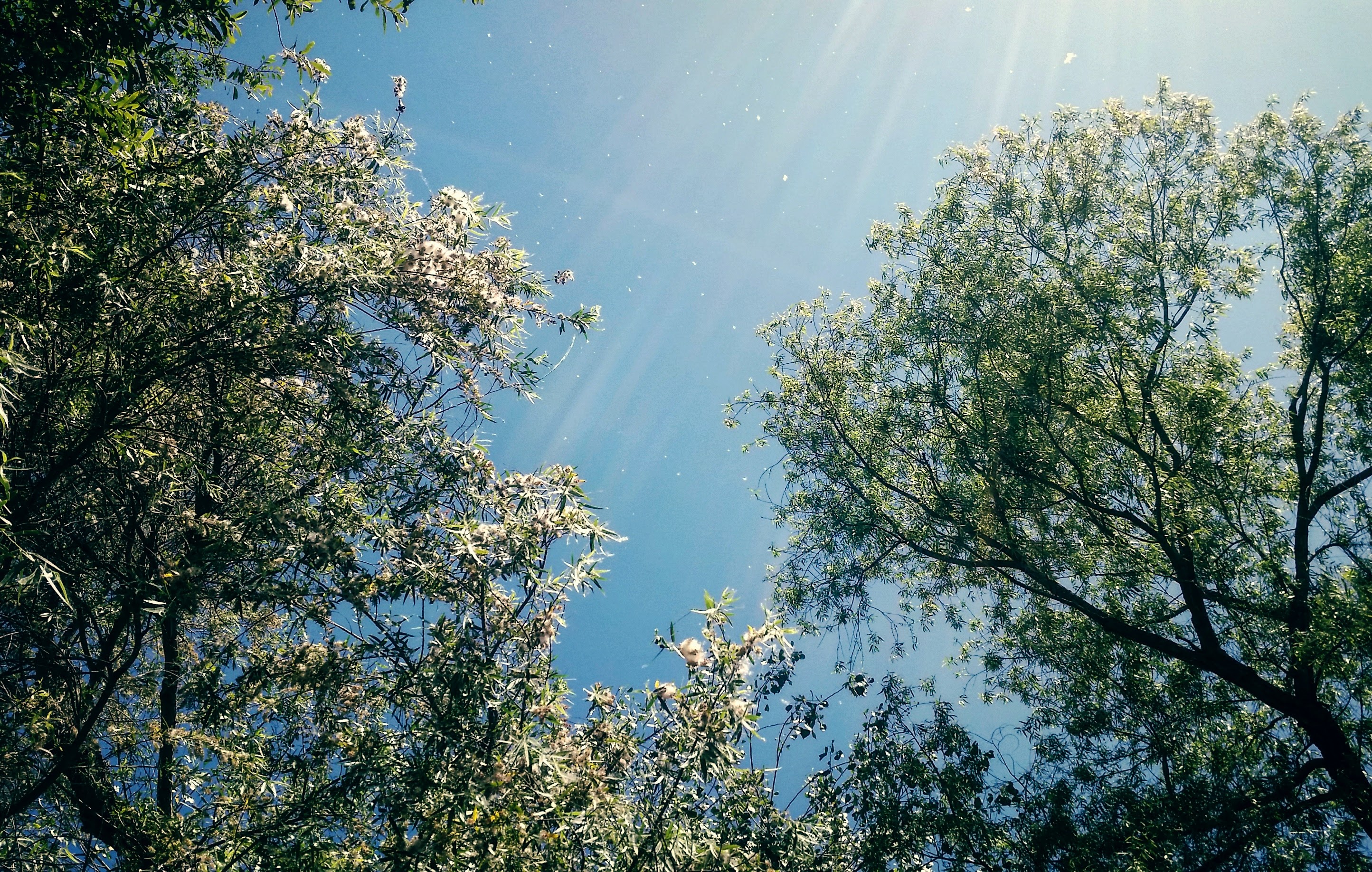
Riparian forest at Mission Trails Regional Park
Photo Credit: Emily Perkins, SDMMP
Goal: Maintain, enhance and restore riparian forest and scrub on Conserved Lands in the MSPA that supports or has the potential to support VF species (i.e., California newt, yellow-breasted chat) and to incidentally benefit a diverse array of other species (e.g., arroyo toad, southwestern pond turtle, least Bell's vireo, southwestern willow flycatcher, Townsend's big-eared bat) so that the vegetation community has high ecological integrity, and these species are resilient to invasive pests and disease pathogens, environmental stochasticity, threats and catastrophic disturbances, such as very large wildfires and intense and prolonged drought, and will be likely to persist over the long term (>100 years).
Management units: 1, 2, 3, 4, 5, 6, 7, 8, 9, 10, 11
In 2017-2018, map tree mortality in riparian forests across the MSPA using high resolution aerial imagery, LIDAR and other remote sensing data and incorporate existing datasets, where available, to determine the current status of riparian forest and scrub in the MSPA that are affected by drought, wildfire and invasive pests and fungal pathogens.
| Action | Statement | Action status | Projects |
|---|---|---|---|
| DEV-1 | Submit project metadata, datasets, analyses, and Riparian Forest Tree Mortality Map to the MSP web portal | In progress | 2017-2019 Developing a Map of Ecological Integrity Using Remote Sensing |
| Criteria | Deadline year |
|---|---|
| Riparian Forest and Scrub Mortality Map completed by 2018 | 2021 |
| Threat Name | Threat Code |
|---|---|
| Altered fire regime | ALTFIR |
| Altered hydrology | ALTHYD |
| Climate change | CLICHN |
| Herbivory/predation | |
| Invasive animals | INVANI |
| Invasive plants | INVPLA |
| Loss of ecological integrity | ECOINT |
| Parasitism/disease | |
| Urban development | URBDEV |
Management units: 1, 2, 3, 4, 5, 6, 7, 8, 9, 10, 11
Beginning in 2019, prepare a riparian forest and scrub vegetation monitoring plan for Conserved Lands in the MSPA to assess tree mortality and recruitment, track community composition, structure and ecological integrity, and to document threats and assess environmental conditions. Prepare the riparian forest and scrub monitoring to integrate where feasible or bulid upon the results of other monitoring projects such as oak woodland vegetation monitoring and shothole borer/Fusarium complex monitoring. The monitoring plan should include a conceptual model, specific monitoring questions, the sampling frame within the MSPA, monitoring methods, a statistically valid sampling design, permanent sampling locations, timeline, and standardized protocols. Use the Riparian Forest and Scrub Tree Mortality map to help develop a sampling frame and stratified sampling design with permanent sampling plots spanning north to south and east to west environmental gradients across the MSPA. Evaluate ecological integrity at monitoring sites by integrating other types of monitoring into the long-term sampling plots, such as abiotic element monitoring (e.g., automated weather stations and soil sensors, GIS-data layers), ecological integrity monitoring (e.g., plant and animal communities, ecological processes), MSP VF species monitoring, and threats monitoring (e.g., fire, climate change, disease, invasive animals and invasive plants).
| Action | Statement | Action status | Projects |
|---|---|---|---|
| PRP-1 | Establish a vegetation monitoring working group of scientists, wildlife agencies, land managers, and other stakeholders to participate in developing the vegetation monitoring plan. The group should also include interested parties from outside the MSPA, such as representatives from other multiple species plans in Orange and Riverside Counties and from San Diego County military bases, to create a regional monitoring program with greater efficiencies in effort and a broader inference across southern California. | waiting for precedent action | |
| PRP-2 | Submit project metadata and the Riparian Forest and Scrub Vegetation Monitoring Plan to the MSP web portal | waiting for precedent action |
| Criteria | Deadline year |
|---|---|
| Riparian Forest and Scrub Vegetation Monitoring Plan completed by 2020 | 2021 |
| Threat Name | Threat Code |
|---|---|
| Altered fire regime | ALTFIR |
| Altered hydrology | ALTHYD |
| Climate change | CLICHN |
| Herbivory/predation | |
| Invasive animals | INVANI |
| Invasive plants | INVPLA |
| Loss of ecological integrity | ECOINT |
| Parasitism/disease | |
| Urban development | URBDEV |
Management units: 1, 2, 3, 4, 5, 6, 7, 8, 9, 10, 11
In 2021, conduct riparian forest and scrub monitoring to implement the Riparian Forest and Scrub Vegetation Monitoring Plan on Conserved Lands in the MSPA.
| Action | Statement | Action status | Projects |
|---|---|---|---|
| IMP-1 | Submit project metadata, monitoring datasets and reports to the MSP web portal | waiting for precedent action |
| Criteria | Deadline year |
|---|---|
| Riparian Forest and Scrub Vegetation Monitoring Plan implemented 2021 | 2021 |
| Threat Name | Threat Code |
|---|---|
| Altered fire regime | ALTFIR |
| Altered hydrology | ALTHYD |
| Climate change | CLICHN |
| Herbivory/predation | |
| Invasive animals | INVANI |
| Invasive plants | INVPLA |
| Loss of ecological integrity | ECOINT |
| Parasitism/disease | |
| Urban development | URBDEV |
| Metric | Condition | Trend | Confidence |
|---|---|---|---|
1. Percent ConservedPercent of baseline riparian forest and scrub conserved |
Caution |
Improving |
Moderate |
2. Ecological IntegrityPercent of trees in high integrity class based on tree greenness |
Good |
Unknown |
Moderate |
|
2017-2019 Developing a Map of Ecological Integrity Using Remote Sensing
This project's objective is to create a map of ecological integrity using remotely sensed data. Data sources include high resolution lidar and high resolution 4-band imagery from multiple sources. Final products from this work will include: 1) an updated high resolution Digital Elevation Model, 2) an updated high resolution Digital Surface Model, 3) a raster image depicting vegetation height (using lidar), 4) a raster image depicting herbaceous, shrub, and tree cover, 5) a map layer of ecological integrity (at a 50m grid) for coastal sage scrub, chaparral, oak woodlands, and riparian woodlands. Ecological integrity is defined for each vegetation community independently, based on analysis of previous field work. This project will build off the information and products previously created.
|
|
Anstine-Audubon Nature Preserve Fencing Project
The goal of this project was to install 855 linear feet of lodge pole fencing along the northern boundary of San Diego Audubon Society’s (SDAS’s) 11.6-acre Anstine-Audubon Nature Preserve (Anstine) in Vista, CA to combat hazardous and non-hazardous dumping and illegal trespassing. The addition of fencing along the northern portion of the property, adjacent to Hidden Lake Lane, will protect the fragile riparian, oak woodland, and endangered coastal sage scrub habitats on the preserve. Urban Corps of San Diego, with SDAS oversight, successfully installed an 855-foot long, five-foot high lodge pole wooden fence along with three access gates on the property in the planned one-year project.
Project Start Date: March 7, 2023
Project Completion Date: January 18, 2024
This project was fully funded by SANDAG TransNet EMP Land Management Grant #S1125499
|
|
Arroyo Toad County Wide Monitoring
Surveys for arroyo toad have been conducted across San Diego County by various biologists from federal and state agencies, educational institutions, and non-governmental organizations. For over 20 years the U.S. Geological Survey (USGS) has been one of the agencies conducting various arroyo toad studies throughout San Diego County in collaboration with other agencies and academic partners. Since 2000, USGS has conducted various monitoring and inventory surveys to determine the status of the species on conserved lands (Brown and Fisher 2002, Ervin, Hathaway, and Fisher 2002, Meyer et al. 2003, Hitchcock, Backlin, and Fisher 2004a, 2004b, Madden-Smith Ervin, and Fisher 2005). USGS has expanded studies on the arroyo toad to assess impacts from disturbance, management operations, and naturally occurring disturbance such as wildfires and drought (Madden-Smith et al. 2003, Madden-Smith, Ervin, and Fisher 2005, Mendelsohn, Madden-Smith, and Fisher 2005, Brown et al. 2020, Gallegos et al. 2021, Hitchcock et al. 2022). USGS has also continued to refine and improve survey methods, data collection, and analysis methods to better inform status and trends, threats and stressors, and responses of arroyo toads to habitat and water management (Brehme et al. 2006, 2011, 2019).
This project builds on this previous work by USGS and partners to develop and implement a monitoring plan for arroyo toad across San Diego County.
Background:
The arroyo toad (Anaxyrus californicus) is a habitat specialist endemic to the coastal plains and mountains of central and southern California and northwestern Baja California (Jennings and Hayes 1994). It has a life span of seven to eight years (Fisher et al. 2018). The species primarily inhabits low gradient streams and rivers composed of sandy soils and containing sandy streamside terraces (Sweet 1992 and 1993, Barto 1999). Reproduction depends on availability of shallow, still, or low flow pools in which breeding, egg laying, and tadpole development occur over 65–85 days (Sweet 1992). These habitat requirements are largely determined by natural hydrological cycles and scouring flood events (USFWS 1999, Madden-Smith et al. 2003).
In 1994, the U.S. Fish and Wildlife Service (USFWS) listed the arroyo toad as endangered in response to a decline of 75% of its historic distribution within the United States (Jennings and Hayes 1994, USFWS 1994) due to extensive habitat loss, human modification to natural water flow regimes, and introduction of non-native predators. The USFWS released a recovery plan for the arroyo toad in 1999 (USFWS 1999) and reviewed its classification status in 2014, which remained as endangered (USFWS 2015). Arroyo toads were detected in 80% of the 25 his
|
|
Artesian Creek Restoration
Approximately 300 acres along Artesian Creek, a tributary of the San Dieguito River, was restored to coastal sage or native riparian. The majority of restored land was previously used for grazing, with an additional two miles of riparian habitat. The project is located between Camino Del Sur and Del Dios Highway, just south and southwest of Lake Hodges. The restoration has been completed, but annual treatment of invasive species remains including ongoing treatment of eucalyptus, tamarix and palms. The focal invasive species included: mustard, French broom, Scotch broom, Spanish Fleabane, arundo, Austrailian salt bush, Brazilian Pepper, caster bean, lapidium latifolia, garland chrysanthemum, bridal creeper, Italian thistle, fountain grass, dittrichia graveolens, artichoke, eucalyptus, tree tobacco, acacia, palms, pampas grass, pride of Maderia, tamarix, and fennel.
|
|
Arundo Treatment in San Luis Rey, Santa Margarita, and San Dieguito Watersheds
This project is a three-year re-treatment/control of Arundo in order to obtain 100% eradication in the San Luis Rey and Santa Margarita watershed. This project will also fund the first round of re-treatments on over half of the San Dieguito watershed. Mission Resource Conservation District will coordinate this project with San Diego River Partners to ensure work is not duplicated in the San Diego River Valley. Additionally any cut or chipped material will be removed from the project sites. Finally, re-treatment is included for the city of San Diego property currently mapped as not included in re-treatment areas.
|
|
Blue Sky Ecological Reserve Fire Restoration and Invasive Removal
Blue Sky Ecological Reserve burned in 2007. In 2008, restoration focused on the removal of Castor bean, mustard, tree tobacco palms, dittrichia, fountain grass, acacia, cape ivy, tamarix and pampas grass. Major restoration efforts concluded after 3 years. Maintenance has continued with the treatment of Castor bean and Italian thistle.
|
|
Fairbanks Ranch/Rancho Santa Fe Invasive Removal and Stream Enhancement
The long-term goal of this project is to restore and enhance wetland/riparian habitat along 3 miles, 200 acres, of the San Dieguito River and reduce fire risk to the surrounding community. Key actions include non-native, invasive plant removal, revegetation with native species, volunteer training, community workshops and education of local residents on how to improve habitat and create Fire-Safe landscapes around their homes. A secondary goal of this project is to highlight the importance of diverse partnerships in conserving habitat along the San Dieguito River. For more information, go to: http://www.ranchosantafereview.com/news/local-news/sd-cm-rsf-restorationproject-20171101-story.html.
|
|
Famosa Slough Stormwater Treatment Pond Restoration and Enhancement
This project is designed to reduce the threat of altered hydrology and threat of loss of ecological integrity to the salt marsh vegetation community at Famosa Slough. In 2000, treatment ponds were built and vegetated at the south end of the Famosa Slough to clean all stormwater flows and retain dry-weather stormwater flows from the surrounding watershed of about 100 acres south of the Slough. The series of ponds and berms collect freshwater runoff as well as sediments, trash, and nutrients, but sediment has built up which reduces their effectiveness. The goal of this project is to restore the treatment ponds and berms and keep the dry weather freshwater and undesirable material from going into Famosa Slough, and thus reducing the risk of type conversion, and the resulting loss of ecological integrity of the strategic habitat of salt marsh vegetation community, and associated MSCP species. The treatment ponds are in urgent need of renovation to prevent the berms from failing and damaging the salt marsh habitat that is downstream. This project will remove sediment so that the dry weather freshwater is retained in the ponds rather than crossing the berm into the saltwater marsh areas, preserving the salt marsh.
|
|
Feral Pig Removal Program Monitoring
This is an ongoing project established to support the feral pig removal effort in San Diego County established and funded by land management agencies that have been participating in the Intergovernmental Feral Pig Project. This is an independent monitoring project intended to complement and inform the USDA Wildlife Services-led removal project. The objectives of the project are to monitor feral pigs and their movements through use of telemetry, remote cameras, and collecting field data pre-, during, and post-removal actions to inform efficient and effective removal efforts. The project is also working to coordinate with the Feral Pig Intergovernmental Working Group and provide results of the monitoring efforts on a quarterly basis.
|
|
Invasive Plant Control - Silverwood Wildlife Sanctuary
Silverwood Wildlife Sanctuary, owned and operated by San Diego Audubon since 1966, is maintained to preserve 787 acres of prime coastal chaparral and riparian woodland habitat in San Diego County, consistent with objectives described in the Management Strategic Plan (MSP). Like much of San Diego County, sensitive wildlife in the preserve is threatened by the presence and potential spread of invasive non-native plant species. This project supports the implementation of invasive plant control in priority habitat areas within the preserve. The primary goal is to reduce extant populations of invasive species and prevent their further spread. Project objectives include treatment of approximately 65 acres of invasive species hot spots with herbicide and approximately 5 acres of emergent invasive species treated via hand management, reducing invasive cover by 90% within the 18-month grant term. This funding is a priority and imminent need for the preserve, largely due to drought-caused, elevated instances of invasive species that threaten high-quality habitat.
|
|
Least Bell's Vireo Surveys - Tijuana River Valley
In 2017, USGS conducted Least Bell's Vireo surveys at the Tijuana River to document the species' status 2 years after the Kuroshio Shothole Borer/Fusarium Dieback infestation and compare it to historic vireo abundance and distribution.
|
|
Lusardi Creek Restoration and Invasive Plant Removal
This project is working to eradicate invasive species and support native plants along Lusardi Creek. Many areas have already been treated and are recruiting natives naturally. Other areas are being planted with natives after invasive plant removal. The current goals include: 1) treat artichoke in several upland areas, 2) continue removing tamarix in the creek, 3) treat any regrowing Peruvian pepper, 4) treat any remaining pampas grass or tree tobacco, 5) work on an overall restoration plan. See the map link below for detailed treatment information.
|
|
Monitoring and Documentation of Post-Fire Recovery of Riparian Bird Community
A 2-year study on the effects of fire on the riparian bird community in San Diego County. Tasks included documenting the effects of the 2007 fires on endangered birds, in particularly, the Least Bell's Vireo, and monitoring post-fire recovery of the entire riparian breeding bird community.
|
|
Quarry Creek Preserve Fencing Project
SDHC will install additional fencing to prevent trespassers from entering vulnerable areas of the preserve that have historically been disturbed by trespassers and encampments. This project was partially funded by SANDAG TransNet EMP Land Management Grant #S1125500.
|
|
Rare Plant Inspect and Manage Monitoring 2014-2026
From 2014-2026, a Management and Monitoring Strategic Plan (MSP Roadmap) monitoring objective for 30 rare plant species is to inspect occurrences to determine management needs. The inspect and manage (IMG) objective is implemented to document the status of rare plant occurrences and assess habitats and threats to develop specific management recommendations. IMG monitoring is implemented by a combination of land managers and contracted biologists in coordination with the SDMMP. Available rare plant data is posted below. New annual updates are typically posted in March. Based upon an evaluation of these data, a 2014-2026 monitoring schedule has been developed for the 30 rare plant species (attached below). Coordinating data collection across the region allows analyses of species and population trends over time and provides a better understanding of the association between habitat and threat covariates and population dynamics.
|
|
Riparian Restoration and Arundo Removal
This project is to remove arundo donax and other non native plants located in an 11 acre 'old growth' riparian forest in the channel of the San Diego River. This area, received a great deal of arundo corms and stakes during the first El Nino storm series of 2016. They arundo stakes formed dikes and debris lines several feet high. Although the area has been cleared of arundo for several years, this flooding brought an inordinate amount of arundo stakes and corms into the riparian forest. They are all sprouting and need to be cleared out to get the infestation under control while it is small enough to be controlled with limited effort.
|
|
San Diego River Channel
This project will take place on 148 acres of the San Diego River Biological Corridor between Santee border to Channel Road in Lakeside. The largest threat to the river is illegal lodging. Homeless individuals and groups in Lakeside always want to use the San Diego River Channel for illegal lodging and we are starting to get hunters in the riverbed as well. Although everyone makes their best effort to ensure that we remove the camps, it is done on an ad hoc basis without regular staff support. Recently, there has been an uptick in illegal lodging in the riverbed. This ls due to their use of a large culvert that drains into the river as as well as the removal of other illegal lodging locations in other areas of the river in other communities. All of the communities along the river are working hard to remove this population, which just creates a shuffle of individuals and camps between areas and communities. We have also had reports of hunters in he river. This needs be be stopped. With homeless comes trash, the cutting of fences, the removal of hazardous waste including sanitary issues, as well as needles and drug paraphernalia.
|
|
San Diego RiverBlitz
Volunteer citizen science teams hike segments of the urban San Diego River to collect data about trash, homeless encampments, and invasive plants. This data is collected using a data mapping app called Mappler.
RiverBlitz takes place twice annually, allowing for year-over-year comparisons of point-in-time data.
On-going surveys and data mapping efforts supplement the RiverBlitz program, allowing the San Diego River Park Foundation to initiate real-time responses to trash and invasive plant species.
|
|
San Dieguito Citizen Science Monitoring Program
The San Dieguito River Valley Conservancy (SDRVC) developed the San Dieguito Citizen Science Monitoring Program as a sustainable, cost-effective, and scientifically valid approach to gather critical data on lands within the San Dieguito River Park Focused Planning Area. This program seeks to fill knowledge gaps on the diversity, population, movements and spatial ecology of species within the watershed to better inform future land acquisitions, adaptive land management, habitat and species restoration, educational initiatives and future research. One of the main objectives of this program is to gather data that is consistent and shared with other regional planning efforts being coordinated by the San Diego Management & Monitoring Program. Data collected is submitted to regional databases and will help meet the management goals and objectives identified in the Management & Monitoring Strategic Plan. Annual expert-led surveys are carried out by volunteer citizen scientists following approved protocols and encourage community involvement and engagement.
|
|
Science Support for Recovery of Southwestern Willow Flycatcher on Conserved Lands
The declines observed among known populations of Southwestern Willow Flycatcher in San Diego County indicate that flycatchers could benefit from a regional conservation strategy. Data on the current distribution and demography of the flycatcher within San Diego County, as well as identification of threats and stressors affecting the species, are essential components necessary to develop and implement a comprehensive approach to ensure the persistence of the species in San Diego County. To help fulfill the MSP goals and objectives established for the flycatcher, several tasks were initiated by USGS scientists, including surveys and demographic monitoring along the San Luis Rey River and other drainages in San Diego County to determine the current status of the flycatcher within the MSPA (Howell et al., 2022). The information obtained from surveys and monitoring between 2015 and 2023 (Howell and Kus, 2021; 2022; 2023; 2024) were combined with data from other ongoing studies (Houston et al., 2024; Howell and Kus, 2025), as well as all available data on historical occurrences (Unitt, 1987; Kus et al., 2003) to form the basis for the analyses for this project.
There are two parts to the recovery effort. The first part presents background information pertinent to recovery-oriented management of the flycatcher, outlines factors influencing flycatcher population dynamics, and summarizes the current knowledge regarding Southwestern Willow Flycatcher population status, trends, and demography (including productivity, survival, and dispersal) in San Diego County. The second part describes a potential science-based regional conservation approach, details site-specific management options to benefit Southwestern Willow Flycatchers, and ranks sites according to their potential to improve persistence of flycatcher populations. In particular, the second part provides managers with options for developing conservation projects to promote flycatcher recovery.
|
|
Southwestern Willow Flycatcher Brown-headed Cowbird Demographic Monitoring
This study expands on the efforts started in 2015 in documenting the status of Southwestern Willow Flycatchers in San Diego County, California. It specifically evaluates the level of parasitism from the Brown-headed Cowbird on flycatcher populations at Lake Henshaw on collecting data on nest success, productivity, and parasitism rate.
|
|
Southwestern Willow Flycatcher Status (2020-2024)
The goal of the survey efforts from 2020 to 2024 was to assess the population status, banding status, breeding status, and habitat attributes of the flycatcher population along the upper San Luis Rey River, in an area downstream from Lake Henshaw, where demographic monitoring occurred from 2015 to 2019 as well as the habitat surrounding Lake Henshaw. The reports contain the annual updates to surveys completed since 2015. In 2024, the efforts also were to (1) assess the flycatcher populations at select locations in San Diego County, including two along the middle San Luis Rey River near Bonsall and four along the upper San Luis Rey River near Santa Ysabel; (2) assess the breeding activities of the flycatcher at Lake Henshaw, including nest success and productivity; and (3) evaluate the level of cowbird parasitism at Lake Henshaw.
|
|
Tijuana River Invasive Plant Control
This project was undertaken to enhance and restore prime riparian and mule fat habitats within the Tijuana River Valley though the treatment of invasive, non-native plants and the planting of native plant species.
|
|
USGS Southwestern Pond Turtle Management and Monitoring Study
The southwestern pond turtles (Actinimeys pallida; pond turtle) has been declining throughout its range and has been extirpated from much of coastal southern California (Bury and Germano 2008, Thomson et al. 2016). Historically, the pond turtle inhabited coastal draining streams, ponds, and lakes, fed primarily on small aquatic invertebrates and vegetation, and had no native aquatic predators (Bury and Germano 2008). However, threats to the pond turtle now include altered hydrology (dams and diversions), habitat fragmentation, direct mortality from roads and development, and predation by nonnative aquatic species (NAS) including American bullfrogs (Lithobates catesbeianus, bullfrog) and largemouth bass (Micropterus salmoides) (Brattstrom and Messer 1988, Stephenson and Calcarone 1999).
The USGS conducts research on the natural history of and threats and impacts to reptiles and amphibians in coastal southern California to understand the demography of rare and listed taxa in the region. The research aims to study the responses of the pond turtle to both threats and management actions. Specifically, USGS research seeks to understand the causes of decline of the pond turtle on conserved lands within San Diego's conserved lands and how the populations respond to management actions including pond turtle translocations and NAS removal.
Translocations of pond turtles, removal of nonnative species, habitat restoration, and restoration of connectivity have been the primary tools used for restoration of pond turtle populations within the MSPA of San Diego County, CA since 2009. In 2009, the USGS partnered with San Diego Zoo and CDFW to study the effects of removing NAS and headstarting (raising hatchlings in a controlled environment before releasing them to the wild) pond turtles at CDFW’s Sycuan Peak Ecological Reserve (SPER). In 2014, the USGS began to study translocations of adult pond turtles as a conservation tool, and 18 pond turtles were translocated from private ponds in the Pine Valley Creek watershed to ponds at CDFW’s Rancho Jamul Ecological Reserve (RJER) to evaluate the potential to restore the pond turtle to the Otay River watershed. In 2019, the USGS translocated 12 pond turtles in the San Dieguito watershed from Black Canyon to a pond near the headwaters of Scholder Creek at The Nature Conservancy’s Mesa Grande Easement with eight additional pond turtles translocated in subsequent years (Sebes et al. 2024a). USGS continues to monitor headstarted and translocated populations for recruitment, study the removal of NAS, and conduct surveys on new or remote conserved lands to find additional populations and restoration sites.
|
|
Vegetation Mapping 2026
The goal of this project is to create a new vegetation map for the western portion of San Diego County. This will be based on the Vegetation Classification Manual hierarchical classification system. The map will consist of a group-level comprehensive map based on satellite remote sensing and an alliance/association map focused on existing preserves or important resources.
|
|
Vegetation Mapping and Classification 2012
This project first created a vegetation classification system and manual. Then, based on 2012 data, this project completed 3 tasks: Task 1. Vegetation Mapping. Task 2. Invasive Nonnative Species Plant Mapping. Task 3. Tecate Cypress Mapping. In 2014, the data was updated based on user's comments. The final products are available to download in the data section.
|
|
Veldt Grass Removal - San Elijo Lagoon Ecological Reserve
The San Elijo Lagoon Conservancy (SELC) aims to secure funding to begin Phase I of eradicating perennial veldt grass (Ehrharta calycha) in the San Elijo Lagoon Ecological Reserve (Reserve). The invasive nonnative grass species currently occurs in Diegan coastal sage scrub, southern maritime chaparral, and riparian scrub habitats. It is also capable of invading coastal dune habitats, potentially displacing several high priority Management Strategic Plan (MSP) plant and animal species. SELC proposes to treat the current range of perennial veldt grass in the reserve and continue to monitor the spread or lack thereof. Perennial veldt grass ls currently under SMSP management level 3 for invasive non-native plants, and needs further evaluation and management information. The proposed project will provide crucial information regarding the species and the potential for its control and eradication.
|
Riparian forest and scrub follow along permanent or ephemeral waterways [1] and are tree-dominated with dominant species including Coast live oak (Quercus agrifolia), Goodding's black willow (Salix gooddingii), Arroyo willows (Salix lasiolepis), Fremont cottonwood (Populus fremontii), and California sycamores (Platanus racemosa). The understory of riparian forest is a mixture of various species including mule fat (Baccharis salicifolia), poison oak (Toxicodendron diversilobum), blue elderberry (Sambucus nigra), yerba mansa (Anemopsis californica), Carex spp., Cyperus spp., and California mugwort (Artemisia douglasiana).Mule fat is dominant in riparian scrub, which consists mainly of lower and denser shrubs. Single species dominated stands include mulefat and tamarix species. Channels and washes are largely un-vegetated and may contain constant or periodic water flow, depending on upstream urban uses and precipitation. A number of invasive plants are common in riparian areas including arundo donax, washingtonia sp., and tamarix [2].
The most common riparian alliances and associations in the MSPA in order of abundance include the P. racemosa alliance, Q. agrifolia/S. lasiolepsis association, S. gooddingii alliance, S. lasiolepsis alliance, B. sarathroides alliance and P. fremontii alliance [1, 2]. Nonnative alliances include Arundo donax and Tamarix.
These species communities generally occur throughout stream systems in California [3, 4, 5]. P. racemosa extends south into Baja Californiaand up to northern California, and is restricted mostly to the coastal areas. Q. agrifolia is present along the California coast, up to San Francisco Bay and the southern portion of its range reaches slightly into Baja California. S. lasiolepis' range includes California, small portions of Oregon, Washington, Idaho, Nevada, Arizona, Utah, and New Mexico and into northern Mexico. S. gooddingii and P. fremontii occur throughout the southwestern U.S. and northern Mexico.
Riparian forest and scrub covers 38,377 acres in the MSPA. Thirty-seven percent (14,487 acres) is conserved. It is found in all MUs, however larger riparian zones are more common on lower order streams along the coast [1].
Lowland areas, including canyons, that encompass streams and the current or potential floodplain. Alluvial soils are typically rich with nutrients [6]. Many riparian species depend on flood events for regeneration from seed [2, 6, 7].
Riparian vegetation is dependent on the hydrologic cycle including surface flow, ground water, nutrient cycling, sedimentation and erosion, and water quality [7, 8, 9]. Flow volume and timing effect species composition and seed regeneration [2, 6, 7, 8].
Riparian areas are affected by altered hyrdology, invasive plants, and invasive animals. Upstream urbanization casuses an increase in flow volume and an increase in the dry season runoff (both amount and the number of days) [8, 10, 11]. Stream geomorphology has changed from a broad, braided channel to an incised, more densely vegetated channel [8, 10]. Species composition and seed regeneration can be altered from changes in the hydrology [7, 8]. Invasive plants and acquatic species can establish themselves fairly easily because of the constant stream water and high nutrient soils [9, 12, 13, 14]. A particular concern for riparian vegetation is the expansion of two introduced Shot Hole Borers (SHB) [15, 16]. The Polyphagous SHB and the Kuroshiro SHB carry Fusarium spp. into the host tree, cutting off the water and nutrient transport system, resulting in branch dieback or tree mortality.
Various threats to riparian areas can cascade downstream. Special consideration to threat management should focus on working from the top of the watershed to the bottom. For example, invasive species removal should begin at any upstream sources. Riparian systems in the MSPA support 14 MSP species (link to species and vegetation assocation table).
[1] Oberbauer, T., F. Sproul, J. Dunn, and L. Wolley. 2012. ECO_VEGETATION_WSD. Prepared by AECOM, California Department of Fish and Wildlife Published by AECOM and SANDAG Technical Services. www.sangis.org. Accessed September 2016.
[2] Sproul, F., T. Keeler-Wolf, P. Gordon-Reedy, J. Dunn, A. Klein and K. Harper. 2011. Vegetation Classification Manual for Western San Diego County. First Edition. Prepared by AECOM, California Department of Fish and Game Vegetation Classification and Mapping Program and Conservation Biology Institute for San Diego Association of Governments
[3] Argus, G. W. 2007. Salix (Salicaceae) Distribution Maps and a Synopsis of their Classification in North America, North of Mexico. Harvard Papers in Botany 12:225-268
[4] Little, E.L., Jr. 1976. Atlas of United States Trees, Volume 3, Minor Western Hardwoods: U.S. Department of Agriculture Miscellaneous Publication 1314. 13 p., 290 maps. Accessed at http://gec.cr.usgs.gov/data/little/
[5] Little, E.L., Jr. 1971. Atlas of United States Trees, Volume 1, Conifers and Important Hardwoods: U.S. Department of Agriculture Miscellaneous Publication 1146. 9 p., 200 maps. Accessed at http://gec.cr.usgs.gov/data/little/
[6] Griggs, F. T. 2009. California Riparian Habitat Restoration Handbook. Second Edition. California Riparian Habitat Joint Venture.
[7] Stromberg, J.C. 1993. Fremont Cottonwood-Goodding Willow Riparian Forests: A Review of their Ecology, Threats, and Recovery Potential. Arizona-Nevada Acadamy of Sciences 27:97-110
[8] White, M. D. and K. A. Greer. 2002. The Effects of Watershed Urbanization on Stream Hydrologic Characteristics and Riparian Vegetation of Los Penasquitos Creek, California. Conservation Biology Institute.
[9] Stohlgren, T. J., K. A. Bull, Y. Otsuki, C. A. Villa, and M. Lee. 1998. Riparian Zones as Havens for Exocitic Plant Species in the Central Grasslands. Plant Ecology 138:113-125.
[10] Taniguchi, K. T. and T. Biggs. 2015. Regional Impacts of Urbanization on Stream Channel Geometry: A Case Study in Semiarid Southern California. Geomorphology 248:228-236. DOI: 10.1016/j.geomorph.2015.07.038
[11] Trimble, S. W. 1997. Contribution of Stream Channel Erosion to Sediment Yield from an Urbanizing Watershed. Science 278:1442-1444. DOI: 10.1126/science.278.5342.1442
[12] Madden-Smith, M. C., Ed. L. Ervin, and R. N. Fisher. 2005. Baseline Surveys for the Arroyo Toad (Bufo californicus) in the Sweetwater River Channel, San Diego County, California. U.S. Geological Survey.
[13] Shafroth, P. B., J. R. Cleverly, T. L. Dudley, J. P. Taylor, C. Van Riper III, E. P. Weeks, and J. N. Stuart. 2005. Control of Tamarix in the Western United States: Implications for Water Salvage, Wildlife Use, and Riparian Restoration. Environmental Management 35:231-246.
[14] Richardson, D. M., P. M. Holmes, K. Esler, S. M. Galatowitsch, J. C. Stromberg, S. Kirkman, P. Pysek, and R. Hobbs. 2007. Riparian vegetation: degradation, alien plant invasions, and restoration prospects. Diversity and Distribution 13:126-139.
[15] Eskalen, A. 2016. Fusarium Dieback Host Range, Biology, and Control Strategies in Native Vegetation. San Diego Monitoring and Management Coordination Meeting Presentation. April 27, 2016.
[16] SANDAG. 2016. Southern California Shot Hole Borers/Fusarium Dieback Management Strategy for Natural and Urban Landscapes.