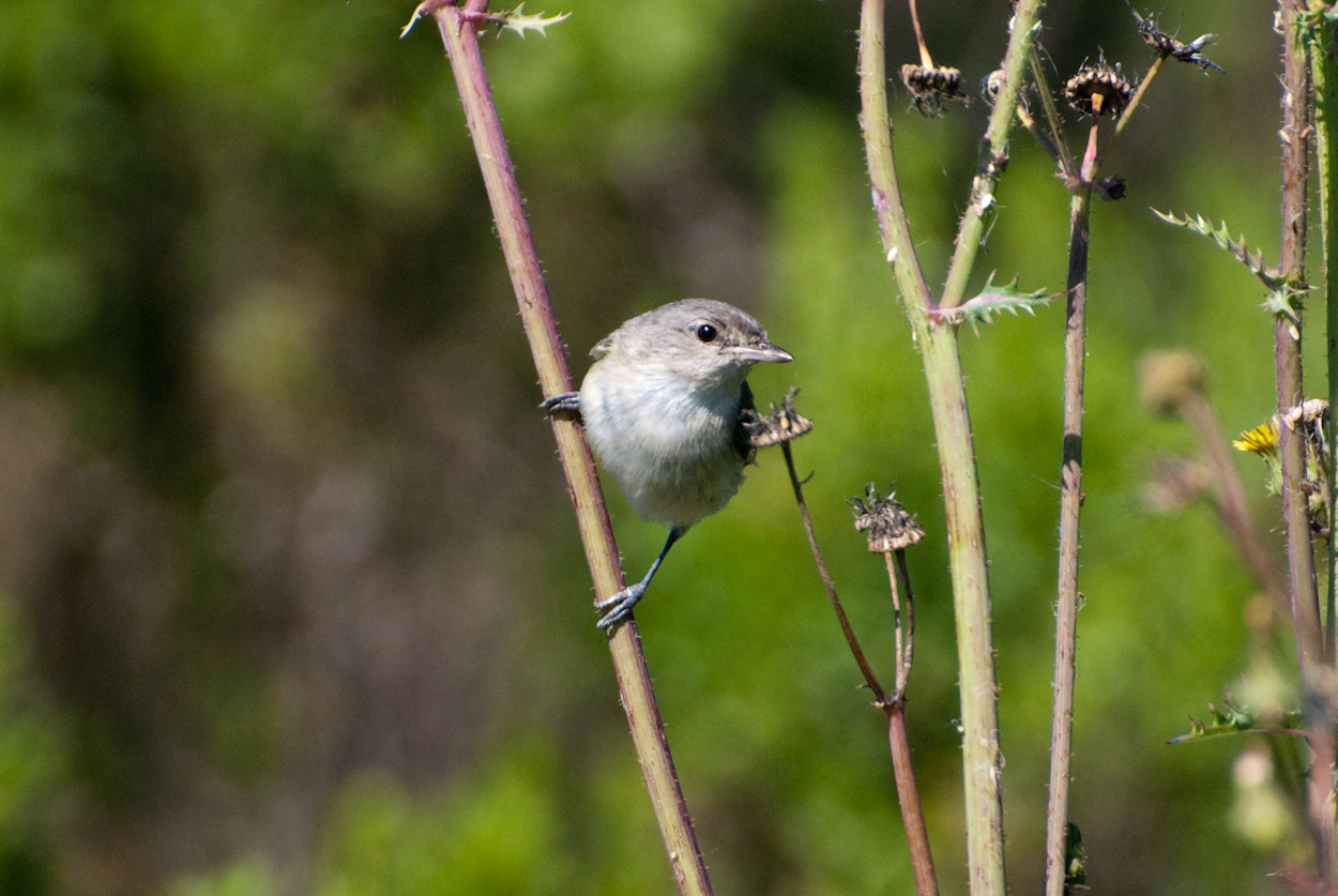
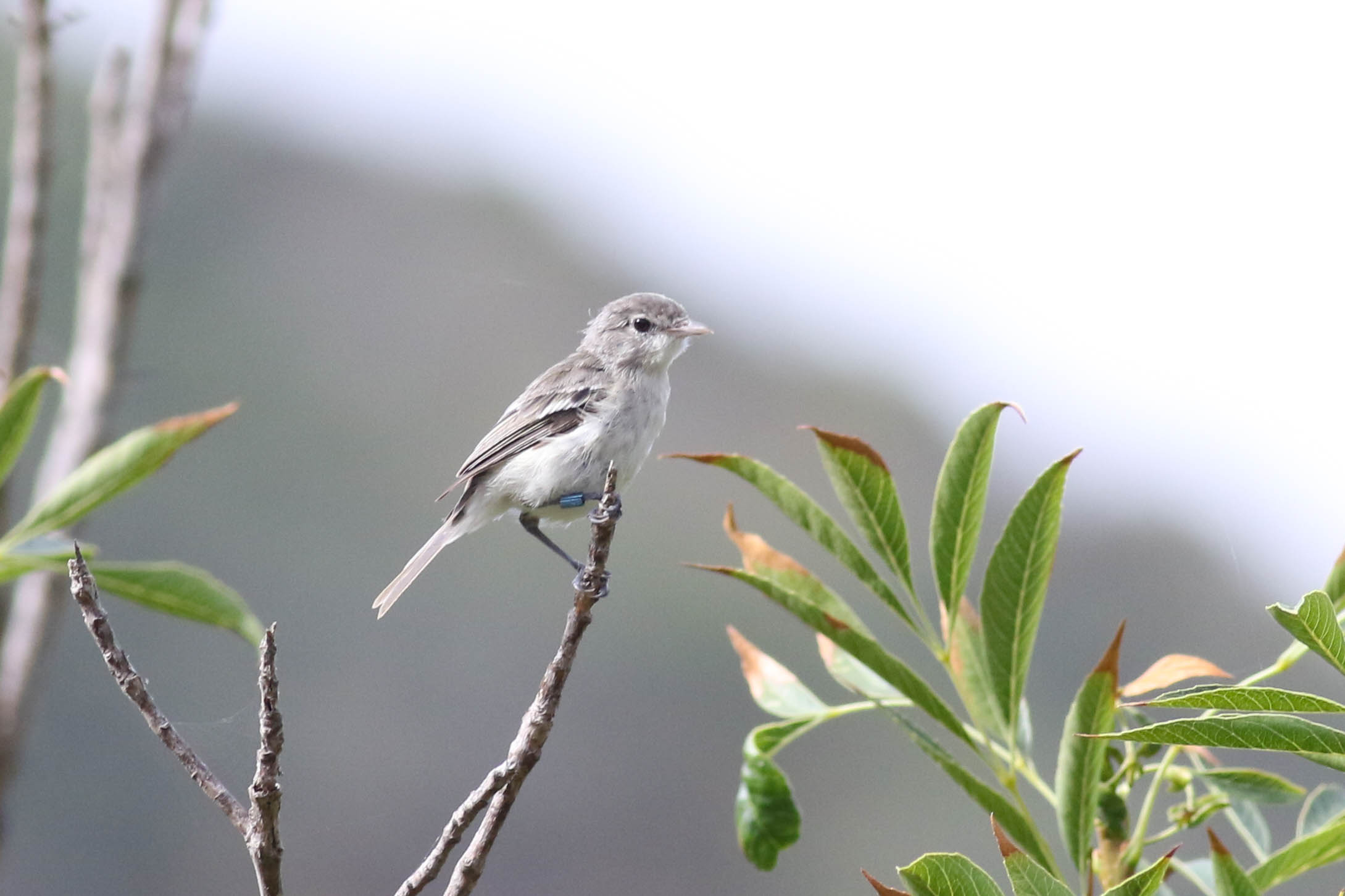
Current Distribution Rangewide
The historic breeding range was centered in the San Joaquin, Sacramento and Central Valleys and extended south to Baja California. Despite a large increase in overall population numbers over the last few decades, most nesting occurs from Santa Barbara County southward and from northwestern Baja California south to at least Cataviña, while the vireo is rare in the northern part of its historic range. Southern California supports 99% of the total population, with 54% in San Diego County and 30% in Riverside County [1]. The range during the nonbreeding season includes the Cape region of Baja California, with stragglers in southern California [2; cited from 3].
Known Populations in San Diego County
Occurrences found in Anza Borrego Desert State Park, San Felipe Valley Wildlife Area, Bureau of Land Management, Barrett Reservoir Open Space, Cleveland National Forest, Tijuana River Valley Regional Park, Mission Trails Regional Park, El Capitan Reservoir Open Space, City of Escondido Open Space, San Luis Rey River Park, Kit Carson Park, Escondido Creek Preserve, Hodges Reservoir Open Space, Encinitas Creek, San Dieguito River Park, Santa Margarita River Park, 4-S Ranch Specific Plan Habitat Management, Los Jilgueros Preserve, Rosemary's Mountain, Otay Lakes Cornerstone Lands, Rancho Jamul Ecological Reserve, San Diego National Wildlife Refuge, Otay Ranch Preserve, Flood Control Channel Southern Wildlife Preserve, SD River Corp. City of Oceanside Open Space, Rainbow Water District, San Diego Revier Ecological Reserve, Rincon San Luiseno Band of Mission Indians, Groves Open Space, San Diego Metropolitan Transit Development, Faubus Farms, Pilgrim Creek Ecological Reserve, City of Carlsbad Municipal Golf Course, Wilmont and Morro Hills, Santa Margarita Preserve, Torrey Pines State NAtural Reserve, Border Field State Park, Hodges Reservoir Open Space, Sweetwater Reservoir Open Space, Buena Vista Creek Ecological Reserve, Los Penasquitos Canyon Preserve, Lilca Ranch, Mount Miguel Open Space, McGinty Mountain Ecological Reserve, City of Chula Vista Central City Preserve, Tijuana Slough Natuinal Wildlife Refuge, Otay Valley Regional Park, San Vicente Reservoir Cornerstone Lands, Pamo Valley, Kit Carson Park (Refer to MOM for more sites).
List Status
FE, CE
Habitat Affinities
Dependent upon riparian habitat during breeding season. Prefers willow-dominated woodland or scrub that typically exists along streams and rivers. Other habitat types used include Baccharis scrub, mixed oak/willow woodland, mesquite woodland, and elderberry scrub. Habitat characteristics that appear to be essential include dense cover from 1-2 meters in height for nesting and foraging, and a stratified canopy providing both foraging habitat and song perches for territorial advertisement [4]. Not limited in winter to willow-dominated riparian areas. Occupy a variety of habitats including mesquite scrub within arroyos, palm groves, and hedgerows bordering agricultural and residential areas [5,6]. During migration, uses coastal scrub, riparian, and other woodland habitats [7; cited from 5]. Elevational extremes of -54 m in Death Valley to 1260 m in Bishop, Inyo County [8; cited from 5].
Taxonomy and Genetics
No changes to taxonomic classification or accepted nomenclature have been published or proposed since listing [1]. Originally thought to be one of four subspecies of Bell's Vireo recognized by the American Ornithologist's Union [AOU 1957; cited from 5], recent research suggests they are not one species with four subspecies, but two species, each with two subspecies. Results support distinctiveness of the Least Bell’s Vireo as a taxon and its recognition as state and federally endangered [9].
Seasonal Activity
Typically arrive on breeding grounds in southern California in mid-March through May, with majority of birds arriving during the latter half of April. In San Diego County, majority of population breeds along San Luis Rey and Santa Margarita rivers [10]. Nesting lasts from early April through July, but adults and juveniles remain on breeding grounds into late September/early October before migrating to wintering grounds in southern Baja California, Mexico [4,11]. Occasionally occur in California in the winter [5].
Life History/Reproduction
Males vocally conspicuous and sing throughout breeding season from exposed perches. Females arrive approximately 1-2 weeks after males, are more secretive, and often seen early in the season traveling through habitat with the male [11]. Typically breed in their first year as adults; breed in dense, low, early successional vegetation where they lay eggs at one-day intervals with three to four eggs per clutch, incubate for about 14 days, and fledge young about 10–12 days later [4,5,12]. Both sexes feed and brood nestlings. Fledged young may be cared for by both parents, or, if the pair renests, primarily by the male [5]. Monogamous, though may switch mates between successive nesting attempts within the same season and between years (serial monogamy) [5;6]. Will attempt to renest following unsuccessful nests and will occasionally raise two broods in the same season [4]. Have an open-cup nest placed in the horizontal fork of a tree or shrub branch and bound at the rim. Nests typically constructed of soft plant strips and shreds, leaf fragments, small pieces of bark, spider webs, and other material. Usually lined with soft substances such as plant down or hair [13; cited from 5].
Diet and Foraging
Primarily insectivorous; takes a wide variety of prey species, including caterpillars, beetles, bugs, moths, grasshoppers [14 cited from 4;13 and 15 cited from 5] and small spiders in the breeding season [12]. Obtain prey primarily by foliage gleaning and hovering, with occasional use of hawking (pursuit and capture of flying prey) and clinging (hovering but with the feet in contact with the vegetation) [5]. Individuals may forage in woodlands or scrub habitat near nesting habitat, concentrated in lower to mid-canopies, especially when actively nesting [12,14; cited from 6]. Also forage in upland vegetation adjacent to riparian corridors particularly late in the season [16,17,18; cited from 6].
Dispersal
On average, 20% of first-time breeders dispersed away from natal drainages, with a higher proportion of males (22%) than females (13%) dispersing [Kus unpubl. data;5]. Site fidelity is high where they may place nests in the same shrub used in the previous year [18, Kus unpubl. data; cited from 5].
Threats
Threatened by loss of riparian habitat due to increased urbanization, agricultural practices, and invasive plant species. Nests also parasitized by the Brown-headed Cowbird (Molothrus aster) [1,5,6,19].
Literature Sources
[1] U.S. Fish and Wildlife Service. 2006. Least Bell’s vireo (Vireo bellii pusillus) 5-year review: Summary and evaluation. Prepared by the Carlsbad Fish and Wildlife Office, Carlsbad, California.
[2] Ehrlich, P. R., D. S. Dobkin, and D. Wheye. 1992. Birds in jeopardy: the imperiled and extinct birds of the United States and Canada including Hawaii and Puerto Rico.
[3] NatureServe. 2015. NatureServe Explorer: An online encyclopedia of life [web application]. Version 7.1. NatureServe, Arlington, Virginia. Available from: http://explorer.natureserve.org. Accessed: October 12, 2016.
[4] Wells, J. M., and B. E. Kus. 2001. Least Bell's Vireo surveys and nest monitoring at Anza Borrego Desert State Park in 2000.
[5] Kus, B. E. 2002. Least Bell's Vireo (Vireo bellii pusillus). In The Riparian Bird Conservation Plan: a strategy for reversing the decline of riparian-associated birds in California. California Partners in Flight. http://www.prbo.org/calpif/htmldocs/riparian_v-2.html. Accessed October 5, 2016.
[6] DUDEK. 2014. Draft Least Bell's Vireo Account; Draft DRECP and EIR/EIS – Appendix Q, Baseline Biology Report; Desert Renewable Energy Conservation Plan and Environmental impact Report/Environmental Impact Statement
[7] Brown, B. T. 1993. Bell's Vireo: Vireo Bellii. American Ornithologists' Union.
[8] Grinnell, J. and A. Miller. 1944. The distribution of the birds of California. Pacific Coast Avifauna Nr. 27. Museum of Vertebrate Zoology. University of California, Berkeley.
[9] Klicka, L. B., B. E. Kus, and K. J. Burns. 2016. Conservation genomics reveals multiple evolutionary units within Bell’s Vireo (Vireo bellii). Conservation Genetics 17 (2): 455-471.
[10] Blundell, M. A. and B. E. Kus. 2011. First record of interspecific breeding of Least Bell's Vireo and White-eyed Vireo. The Wilson Journal of Ornithology 123 (3): 628-631.
[11] RECON Environmental, Inc. 2008. Least Bell's Vireos and Southwestern Willow Flycatchers at the San Luis Rey River Flood Control Project Area in San Diego County, California: Breeding Activities and Habitat Use. Prepared by the US Geological Survey Western Ecological Research Center, San Diego, California.
[12] Kus, B. E., S. L. Hopp, R. R. Johnson and B. T. Brown.
2010. Bell's Vireo (Vireo bellii), The Birds of North America Online
(A. Poole, Ed.). Ithaca: Cornell Lab of Ornithology. Retrieved from
the Birds of North America Online: http://bna.birds.cornell.edu/
bna/species/035. Accessed July 2011."
[13] Bent, A. C. 1950. Life histories of North American wagtails, shrikes, vireos, and their allies. Vol. 197. Courier Corporation.
[14] US Fish and Wildlife Service. 1998. Draft Recovery Plan for Least Bell’s Vireo. US Fish and Wildlife Service. Portland, Oregon. Prepared by the Portland Fish and Wildlife Office, Portland, Oregon.
[15] Chapin, E. A. 1925. Food habits of the vireos.
[16] Kus, B. E. and K. L. Miner. 1989. Use of Non-Riparian Habitats by Least Bell's Vireos.
[17] Gray, M. V. and J. M. Greaves. 1984. Riparian forest as habitat for the least Bell's vireo. California Riparian Systems: Ecology, Conservation and Productive Management, R. Warner and K. Hendrix, eds., Univ. California Press, Davis, California.
[18] Salata, L. R. 1983. Status of the Least Bell's Vireo on Camp Pendleton, California: research done in 1983. Final Report, U.S. Fish and Wildlife Service, Laguna Niguel.
[19] Patten, M. A. "LEAST BELL'S VIREO.

