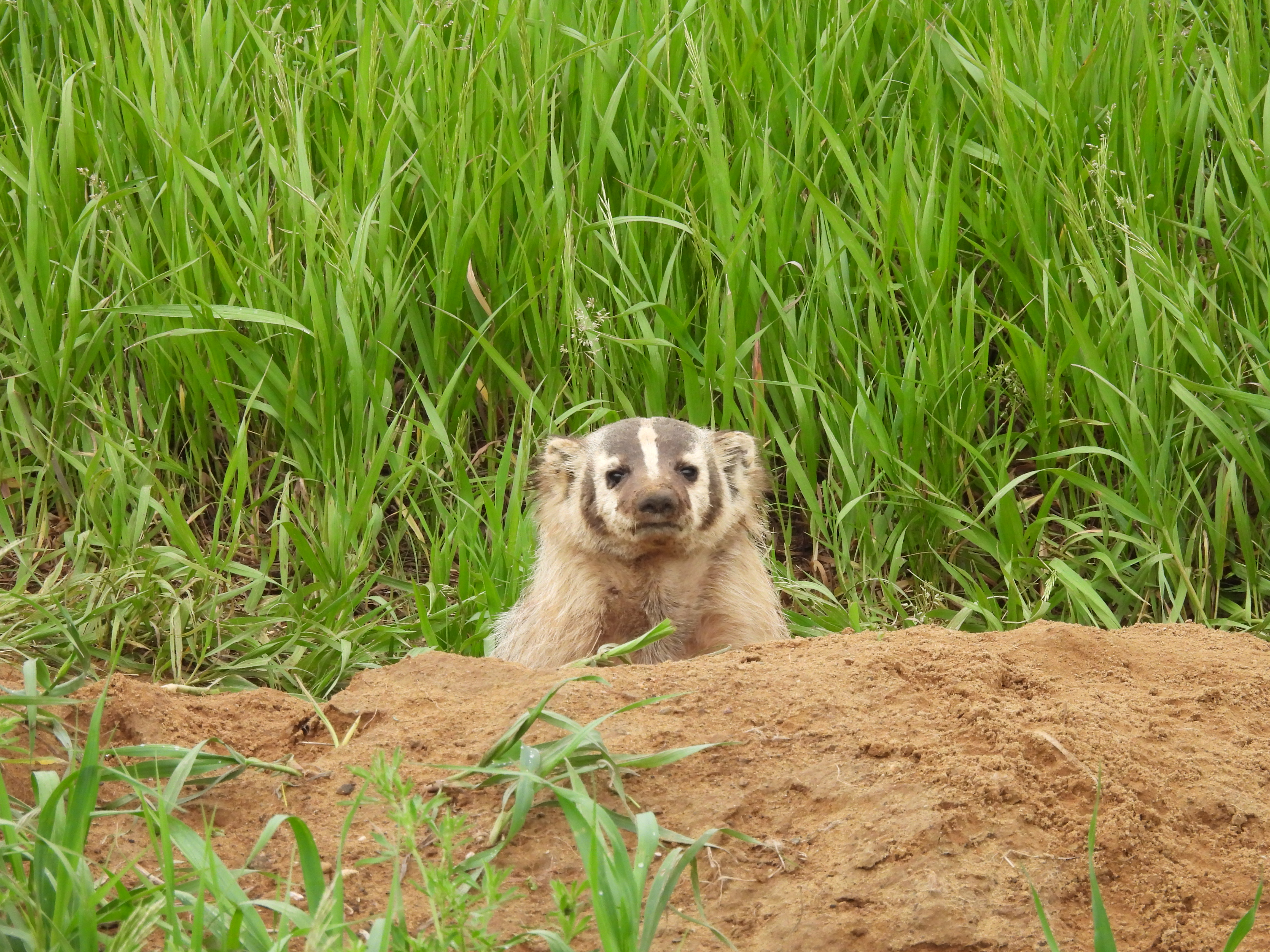
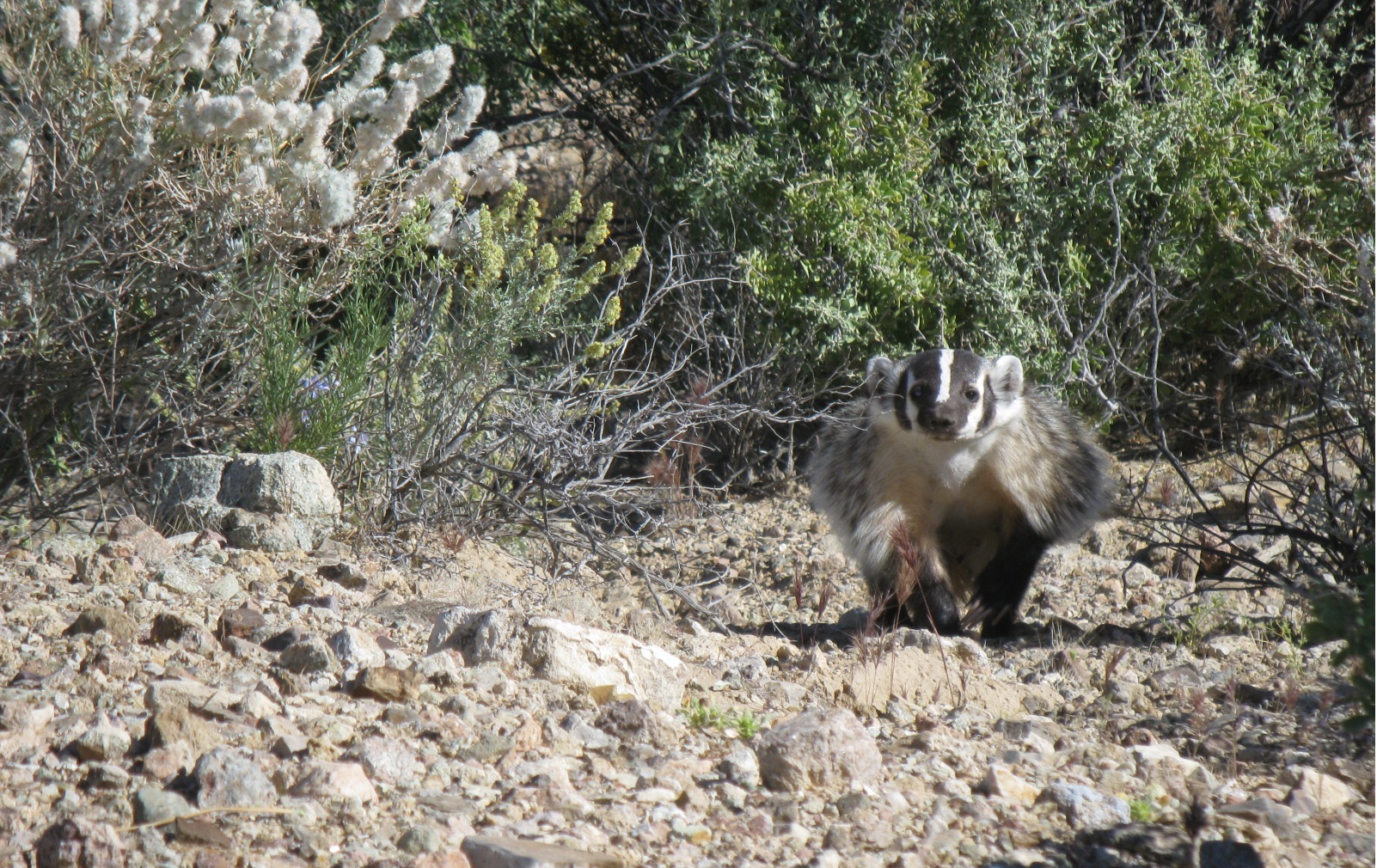
Historically present | |
Currently present | |
Currently not detected |
Goal: Enhance and expand areas occupied by American badger in San Diego County in large interconnected blocks (>1,000 acres) of suitable natural vegetation surrounded by a limited number of high use roads, and increase connectivity (and reduce potential road mortality) between occupied and suitable habitat areas to allow expansion and movement of badger occurrences and to ensure persistence in the MSPA over the long-term (>100 years).
Management units: 3, 4, 5, 6, 8, 9, 10, 11
In 2019-2020, continue the study begun in 2014 to: determine the locations of American badgers in western San Diego County (see occurrence table); to assess and analyze occurrence status, identify and characterize suitable habitat, and evaluate threats; to record movement patterns to determine the risk of direct mortality from existing and planned future roads; and to examine ways to improve badger connectivity between IMAs and reduce mortality (e.g. culverts, bridges, fencing, etc.). Use the study results to prepare specific management recommendations for badger habitat management and for connectivity enhancement within the MSPA.
Action | Statement | Action status | Projects |
---|---|---|---|
RES-1 | Conduct badger surveys to determine spatial and temporal distribution of badgers, assess habitat, and collect threat covariate data. | in progress | |
RES-2 | Conduct badger information outreach with hotline for the public to report badger detections. | unknown | |
RES-3 | Utilize species experts and veterinarians (through workshops or other collaborative means) to develop techniques to safely attach satellite transmitter packages to track the movement of American badger. | in progress | |
RES-4 | Use satellite transmitters and other methods as appropriate to examine the movement patterns of badgers in San Diego County and to determine high risk areas for badgers crossing roads and priority areas for fencing and under crossings. High priority areas for the study should include areas within or adjacent to badger IMAs where traffic volume is anticipated to increase in the next 5-10 years. The study results should include recommendations for locations and types of structures (including fencing) needed to allow safe movement of badger. | ||
RES-5 | All badgers captured as part of studies should have their rodenticide levels evaluated and genetic samples collected. | in progress | |
RES-6 | Submit project metadata, datasets, and reports including results, analyses, and management recommendations to the MSP Web Portal. | in progress |
Criteria | Deadline year |
---|---|
In 2020, Completed Badger Habitat and Connectivity Study Report | 2021 |
Threat Name | Threat Code |
---|---|
Climate change | CLICHN |
Invasive plants | INVPLA |
Loss of connectivity | LOSCON |
Pesticides |
Management units: 3, 4, 5, 6, 8, 9, 10, 11
In 2019-2020, continue the study begun in 2014 to determine the population genetics of American badger in western San Diego County (see occurrence table), within the range of T. t. Jeffersoni, to determine the extent of connectivity between badger occurrences and if possible, the number and relationship of existing individuals, and use this information to determine where to prioritize connectivity enhancements and whether or not existing occurrences of American badger are self-sustaining.
Action | Statement | Action status | Projects |
---|---|---|---|
RES-1 | Collect and analyze genetic data from the badgers using scat, hair traps, and captured individuals to determine the abundance and location of individual badgers in the MSPA. | in progress | |
RES-2 | Based upon the genetic results, try to determine effective population size for occurrences in the MSPA. | in progress | |
RES-3 | Evaluate population genetic structure to determine if there is connectivity between badger occurrences in the MSPA. | in progress | |
RES-4 | Prepare management recommendations to enhance connectivity and to maintain genetic diversity. | in progress | |
RES-5 | Submit project metadata, datasets, and reports including results, analyses, and management recommendations to the MSP WebPortal. | in progress |
Criteria | Deadline year |
---|---|
In 2020, Completed Badger Genetics Report | 2021 |
Threat Name | Threat Code |
---|---|
Loss of connectivity | LOSCON |
Management units: 3, 4, 5, 6, 8, 9, 10, 11
Beginning in 2020, use data and recommendations from the research and genetic studies to develop a long-term American Badger Monitoring Plan in the MSPA to efficiently and periodically monitor the distribution, abundance, mortality and connectivity of the badger population using non-invasive and cost-efficient monitoring methods, such as the collection of scat for genetic analysis, tracking and burrow surveys. The plan should include specific monitoring objectives, sampling frame, sampling design, methods and analytic approach.
Action | Statement | Action status | Projects |
---|---|---|---|
PRP-1 | Submit project metadata and American Badger Monitoring Plan to MSP Web Portal. | waiting for precedent action |
Criteria | Deadline year |
---|---|
In 2021, Completed American Badger Monitoring Plan | 2021 |
Threat Name | Threat Code |
---|---|
Climate change | CLICHN |
Invasive plants | INVPLA |
Loss of connectivity | LOSCON |
Pesticides |
Management units: 3, 4, 5, 6, 8, 9, 10, 11
Beginning in 2020, use results and recommendations from the research and genetic studies to develop a 2022-2026 comprehensive American Badger Management Plan in the MSPA to enhance connectivity within and among IMAs (see Table of Occurrences) and to manage grasslands to improve habitat quality and prey availability. The plan should identify high priority areas for badger management and provide site-specific management recommendations and guidelines for monitoring the effectiveness of management actions.
Action | Statement | Action status | Projects |
---|---|---|---|
PRP-1 | Use research results to develop specific recommendations to improve road crossing infrastructure, such as culverts, bridges and fencing, to enhance connectivity and reduce mortality risk. | waiting for precedent action | |
PRP-2 | Analyze habitat assessments and information from other studies (e.g., western burrowing owl and California ground squirrel BMPs) to prepare specific management recommendations land managers can take to enhance availability of prey species, particularly California ground squirrels, and improve habitat quality for badgers. Identify opportunities to conduct grassland management for badgers in conjunction with habitat management for other MSP species, such as golden eagles. | waiting for precedent action | |
PRP-3 | Submit project metadata and American Badger Management Plan to MSP Web Portal. | waiting for precedent action |
Criteria | Deadline year |
---|---|
In 2021, Completed American Badger Management Plan | 2021 |
Threat Name | Threat Code |
---|---|
Climate change | CLICHN |
Invasive plants | INVPLA |
Loss of connectivity | LOSCON |
Pesticides |
American Badger Research and Monitoring
Badgers have been identified by the San Diego Monitoring and Management Program Connectivity Monitoring Strategic Plan as a target species for monitoring regional-scale functional connectivity of upland and grassland habitats. However, prior to these studies there was little information on badger distribution, movement, or habitat use within San Diego County. In 2011, the California Department of Fish and Game Local Assistance Grant funded an initial study to determine if badgers still persist in the western portion of San Diego County. Canine scent surveys were conducted for American badger scat from November 14-December 14, 2011. Thirty-two sites in San Diego County and two sites in southern Riverside County were surveyed. The scent dog had positive behavioral responses to scat at 13 sites, and a badger specific DNA test verified the scat collected at twelve sites. A recommendation from the 2011 study led researchers to develop a microsatellite DNA test to identify individual animals from scat. This would allow for estimation of minimum population sizes in areas with multiple scats. In 2014, a follow up study was conducted to the initial 2011 rapid assessment for the American badger. The objectives were to identify target areas with potentially higher densities of badgers and to better assess the level of connectivity between known occupied areas. Thirty canine scent surveys for badger scat were conducted. This study involved: 1) additional focused surveys to identify areas occupied by badgers, and 2) determination of the number of badgers at various locations using genetic tests of scat or hair to identify individuals. In 2015, researchers continued studies of the spatial and temporal use of habitats by the American badger by conducting monthly field sign and infrared camera surveys across seven focal sites in the County where we previously documented substantial and/or repeated badger activity. The objective was to determine if badger use is irregular, seasonal, or consistent. American badgers were active at two of the seven focal sites in 2015, the upper San Diego River at El Capitan Grande Reservation and Rancho Guejito. From 2011 to present, researchers established that the American badger currently occupies or uses conserved lands within MSCP and MHCP and many other portions of the county.
|
Connectivity Strategic Plan for Western San Diego County Science Session
A strategic plan for connectivity (CSP) of preserve lands in western San Diego County was developed for the San Diego Association of Government's Environmental Mitigation Program Working Group (EMPWG) in 2011. It was prepared by the SDMMP utilizing the input from a science workshop held in 2010. Many of the high priority items in the CSP have been completed and the data collected over those several years were utilized to inform management decisions. In 2014, there was a need to update and refocus the connectivity strategies and priorities for implementation. The purpose of this meeting was to gather input for the updated CSP. It followed a similar format to the 2010 connectivity workshop. The meeting consisted of a review of completed and in process projects, followed by breakout groups, and then an integration of ideas and recap session. The breakout groups were: (1) Large Animals and Landscape Connectivity; (2) Small Animals; and (3) Pollinators. The meeting focused on:
1. Identifying species to focus questions on connectivity; 2. Identifying questions and objectives to be considered for connectivity for species, and 3. Identifying available methodologies for addressing the questions and objectives. The updated CSP is found in Volume 3 of the Management Strategic Plan.
|
Regional Grazing Monitoring Plan
This project evaluates using grazing as a management tool for degraded grasslands and coastal sage scrub habitat. Pilot projects will be conducted to look at the efficacy of grazing as management tool and necessary monitoring methods. The project was designed to answer four primary questions (and their associated objectives): 1) How effective is grazing at reducing fire risk? 2) Can grazing effectively enhance disturbed native grassland and forb habitats 3) Can grazing enhance disturbed native coastal sage scrub habitat? 4) Can grazing reduce nonnative grass and forb cover in disturbed coastal sage scrub to increase native shrub cover and bare ground and improve habitat for MSP species such as Quino checkerspot butterfly (Euphydryas editha quino), California gnatcatcher (Polioptila californica), and black-tailed jackrabbit (Lepus californicus)? Initial study sites were established at Rancho Jamul Ecological Reserve and Hollenbeck Canyon Wildlife Area. This is a SANDAG-funded project.
|
Reserve Connectivity for Focal Species: American Badger
An assessment of which areas within and adjacent to the San Diego Multiple Species Conservation Program (MSCP) are occupied by American badger and would be suitable for further study of connectivity for badger. The Connectivity Monitoring Strategic Plan (CMSP) lists badgers as a priority for functional connectivity monitoring. The objective of this study was to identify badger locations in San Diego using canine scent detection. This method is advantageous in that large areas can be surveyed, in relatively little time, for badger scat, yielding information on badger home range locations and habitat usage within the county. This information will be utilized in future years to implement subsequent portions of the CMSP priority 1 connectivity monitoring of badgers which will analyze badger movement using radio telemetry techniques.
|
SR 94 Wildlife Infrastructure Plan
Proposed road improvements to SR 94 provide an opportunity to mitigate the potential barrier effects of the highway. This project identifies where improvements to existing infrastructure on SR-94 could improve connectivity across the South County preserves, using Best Management Practices from the scientific literature; recommends wildlife movement monitoring to identify where new crossings are needed; and identifies where additional conservation would enhance the integrity of South County linkages. The review prioritizes infrastructure improvements of 35 existing undercrossings inspected by wildlife experts in the field along 14.6 miles of SR-94 where the highway bisects conserved lands. The majority of the recommendations for infrastructure improvement focus on increasing the diameter, and thus the openness ratio (cross-sectional area divided by length), of the undercrossing itself, removing vegetation and debris blocking the undercrossing, restoring habitat in the approach to the undercrossing, and installing fencing to both (1) keep animals off the highway and (2) funnel wildlife to the undercrossings.
|
From northern Alberta to central Mexico, and from Pacific Coast east through Ohio [1,2]. Ranged throughout California except for humid coastal forests of northwestern California [2].
Localities in the MSPA are mainly valleys in coastal foothills (e.g., Ramona, Pamo Valley, Santa Ysabel, Witch Creek, and Sweetwater Reservoir. Not reported from large mid-elevation meadows on Palomar and Laguna Mountains [4]. Surveys by USGS in 2011 confirmed positive identification of badger scat at 12 sites: Marine Corps Base Camp Pendleton (Juliett and Oscar One), Fallbrook Naval Weapons Station, Daley Ranch in Escondido, Ramona Grasslands, Warner Springs Ranch, Whelan Lake, Crestridge Ecological Reserve, Santa Ysabel Ecological Reserve, Hollenbeck Canyon Wildlife Area, Marron Valley, and the Santa Rosa Plateau [5].
CSC
Elevational range from below sea level (Death Valley) to 12,000’ (3,660 m; [1]). Occupies diverse habitats in California [2]. Primary requirements appear to be relatively open, uncultivated ground with friable soils and adequate food sources [2]. Preferred areas include grasslands, savannas, mountain meadows near timberline, and desert scrub [2,3]. Seems to prefer sites with low to moderate slope [4]. Burrows used for denning, escape, and predation on burrowing rodents [1]. In Monterey County, home ranges were 1-26 km2 and for den placement badgers preferred native grassland and scrub habitat over riparian/wetland and urban areas, and preferred intermediate slopes to flat slopes [6].
Long [8] recognized 4 subspecies range-wide, with 2 sub-species occurring in California: T.t. jeffersonii (generally more coastal) and T.t. berlandieri (generally inland areas; Table 3). Williams [2] indicates that T.t. jeffersonii (Harlan) generally occurs in more moist areas of California, including coastal areas, and that T.t. berlandieri (Baird) occurs in hotter, drier desert grassland areas of southeastern California and the Central Valley. Differences in opinionon designations for some populations in California [2, 8].
Activity mostly nocturnal in two studies [7,9]; although in the latter study, daytime movement increased in June, July, and early August (attributed primarily to dispersing young and possibly adults and yearlings searching for mates). Males solitary except during the mating season; females generally solitary except in breeding season and when rearing young [1]. At high elevations and latitudes become torpid during winter [1]. Underground stays generally were less than 24 hours, except in winter [9].
Reported as promiscuous mating system; mate in summer and early autumn, with delayed implantation (February; [7]). Impregnation occurs in females older than 1 year, and occasionally in juvenile (4 to 5 months) females [1]. Young born in March and early April [1,7]. Litter size ranges 1-5 [7].
Throughout the range, prey consists primarily of fossorial rodents in the families Sciuridae and Geomyidae, supplemented by a diversity of smaller rodents, arthropods, and reptiles [9]. In a Wyoming study area where Uinta ground squirrels (Spermophilus armatus) were at very high densities, adult badgers preyed primarily on ground squirrels whereas juveniles consumed more insects than did adults [11].
In Idaho, most young-of-the-year dispersed from their natal area and their movements were more erratic and more frequent than resident badgers; young-of-year also moved into or through farmland or other unsuitable habitats and showed more daytime activity than residents [9]. In Wyoming, male home range areas doubled or tripled in size during the breeding season (mean 8.35 km2) but shrunk during the non-breeding season to closer to that of female home ranges size (mean 2.82 km2; [11]).
Dramatic declines in California over the last 100 years; have been extirpated from many areas in southern California [2]. Major factors include deliberate killing, agriculture and urban development [2]. Rodent and predator poisoning pose a direct threat through secondary poisoning and reduction in prey. Collisions with vehicles are a significant mortality source for badgers in British Columbia and elsewhere in their range (references in [12]).
[1] Long, C.A. 1973. Taxidea taxus. Mammalian Species. American Society of Mammalogists. 26: 1-4.
[2] Williams, D.F. 1986. Mammalian species of concern in California. California Department of Fish and Game Report 86-1. Sacramento, CA: California Department of Fish and Game.
[3] MSP-MOM. 2014. Management Strategic Plan Master Occurrence Matrix. http://sdmmp.com/reports_and_products/Reports_Products_MainPage.aspx
[4] Stephenson, J.R., and G.M. Calcarone. 1999. Southern California mountains and foothills assessment: Habitat and species conservation issues. General Technical Report GTR-PSW-172. Albany, CA: Pacific Southwest Research Station, Forest Service, U.S. Department of Agriculture.
[5] Brehme, C.S., C. Rochester, S.A. Hathaway, B.H. Smith, and R.N. Fisher 2012. Rapid assessment of the distribution of American Badgers within western San Diego County. Data Summary prepared for California Department of Fish and Game. 42pp.
[6] Quinn, J.H. 2008. The ecology of the American badger Taxidea taxus in California: assessing conservation needs on multiple scales. PhD Dissertation. University of California, Davis.
[7] Lindzey, F.G. 1978. Movement patterns of badgers in northwestern Utah. Journal of Wildlife Management. 42: 418-422.
[8] Long, C.A. 1972. Taxonomic revision of the North American badger, Taxidea taxus. Journal of Mammalogy. 53: 725-729.
[9] Messick, J.P., and M.G. Hornocker. 1981. Ecology of the badger in southwestern Idaho. Wildlife Monographs. 76: 1-53.
[10] Lindzey, F. G. 1982. Badger, Taxidea taxus. Pp. 653-663 in Wild mammals of North America - biology, management, and economics. (J. A. Chapman and G. A. Feldhammer, editors). Johns Hopkins University Press, Baltimore, MD.
[11] Minta, S.C. 1990. The badger, Taxidea taxus (Carnivora: Mustelidae): Spatio-temporal analysis, dimorphic territorial polygyny, population characteristics, and human influence on ecology. PhD Dissertation. University of California, Davis.
[12] Kinley, T.A. and N.J. Newhouse. 2009. Badger roadkill risk in relation to the presence of culverts and Jersey barriers. Northwest Science, 83(2):148-153. 2009.