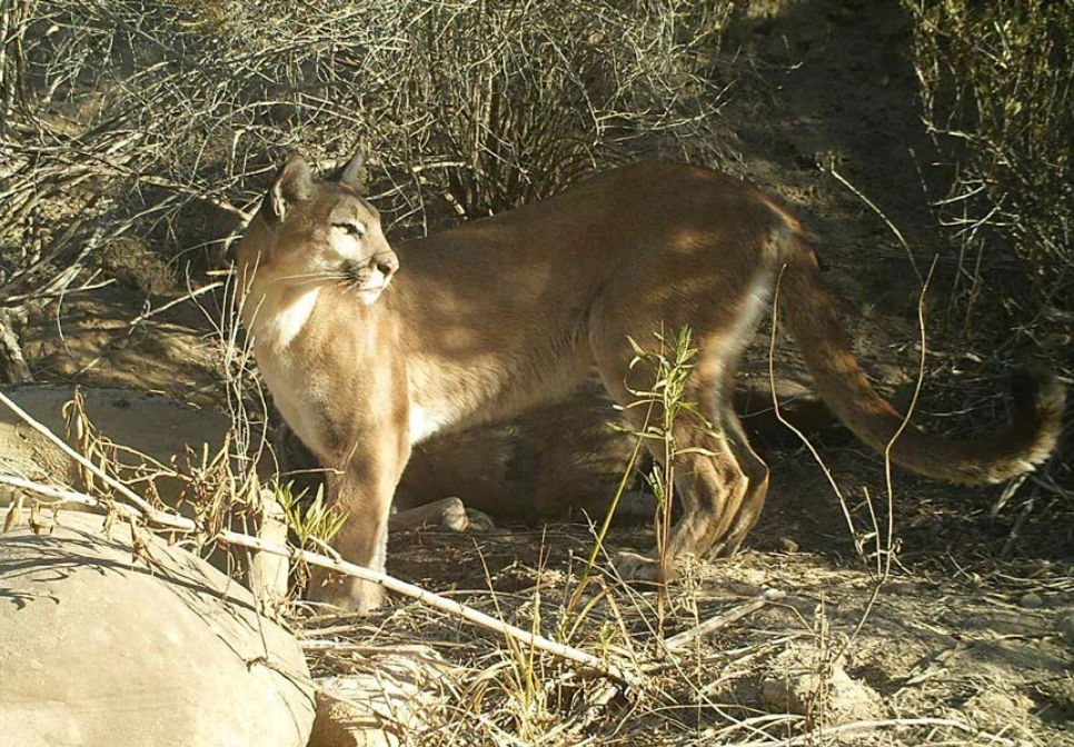
Mountain Lion Connectivity and Genetics Study- North San Diego County
The purpose of this study is to provide the data needed regarding which lands in north San Diego County are likely utilized by mountain lions, and to assess connectivity within and between current and proposed future conserved lands in MSP Management Units (MU) 5, 6 and 8 and conserved and unconserved mountain lion habitat in adjacent Riverside, and Orange Counties. The results from this study of mountain lion movement, habitat use, gene flow, and highway crossings will be available to inform critical decisions regarding the prioritization of lands for conservation and the potential need and location of highway modifications to enhance connectivity for mountain lions and other wildlife. For this study, the UCD-WHC team will be conducting genetic analyses, resource selection and movement modeling, analysis of potential crossing points of highways.
Project Groups
-
SDMMP13 Mountain Lion Research, Monitoring, and Management
Project Focus
Mountain lion
Winston Vickers
University of California, Davis
Winston Vickers
Emily Perkins
Winston Vickers
Project Protocol
Methods include: trapping and GPS collaring mountain lions, DNA analysis, movement modeling, and defining mountain lion movement
Strategic Elements
- FY15-16 - 3.1
Project Location
Mountain lion Puma concolor
Goal: Enhance and expand areas occupied by mountain lion in San Diego County in large interconnected blocks (>1,000 acres) of suitable natural vegetation surrounded by a limited number of high use roads, and increase connectivity (and reduce potential road mortality) between occupied and suitable habitat areas to allow expansion and movement of mountain lion occurrences within San Diego County and adjacent counties to increase effective population size to sustainable levels and work to reduce depredation on livestock to ensure persistence in the MSPA over the long-term (>100 years).
MON-RES-SPEC PUMCON-1
Management units: 3, 4, 5, 8, 9, 10
In 2017, finalize efforts begun in 2016, using available regional mountain lion movement data, to develop quantitative models of mountain lion movement in the MSPA to validate likely movement patterns and to assist with linkage and land protection prioritization.
| Action | Statement | Action status | Projects |
|---|---|---|---|
| RES-1 | Project metadata, data, and report submitted to MSP web portal | completed | Mountain Lion Connectivity and Genetics Study- North San Diego County, Mountain Lion Critical Linkage Evaluation in MSPA |
| Criteria | Deadline year |
|---|---|
| Mountain lion connectivity model completed by 2017 | 2021 |
| Threat Name | Threat Code |
|---|---|
| Human uses of the Preserves | HUMUSE |
| Loss of connectivity | LOSCON |
| Urban development | URBDEV |
Mountain lion Puma concolor
Goal: Enhance and expand areas occupied by mountain lion in San Diego County in large interconnected blocks (>1,000 acres) of suitable natural vegetation surrounded by a limited number of high use roads, and increase connectivity (and reduce potential road mortality) between occupied and suitable habitat areas to allow expansion and movement of mountain lion occurrences within San Diego County and adjacent counties to increase effective population size to sustainable levels and work to reduce depredation on livestock to ensure persistence in the MSPA over the long-term (>100 years).
MON-EVAL-LINK PUMCON-2
Management units: 5, 8, 9, 10
In 2017-2018, guided by information from telemetry studies and mountain lion movement modelling, prioritize potential mountain lion crossing locations for SR 78, SR 76, SR 79, I-15, and other priority roads. For each priority crossing location, conduct detailed linkage assessments to identify existing impediments to successful crossings and recommendations for wildlife crossing infrastructure improvement (culvert maintenance, undercrossing construction, fencing, etc.) and habitat/land protection needs.
| Action | Statement | Action status | Projects |
|---|---|---|---|
| EVAL-1 | Use telemetry and modelling data to inform important wildlife crossing locations along SR 78, SR 76 and SR 79 where follow up surveys will be conducted to identify specific locations and recommendations for wildlife crossing infrastructure improvements. | completed | Mountain Lion Connectivity and Genetics Study- North San Diego County |
| EVAL-2 | At each location, detailed field assessments will be performed to identify existing impediments to successful crossings, specific recommendations for wildlife crossing infrastructure improvements, and land protection needs in the area defined in order to provide for long term successful connectivity between protected lands for mountain lions and other wildlife. | completed | Mountain Lion Road Crossing and Deterrent Methods Evaluations |
| EVAL-3 | Project metadata, data, and reports submitted to MSP web portal. | completed | Mountain Lion Connectivity and Genetics Study- North San Diego County |
| Criteria | Deadline year |
|---|---|
| By 2019, linkage evaluations completed for mountain lion crossing locations for SR 76, SR 79, SR 78 and other priority roads | 2021 |
| Threat Name | Threat Code |
|---|---|
| Human uses of the Preserves | HUMUSE |
| Loss of connectivity | LOSCON |
| Urban development | URBDEV |
