Brief Community Description
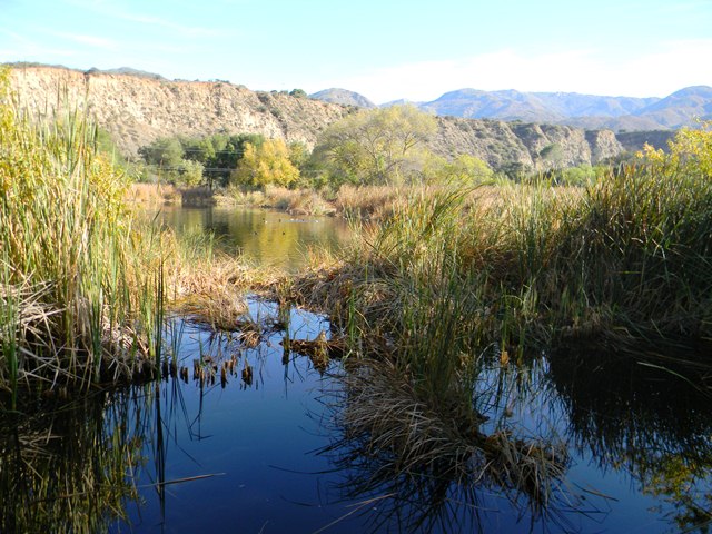
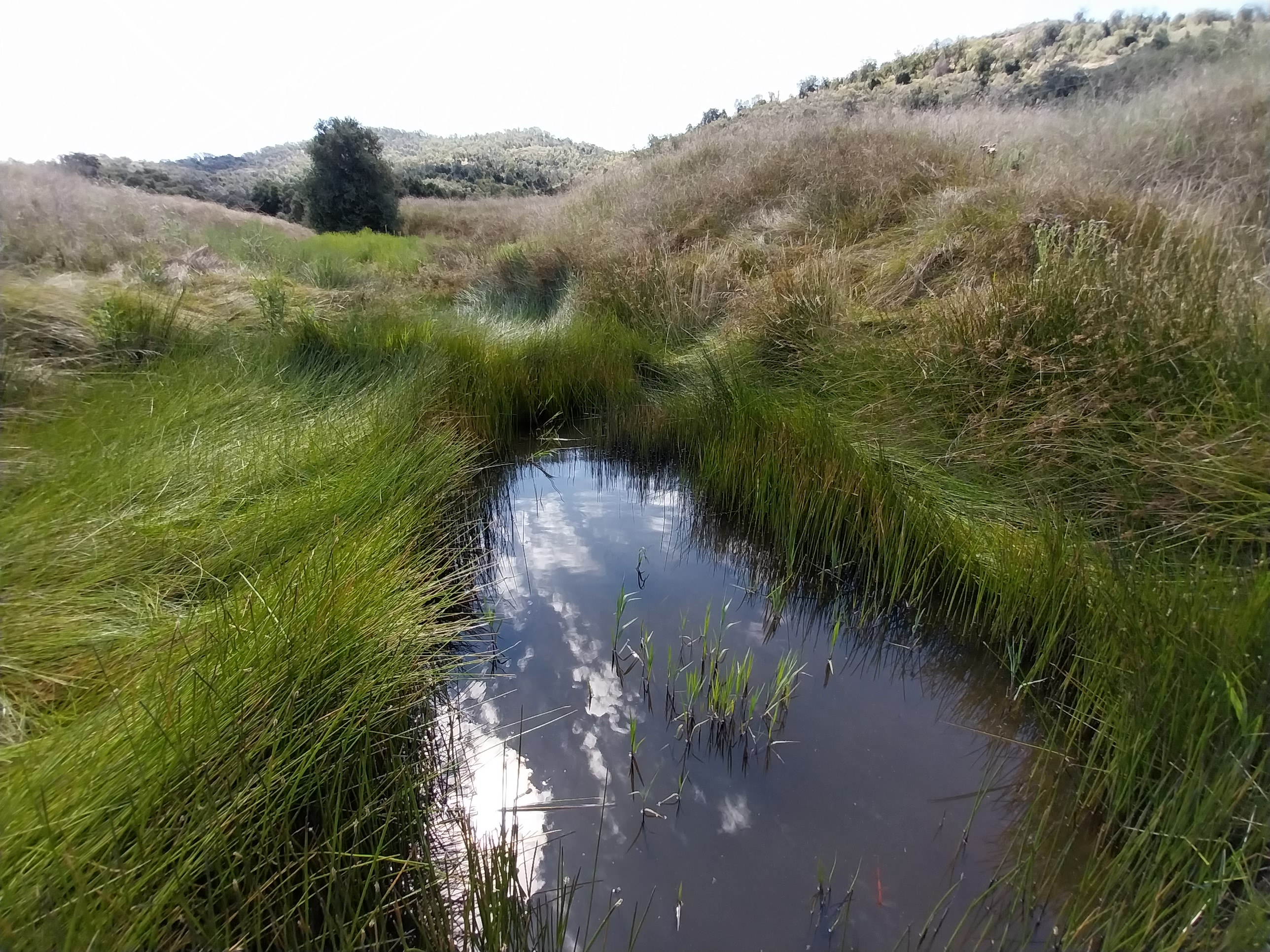
Freshwater marshes are transitional habitats that occur at the convergence of terrestrial and aquatic environments [1]. Emergent plants, such as cattails (Typha) or common reed (Phragmites), are common inhabitants of freshwater marshes. These plants often have very high rates of primary production, making freshwater marshes among the most productive ecosystems. Due to drainage and conversion to other uses, primarily agriculture, fresh emergent wetlands in California has decreased substantially in the last 100 years [2].
Alliances
There three freshwater marsh alliances in western San Diego County are: the Schoenoplectus acutus Alliance, the Schoenoplectus americanus Alliance, and the Typha (angustifolia, domingensis, latifolia) Alliance [3]. The Schoenoplectus acutus Alliance is widespread and found throughout much of North America. The vegetation alliance exists in freshwater to slightly brackish water and is not commonly found on the edges of large stretches of open water. Vegetative cover is intermittent to continuous in this alliance, with Schoenoplectus acutus as the dominant or codominant plant in the herbaceous layer. The Schoenoplectus americanus Alliance occurs in many wetlands throughout the western United States and the southern Great Plains. In California, most stands are associated with inland wetlands adjacent to alkali playas and seeps, but they also occur in coastal brackish marshes. Vegetative cover is intermittent to continuous in this alliance, with Schoenoplectus americanus as the dominant or codominant plant in the herbaceous layer. The Schoenoplectus americanus Alliance tends to tolerate higher alkalinity or salinity than the Schoenoplectus acutus Alliance. The Typha (angustifolia, domingensis, latifolia) Alliance includes all three cattail species as they have similar ecologies and often hybridize in mixed stands. Vegetative cover is intermittent to continuous in this alliance, with Typha angustifolia, T. domingensis, or T.latifolia as dominant or codominant in the herbaceous layer. In coastal Southern California, stands tend to have T. domingensis as the most common dominant species.
Range wide dist. status
Freshwater marshes are found worldwide in low areas of the landscape where water collects or where a relatively impermeable soil or geologic layer causes water to pond [4]. In California, freshwater marshes are found throughout the state, occurring in many different climates and elevations [5].
MSPA distribution
There are 5,910 acres of freshwater marsh in the MSPA in all MUs, of which 2,973 acres are conserved. MUs 9, 10, and 7 have the greatest amount of conserved freshwater marsh in the MSPA.
Habitat affinities
In California, freshwater marshes occur in many different climates and elevations [5]. They typically occur in nutrient-rich mineral soils that drain slowly and are waterlogged or saturated for most or all of the year. Freshwater marsh occurs in drainages, seepages, and other perennially moist, low places often found along stream courses and near riparian wetland areas [6]. Some freshwater marshes are vernal, filling with winter and spring rains and drying out in the summer [5]. They often have open water in depressions or natural springs [6].
Freshwater marsh vegetation communities are characterized by the presence of emergent hydrophytes (plants adapted to growing in saturated soils and standing water) [5]. The dominant plants within freshwater marshes often include rushes (Juncus spp.), cattails (Typha spp.), bulrushes or tules (Schoenoplectus spp.), sedges (Carex spp.), grass species, and several species of small willows (Salix spp.) [6]. Many of these species are rhizomatous (spreading from underground horizontal stems) and can tolerate growing in low oxygen conditions characteristic of saturated soils.
Ecosystem processes
Emergent plants, such as cattails (Typha) or common reed (Phragmites), are common inhabitants of freshwater marshes [1]. These plants often have very high rates of primary production. Most of the living plant biomass is not consumed by herbivores and instead enters the detrital pool following plant senescence and death. Microbial decomposers (fungi and bacteria) and detritus-feeding consumers (macroinvertebrates) are important in the breakdown and mineralization of this plant matter.
Threats
More than 90% of freshwater marshes in California have been destroyed due to filling with soil, draining, overgrazing, or conversion to non-native species [5]. Channelization and clearing of vegetation within stream channels have also negatively affected freshwater marsh communities [6]. Additional factors contributing to the loss and degradation of freshwater marsh include diversions and damming of river flows, disconnecting floodplain wetlands from flood flows, eutrophication, contamination, harvests of plants and animals, climate change, and invasions by invasive exotics [7].
Special considerations
Freshwater marshes can reduce destructive flooding, decrease waterborne pollution, and support many species of resident and migratory animals [5].
Eight MSP species are associated with freshwater marsh, including one plant, one reptile, and six bird species. The eight SL, SO, and VG species will benefit incidentally from freshwater marsh vegetation management. In particular, the Southwestern pond turtle will benefit from invasive aquatic animal and plant removal, and the tricolored blackbird will benefit from restoring the El Monte ponds.
Sources
[1] Brinson, M., and A. Malvarez. 2002. “Temperate Freshwater Wetlands: Types, Status, and Threats.†Environmental Conservation 29 (2): 115–33. doi:10.1017/S0376892902000085.
[2] Cheadle Center for Biodiversity & Ecological Restoration. 2017. “Freshwater Marsh.†Accessed November 14. https://www.ccber.ucsb.edu/ecosystem/habitats-wetland/freshwater-marsh.
[3] County of San Diego Dept. of Planning and Land Use. n.d. “Marsh Vegetation Community.†San Diego, CA.
[4] Crandell, Caren J. 2017. “Wetlands.†Encyclopedia Britannica. https://www.britannica.com/science/wetland.
[5] Gilmer, David S, Michael R Miller, Richard D Bauer, and John R Ledonne. 1982. “California’s Central Valley Wintering Waterfowl : Concerns and Challenges.†In Transactions of the Forty-Seventh North American Wildlife and Natural Reosurces Conference.
[6] Gulis, V., K.A. Kuehn, and K. Suberkroop. 2009. “Fungi.†In Encyclopedia of Inland Waters, 233–43. Academic Press, 2009.
[7] Sproul, F., T. Keeler-Wolf, P. Gordon-Reedy, J. Dunn, A. Klein, and K. Harper. 2011. Vegetation Classification Manual for Western San Diego County. First. San Diego, CA.

